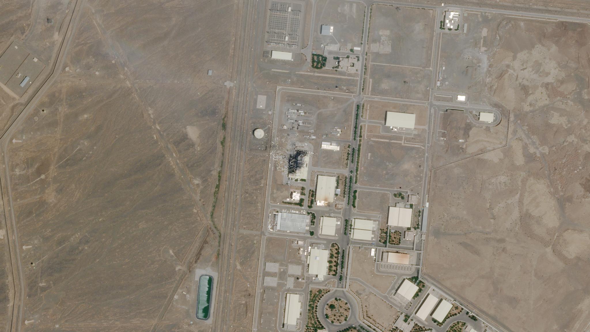
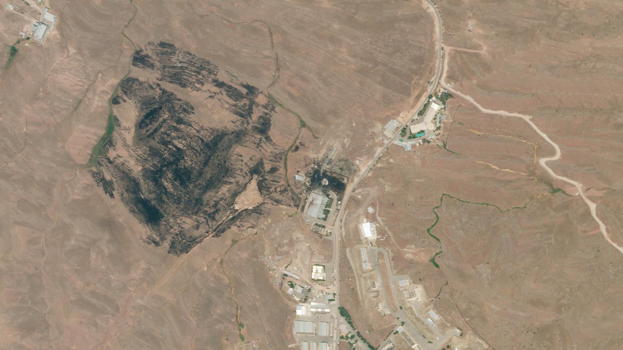
This Planet image shows the damage at Iran’s Natanz Nuclear Enrichment Facility on July 5, 2020. © 2020, Planet Labs Inc. All Rights Reserved.
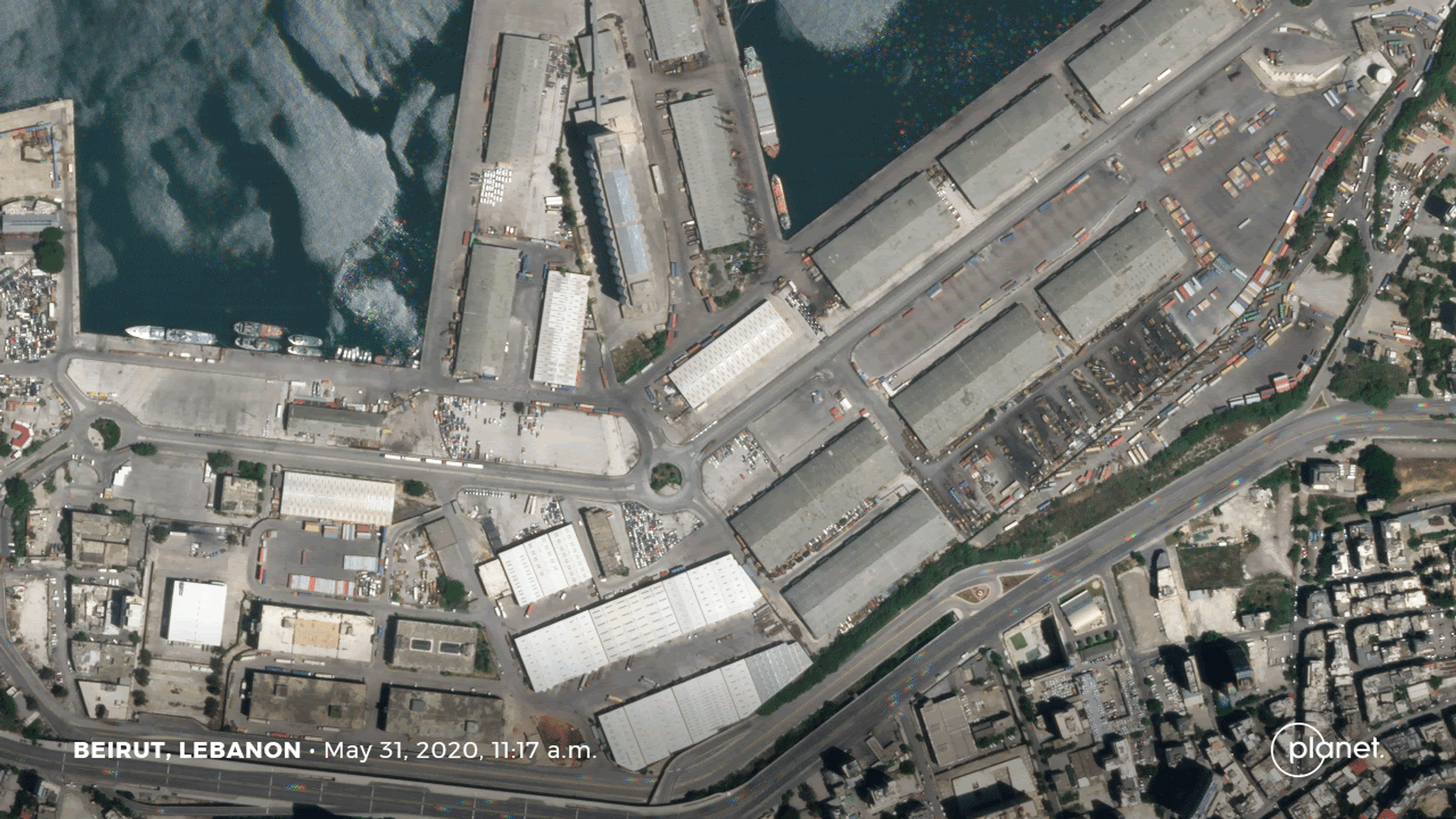
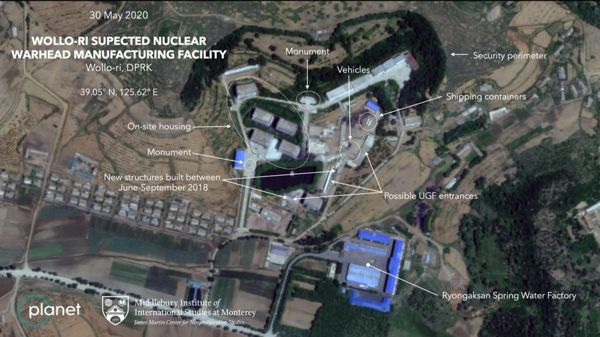
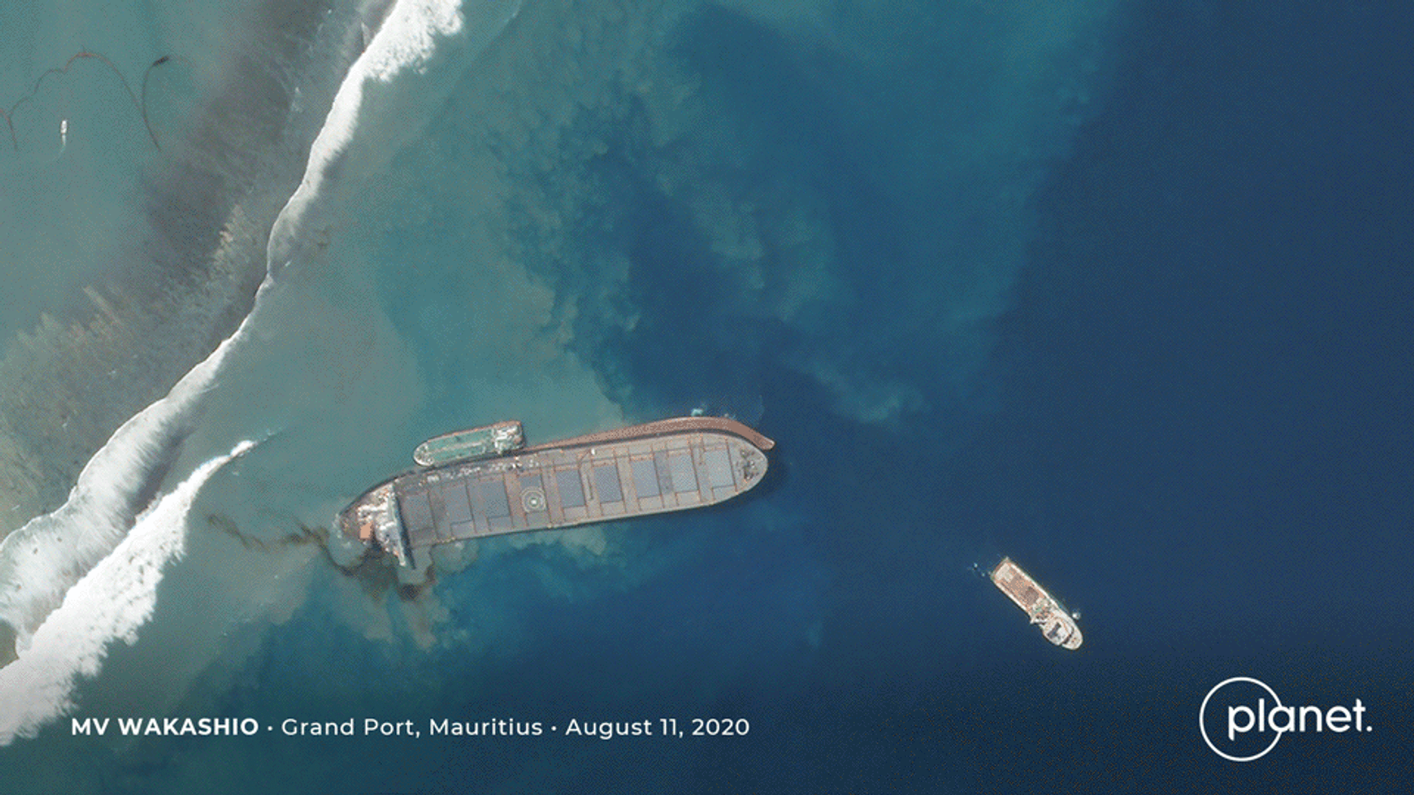
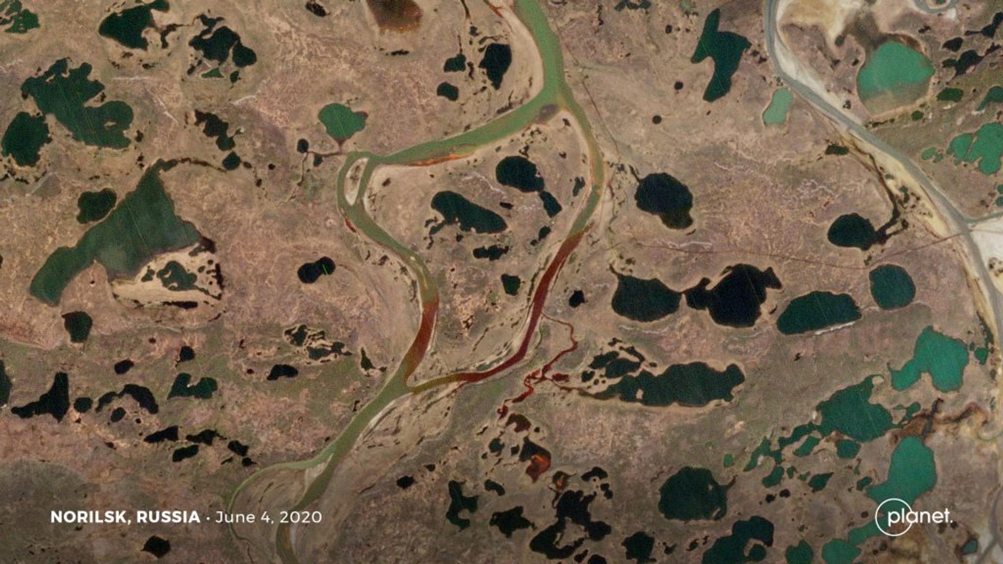
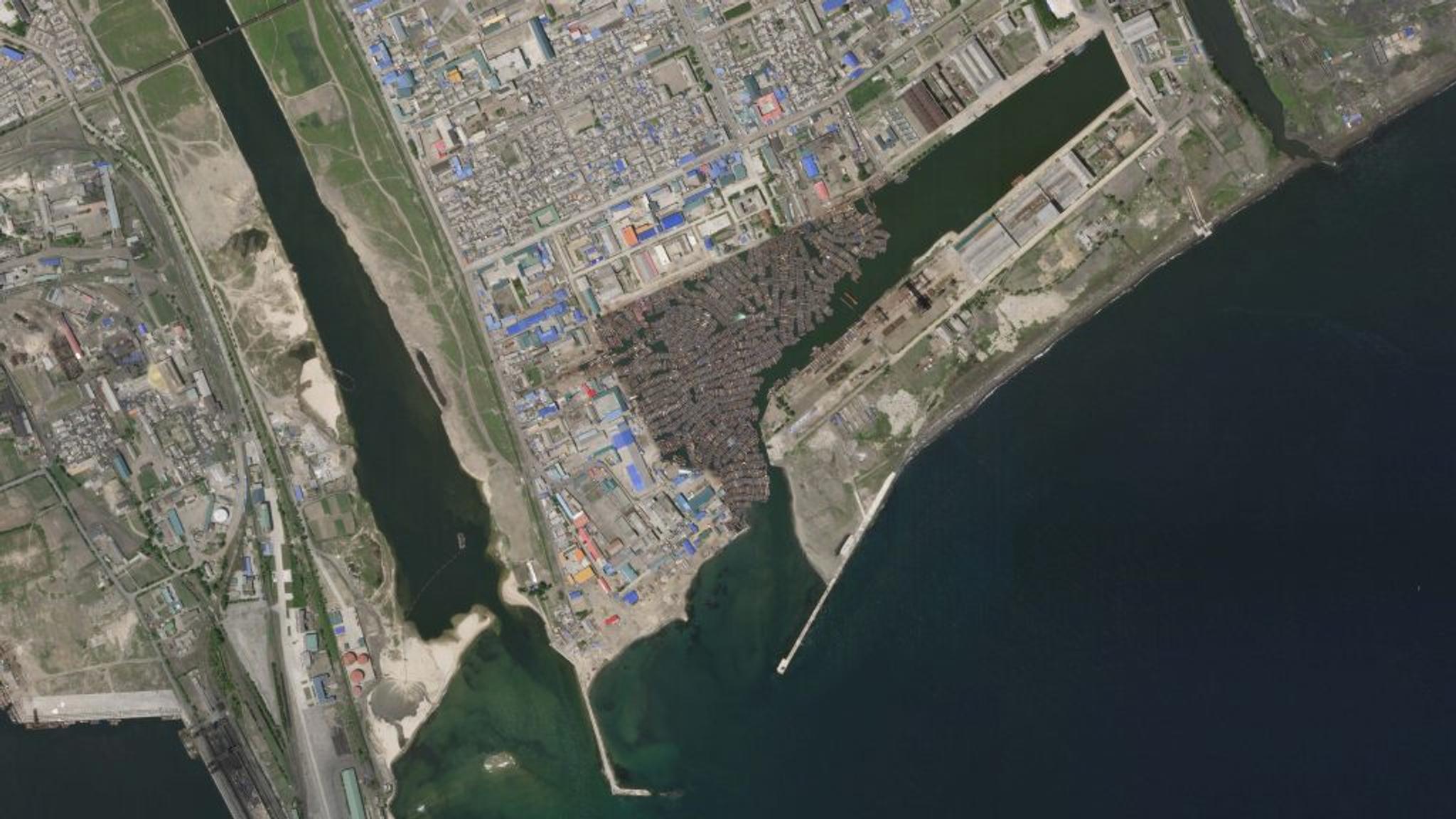
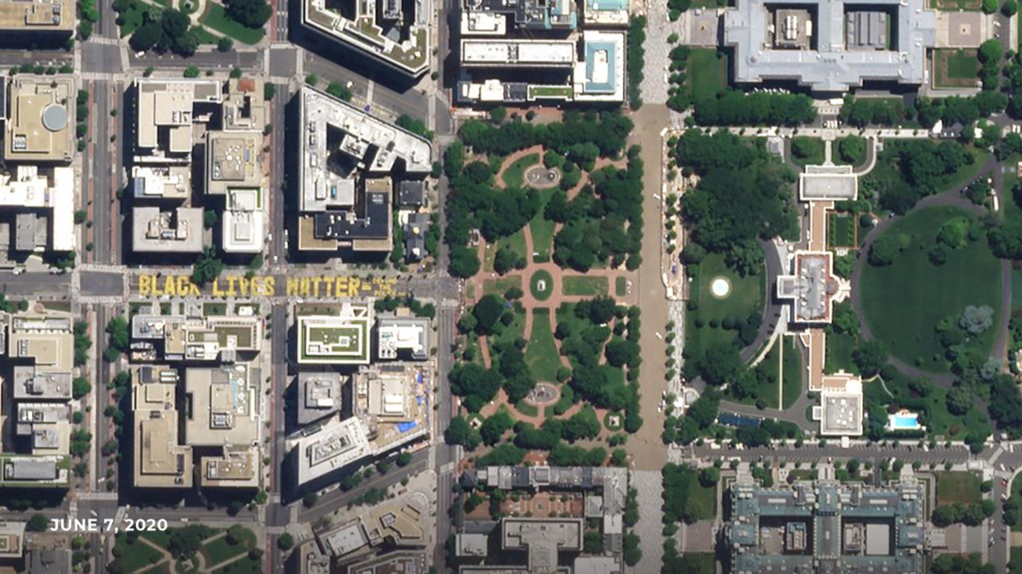
AUTHOR PROFILE Priya Pradhan
Curious Planeteer working to make the Earth's changes visible, accessible and actionable.

Clashing Eastern Superpowers, Explosions in the Middle East, Dark Fishing Fleets and More

News

Despite these uncertain times, when on the ground coverage is limited, satellite imagery is still there for journalists–helping them find new insights and report on global happenings. Check out how Planet imagery has helped reporters follow stories and bring news to readers.

Beirut blast leaves city shocked and port in shambles

Hours after an unexpected explosion ripped through the city of Beirut, Lebanon, satellite imagery showed the extent of the widespread destruction. Caused by the detonation of a warehouse filled with over 2,700 tons of highly explosive ammonium nitrate, the blast left a massive crater at the port and severe damage throughout the city. 

Numerous media outlets have used this imagery to map the damage as Beirut and its people deal with the aftermath of this disaster. Our imagery was published in The New York Times, CNN, NPR, NBC and AP

Before and after photos of Beirut’s port shows the damage done by the unexpected blast

Before and after photos of Beirut’s port shows the damage done by the unexpected blast. © 2020, Planet Labs Inc. All Rights Reserved.

Border disputes between superpower neighbors

On June 15th, 2020, China and India saw troops clash violently at the Line of Actual Control, which has long been disputed territory in the Himalayan region. Tensions flared as the opposing nations built up encampments and a map of China was inscribed onto the shore of Lake Pangong Tso

The New York Times reported that the Indian army suffered at least 20 fatalities, and there were an unreported number of casualties on China’s side as well. Given the treacherous terrain of the region and its inaccessibility, satellite imagery was sought after by media sources ranging from CNN to the more localized India Today and NDTV.

Adding fuel to the coronavirus pandemic, this border dispute has come between efforts of the two superpowers to build better relations. The New York Times combined Planet’s imagery with the latest details to create a visual article that walks readers through this battle in the Himalayas.

An image of Galwan Valley along the India-China border that saw buildup of troops, June 9, 2020 © 2020, Planet Labs Inc. All Rights Reserved.

Mysterious explosions pop up across Iran

A series of fires and explosions, all only a few weeks apart, shook Iran in late June and early July. From a massive explosion at a missile production facility to an alleged attack on the Natanz nuclear complex that left a centrifuge assembly building in flames, satellite imagery was crucial in corroborating the extent of damage.

This series of unexplained incidents has led to conspiracy theories and attack claims as well as coverage by NPR, CNN, Washington Post, BBC and the New York Times.

Before and after Planet images show the burn scar left by an explosion at the Khojir Missile Production Complex in East Tehran on June 10, 2020 (first image above) and June 27, 2020 (second image above). © 2020, Planet Labs Inc. All Rights Reserved.

Activity at suspected North Korean nuclear facility 

Planet’s imagery, analyzed by experts at the Middlebury Institute of International Studies (MIIS), has shown that a North Korean facility, suspected to be linked to the country’s nuclear program, is home to ongoing activity. Located in Wollo-ri, a village near the country’s capital of Pyongyang, researchers suspect that this facility is being used to manufacture nuclear warheads. Although the facility was identified in 2015, this is the first time it is being openly disclosed to the public.

Jeffrey Lewis, a professor at MIIS, told CNN, “The big thing that sticks out is all the vehicle traffic–cars, trucks, shipping containers. This factory is very active. That activity has not slowed down–not during negotiations and not now. It’s still making nuclear weapons.” 

The Middlebury Institute of International Studies analysis of our imagery shows recent activity at a previously undeclared North Korean facility. Credit: Analysis was provided by the Middlebury Institute of International Studies and imagery was provided by Planet. © 2020, Planet Labs Inc. All Rights Reserved.

Environmental disasters hit the Arctic Circle and Indian Ocean

This summer, two major oil spills have polluted the world’s oceans and caused widespread environmental devastation.

In late July, the MV Wakashio, a Japanese-owned ship, ran aground off the coast of Pointe d’Esny, Mauritius, and began leaking oil on August 6, 2020. The tanker has since split apart, spilling tons of oil into the turquoise, tropical waters of Mauritius, leaving them stained black and brown. Satellite imagery caught the exact moments that the hull of the ship broke apart and has been used to track the ship’s journey that led it to Mauritius.

gif f oil spill and tanker splitting

A timelapse shows the progression of events as the MV Wakashio tanker leaks oil and eventually splits in two off the coast of Mauritius. © 2020, Planet Labs Inc. All Rights Reserved.

Another major oil spill in Norilsk, Russia hit earlier this summer. Despite efforts to contain it, approximately 150,000 barrels of diesel have been released. Having burst in early June, the oil tanker’s pollutants have spread north towards the Arctic Ocean.

The spill is one of the largest in Russia’s modern history, with vast environmental repercussions  expected to follow. As the diesel seeped into marshy riverbanks and crossed rivers, it left an iridescent red sheen on the surface that could be seen all the way from space. 

Planet imagery shows oil spreading from a tanker that burst near Norilsk, Russia. © 2020, Planet Labs Inc. All Rights Reserved.

Planet Data contributes to a report exposing illegal fishing in North Korean waters 

A new paper titled “Illuminating Dark Fishing Fleets in North Korea,” published in the journal Science Advances, revealed nearly 900 unauthorized Chinese industrial boats fishing in North Korean waters during 2017 and 2018. Global Fishing Watch led a study that utilized a ground-breaking synthesis of Planet’s Dove and SkySat imagery, automatic identification system (AIS), cloud-penetrating radar imagery, night-time imagery and machine learning. The illegal fishing activities identified included 160,000 metric tons of squid poaching valued at over $440 million. 

Planet’s optical imagery was crucial in providing the clearest proof of these vessels and helped researchers bring the transgressions of these dark fleets to light. This breakthrough report was covered by Mongabay, WIRED, Fortune and Reuters among several other media outlets.

image of the Port of Chongjin, North Korea

Small boats are anchored in a dockyard adjacent to the Port of Chongjin, North Korea. This Planet SkySat image was collected on June 3, 2020. © 2020, Planet Labs Inc. All Rights Reserved.

Black Lives Matter movement seen from space

A symbol marking the recent global movement advocating for equal treatment of Black, Indigenous and People of Color (BIPOC) was seen even from space. The Black Lives Matter mural, painted near the White House, was captured by Planet’s satellites as thousands have raised their voices to fight for openness, inclusion and social justice.

This powerful imagery was shared widely by CNN, The Independent and the Washington Post.

Black Lives Matter mural in Washington D.C.

Black Lives Matter mural in Washington D.C., as seen from outer space. © 2020, Planet Labs Inc. All Rights Reserved.

Journalists! Planet is dedicated to helping reporters investigate important issues, and our tools are designed to do just that. If you haven’t already, sign up for a Planet Explorer account—free for the first two weeks—to unlock the potential for visual and compelling stories.