
How Farmdar Achieves 95% Accurate Sugarcane Yield Predictions Using AI-Driven Satellite Analytics
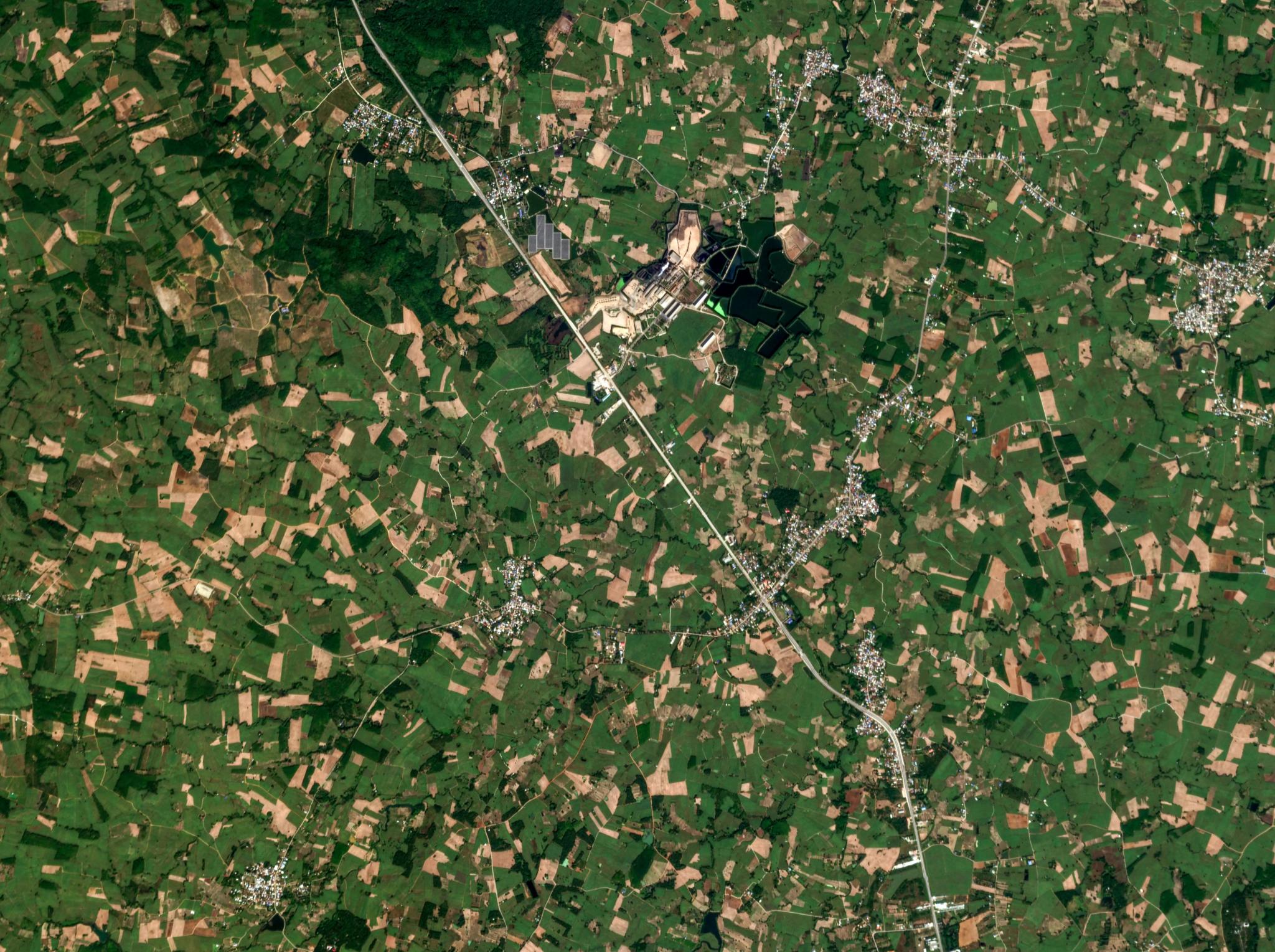
PlanetScope image of agricultural fields in Loei, Thailand, captured December 26, 2025. © 2025, Planet Labs PBC. All Rights Reserved.
StoriesThe sugarcane industry has a very complex supply chain, with millers managing millions of fragmented acres of farms to sustain their local economies and global demand.
Procurement and harvest planning have traditionally relied on manual sampling and public satellite data. But because these methods are infrequent, they lack consistent field-level visibility, resulting in inaccurate yield predictions and revenue loss during the milling process.
Farmdar, an agritech solutions company with operations in Thailand, Singapore, Pakistan, and Brazil, is addressing this issue with AI-enabled remote sensing technology. They develop user-friendly platforms for agribusinesses and their farmers to optimize supply chains, boost farm yields, and save production costs.
Sugar Mill Challenges in Asia-Pacific
In sugar milling, the procurement strategy and supply chain planning heavily depend on precise crop harvest timing and yield estimates. According to Farmdar’s Co-Founder, Muhammed Bukhari, “Even small errors in crop estimation can result in material monetary impact.” That is why accurate crop monitoring data is critical for farm operations.
Many mills rely on field teams to conduct surveys, but this is difficult to execute at scale. “Such surveys are generally based on partial sampling rather than comprehensive coverage,” Bukhari shared. As a result, accuracy is “inconsistent and often questionable.”
Public satellite data is also used, but the revisit rate is too infrequent to gather cloud-free data on a continual basis. In addition, the resolution of public data is often too low to monitor activity in small or narrow fields. “Such data is typically less than 80% accurate overall and even less accurate at field level,” he added.
To stay competitive, mills need a more precise and scalable way to monitor crops and manage operations.
How Farmer Delivers Field-Validated Crop Data Accuracy
With a strong understanding of on-the-ground challenges and more than four years of experience working alongside sugarcane millers across Asia-Pacific and Africa, Farmdar developed two proprietary AI-powered platforms, CropScan™ and YieldPro™, for managing vast farmlands.
CropScan automates the identification of crop types across vast areas. Farmdar considered using drones or other satellite data as inputs for this system, but ultimately selected PlanetScope® because it has the revisit rate and resolution needed to understand which crops are growing where — eliminating guesswork and significantly reducing the need for manual checks.
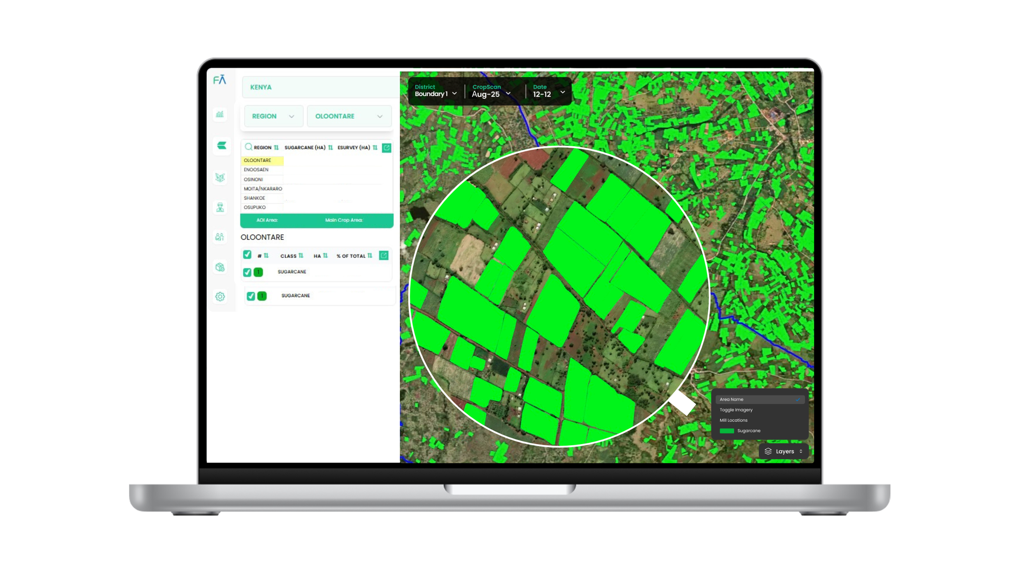
Farmdar’s CropScan platform analyzes vast fields to optimize mill capacity.
Farmdar’s other platform, YieldPro, helps farmers monitor crop health throughout the growing season. It uses current and archival PlanetScope imagery from a specified time over fixed areas of interest, allowing customers to monitor fields from planting to harvesting and track changes over time. With high revisit rates, cloud coverage during the monsoon season is less of a constraint.
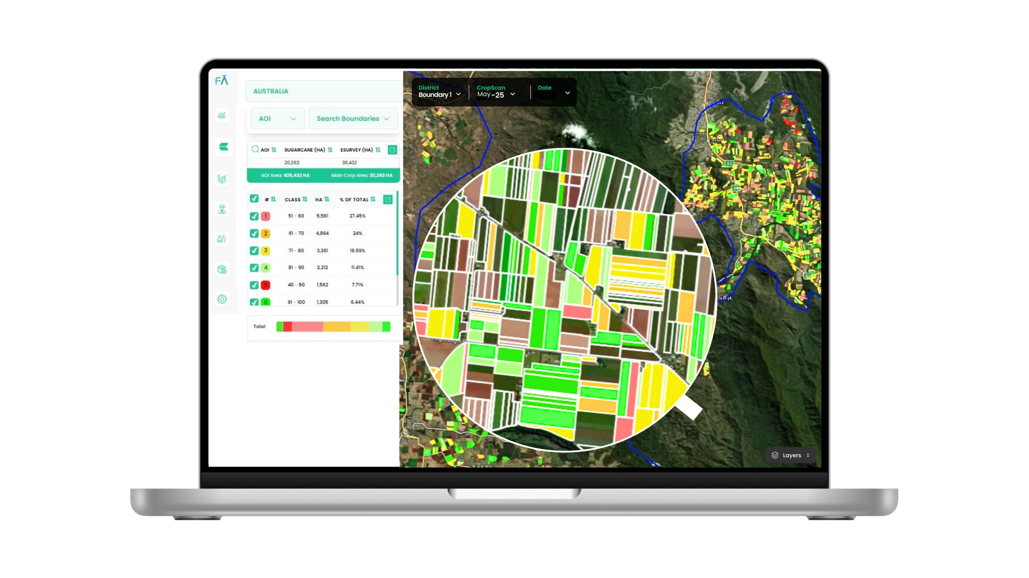
Farmdar’s YieldPro platform analyzes crop health to optimize yields.
“The frequency of Planet imagery ensures that customers receive data when they need it, especially during key crop stages,” shares Bukhari.
Using PlanetScope data, the CropScan and YieldPro platforms equip farmers and agribusinesses with:
- Near-Real-Time Monitoring: Accurately classify crops, determine sowing trends, and engage in harvest monitoring across millions of acres. “In Pakistan, our clients using YieldPro have improved farmer yield by 15% and created upsell opportunities for their fertilizer products,” Bukhari notes.
- Precision Yield Prediction: When combined with a mill’s historical records, CropScan “can deliver 90-95% field-validated accuracy when clients work with Farmdar to use their historical records, allowing us to tune our yield prediction models,” Bukhari says.
- Seamless Integration: Farmdar solutions integrate with Planet Insights Platform via APIs, ensuring that high-frequency imagery is converted into actionable insights without operational lag.
Both CropScan and YieldPro promise an exceptional degree of accuracy. Initially, some agronomy and procurement team heads were skeptical of the technology and Farmdar’s 95% accuracy claim, but with time, they were thrilled with the results.
Bukhari shared, “They took an active interest and participated in field-based validation activity. It has been very rewarding for us to see them develop belief through thorough ground-based testing of our product. They are our most valuable promoters now.”
Year-Over-Year Increase in Agricultural Outputs
By integrating Planet satellite data with Farmdar’s CropScan and YieldPro platforms, mills can manage millions of acres of farmland using reliable, timely, and accurate insights. For Farmdar’s customers, the measurable impacts have been significant:
- Exponential Financial Returns: Optimized workflows have resulted in significant cost savings. Bukhari shared that Farmdar’s customers based in Thailand have achieved an ROI of 260% in year one and 430% in year two. In Pakistan, Farmdar’s clients using YieldPro have improved farmer yield by 15% and created upsell opportunities for their fertilizer products.
- Focus on Higher-Value Activity: Understanding crop activity and health at scale has significantly reduced the need for manual surveys. This allows customers to focus on higher-value activities like farmer advisory, to improve yields.
- Sustainability Through Resource Optimization: Clearer insights into field activity allows customers to allocate inputs and logistics more efficiently. Bukhari notes that this helps to reduce the business’s carbon footprint, and enables farmers to produce more from the same land with fewer resources.
And this is just the beginning of Farmdar’s plans — in the future they will expand the use of their products for larger-scale deployments. “We also plan to conduct R&D on more Planet data, such as Tanager,” Bukhari shared.
Tanager™ is Planet’s first hyperspectral constellation that collects data across more than 400 distinct wavelengths to support a wide range of applications, from detecting methane and carbon dioxide emissions to monitoring biodiversity and vegetation health.
Smarter, Faster, and Sweeter Results
Farmdar’s deep understanding of sugarcane farming in Asia-Pacific, from local conditions to farmer challenges, combined with Planet’s scalable satellite data and monitoring capability, resulted in a practical tool for improved efficiency in field operations and enhanced yields.
Interested in exploring how satellite data can fit into your farm operations? Read our e-book, From Imagery to Data to learn how Planet data can help optimize operations and maximize profits, or reach out to a Planet agriculture advisor directly to start a conversation.
Ready to Get Started
Connect with a member of our Sales team. We'll help you find the right products and pricing for your needs.