World Maritime Day 2026-2027: Bridging Maritime Policy and Practice With Satellite Imagery


SkySat image of the Yulin Naval Base in China, captured on October 1, 2025 © 2025, Planet Labs PBC. All Rights Reserved.
TechThe 2026-2027 theme for the International Maritime Organization (IMO)’s World Maritime Day, From Policy to Practice: Powering Maritime Excellence, recognizes that maritime policies alone do not solve all global maritime challenges. Turning maritime policy into real-world action requires timely and accurate data to identify change, validate threats, and close gaps in enforcement.
Maritime domain offerings through Planet leverage high-frequency satellite imagery to provide an independent, continual view of what is actually happening along coastlines, shipping routes, and marine environments. These near-real-time insights help governments, ports, and maritime authorities advance many of the IMO’s key priorities, including trade policy enforcement, marine environmental protection, and climate resilience.
Minimizing Blind Spots In Maritime Monitoring
Gaps in policy enforcement often stem from a lack of timely and reliable information about maritime activity over large areas. Traditional tactics, such as automatic identification systems (AIS) signal monitoring, can fail to detect potentially illicit activity when vessels turn off or spoof their transmissions. And while aircraft, patrol boats, and tasked satellite imagery help agencies supplement signal monitoring, they are expensive to deploy and can’t be everywhere at once.
Broad area monitoring with Planet near-daily satellite imagery can fill these gaps left by providing foundational visibility across vast areas. And when this data is paired with AI-enabled analytics, agencies can automate the detection of dark vessel activity to better understand patterns, spot anomalies, and accelerate action — including the enforcement of global maritime rules as defined by the IMO, government policies, and port authorities.
Protecting the Marine Environment
Several environmental concerns are also IMO priorities, including marine litter and plastics, underwater radiated noise, ballast water and biofouling, and sustainable ship recycling.
Near-real-time satellite monitoring, combined with Planet archival imagery, allows analysts to compare current observations with past conditions and quantify change in sediment patterns, algal activity, oil-related pollution, and other dynamic situations. In addition, in marine protected areas (MPAs) these capabilities can highlight the impact of human activity. Satellite monitoring helps authorities track whether conditions are improving or worsening over time and allocate response or recovery resources effectively.
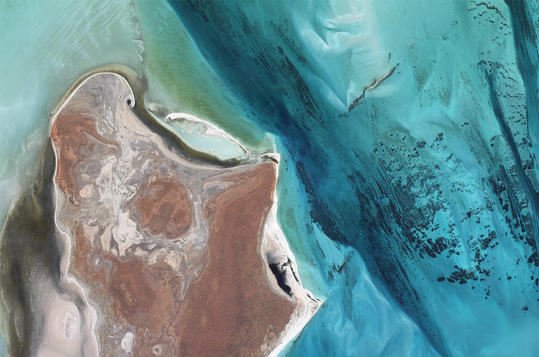
Planet SkySat image of the largest seagrass bed in the world, Shark Bay, Australia, captured April 8, 2023.
Building Resilience and Supporting Climate-Vulnerable Nations
Finally, World Maritime Day also gives attention to Small Island Developing States (SIDS) and Least Developed Countries (LDCs), which often face geographic isolation, limited institutional capacity, climate vulnerability, and resource constraints. Satellite data can help address these challenges by enabling agencies to understand change in remote areas and use limited budgets as effectively as possible.
An analysis published in The Straits Times provides a model that SIDS and LGDCs could follow. The analysis looked at the growing number of vessels arriving in Singapore in light of the geopolitical tensions in the Middle East. They used Planet satellite imagery from April to June 2026 to track vessel count and compared it with the official data from the Maritime and Port Authority of Singapore (MPA).
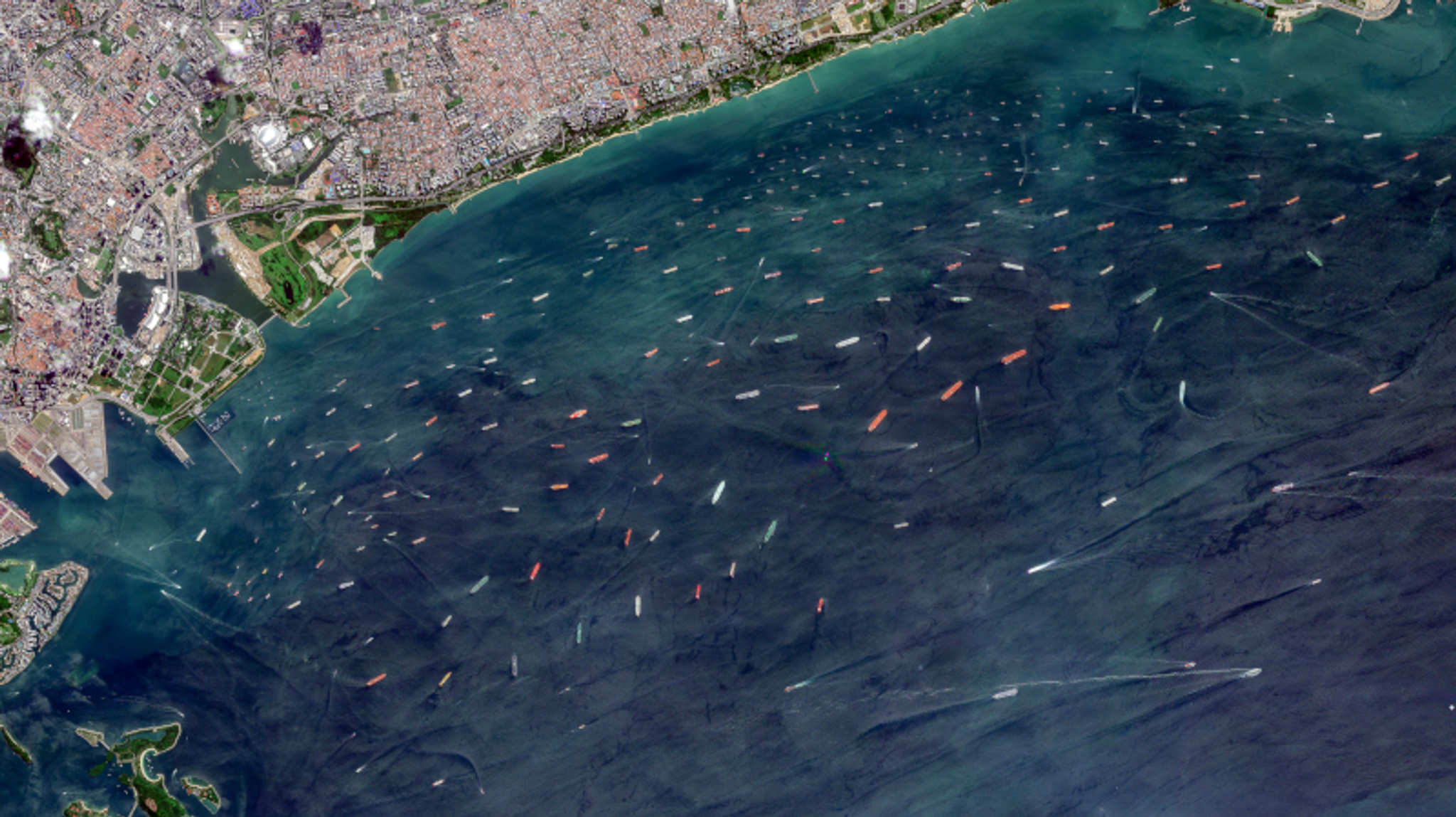
PlanetScope® image of the Singapore Strait captured on June 13, 2026 © 2026, Planet Labs PBC. All Rights Reserved.
By combining unclassified Planet data with other maritime intelligence, analysts were able to better identify changes in shipping patterns and understand the impact of geopolitical disruptions. For SIDS and LDCs, this example underscores the value of using numerous sources to understand the issue at scale and with limited resources.
Supporting IMO’s Priorities with Planet Satellite Data
This year’s World Maritime Day theme: From Policy to Practice: Powering Maritime Excellence, can only be achieved with timely, actionable data.
While satellite imagery does not replace traditional monitoring strategies, such as vessel inspections, AIS, and patrols, it adds a foundational layer of visibility and situational awareness to help authorities identify areas of concern, track change, and prioritize where resources are needed.
Interested in leveraging near-daily satellite monitoring for your organization? Watch our on-demand APAC GeoGov Insights Episode 3 webinar, Detecting the Unseen: Near-Daily Satellite Monitoring for APAC Defense and Governments.