
How Governments Use Near-Daily Earth Data to Better Manage Subsidy Payouts
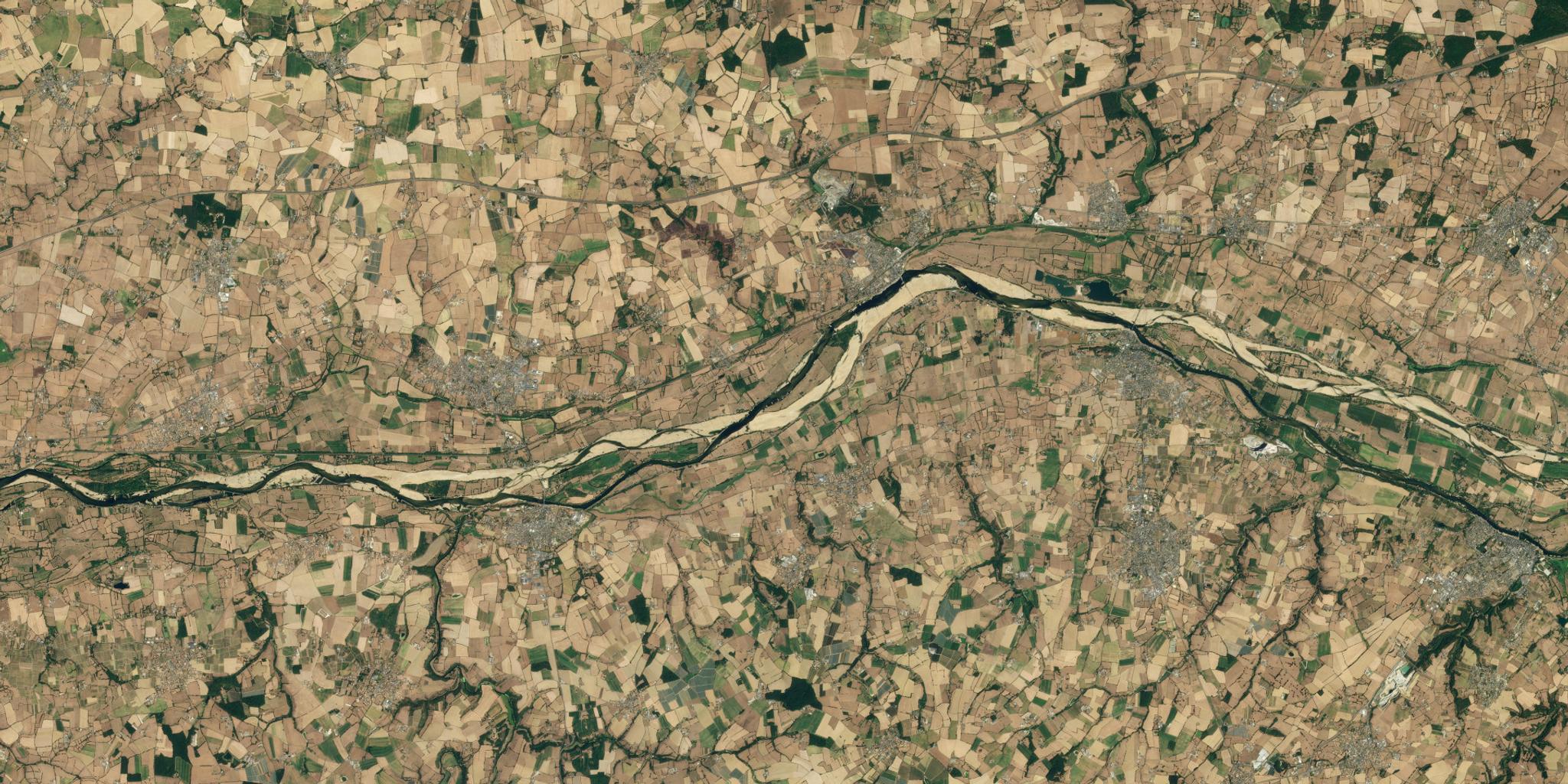
PlanetScope image of drought Loire River, captured August 11, 2021. © 2021 Planet Labs PBC. All Rights Reserved.
TechMonitor change and verify eligibility with broad area management.
Governments need accurate and current data to track how well policies are working. But many data sources paint an incomplete picture — especially when policies impact vast land areas and irregular plots of land.
Free public satellite images often do not show changes in enough detail to be meaningful. High-resolution aerial data can be too expensive to scale. And harmonizing data from many sources into one efficient system can become the most challenging part of the process. All of these factors can make it difficult for policy makers to demonstrate success and secure ongoing subsidy payouts.
Broad area management empowers governments to manage subsidy payouts more efficiently and effectively. A broad area management approach entails monitoring, measuring, and reporting on changes to natural and human-made assets over vast areas and across multiple time scales.
For governments, this includes continually observing fields of all shapes and sizes — and flagging discrepancies faster.
Supporting Subsidy Payouts With Broad Area Management
Earth observation (EO) data makes broad area management possible because it offers a unique vantage point across Earth’s landmass. And as EO data has become more available and affordable, greater numbers of governments are able to access and exploit it for analyzing Earth’s changing conditions.
Near-daily Earth data from Planet brings governments a wide range of opportunities to manage subsidy payouts by allowing them to:
- Flag discrepancies faster: Use automated change detection to identify irregularities, on an ongoing basis.
- Broader their reach: Use PlanetScope and Analysis Ready Data to access remote fields and parcels of all shapes and sizes.
- Enhance transparency: Use Area Monitoring to document compliance with subsidy criteria.
Spotlight: European National Paying Agencies
As part of Europe’s Common Agricultural Policy (CAP), farmers who undertake certain “greening” practices may be eligible for income support through direct payments. Some CAP payments are area-based, requiring on-the-spot checks, which can pose an administrative burden on member countries.
When the European Union (EU) began allowing governments to use remote sensing to help verify eligibility for direct payments, the Slovenian National Paying Agency (ARSKTRP) launched a country-scale Area Monitoring System (AMS) to help streamline the process of determining subsidy payment eligibility.
However, they quickly discovered that Sentinel data was an incomplete solution. Nearly a quarter of the fields in Slovenia were too narrow for Sentinel-2 to produce reliable time-series data. Additionally, Sentinel-2 wasn’t detailed enough to monitor changes to permanent grasslands and orchards, nor frequent enough to verify when certain events like mowing occurred. It was impossible for ARSKTRP to monitor all declared parcels using Sentinel-2 data alone.
The data quality problem was not the only one. Harmonizing remote sensing, manual follow-ups, farmer declarations, and other data sources into this system is a process and cost burden to the paying agency. Inaccurate results could result in lower subsidy allocations for the next budgeting period.
Looking for another solution, the team turned to Planet Fusion, which produces a consistent, daily stream of accurate radiometric data showing changes in vegetative health. Today, ARSKTRP combines Sentinel-2 with Planet Fusion data to verify subsidy payments. They first use Sentinel data to evaluate if it is sufficient. When Sentinel-2 is inconclusive, they use Planet Fusion. Signals from Fusion enter machine learning (ML)-based models in Planet’s Area Monitoring solution to calculate markers such as mowing and harvest events, crop and land cover type and overall similarity to neighboring parcels of the same type.
Planet Fusion has reduced the number of inconclusive parcels from 246,000 to 66,000 and lowered the cost of follow-up activities by more than €1M. Reducing the need for farmers to submit additional proof of certain activities has also improved public sentiment. ARSKTRP found that Planet Fusion data serves as the best data offering to Sentinel-2 with its daily EU-wide coverage and increased spatial resolution at 3 m per pixel.
In addition, Planet Area Monitoring helped ARKSTRP to identify markers and validate information against compliance requirements, as well as detect compliant and noncompliant parcels and communicate results. The system decreased their operational costs, improved processes, and contributed to more transparency for stakeholders.
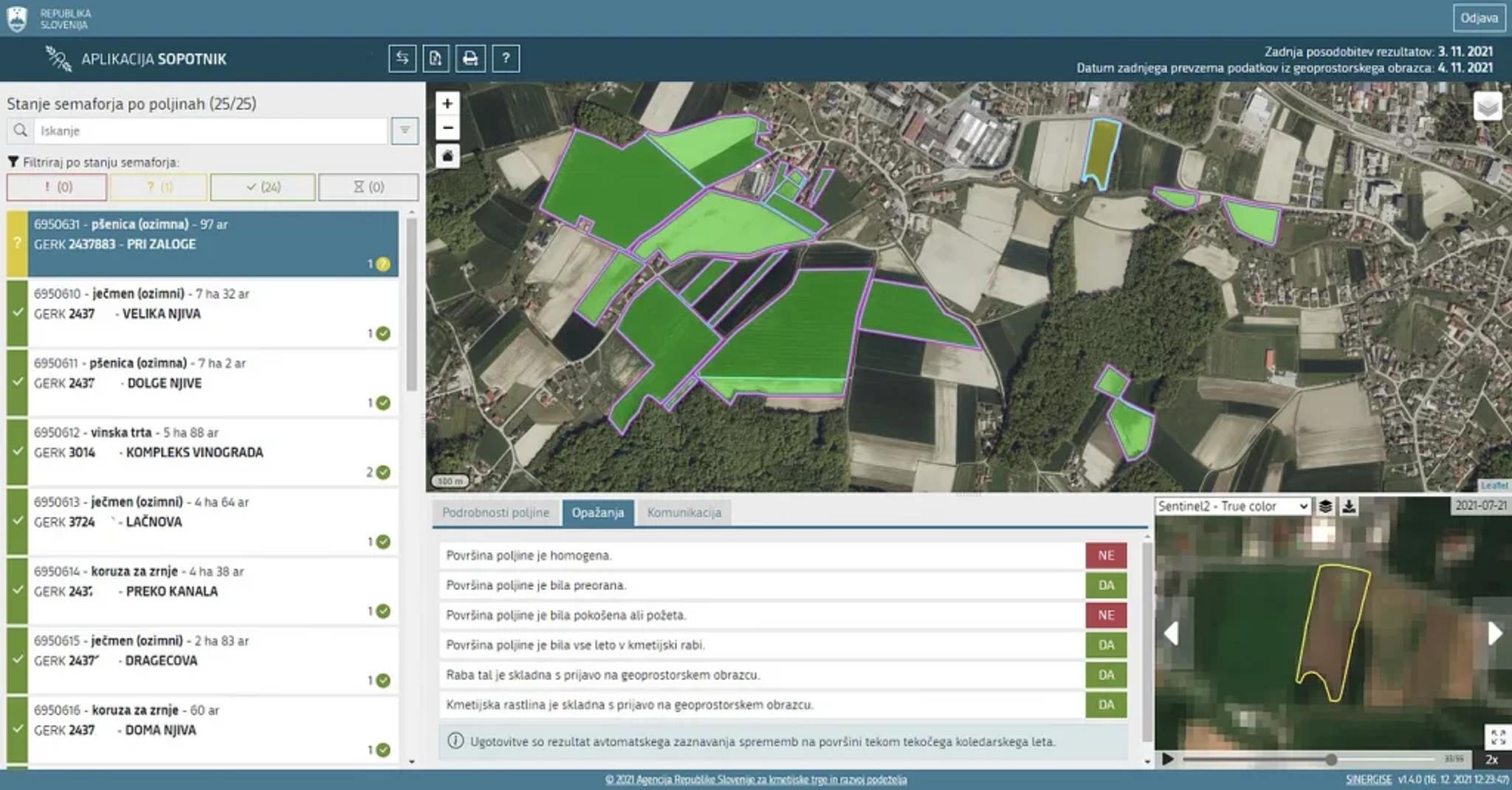
Planet Fusion shows detailed changes in the vegetative health of fields, helping the Slovenian National Paying Agency save time and money as they verify eligibility for direct payments to farmers.
Do More With Planet Insights Platform
As a leader in the EO industry, Planet already helps agencies managing subsidy payouts see change in unprecedented detail. Now our data is becoming more accessible to them through Planet Insights Platform — a powerful set of APIs that bring governments the ability to look broader, look back, look closer, and look deeper.
By combining Planet’s analysis ready data and analytics tools with existing data inputs required by compliance policymakers, analysts can access targeted insights that help plan and distribute farmer subsidy payouts.
Interested in learning more? Learn how Planet can help governments improve compliance. Or, download our e-book, Driving Program and Policy Effectiveness with Planet.
Ready to Get Started
Connect with a member of our Sales team. We'll help you find the right products and pricing for your needs.