
How Governments Use Near-Daily Earth Data to Reduce Risk in Key Policy Areas
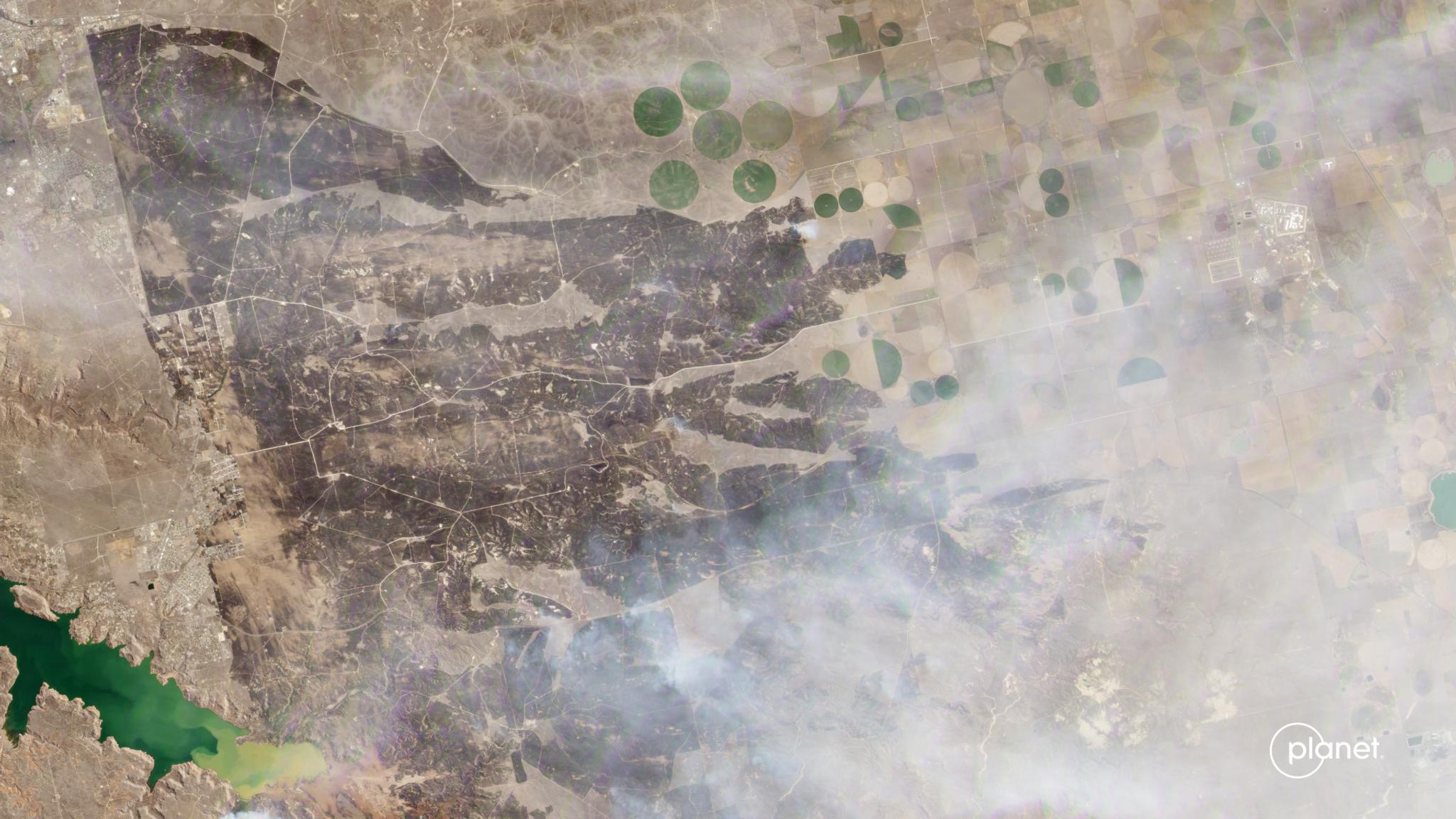
PlanetScope image of the Windy Deuce Fire in northern Texas, near the town of Fritch, captured February 28, 2024. © 2024 Planet Labs PBC. All Rights Reserved.
TechMonitor and track change with broad area management.
Today’s regulatory environment requires governments to meet evolving standards around transparency, traceability, and credible measurement. At the same time, they face numerous climate change-related challenges, ranging from natural resource management to disaster response.
To address and minimize these risks, governments need to see changes on a regular basis and create monitoring and reporting systems that guide resource allocation and improve efficiency.
At Planet, we call this approach broad area management. It refers to the practice of monitoring, measuring, and reporting on changes to natural and human-made assets over vast areas and across multiple time scales.
How Broad Area Management Helps Reduce Risks for Governments
From tracing commodity origins and monitoring deforestation, to enhancing natural resource management and improving disaster and emergency response, governments need tools to help them track and understand change. Near-daily Earth data from Planet brings governments a wide range of opportunities to support risk management.
- Detect issues faster: Monitor vast and remote areas and zoom-into areas of interest or areas affected by emergencies.
- Detect patterns: Use Planet Archive data and statistical analysis to detect patterns and developments and create early warning systems.
- Detect issues more precisely: Detect selective logging or forest degradation with the highest precision.
- Cover more ground: Improve pre-planning, optimize routes, and accelerate onsite inspection processes.
- Reduce operational risk: Preview site before visiting, reduce onsite time, and improve safety for inspectors who visit higher-risk areas.
- Improve reporting: Comply with international frameworks, such as EUDR, and improve due diligence efforts, monitor damage perimeter for disasters.
Customer Spotlight: A U.S. State Division of Forestry
The Division of Forestry oversees activity across millions of acres of forested areas, including wildfire suppression efforts. Before working with Planet, the division relied on helicopters to monitor wildfire perimeters, which was both costly and dangerous.
But with PlanetScope® near-daily data, they have significantly improved situational awareness during active incidents, helping accelerate inter-agency response efforts.
Planet data also helps them monitor suppression activities during and after active incidents, reducing the time and cost of investigation by $160,000 USD while shortening the time it took to digitize wildfire perimeters to just minutes.
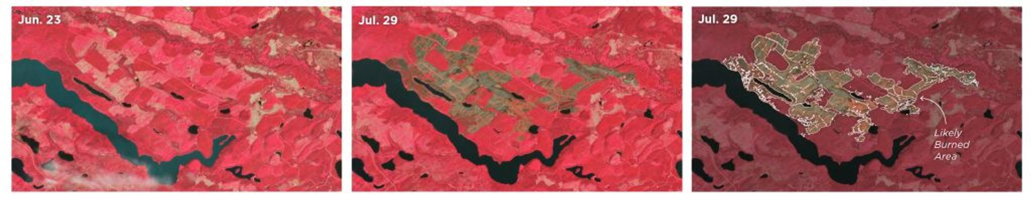
Emergency management officials can digitize wildfire boundaries in minutes, improving situational awareness and accelerating damage assessment.
Do More With Planet Insights Platform
As a leader in the EO industry, Planet already helps agencies managing subsidy payouts see change in unprecedented detail. Now our data is becoming more accessible to them through Planet Insights Platform — a powerful set of APIs that bring governments the ability to look broader, look back, look closer, and look deeper.
By combining Planet’s analysis read data and analytics tools with existing data inputs required by compliance policymakers, analysts can access targeted insights that help plan and distribute farmer subsidy payouts.
Interested in learning more? Learn how Planet can help governments improve compliance, better manage subsidy payouts, and increase operation efficiency. Or download our e-book, Driving Program and Policy Effectiveness With Planet.
Ready to Get Started
Connect with a member of our Sales team. We'll help you find the right products and pricing for your needs.