
How Precision Agriculture Can Change Farming’s Financial Landscape
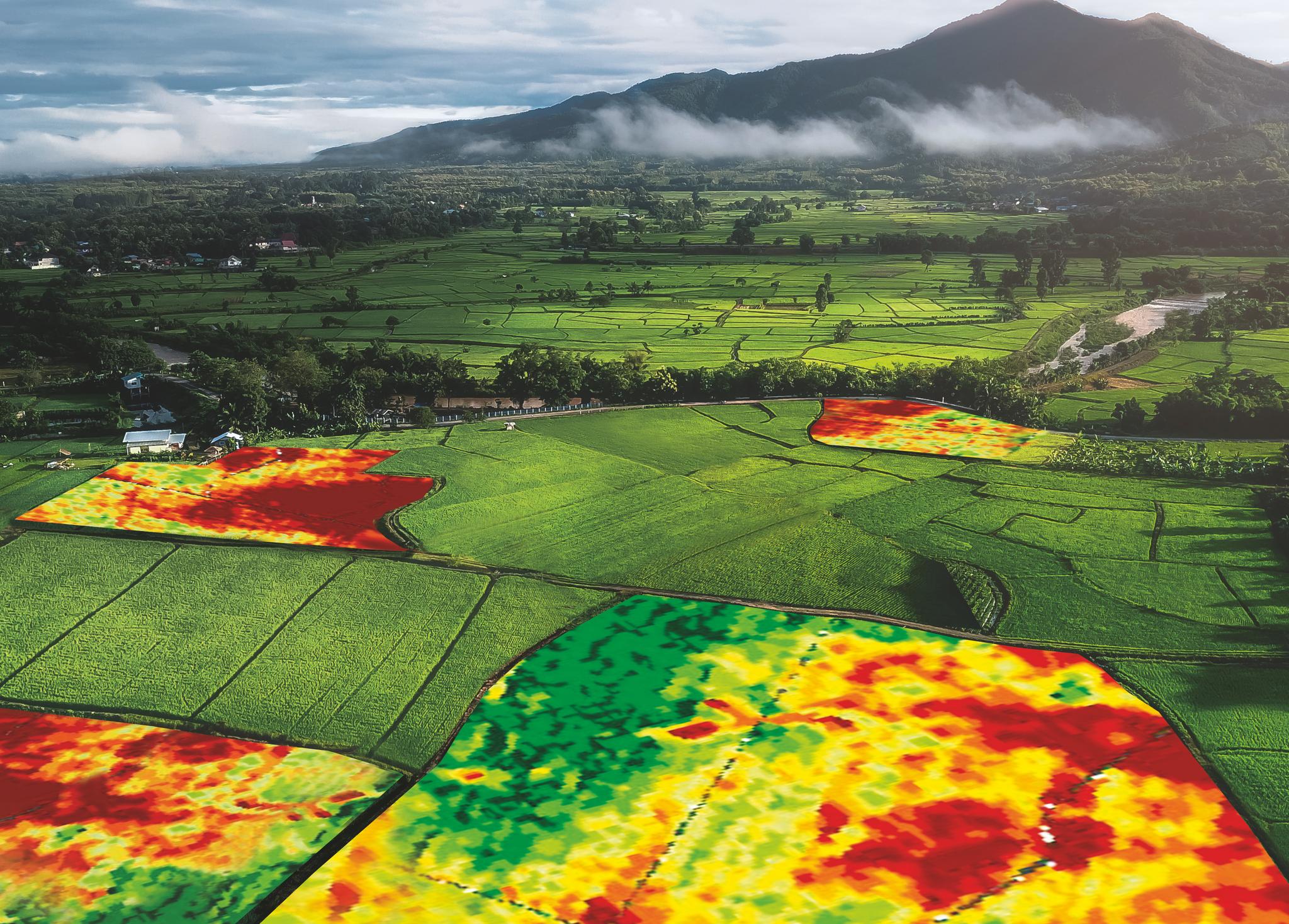
Farmers are now accessing advanced satellites to provide near-live images of fields and crop damage // Credit: RHIZA
StoriesIt’s not surprising that agricultural technology, and in particular, precision agriculture, is becoming a crucial tool in a farmer’s arsenal. In order to boost productivity and profitability, farmers need to carefully manage where they invest their time and resources. New technologies are making this possible at a scale never before possible.
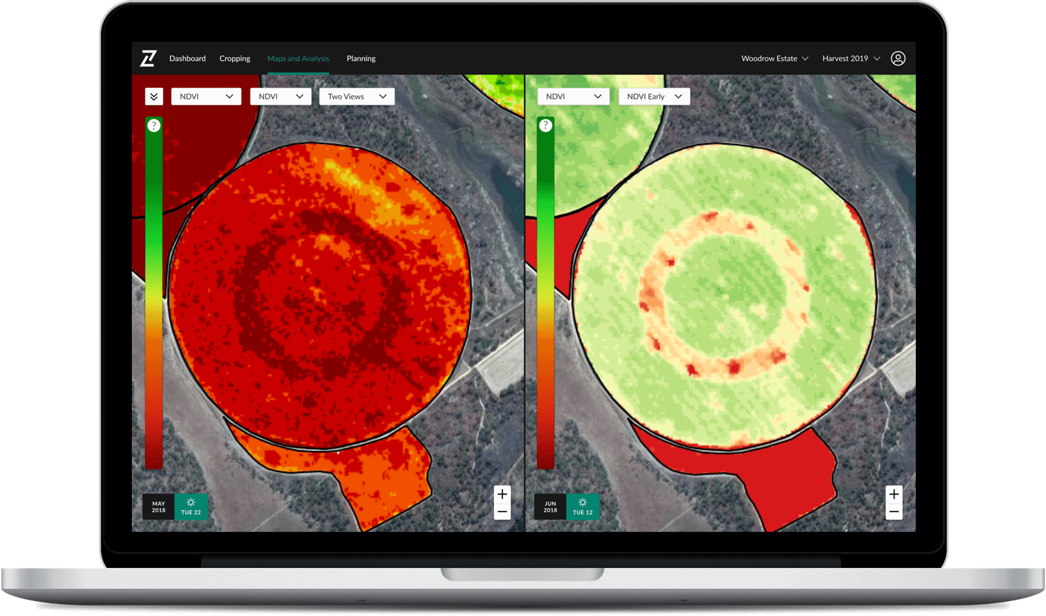
During Zambia’s first harvest in May 2018, Derek Nicolle, General Manager of Agrivision Zambia - Mkushi Estates, who grows soy, wheat, and maize on 3,000 hectares, was experiencing unnoticed irrigation issues. He managed to avert a critical loss, equivalent to about 15 percent of the field’s yield — thanks to his decision to work with RHIZA, an agtech company that allows farmers to monitor and manage their crops in-season.
With the use of Planet high frequency-satellite imagery, Nicolle was able to properly monitor irrigation effectiveness and detected an error early in the growing season. Below are sample outputs from RHIZA’s app, Contour. You can see an image presented with a vegetation index that is color coded to indicate crop health - red indicates lower vegetation and green indicates higher vegetation.
The two sections show different periods of the growing season. The dark red circle in the left image is from early in the growing season, when the RHIZA app detected an anomaly. Some of the irrigation nozzles had been replaced prior to the season with the incorrect nozzle aperture.
With the early alert, Nicolle was able to take immediate action and see significant improvements in just a matter of weeks. The right image shows the improvement with the crop emerging and maturing, as shown by the greening fields. However, there are still remaining signs of the earlier damage seen in the yellow and red inner circle.
.
Ready to Get Started
Connect with a member of our Sales team. We'll help you find the right products and pricing for your needs.