
Adding a Time Axis to Maps—Introducing Planet Explorer Beta
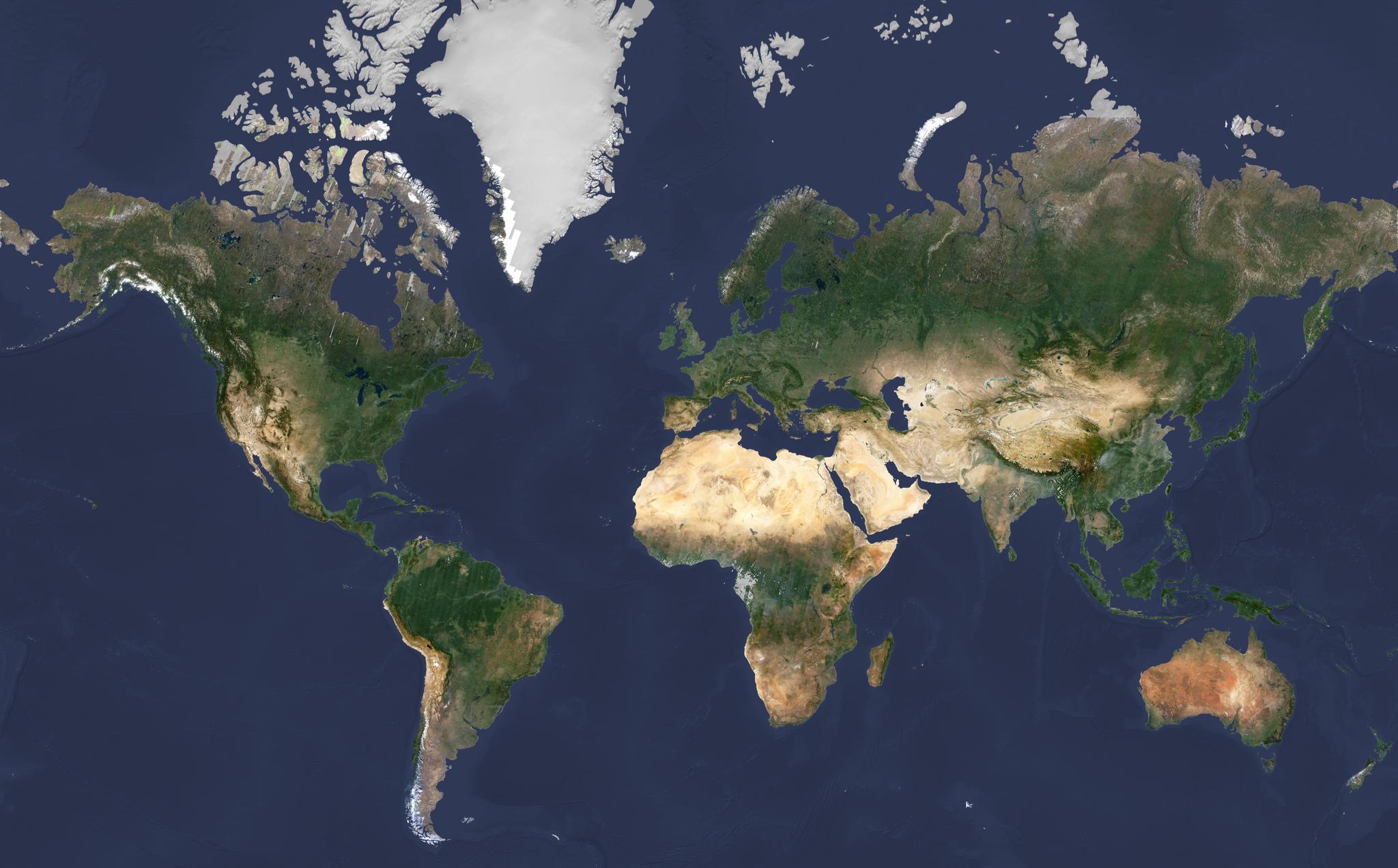
Today we’re excited to release Planet Explorer Beta, an online tool that lets users browse geospatial data through time and see change across the globe. In short, Planet has introduced a time axis to maps. Planet operates 149 satellites, the largest fleet in human history, giving us the capacity to collect a new image of everywhere on Earth’s land area every day.
Most satellite imagery online today is years old. Planet’s imagery is different — it’s being constantly updated. With Planet Explorer Beta users can for the first time browse and see change month by month across the whole planet: every port, every farm, every forest, every city.
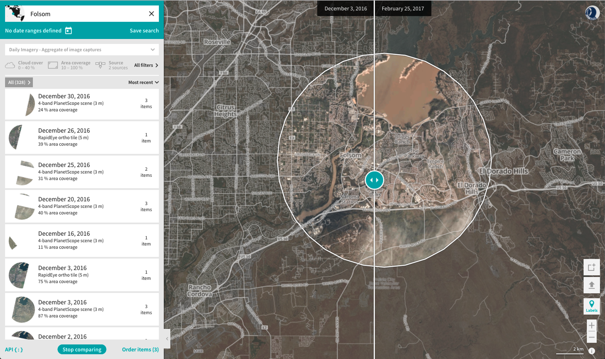
Here is what Explorer Beta looks like:
Navigate the globe through space and time
The goal of Planet Explorer is to enable users, both commercial and humanitarian, to browse the imagery we have and understand how it can meet their needs. We hope this will lead to more commercial partnerships and ensure humanitarian benefits are enabled.
We also hope it will change the way people think about satellite imagery. What is surprising to me is that in nearly every image we collect, when we compare it to a previous image, we see some level of change: a reservoir level drains, a tree is cut down, a field is harvested. People think of the Earth as static because we’ve been trained on static maps. In reality, Earth has never been static; it’s always changing and imagery of our planet should reflect that.
Explorer Beta is available publicly and, with no login, users can see regional and global change month-by-month or quarterly as they browse our global Timelapse Basemaps. Each basemap is made from over 2 million satellite images automatically processed and stitched together. At 3-5 meter per pixel, users can see a tree, a road or a ship, but not people or license plates; the goal is to see broad-scale change.
This is a Beta release so it’s not perfect. Planet’s mosaicking technology is cutting edge, but it’s also evolving: users will notice color anomalies and tiling in some of the satellite imagery, and some places where there is no data during a given timeframe. The data available via this browser is for personal, non-commercial uses only — we encourage commercial uses but for that a paid account is required. The browser is optimized for the big screen now, so don’t get out your mobile phones just yet.
And there’s more ... once logged in with a free account, users can browse our full set of imagery worldwide. Planet has an average of more than 100 images for any location on Earth’s land surface. Users can browse these deep stacks of images, and see new imagery as it comes down daily. There’s also a tool to compare images from different days to see changes.
Ready to Get Started
Connect with a member of our Sales team. We'll help you find the right products and pricing for your needs.