
McGill University Partners with Planet to Track Earth Systems Changes Daily
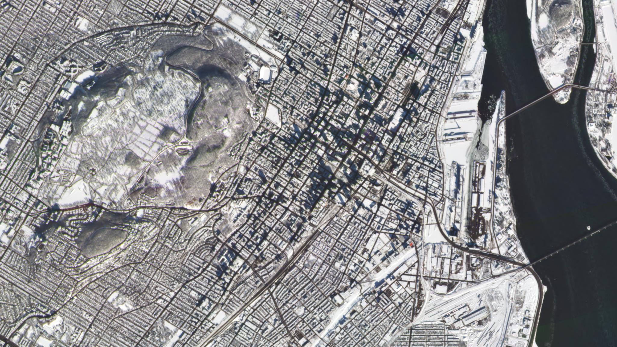
McGill University, located in Montreal, Quebec, Canada, in February of 2020 © 2020, Planet Labs Inc. All Rights Reserved.
NewsMcGill University, one of the oldest universities in Canada, recently signed an agreement with Planet to provide students with subscription access to Planet’s data and satellite imagery. McGill students will now be able to use our growing catalogue of PlanetScope satellite imagery for non-commercial research and classroom activities across a variety of disciplines. We are excited to continue expanding our university partnerships in Canada and other places across the globe. Dr. Tim Elrick, director of McGill’s Geographic Information Centre (GIC), was eager to bring Planet imagery into McGill, which is at the forefront of geospatial research. “Our students and faculty will undertake a variety of geographic and urban studies,” Elrick says. “We are excited to partner with Planet to expand the catalogue of satellite imagery available to our community.” Planet is enabling researchers across the world to study global change in near real time by providing high temporal resolution satellite imagery that is not available through conventional sensors, according to Dr. Joe Mascaro, director of Planet’s Education and Research Program. “We are impressed by the caliber of research at McGill, and are looking forward to the new research and insights that come out of this collaboration,” Mascaro says. McGill biology professor Catherine Potvin is excited about the potential applications for tropical forest science and conservation in the Darién in Panama, where she works with indigenous groups. “We’re eager to use Planet imagery in these forests, where our team has been ‘hunting’ for big trees at the landscape level,” Potvin says. “Because Planet’s spatial resolution is 3.7 m per pixel, we can look for large tree crowns, which is vital to our conservation and research efforts.” Planet’s data enhances students’ research capabilities in a variety of different fields, says McGill geography professor Margaret Kalacska. “This partnership with Planet will allow McGill geography students and researchers to explore Earth observation at an unprecedented scale—from food security, ecosystem and biodiversity conservation, climate change impacts and more,” Kalacska says. Students and faculty interested in using Planet’s imagery for their research should submit a request through the McGill GIC. They can also find more information on satellite imagery and Planet via this guide. Learn more about Planet’s Education and Research Program here. If you’re interested in purchasing Planet data for university use, contact us.
Ready to Get Started
Connect with a member of our Sales team. We'll help you find the right products and pricing for your needs.