
Monitoring River Flushing and Hydropower from Space
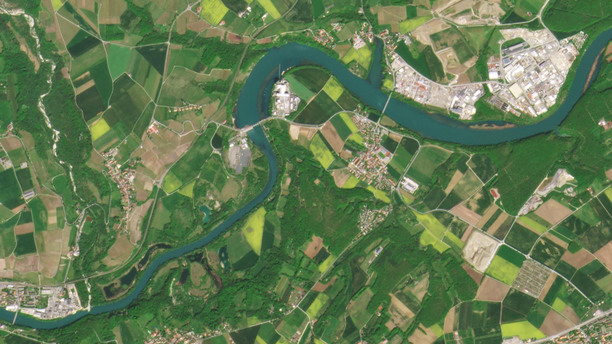
PlanetScope of the Verbois hydroelectric dam outside of Geneva, Switzerland captured on May 3, 2021. © 2021, Planet Labs PBC. All Rights Reserved.
StoriesThere are innumerable dams around the world helping communities manage water supply, regulate flooding, and generate hydropower. However, dam and reservoir systems have to contend with excess sedimentation, like sand and gravel from floods or rivers that are deposited downstream into these systems. Sedimentation that settles in reservoirs can build up over time, leading to a loss of water storage capacity and damaging hydropower dams, turbines, and water intakes. Sediment-related maintenance and removal costs can account for up to 40% of all maintenance costs. Reservoirs and dams require adequate monitoring and sustainable management in order to provide reliable services to surrounding communities.
Regulations monitoring river flushing events have grown in recent years to mitigate excessive sedimentation and protect water resources and the structural integrity of these dams. Since 2000, the European Union has been working with member states on the EU Water Framework Directive with guidelines for reporting on flushing activities and providing ecological assessments. But accurate reporting takes time and resources given the scale of these events.
Satellite imagery and analytics can help.
EOMAP is one environmental services company using Planet satellite imagery to offer daily monitoring of water body changes during flushing events. Using high-frequency PlanetScope data, EOMAP analyzed sediment levels before and after a river flushing event at the Verbois hydropower plant in Switzerland.
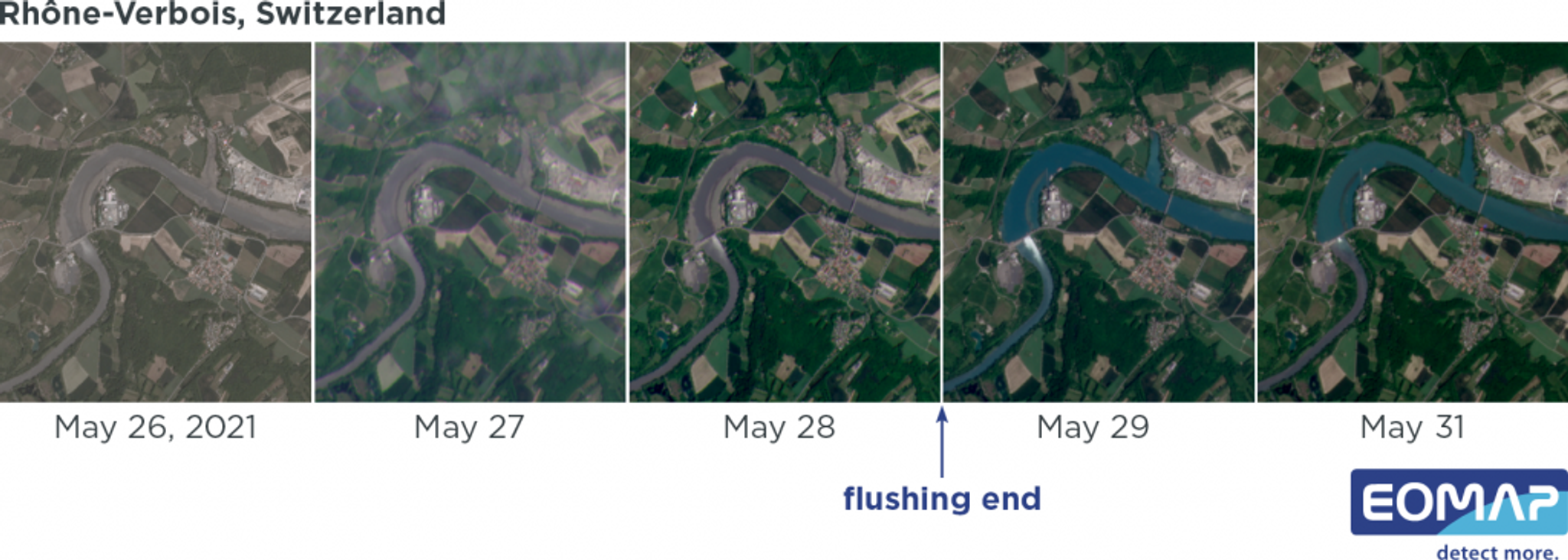
3 meter PlanetScope time-series showing water expansion and turbidity in true color over the course of a week. Image credit: EOMAP
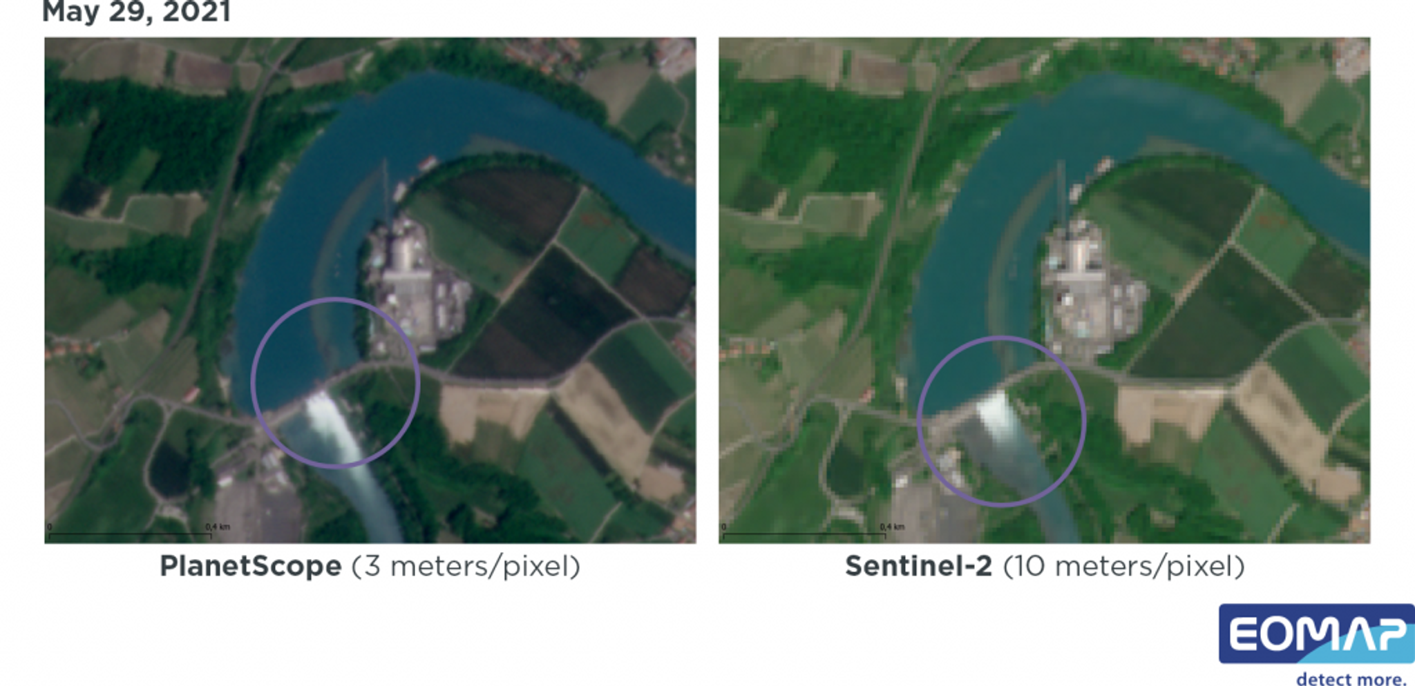
Side-by-side comparison of 3 meter PlanetScope and 10 meter Sentinel-2 data showing water dynamics at the Verbois hydropower plant on May 29, 2021. Image credit: EOMAP
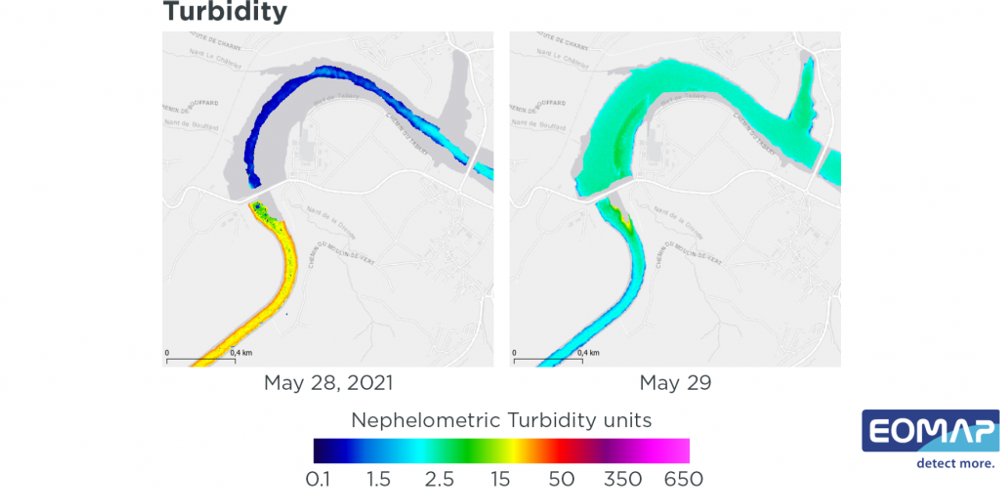
Analysis of Turbidity dynamics before and after a flushing event at the Verbois hydropower plant between 28 May 2021 and 29 May 2021. Image credit: EOMAP
EOMAP’s analysis of PlanetScope imagery from before and after the event revealed how sediments were redistributed. These types of analyses can enable reservoir and dam management authorities to carefully monitor the effectiveness of river flushing events and plan for further sedimentation mitigation efforts if necessary.
Learn more about how effective water management can employ satellite imagery here.
Ready to Get Started
Connect with a member of our Sales team. We'll help you find the right products and pricing for your needs.