
PlanetScope Data Leveraged to Map and Monitor the Forests of the Czech Republic
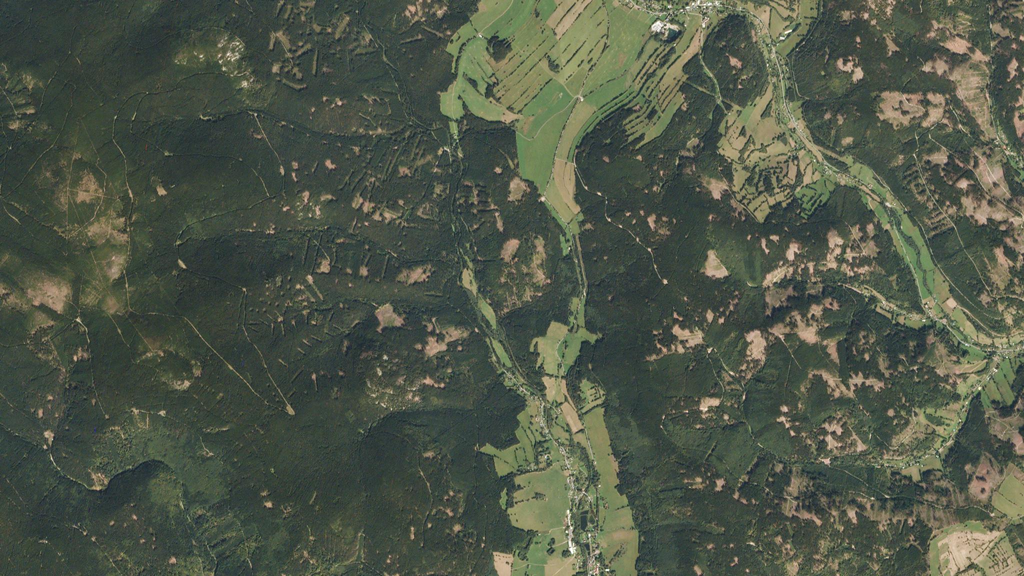
Forest impacted by bark beeles in Bruntál, Czech Republic captured by PlanetScope on September 12, 2018. © 2018, Planet Labs PBC. All Rights Reserved.
StoriesThe Forest Management Institute (FMI) is the government organization, established by the Czech Republic’s Ministry of Agriculture, responsible for implementing the National Forest Inventory. In 2018, FMI began working with Planet datasets to undertake a comprehensive geospatial analysis and report the devastating impacts of the bark beetle epidemic on Czech forests.
By leveraging PlanetScope, Sentinel-2, and data from the national aerial inventory, FMI was able to create a public portal for forest stakeholders to see which trees were recently removed due to bark beetle activity, and which were standing deadwood due to bark beetle infestations. With our data in 2018, FMI was able to determine that $200 million worth of timber, approximately 16,000 hectares, were impacted by this epidemic, and over 90% of 55 selected plots were confirmed to be at risk of further disease spreading. FMI more recently noted that between 2015 and 2021, approximately 200,000 hectares of forest were impacted by bark beetles, making it the largest bark beetle calamity in the history of the Czech Republic. This work supported efforts by the Ministry of Agriculture to propose new legislation to rezone forests to minimize the spread of the disease and optimize healthy timber harvesting.
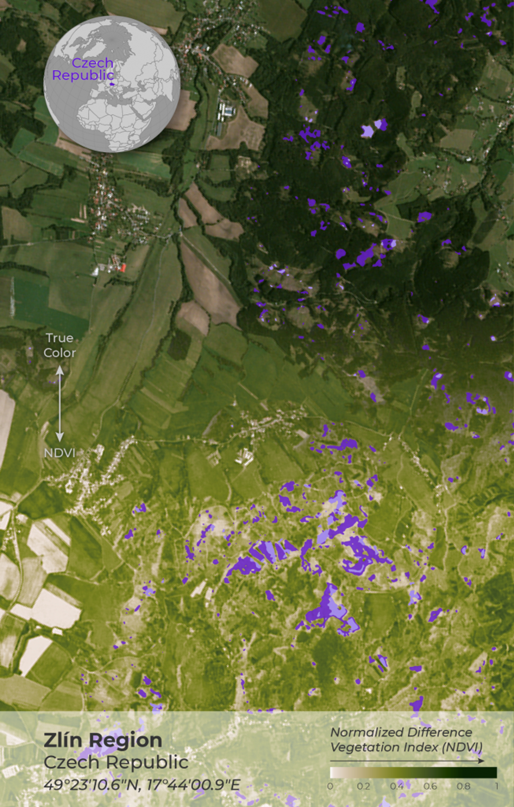
Planet imagery from 2018 showing the dead standing wood and recent forest removal due to the bark beetle calamity. Graphic by Leanne Abraham.
Since this time, FMI has expanded their work with Planet in order to deliver objective yet robust forest data across the entire territory of the Czech Republic. It was important to FMI to have a dataset with high update frequency that would not require the processing of individual source images – a very computationally and storage intensive activity. Our PlanetScope product provided an affordable tool to FMI, and offered the right capabilities for forest monitoring.
Traditionally, FMI conducted visual interpretations of aerially collected RGB photos, requiring manual digitalization, to evaluate forests, but this was operator subjective and time-consuming. As the years went on, FMI employed a diversity of digital data sources to evaluate tree heights and forest change. Using 3D information from LiDAR-collected data, digital aerial photos, Landsat, and Sentinel-2 data, they were able to generate automated detection of clearcuts and evaluate full forest mosaics. However, the revisit time of the aerial campaign was once every two years, and from satellite sources, they could only receive three cloud-free mosaics a year at a 20 meter resolution. These infrequent collections limited FMI’s insights regarding the country’s forests.
As forest dynamics were changing at unprecedented rates due to climate change, drought, and bark beetle infestations, FMI wanted continuous insights with increased spatial detail and high temporal resolution. PlanetScope’s daily imagery enabled FMI to round-out their data sources, collect more frequent data, and conduct their analyses in reduced timeframes.
“Planet is an integral part of our remote sensing information source. A kind of bridge between very detailed (20cm pixel) 3D aerial imagery with poor temporal resolution and the Sentinel-2 satellite images with great spectral bands and limited spatial resolutions,” said Filip Hájek Head of FMI’s Remote Sensing Department.
With PlanetScope, FMI was able to get high quality mosaics of large areas with low cloud coverage at an interval that they could well define. This has allowed the institute to interpret the state of forest stands across the country, supporting change detection products looking at clearcutting and forest borders with reasonable computational power.
“What makes our analysis more flexible is the significantly smaller volume of data to process. We get a straight seamless nearly-cloudless mosaic of our country with Planet, which has an order of magnitude less data volume compared to aerial data,” said Hájek.
PlanetScope’s spectral bands also offer FMI the ability to distinguish subtle changes happening on the ground. With Planet’s near-infrared (NIR) and Red edge bands, FMI was able to detect standing land and logging in their forests. Additionally, our bands have helped FMI identify forest species phenology, allowing them to distinguish different tree species from each other based on their different evolution over time.
“At FMI, we have developed a process line for interpreting diverse data to accurately map the species composition of our forests. Satellite observations at different stages of the growing season within a year are a great added value for us to refine the species classification,” said Hájek. “The inclusion of Planet data will allow us to make the latest version of the tree species map even more accurate with more time slices and better spatial resolution.”
With all of these insights, FMI is now looking towards the future. Following on from their early work with Planet, monitoring bark beetle infestations, FMI is now using PlanetScope data to map the restoration of forests damaged from the epidemic.
“Here we are dealing with practically the opposite problem [from before]. Instead of assessing stand decay, harvesting, and the presence of droughts, we will assess the trends of ‘greening’ of the clearcuts,” said Petr Lukeš, remote sensing developer at FMI. “This activity is still in its infancy, but we firmly believe that the combination of the relatively high spatial detail of the Planet data, together with the presence of the Red edge band, and the assessment within a single year and across years, will help us monitor trends in the regeneration of our forests.”
To learn more about their work with us in the past, read our previous blog on the bark beetle calamity.
Ready to Get Started
Connect with a member of our Sales team. We'll help you find the right products and pricing for your needs.