
Protecting Indigenous Populations and Ancestral Land with Planet Data
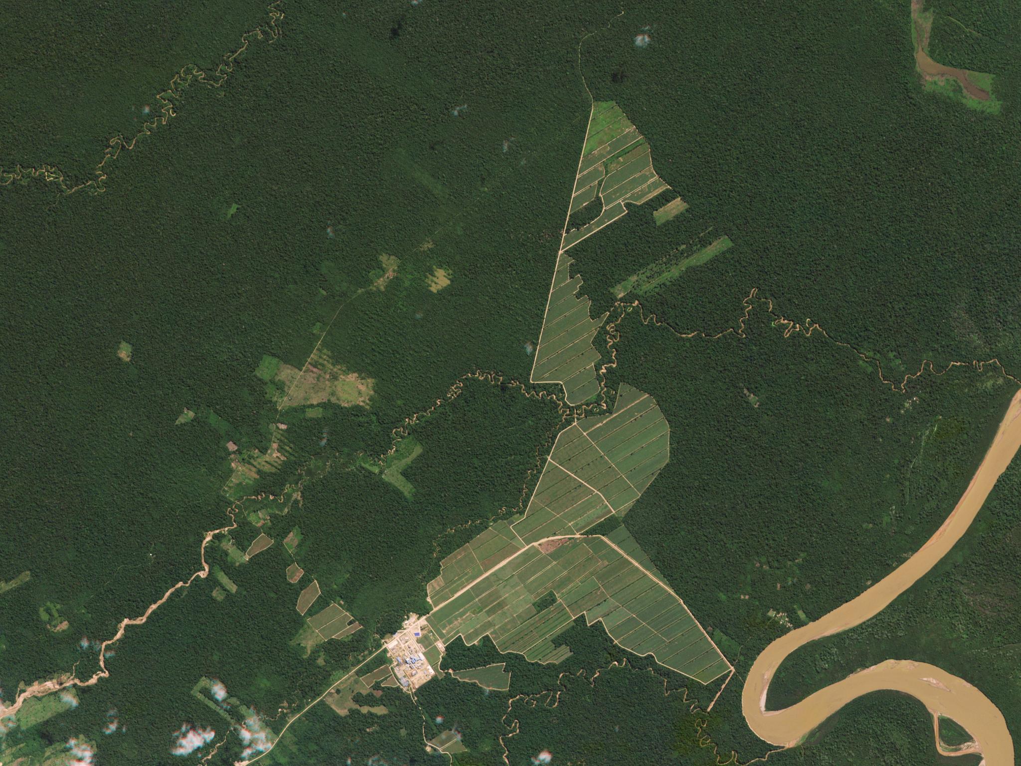
With a growing demand for sugarcane, rapid deforestation in Bolivia has ensued, as is evident by this image of deforestation © 2016, Planet Labs, Inc. All Rights Reserved.
NewsAn ancestral territory known as “Patrimonio Natural y Cultural Ayoreo Totobiegosode” (PNCAT), located in the Gran Chaco, an area that spans across Argentina, Bolivia, and Paraguay, is currently suffering rapid deforestation at a rate of 250,000 hectares per year. This biodiversity loss is affecting indigenous populations living in the forest, and in an effort to advocate for these groups, Stiftung für indigene Gemeinschaften in Paraguay, is using Planet data to combat deforestation and resolve land disputes. The organization aims to protect the Totobiegosode Indigenous Community of the Ayoreo Ethnic Group, whose name in Ayoreo is “Organizacion Payipie Ichadie Totobiegosode” (OPIT). The ultimate goal of “Stiftung für indigene Gemeinschaften in Paraguay” is simple: to stand for the rights of indigenous peoples and environmental protection in Chaco. "We want OPIT, assisted by their advocates to secure sufficient territory for themselves and their extended family members who have chosen to live in their forest isolated from mainstream society; to receive the protection of the state as guaranteed in their national constitution, free from further intrusions by outsiders,” says Julio Duarte Romero, lawyer of OPIT. Beginning in 2000, significant parts of PNCAT became increasingly farmed and divided between the livestock industry and agricultural companies breaking the original promise of preservation as agreed upon in 1993 and renewed by Inter-American Commission on Human Rights (IACHR) (Resolution No. 04/2016, of February 3, 2016, issued within the framework of MC54-13) covering a total area of about 550,000 hectares. Committed to preventing deforestation and third-party entry into the territory, OPIT began monitoring 90 focus areas within the 550,000 hectares of the main part of the PNCAT. Four out of 90 areas are threatened by Agri-businesses and have squatters who practice fire lighting to make way for fresh grass for their cattle. With Planet’s high and medium resolution offerings, monitoring illegal activities on a near real-time basis has become a reality. "We chose Planet since they offer the best affordable service, with the greatest frequency of collections, in the most flexible way, offering irrefutable evidence in defense of any action as and when necessary," says Peter Sawatzky, OPIT’s remote monitoring consultant in Canada, supported by Alfred Sawatzky, senior GIS specialist in the US.
Using medium-resolution data with a very high resolution gives viewers the possibility to react to these threats promptly. PlanetScope’s monitoring is frequent and accurate enough to easily detect illegal logging, settling, or fencing quarrels. This allows immediate action against violators—a number of them have been forced to pay the fine or to leave the territory after repeated infractions. From August 2020 to November 2020, 5,000 Hectares were scorched by squatters in PNCAT. In one area, illegal clearing is evident on a weekly basis during the dry season. For most other parts, illegal activities are caught once or twice a year. Planet’s high-resolution SkySat data also is frequently used as a form of visual proof in formal documentation. With a 50cm resolution, changes are vivid and apparent. This can verify suspected changes such as small-scale clearings, line fences, corals, and water-holes. Currently, legal cases are ongoing using the imagery as evidence. The cases tackle environmental crimes, invasion of property, and damage based on the Resolution of IACHR that took place in 2016. Only with international support will it be possible to secure the integrity of PNCAT as a single contiguous territory. With Planet’s imagery, OPIT and other conservation groups can effectively fight against increasing encroaches into the protected land. So far OPIT has been able to protect approximately 250,000 to 520,000 hectares covering PNCAT. We look forward to our continued work in matters of environmental protection. Learn more about their work.
Ready to Get Started
Connect with a member of our Sales team. We'll help you find the right products and pricing for your needs.