
USDA’s National Agricultural Statistics Service to use Planet Basemaps to Support their 2021 Growing Season Assessment
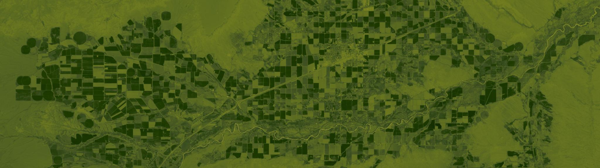
Fields near Powell, Wyoming. Normalized Difference Vegetation Index calculated from Planet’s June 2019 surface reflectance basemap. © 2019, Planet Labs Inc. All Rights Reserved.
NewsPlanet Federal, a wholly owned subsidiary of Planet Labs Inc., a leading provider of daily data and insights about Earth, has inked a deal with the United States Department of Agriculture’s (USDA) National Agricultural Statistics Service (NASS) to integrate Planet Basemaps into NASS’s robust data collection and analysis processes. With Planet data, NASS will begin exploring higher spatial granularity and timely assessments of the 2021 growing season. Annually, NASS conducts hundreds of surveys and prepares reports covering virtually every aspect of the U.S. agricultural sector. Since 2007, NASS has used satellite data from missions such as Landsat, Sentinel 2, the Disaster Monitoring Constellation, and Resourcesat-2 to operationally derive land cover products, investigate crop progress and conditions, and produce crop production statistics throughout the growing season. The addition of Planet’s satellite data will further this work and also help NASS evaluate enhanced disaster response observations and assessments not possible from medium resolution optical systems. Research and development efforts are underway to explore using Planet’s Basemaps to provide NASS with a spatial and temporal boost that may support independent, high resolution state- and county-level crop area yield assessments. Planet’s enhanced satellite data can help determine if higher resolution classifications improve statistical accuracy and quality over the contemporary medium resolution products. “USDA’s NASS’ reporting is vital to U.S. food production, and we are thrilled they are incorporating Planet’s satellite data to contribute to their agriculture intelligence used by partner agencies and the public,” said Vince Hurley of Planet Federal. “It’s encouraging to see this group integrate commercial datasets and products into their workflows, and we’re eager to see how accurate and timely Planet data contributes to their 2021 growing season assessment.” Accurate data is valued by farmers and agribusinesses throughout the United States, because it supports informed decisions about crop management, marketing, and logistical operations,. Further, data driven decision-making can help ensure a sustainable food supply, manage risk, and increase profitability. “Planet’s Basemaps provide a frequent and high-resolution solution for agricultural monitoring as farming becomes an increasingly data and technology driven process,” said Rick Mueller, section head, USDA NASS Spatial Analysis Research Section. “With Planet’s robust dataset integrated into our workflow, NASS can better understand and quantify trends in upcoming growing seasons, identify regions prone to drought stress and natural disasters, and provide high resolution assessments of crop production.” Planet recently entered into a definitive merger agreement with dMY Technology Group, Inc. IV (NYSE:DMYQ), a special purpose acquisition company, to become a publicly-traded company. David Johnson and Rick Mueller from USDA will be sharing more details on this important work at Explore 2021 in October. Register for our annual user conference now to hear from this team and other thought leaders using Planet data to drive greater impact in their organizations.
Ready to Get Started
Connect with a member of our Sales team. We'll help you find the right products and pricing for your needs.