RapidEye image of New Zealand flooding on March 20 2017 © 2017, Planet Labs Inc. All Rights Reserved.
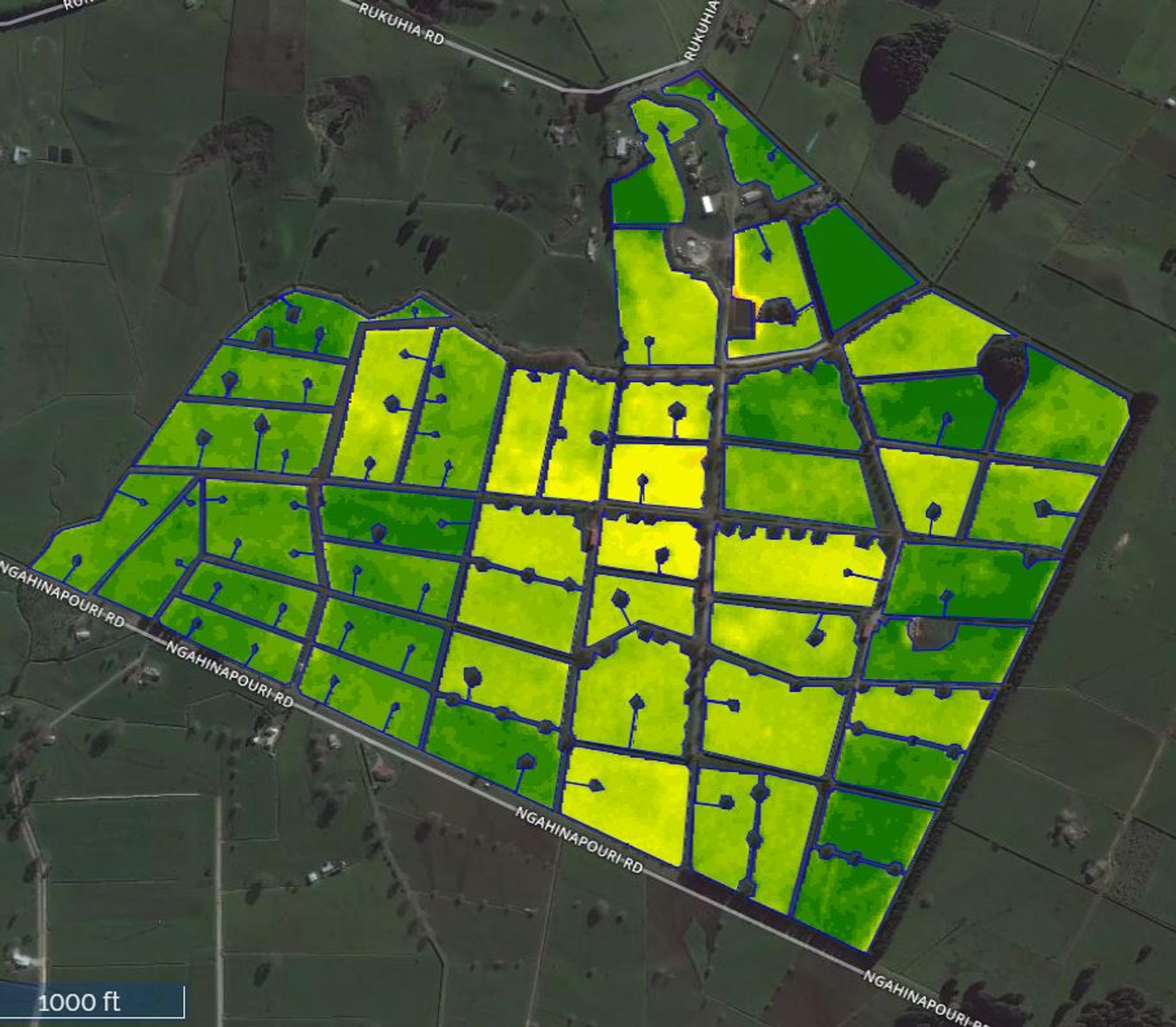
AUTHOR PROFILE Ian Ritchey
Curious Planeteer working to make the Earth's changes visible, accessible and actionable.

Planet and FarmShots Team Up to Deliver Advanced Pasture Management Solution

News

Planet has again partnered with FarmShots to power a next-generation agriculture solution for Livestock Improvement Corporation (LIC). LIC’s Satellite Pasture and Cover Evaluation (SPACE™) service uses daily satellite imagery from Planet and field analysis software from FarmShots to measure pastures. We are very excited to collaborate with Farmshots on this innovative approach to pasture management.

Planet imagery can quantify the amount of pasture in each paddock. Pasture variations is represented by color with dark grass implying an abundance of pasture, while yellow shows less pasture.
 

Using satellite imagery to accurately estimate pasture cover, LIC customers are able to better plan where to send livestock for grazing and make the most out of their grass.

This technology is a first for New Zealand and has not been previously commercially viable due to the frequent cloud cover over the country. Planet’s ability to capture images daily effectively counters this issue and provides famers – via FarmShots advanced field analysis technology – with timely, accurate assessments of their pasture cover.

This collaboration allows farmers to make more informed decisions around grazing, fertilizer and overall feed management – a giant leap forward for pasture management.