
Building a new world: infrastructure monitoring for a more sustainable future
Dhuba, Tabuk, Saudi Arabia captured by SkySat on March 13, 2021. © 2021, Planet Labs Inc. All Rights Reserved.
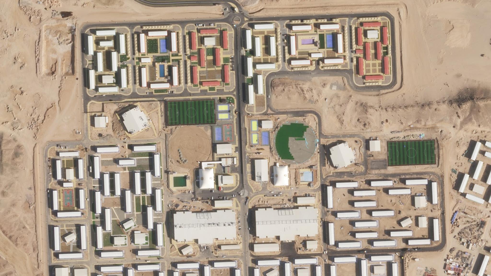
TechAs the world continues to recover from a historic pandemic, there is a growing awareness in government and industry that new, innovative solutions are needed to protect natural resources and create more effective policy for economic growth. Transparency and reliable decision-making are imperative in this effort to renew public confidence and restore a sense of stability. Today, some 55 percent of the world’s population live in cities, and that number is expected to double by 2050. As a consequence, cities are quickly expanding with an expected 1.2 million km2 of new urban development built around the world putting massive strain on land and natural resources. As the world rebuilds, organizations need a reliable and scalable way to measure the growth and impact of key infrastructure projects. More governments are adopting frequent, broad-area satellite monitoring as a solution for more efficiently managing these initiatives, and identifying new projects from the private sector. Sending workers into the field for inspections can be costly and resource-dependent, and open datasets can’t provide the fast, reliable data required to optimize these operations. Planet offers a way for decision-makers to speed their time to insight for greater visibility over remote regions. Our Road and Building Change Detection automatically extracts changes from Planet’s quarterly and monthly Basemaps, alerting users to new construction and signs of activity in areas they’re most interested in. These advanced models allow governments, corporations, and NGOs, to monitor large-scale infrastructure projects at the speed in which they unfold. Planet’s automated road and building change detection recently picked up development of a new project called The Line. In January 2021, the Kingdom of Saudi Arabia announced ambitious plans to build a postmodern city on the kingdom’s northwest coast. This narrow strip of land will span 106 miles, have zero roads, cars, or emissions, and is said to preserve 95% of the region’s natural environment. [video width="1280" height="720" autoplay="true"][/video] Planet’s automated Road and Building Change Detection picked up the city’s development shortly after they broke ground early this year. With these detections, we have been able to monitor growth of the project from just a small dirt road to a modern village complete with new housing developments and sports facilities. Because Planet Road and Building Change Detection extracts data from our monthly basemaps, we’ll be able to get a monthly update on the progress of the project. To learn more about how Civil governments are using satellite data for broader visibility over their territories, click here.
Ready to Get Started
Connect with a member of our Sales team. We'll help you find the right products and pricing for your needs.