NewsNewsPlanet, Paul G. Allen Philanthropies, & Leading Scientists Team Up to Map & Monitor World’s Corals in Unprecedented DetailAndrew Zolli |June 4, 2018|3 min readRead more
NewsNewsExplore and analyze Planet imagery with Harris ENVIAlex Shih |June 5, 2017|2 min readRead more
NewsNewsExtracting Insights from Imagery: Planet Analytics WebinarHilary Salazar |August 2, 2018|1 min readRead more
StoriesStoriesAnalyzing the Impact of Agricultural Activity on EcosystemsShelby Siegel |August 2, 2021|5 min readRead more
NewsNewsPlanet and Farmshots Offer Trial to John Deere Operations Center UsersRyan Schacht |April 18, 2017|2 min readRead more
NewsNewsCheck Out Planet’s Latest Innovations at the 2019 GEOINT SymposiumJasmine Rice |May 31, 2019|2 min readRead more
StoriesStoriesExecuting a Successful Growing Season Using Satellite ImagerySteve Levay |July 23, 2021|4 min readRead more
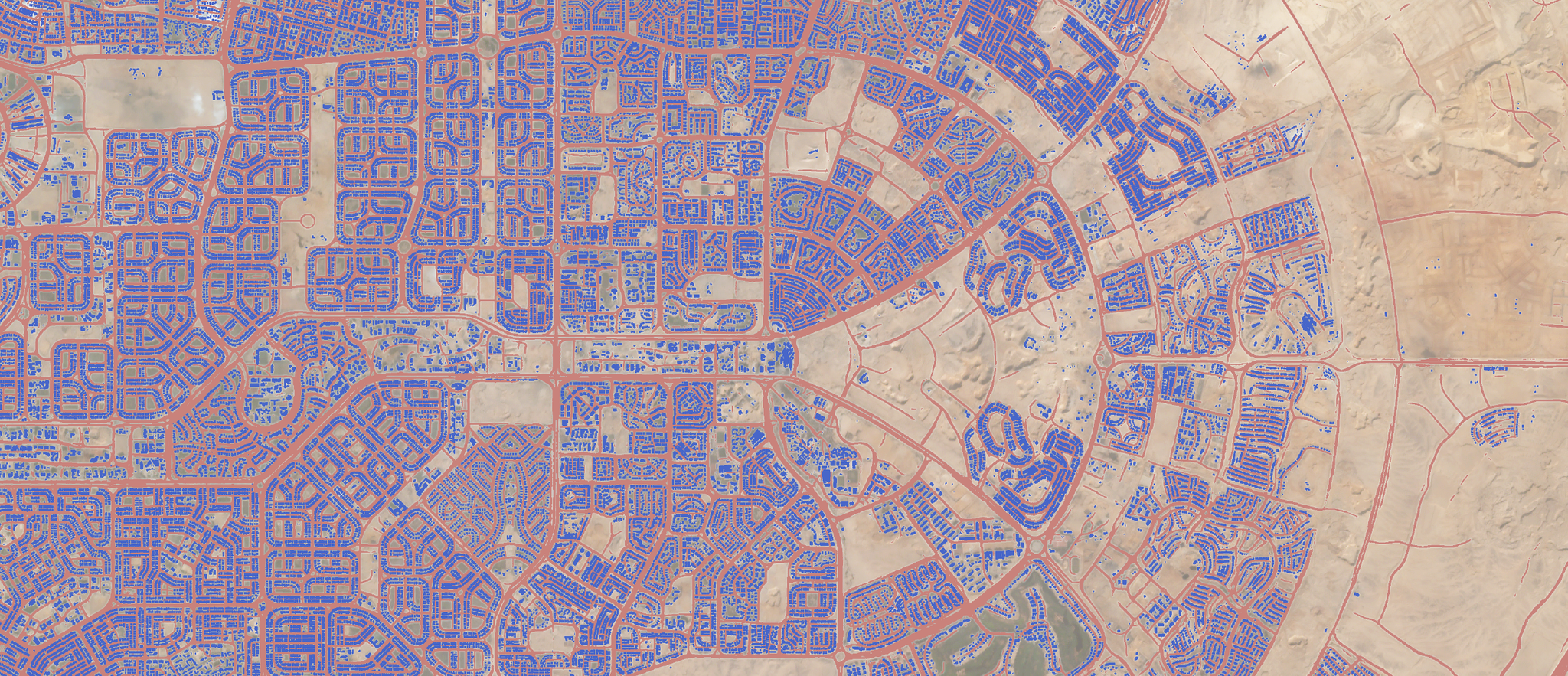
TechTechBuilding a new world: infrastructure monitoring for a more sustainable futureSarah Preston |April 29, 2021|3 min readRead more
StoriesStoriesYou Can’t Fix What You Can’t See: The Realities of AI and Satellite DataGiovanni Marchisio |July 15, 2019|7 min readRead more