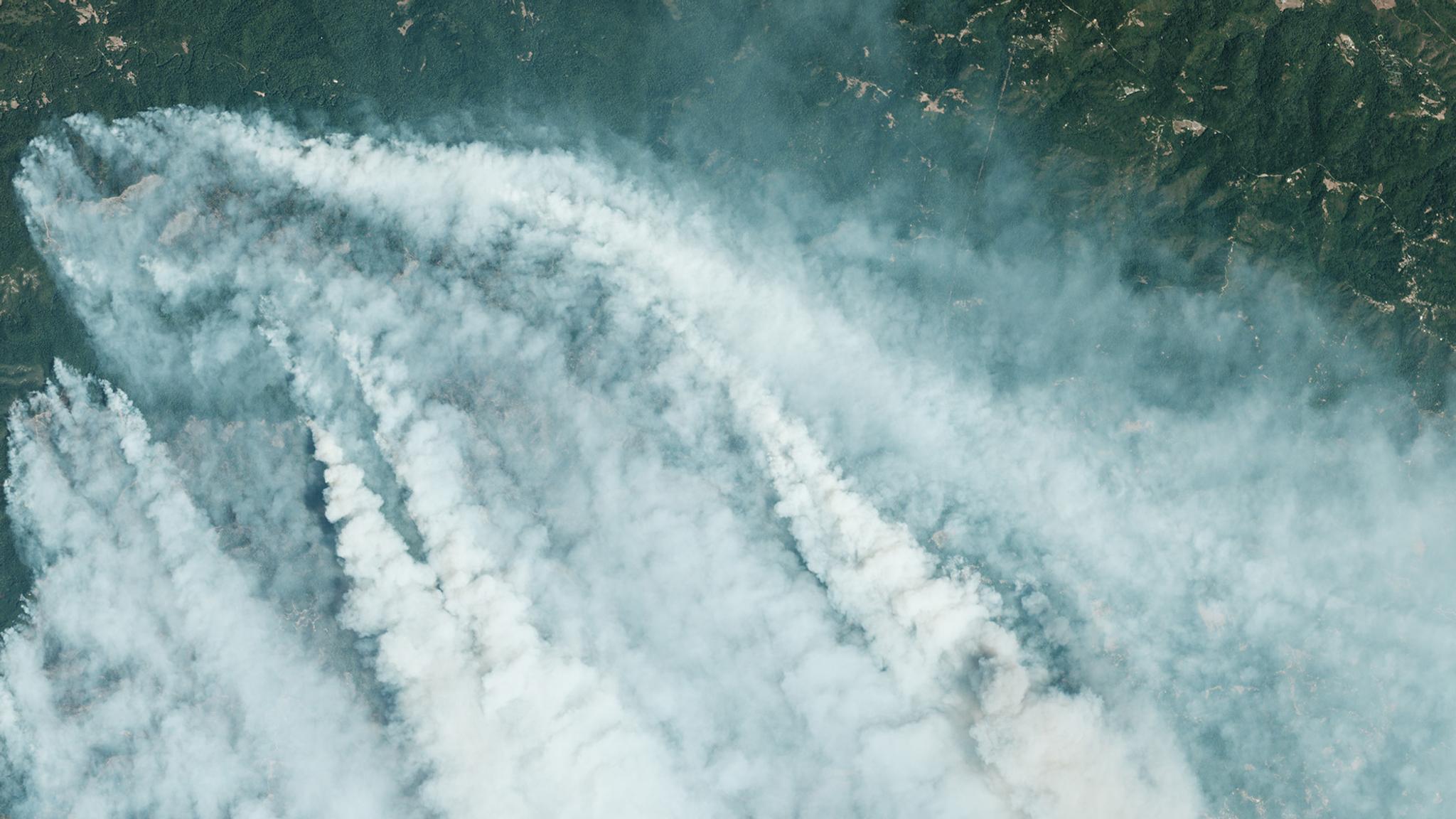
CZU August Complex fire just north of Santa Cruz on August 20, 2020. © 2020, Planet Labs Inc. All Rights Reserved.
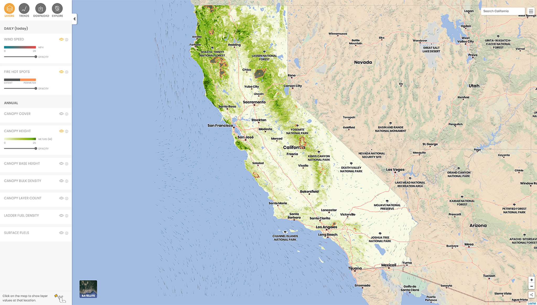
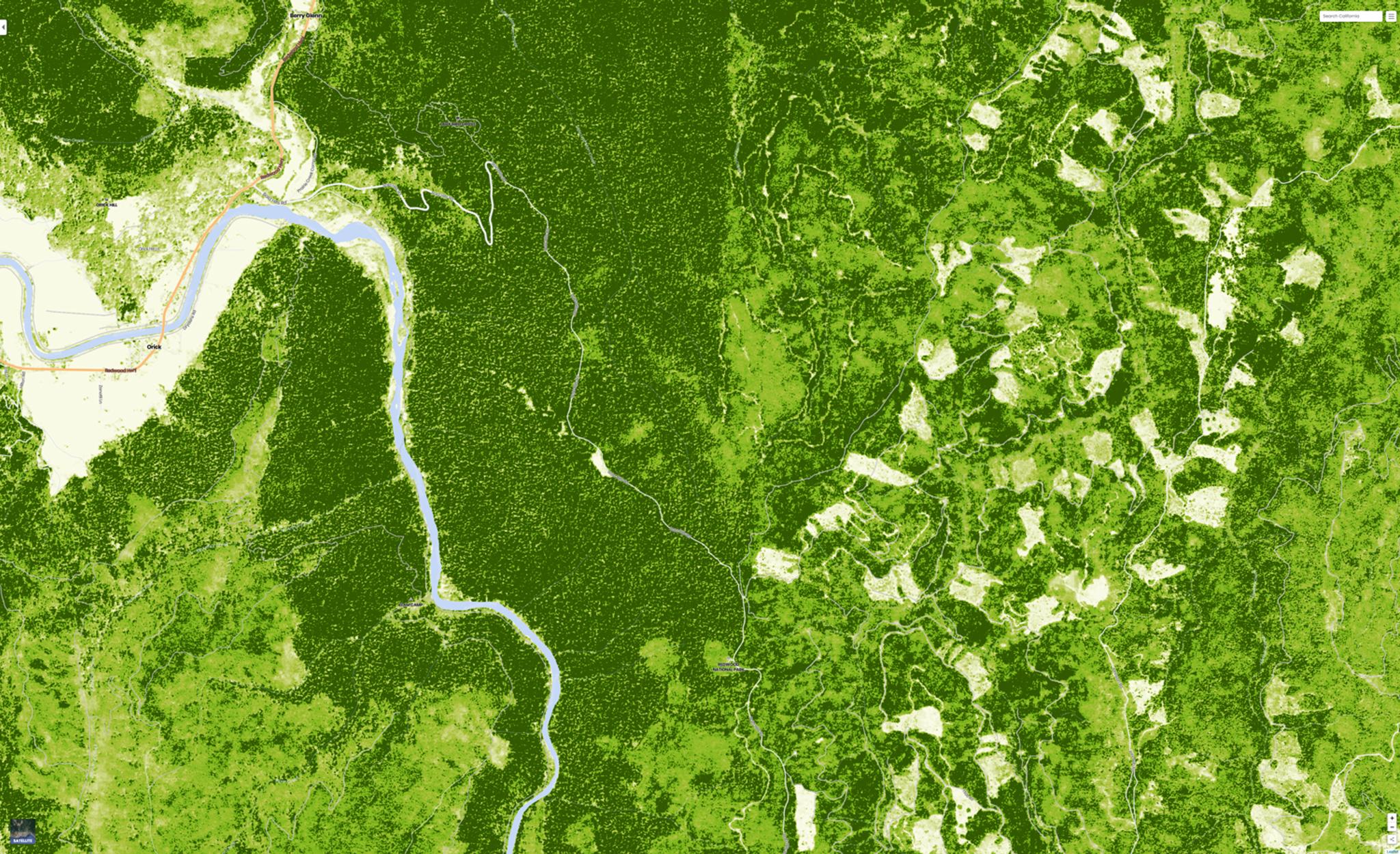
AUTHOR PROFILE Paris Good
Curious Planeteer working to make the Earth's changes visible, accessible and actionable.

California Forest Observatory Sets New Standard for Mapping Forests and Wildfire

Tech

The California Forest Observatory (CFO) is a new data-driven forest monitoring system designed to dynamically map forest structure and vegetation fuel loads at the individual tree level. This wall-to-wall, statewide data will set a new standard for how we research, plan for, and respond to wildfires in the state.

Powered by a partnership between Planet, Salo Sciences and Vibrant Planet, with support from the Gordon and Betty Moore Foundation, the CFO provides unprecedented and continuously updated views of wildfire hazard and forest health for California. The tech leverages artificial intelligence, satellite imagery and airborne LiDAR to produce detailed data on vegetation fuels—including tree heights, canopy cover, density and understory ladder fuels. Combining these fuses data with weather and topography to assess wildfire hazards across the landscape. The CFO is built to support forest restoration and wildfire mitigation efforts, providing free access to current data for government, researchers and nonprofits.

Up until recently, the methods for tracking and mapping wildfires and hazards have been inadequate, offering vegetation fuel maps that are static, low resolution and outdated. Government agencies, first responders, municipalities and other organizations traditionally lack the tools to proactively plan for and build long-term resilience to wildfire.

The California Forest Observatory web platform displays vegetation, wildfire, and weather data layers across the entire state, including historical data back to 2016 to visualize trends across space and time. © Salo Sciences, Inc. 2020

The California Forest Observatory web platform displays vegetation, wildfire and weather data layers across the entire state, including historical data dating back to 2016 to visualize trends across space and time. © Salo Sciences, Inc. 2020

But with the improved specifications and resolution offered by Planet data and Salo’s proprietary artificial intelligence-powered ecological modeling, the CFO can enable state and federal agencies to increase resilience among communities facing wildfire risks and challenges, while improving emergency operations through planning, prioritizing and treatments of hazardous fuels.

“The CFO uses disruptive technology to quantify forest vegetation structure at the scale and with the precision needed to inform management,” says Dr. John Battles, Professor of Forest Ecology at UC Berkeley. “For researchers, this data provides a valuable and novel resource that supports ongoing efforts to develop strategies that promote the sustainability of California’s forests.”

Wildfires have accelerated rapidly in recent years, with many lives lost, billions of dollars in property damages and the destruction of forest land. This acceleration is so dramatic, in fact, that some are referring to this time period as the “Age of Megafire.”

This year, California’s fire season started early, with over 7,000 wildfires occurring in the state by early September, burning a record 2.2 million acres, according to the National Interagency Fire Center. Fires east of San Jose and north of San Francisco were the second and third largest that California has ever seen. With the state seeing its driest February on record this year, vegetation across California has essentially become a tinderbox.

With half of the state’s 33 million acres of forest at risk of megafire, and 350,000 Californians living in zones with high wildfire hazard, urban populations could be breathing in toxic wildfire smoke regularly if this trend of megafires continues.

High resolution tree height map (taller trees in dark green) of a portion of Redwood National Park and nearby recently clearcut patches of forest. © Salo Sciences, Inc. 2020

High resolution tree height map (taller trees in dark green) of a portion of Redwood National Park and nearby recently clearcut patches of forest © Salo Sciences, Inc. 2020

Helping to power the CFO are Planet’s Surface Reflectance Basemaps, which are analyzed by Salo’s A.I. algorithms to provide tree-level views of fuel loads and forest structure. By integrating Basemaps, the platform can reveal the structure of vegetation—like its height and crown density—in high resolution over broad areas.

Going forward, the data could not only be valuable to academic and government agencies, but could extend to private land management operations, carbon offset markets, regulators and utility-related vegetation management. And because the data is made freely available for non-commercial use, it provides the opportunity for anyone to explore forest statistics, as well as visualize and understand forest land in the state of California. Commercial licenses to existing and future data will be available to private-sector entities invested in forest welfare, whose missions would benefit from the best available fuel data– including utilities, insurers, private land managers, fire response tool and service providers, and more.

“Current, high-resolution information about California’s forests will enable faster and more effective fire response when time is of the essence, and more thoughtful and targeted planning when it is not,” says Andrew Zolli, Planet’s VP for Global Impact Initiatives. “We at Planet hope the CFO results in the better management of the state’s forest ecosystem, less-catastrophic wildfires, and ultimately, fewer lives and property impacted.”

Find out how you can leverage the CFO’s unique technology and insights by visiting the CFO website.