
Decoupling Commodities Production from Deforestation
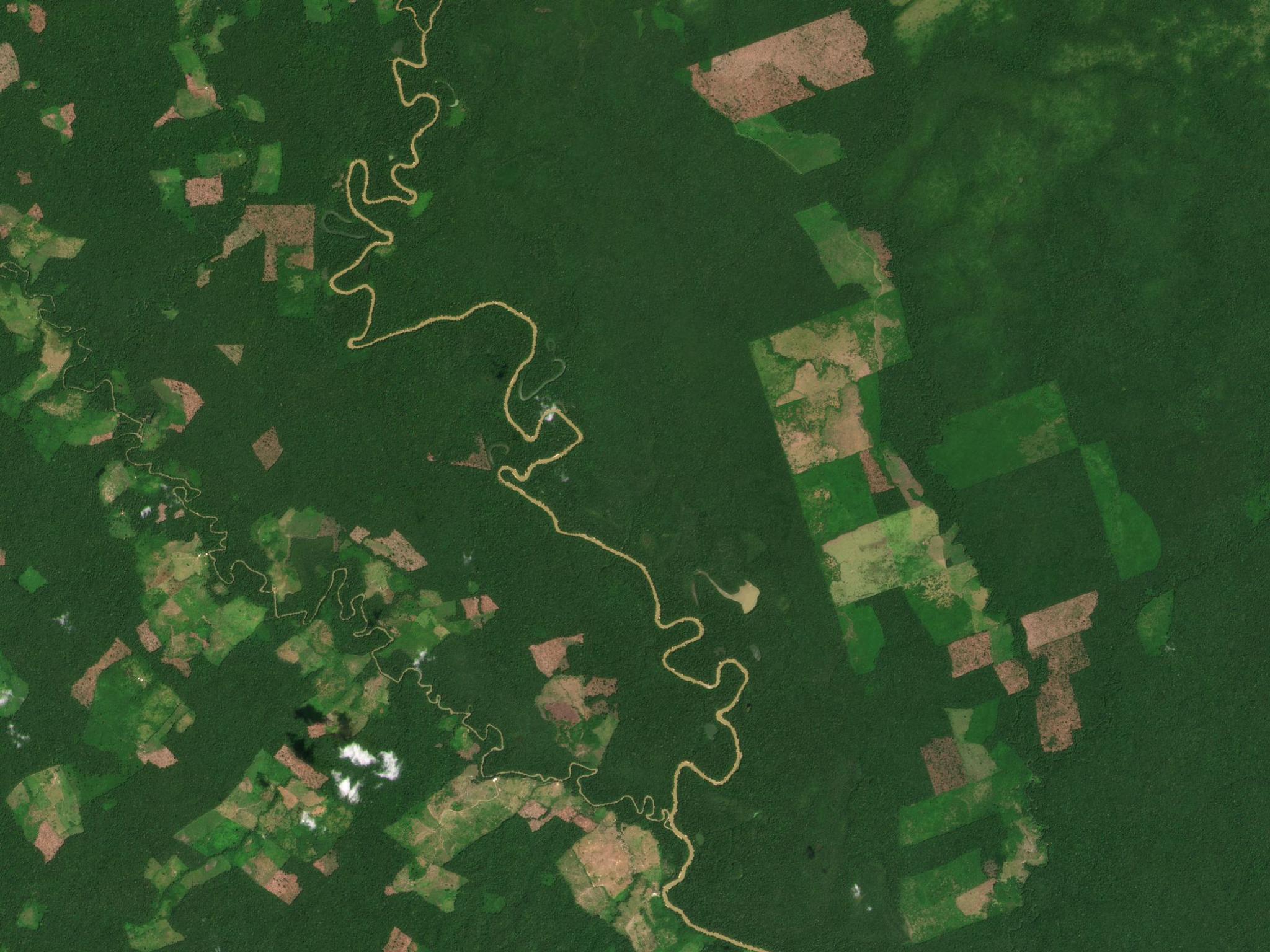
In the Colombian Amazon, PlanetScope imagery shows changes in forest cover in and around Chiribiquete National Park. © 2021, Planet Labs Inc. All Rights Reserved.
StoriesDecoupling deforestation from commodities production is critical to climate and sustainability solutions. Today, over two-thirds of tropical deforestation occurs due to the production of just four commodities: cattle, soy, palm oil, and pulp and timber. However, global supply chains are complex, and commercial-grade solutions to account for and manage deforestation risks remain underdeveloped. In September 2020, Norway’s Ministry of Climate and Environment awarded KSAT, Planet, and Airbus a contract to bring comprehensive access to high-resolution (<5m) satellite monitoring of the tropics to help stop deforestation and combat climate change. A key goal of this program is to stimulate and facilitate solutions that help reduce pressure on tropical forests from global markets. This International Day of Forests, the NICFI Satellite Data Program is therefore teaming up with the Tropical Forest Alliance to inspire collective action for deforestation-free commodities supply chains. On March 25, the NICFI Satellite Data Program team will host an on-demand webinar with the Tropical Forest Alliance’s multi-stakeholder community, sharing more information on how high-resolution satellite imagery can help bring solutions to this space, and how inspiring early movers like AidEnvironment and Unilever are already leading the way. Take AidEnvironment’s work in mapping deforestation and finance, for example. Through data driven and in-depth company and supply chain analysis, the nonprofit AidEnvironment urges the private sector and its investors to incorporate deforestation into their decision-making processes. With the Planet Tropical Basemaps available through the NICFI Satellite Data Program, AidEnvironment is now conducting high-resolution, near real-time monitoring of deforestation in global commodity supply chains and publishing improved risk analyses for multiple stakeholders. Unilever, a global leader in consumer goods and sustainable sourcing practices, is another entity leading the way in developing new solutions with high-resolution satellite imagery. Already with the NICFI Satellite Data Program, Unilever is testing the use of the high-resolution Planet Tropical Basemaps to validate and verify deforestation alerts in key palm oil sourcing regions - enabling their team to engage suppliers and act early on deforestation risks. Looking forward, the Unilever team sees opportunities for high-resolution satellite imagery to address a variety of questions related to land use change such as how to validate deforestation alerts and understand infrastructure expansion as it relates to deforestation and sustainable land use risks. While these early movers are leading the way in demonstrating what is possible with high resolution satellite imagery, their actions can no doubt inspire others to also collectively develop and apply solutions that decouple deforestation from commodities production and sourcing. The NICFI Satellite Data Program team is proud and excited to partner with The Tropical Forest Alliance’s leading coalition and programs in this work. Click here to register for the On-Demand Webinar.
Ready to Get Started
Connect with a member of our Sales team. We'll help you find the right products and pricing for your needs.