
Explore and analyze Planet imagery with Harris ENVI
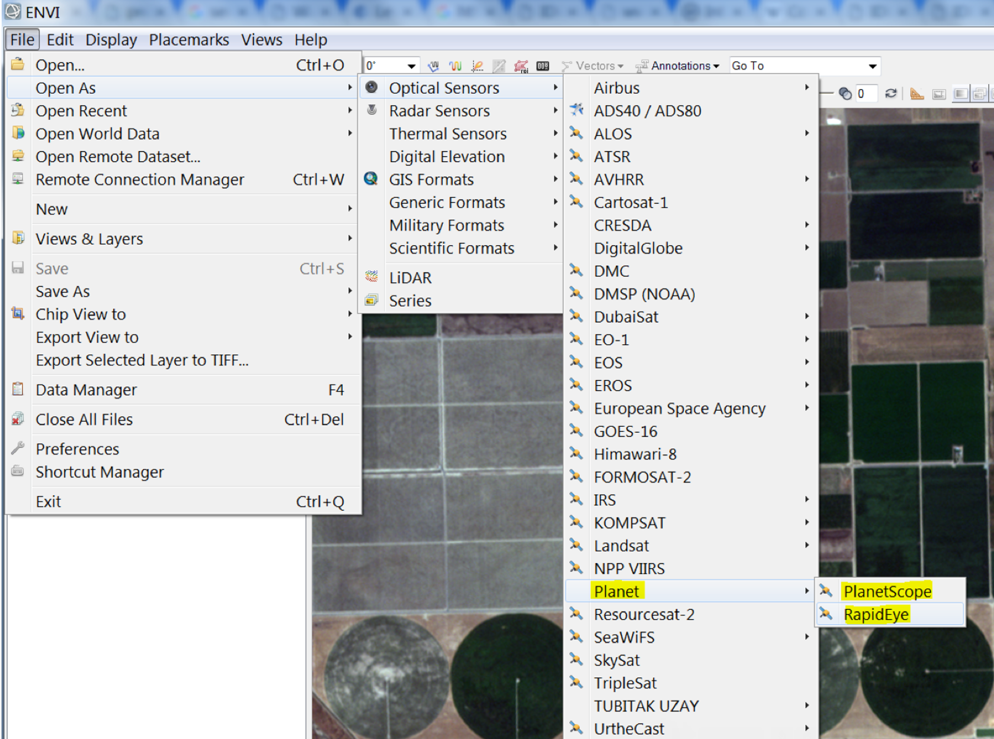
Whether you’re a farmer measuring crop performance or a crisis mapper assessing damage after a natural disaster, you need speedy and reliable remote sensing data preparation and analysis workflows that you can count on. Today, we are excited to announce that, with the integration of Planet data into the ENVI platform, Harris Geospatial is the newest member of Planet’s Application Developer Program. With this integration users can work directly in the ENVI desktop platform, applying the analysis methods they’re familiar with to Planet’s global, daily imagery dataset. The integration includes tools such as change detection (thematic and pixel-based), extensive classification, and feature extraction, plus a complete API to ENVI Tasks enabling seamless integration of Planet imagery with ENVI analytics for robust application development.
Start exploring!
You can also see this integration in action in this ENVI Analytics demo*, a cloud based application preloaded with example deep stacks of Planet’s satellite imagery. Run ENVI Analytics on top of the data, and derive insights from day-to-day changes in your area of interest. To activate additional imagery, refer to our API documentation.
Learn more about this partnership and integration on the Harris blog and documentation page. *NOTE: If you don’t have a Planet account and API key yet, sign up here first before trying the demo
Ready to Get Started
Connect with a member of our Sales team. We'll help you find the right products and pricing for your needs.