
Getting to Ground-Truth in Asia: Part One - How Satellite Data Is Helping to Verify Food Distribution
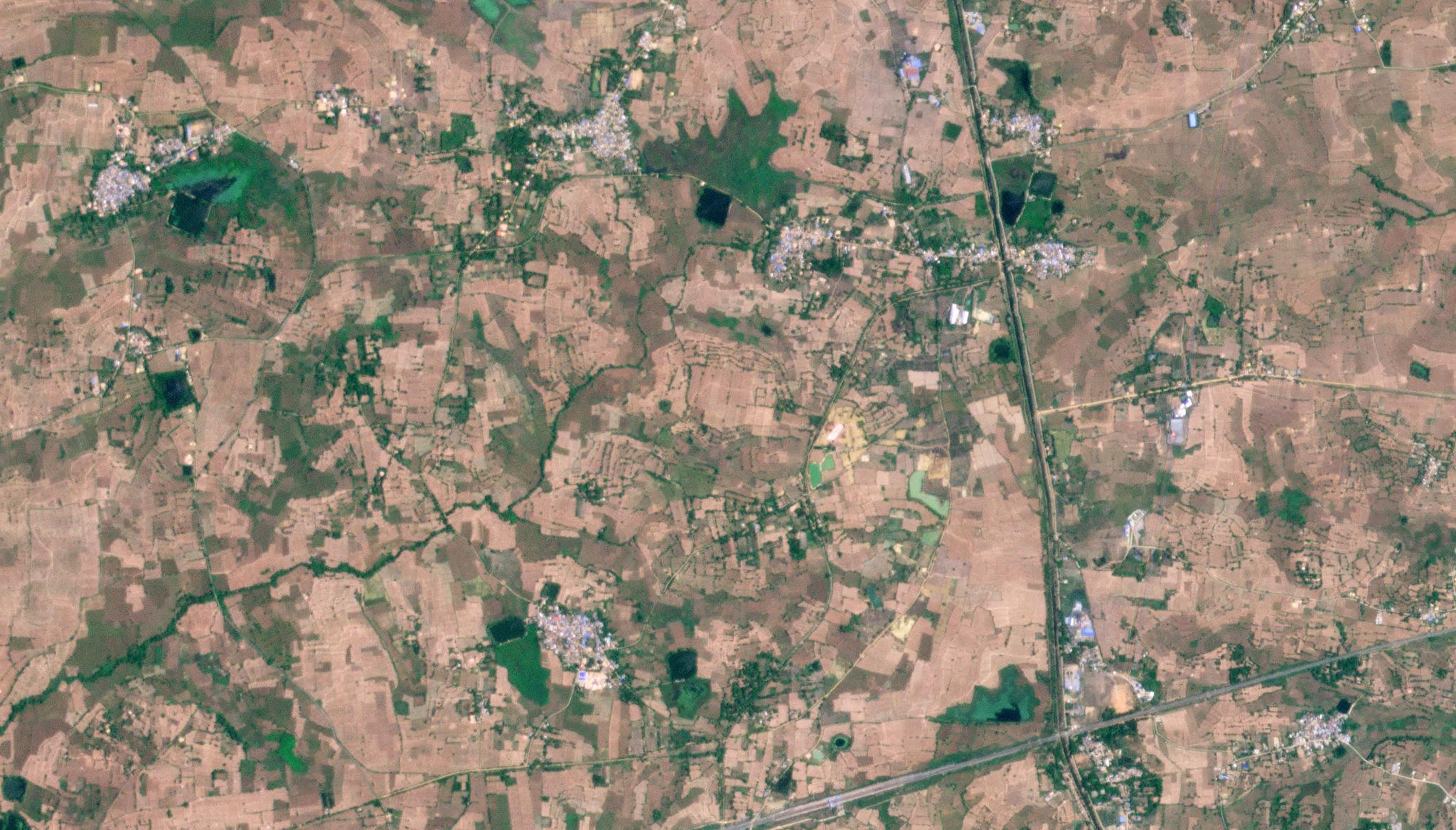
PlanetScope image of rice paddy region in Attabira, India taken May 23, 2023. © 2023, Planet Labs PBC. All Rights Reserved.
StoriesWith national and international aid efforts underway to provide social protections and food support to families below the poverty line in some of India’s poorest states, government organizations like Odisha’s Food Supplies and Consumer Welfare Department needed to find a way to ensure its citizens were getting the food support they needed – and that starts at the ground level.
But there can be discrepancies between what’s reported – whether that’s rice paddy crop production like in the Odisha case, harvested forests in New Zealand, or an unclear sense of disaster damage in the Pacific Islands – and what can be seen from space. In this four-part series about getting to ground truth, we’ll explore why civil governments are increasingly turning to Planet’s satellite data to help them better understand and verify what’s happening on the ground so they can make the best decisions to support their citizens, as well as what the larger opportunity for earth observation data in Asia can look like.
Agriculture: seasonal rice paddy crop analysis to mitigate food insecurity
In addition to providing food grains and other essential items to its citizens, another responsibility of the Odisha government’s Food Supplies and Consumer Welfare Department is to investigate and end false or inflated claims during the registration and procurement process of adding farms to their network and ensuring genuine farmers receive a minimum support price (MSP) or profit for the crops they produce. The minimum support price system is a program that guarantees a “floor price” for a commodity and ensures that growers are protected from excessive price falls during high yield years.
But the government department was facing challenges to meet this target due to a number of factors: land parcel anomalies, underestimations of production, fraudulent procurement by buying it from small/marginal farmers, lack of authenticated field data, lack of intelligence on crop and land registration and lack of platform to analyze crop patterns. Why? Growers willing to sell paddy to the government voluntarily registered their growing areas during the Kharif paddy crop season (monsoon or autumn crops) and Rabi paddy crop season (after the monsoon rains are over with harvest in the spring). When registering, growers provide specific land details, indicating the area of land on which actual cultivation has been taken up. The major flaw in this system is that voluntary self-reporting has allowed for instances of false or inflated claims. Due to these false and/or inflated claims, the price support ended up being paid out on uncultivated land claims and resulted in waste of public money.
Enter satellite data. In order to mitigate these false or inflated claims, the Department decided to employ remote sensing technology to verify cultivation within the registered areas. The goal? Provide greater transparency across the entire minimum support price system.
Through adept use of GIS and analysis of Planet’s high-resolution satellite imagery using artificial intelligence (AI) and machine learning (ML) techniques, SPARC assisted ORSAC, a Nodal agency, and the government of Odisha in validating paddy crop at a farmland level. The team compared the satellite data analysis alongside the information reported by millions of farmers across 30 districts during different crop seasons. Through this side-by-side analysis, they were able to help avert procurement from misreported lands, which led to substantial savings in the government exchequer.
Kharif Paddy Classification derived from Planet data
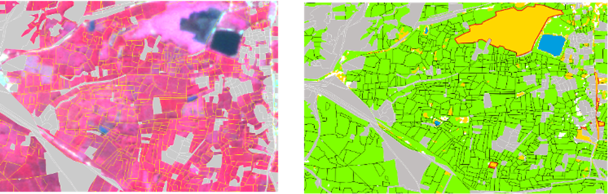
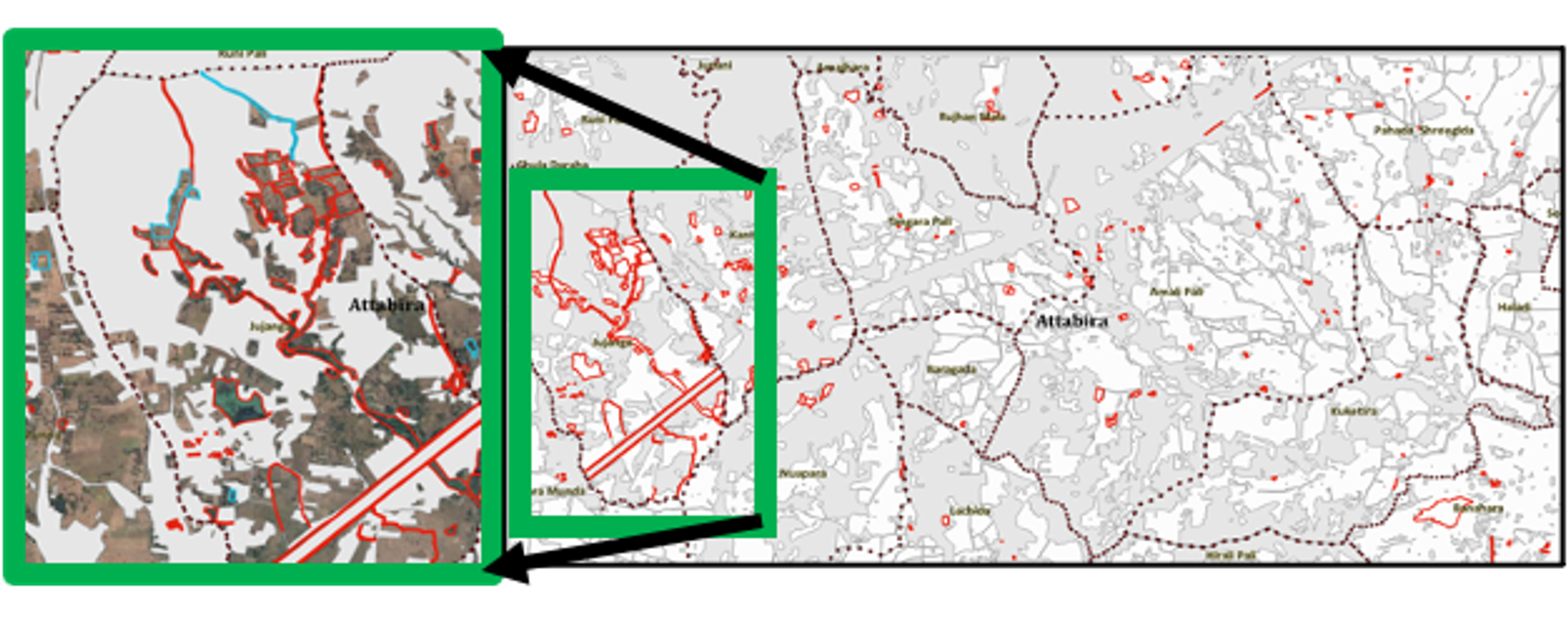
Doubtful Paddy Crop as per imagery. Credit: ORSAC. Integrating Planet data about paddy crops with farmer-reported information about those paddy crops helped to identify discrepancies between the farmer-reported areas and GIS-verified areas. These disputed farming areas were sent for field verification using a mobile app.
The result? The number of farmers projected to benefit from this program based on initial procurement was 1.6 million, but based on the analysis using GIS and Planet data to root out misreported lands and fraudulent claims of production, the benefitting farmers were about 0.7 million based on field verification in combination with GIS mapping and analysis of Planet data.
In 2022, this system enabled the identification and field confirmation of fraudulent reporting of about 865 thousand metric tonnes of paddy. The net saving to government exchequer during 2022 was about INR 1,700 crores (~ 206 million USD). The percentage of contribution of small and medium farmers to the paddy procurement also increased from 67% to 73%.
That’s a marked increase in program intelligence and an easy-to-use in-field verification solution. More information about this project and other ways governments and organizations around the world are using digital agriculture to enhance rice cultivation and mitigate food insecurity can be found here.
Hear directly from Subhadarshi Mishra, Managing Director, ORSAC & SPARC India, about how the organization is leveraging Planet satellite data:
Planet in the Asia-Pacific region
Planet designs, builds and operates the world’s largest fleet of earth observation satellites with a mission to use space to help life on earth – as evidenced through projects like those above working in areas of food security, ecosystem rehabilitation, and disaster response. Planet formally established our presence across Asia and Australia since 2017, with around 40 employees, serving over 130 customers and working with ~40 partners across the continent.
Stay tuned for Getting to Ground Truth in Asia - Part Two, in which we’ll see how New Zealand and the Philippines are using satellite data to monitor forest harvest and growth.
Ready to Get Started
Connect with a member of our Sales team. We'll help you find the right products and pricing for your needs.