
How Planet Data Keeps the Ball Rolling for Sports Teams
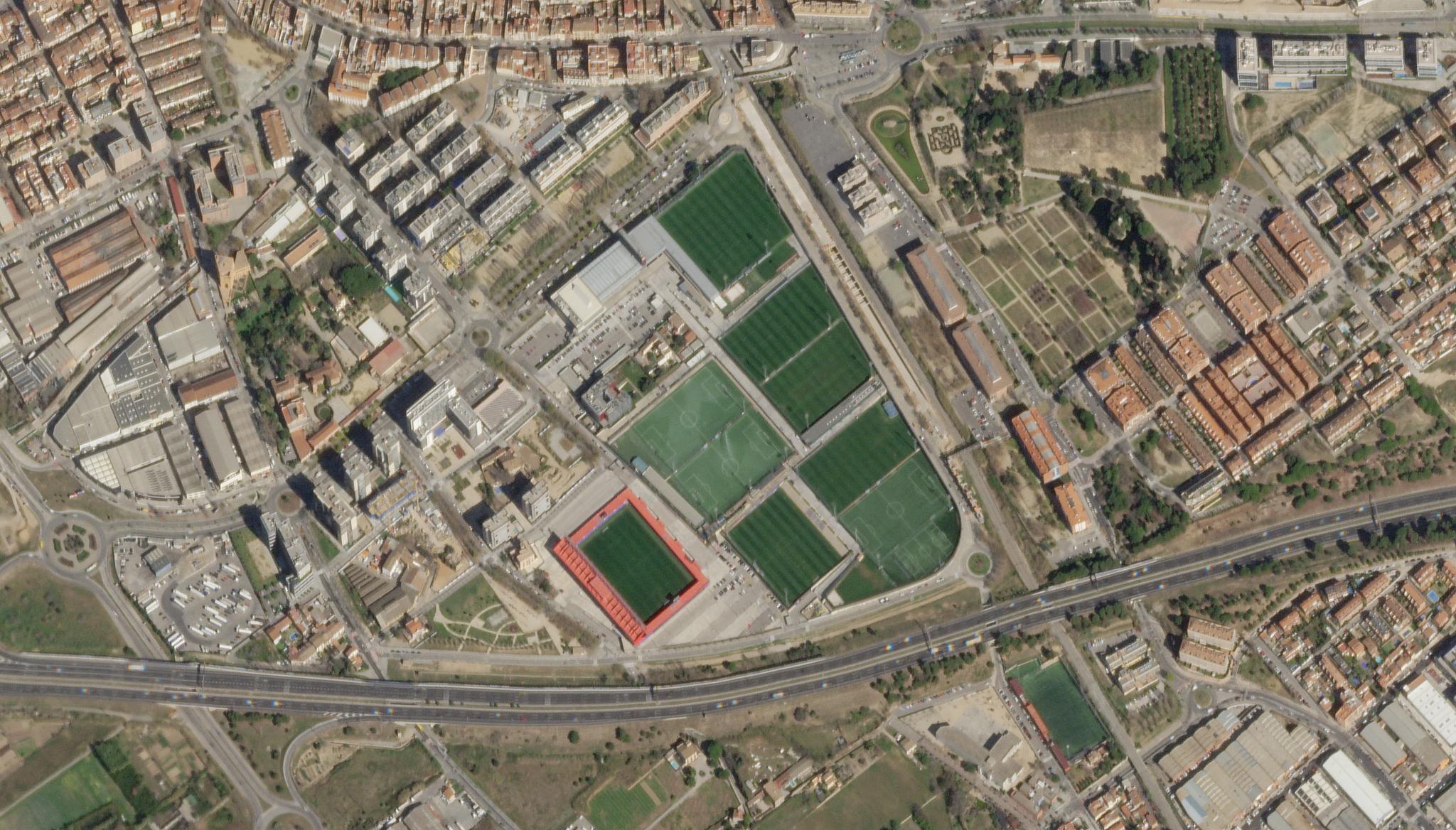
SkySat of soccer fields in Barcelona, Spain taken March 20, 2023. © 2023, Planet Labs PBC. All Rights Reserved.
StoriesBy: Tasha Gillotti and Thamires De Souza Ferreira
Modern soccer pitches are more like patchwork quilts than traditional fields. Increasingly large, closed-off stadiums do not allow enough sunlight for grass to thrive naturally, so clubs grow it in nearby fields and retrofit it into their pitches.
But professional players can’t be expected to bounce between six different types of turf; the pitch needs to be totally uniform. To achieve this, several of Spain’s major soccer clubs enlisted E-STRATOS, a pioneering technology platform designed to help land managers monitor their crops.
E-STRATOS has built its platform around satellite imagery, creating an automated data store that land managers and advisers can easily consult to track field changes. The platform enables stadium managers to simultaneously monitor their soccer fields and plain land in addition to grass transfer to the pitch at the right moments to create consistent terrain.
That clubs would embrace such a solution was not inevitable. Introducing new technology to the land management industry is a hard sell. There is a lot of hesitation and customers’ processes have to change. It can be an intimidating first step for many.
Josep Renard Segarra, Chief Technology Office for E-STRATOS, explains his approach to such a problem, “we had to build a product that not only could solve some of the issues that they had, but also give them a bit more in order to be attractive.” And that is where Planet came in. At 3 meter resolution, our satellite imagery was ten times higher resolution than the data E-STRATOS was used to. But the frequency of Planet’s imaging was also crucial.
Cloudy conditions present a significant challenge for land management consultants, obscuring their imagery and making consistent coverage difficult. By capturing images on a near-daily imaging cadence, our data greatly increase the chances of securing at least one cloud-free image available weekly for these teams.
“It’s all about reliable data resolution, frequency, and easy access,” Segarra said. “We created an automated workflow where we can easily ask Planet for data, download it, and then present it to the customer.” And the company keeps discovering new applications for this process.
Professional golf courses, for example, must be maintained to a high standard. But it’s not the greenness of the grass that E-STRATOS uses our data to monitor; it’s actually the ground’s humidity. Grass only tends to show signs of going bad when it’s too late. Measuring the humidity with their supplemental drones enables course owners to properly assess the state of their grass and proactively manage it.
Segarra expects these innovations to continue as the quality and volume of satellite data increase. “Now we are working with variable rate applications…the machine knows exactly where to apply some amount of fertilizer, for example, in different zones, all based on the maps that we collect from clients and process.”
Ready to Get Started
Connect with a member of our Sales team. We'll help you find the right products and pricing for your needs.