
Mapping All of Earth’s Roads and Buildings From Space
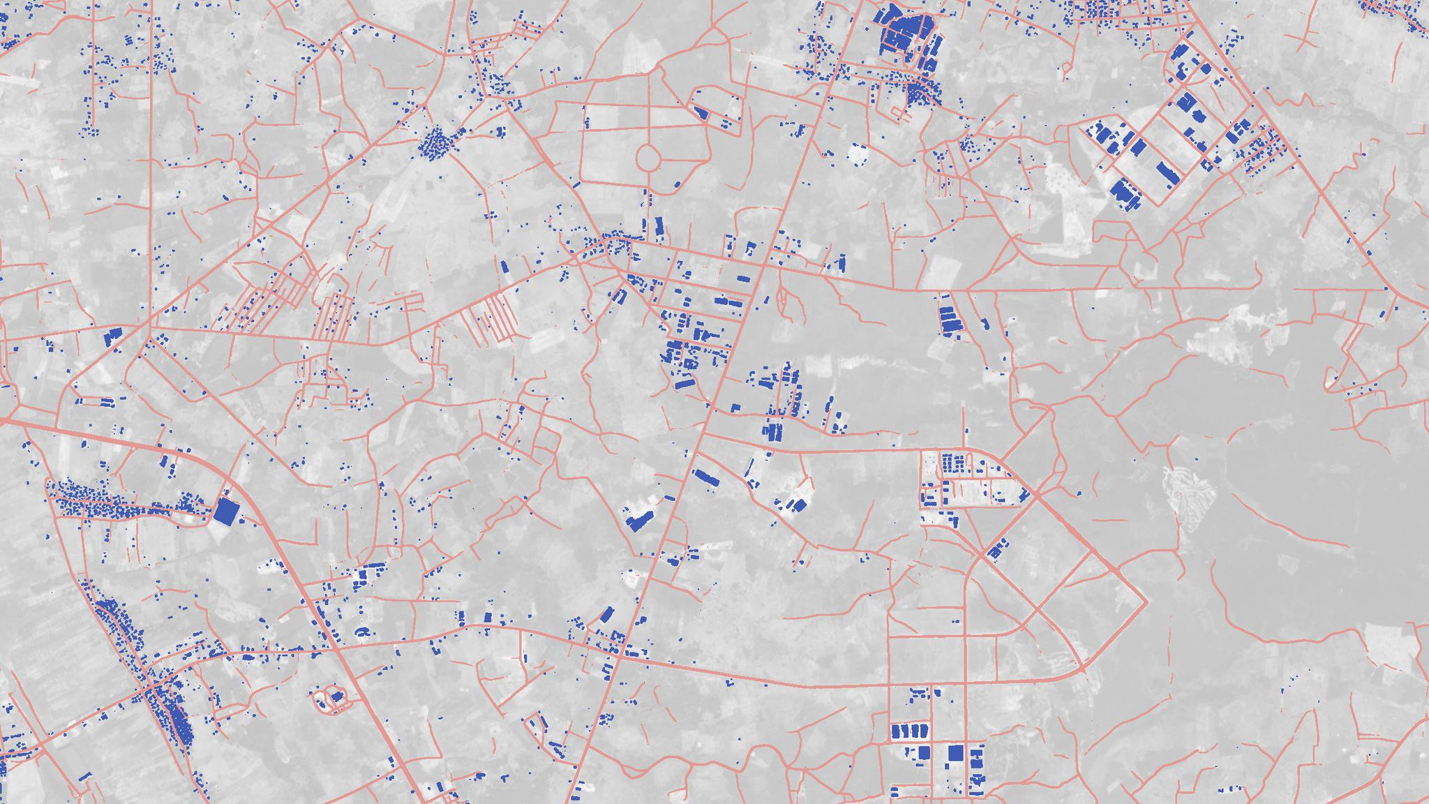
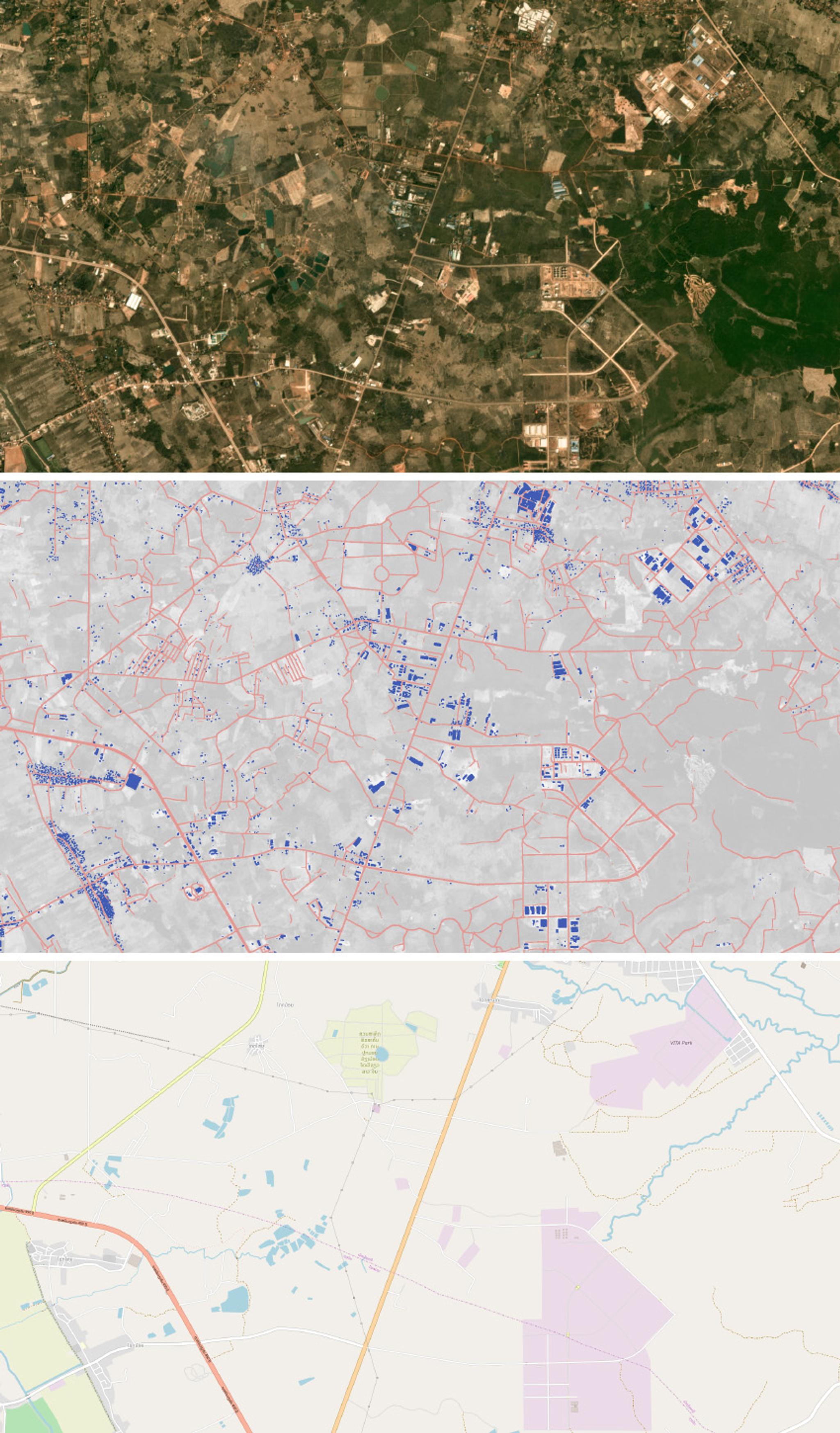
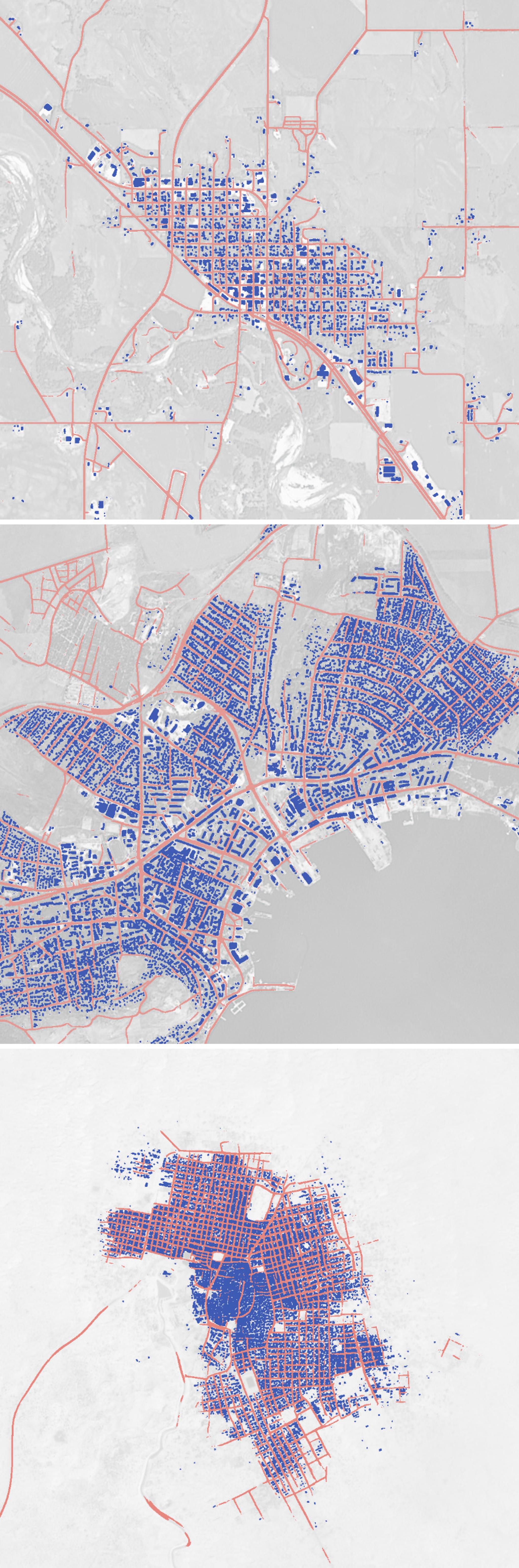
Planet's road and building detection show a rural area northeast of Vientiane, Laos © 2019, Planet Labs Inc. All Rights Reserved.
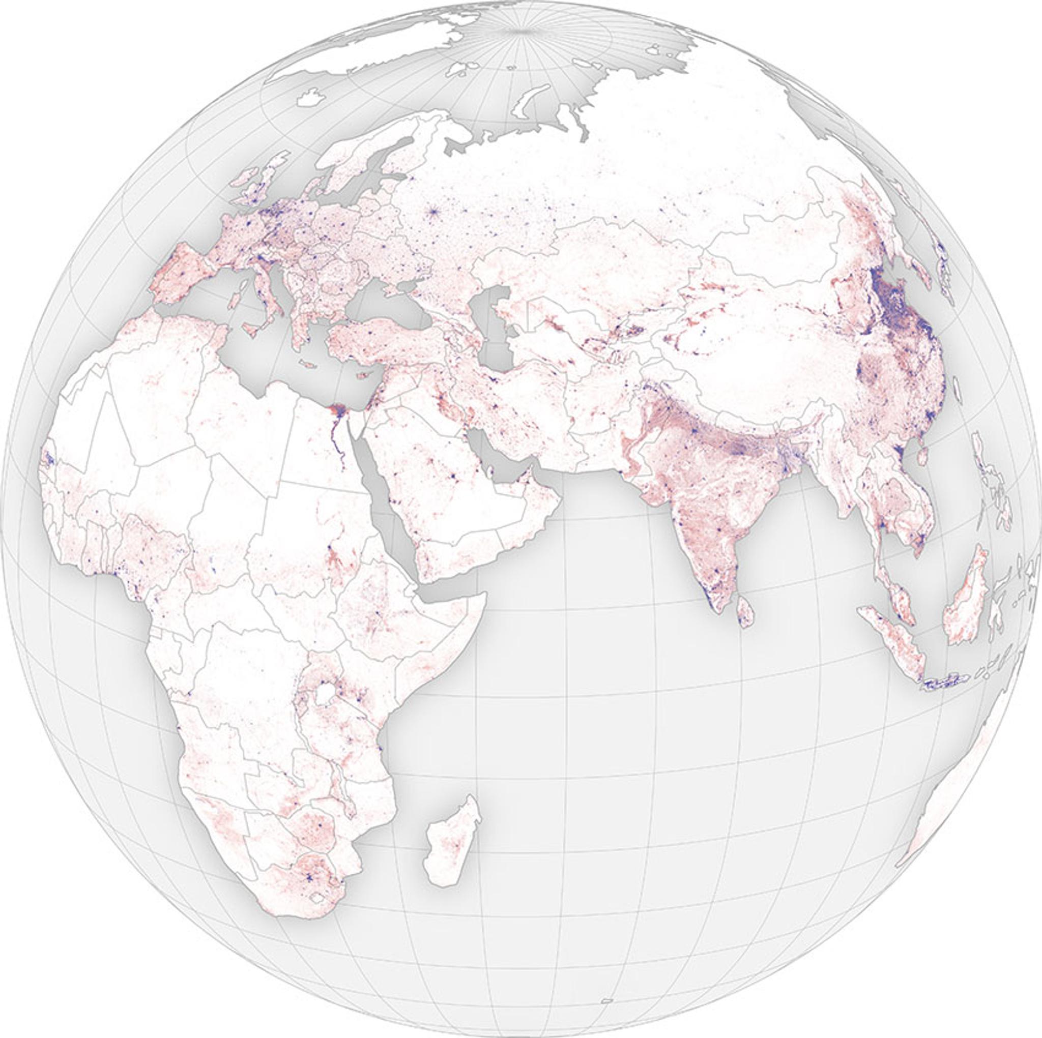
TechDespite the widespread availability of mapping services, key layers of human infrastructure like roads and buildings are often missing or incomplete. And while open and proprietary data providers have rich layers with building shapes and road networks mapped in great detail for some major cities, this level of detail is geographically biased and is not readily accessible in most rural areas or in the majority of the developing world.
Even in cities like San Francisco, keeping maps up-to-date is difficult because of continual change. Increasing access to this type of data can empower people to make more informed decisions and take actions, whether they are disaster response teams, mission logistics planners, forest conservationists, or any other kind of map user.
Fortunately, new technologies enable us to produce maps with greater completeness and faster updates than previously possible. By combining satellite imagery, deep learning, and cloud computing, several groups have released automatically-generated maps of buildings or roads over a handful of countries.
Here we’ll dive into the technology that makes this possible and show how we’ve applied it with our new Planet Analytic Feeds. Planet Analytic Feeds are a set of foundational analytics that can be applied to Planet imagery in order to extract relevant features and objects. These feeds automate a set of manual or labor-intensive operations, including inspecting large volumes of imagery or building their own models, allowing end users to build their solutions faster. This helps people spend less time managing and processing imagery and focus their resources on higher order challenges.
Our Approach
Planet’s constellation of monitoring satellites has global coverage, frequent revisits, and the necessary spatial resolution to identify buildings and roads. Images are captured and downlinked, then passed through a data processing pipeline that calibrates for differences between satellites and rectifies pixels to a common spatial reference. After being ranked for a variety of criteria like cloudiness, snow cover, or resolution, the best images for a chosen time window are composited into mosaics that we can analyze.
With access to this petabyte-scale archive of global imagery and cloud computing resources ready to process those images, we can apply algorithms to extract features of interest from the data and build maps at scale. Deep learning architectures provide state-of-the-art performance at a variety of image recognition tasks, and require one more key ingredient: training labels.
To map buildings and roads, we collected a large sample of labels for these features from a diverse set of geographies and seasons, from which we could scale globally. Key to our development process was an iterative approach balancing model experimentation with label collection, driving toward our objective. We built a tight feedback cycle to measure the performance of each new model, identify paths to improve upon it, and execute the next set of experiments.
With a model scoreboard, anyone on the team can test a new idea and see how it fares against the best model. Aggregate quantitative metrics like the F1 score provide an objective tool to compare one model candidate with another, while more granular slicing of metrics and visual examples help motivate subsequent experiments.
Complementing these objective criteria, we also gathered feedback from customers to understand where further optimization was needed. This input was critical to keep our development on a path to address real needs of users. During the development cycle, we ran many experiments — including trying out new models discussed in the literature, searching different patches of the high-dimensional parameter space occupied by the candidate models, and implementing new preprocessing transforms on the imagery. But more often than not, the best path forward was to gather more diverse training examples.
“It’s the labels, stupid” became a refrain for how best to improve our models, despite the intellectual appeal of squeezing out a bit more performance with a fancy new architecture. The core model is a modified U-Net implemented in TensorFlow, with about seven million parameters trained on several billion labeled pixels. As newer model versions started producing outputs that accurately captured buildings and roads on our training and validation samples, and generalizing well to regions beyond, our attention turned toward scaling the model to run on larger regions. First countries, continents, and finally the whole world.
To execute the model on many images in parallel, we deployed it to an internal orchestration system running on a Kubernetes cluster, taking advantage of its flexible configuration and auto scaling of compute resources. The outcome is a pipeline that can produce a global map of roads and buildings, and update it as new satellite imagery is collected. And by gathering more training data for different land features, we can extend this pipeline to other categories like water, forests, and agriculture.
Conclusion
All of this said, there is still work to be done. False positives crop up in some rugged mountains and deserts where ridges can appear like roads, and the resolution of the imagery can cause blocks of buildings or divided road lanes to glom together. But this automated approach offers a degree of global completeness and spatial consistency that is hard to beat and is already useful for many applications, like identifying construction in flood risk zones.
And with continually refreshed imagery from space, such maps can be updated to highlight new changes around the world, opening up new possibilities to improve transparency and help life on Earth.
---
Ready to Get Started
Connect with a member of our Sales team. We'll help you find the right products and pricing for your needs.