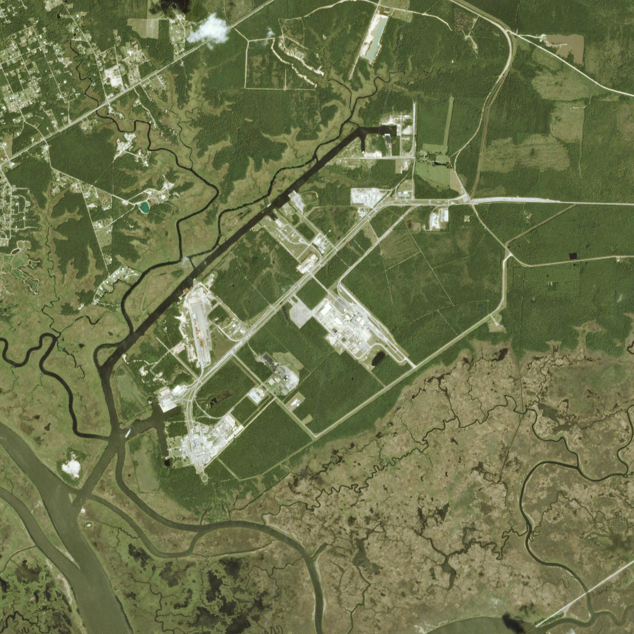
Jackson Landing coastal region, Mississippi, USA © 2020, Planet Labs Inc. All Rights Reserved.
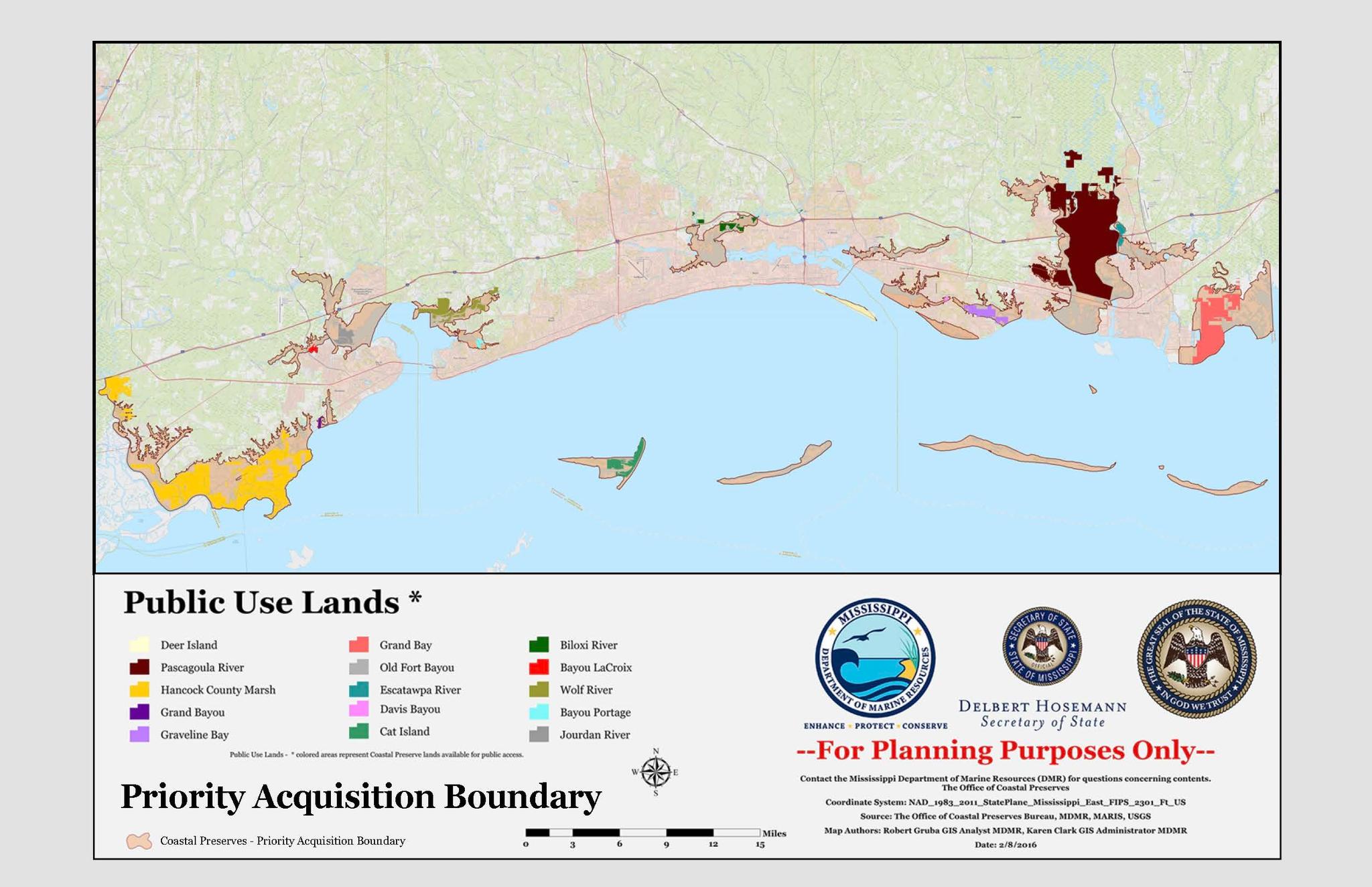
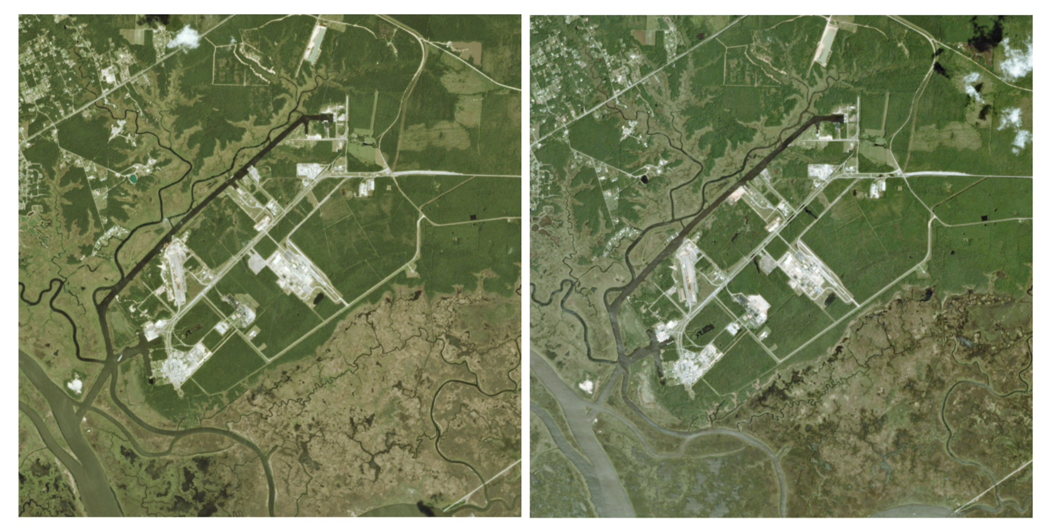
AUTHOR PROFILE Sarah Preston
Curious Planeteer working to make the Earth's changes visible, accessible and actionable.

Monitoring Coastal Habitats That Support Local Communities and Diverse Ecosystems

Stories

Coastal marshes and wetlands are key to supporting the health and productivity of the surrounding communities and their marine habitats. Strong aquatic ecosystems support local fishing industries and improve water quality for safe recreation. They also serve as “blue carbon” sinks and promote coastal resilience against flooding and erosion. But as climate change and human activity put greater strain on these systems, officials are looking to new solutions to monitor and reduce the loss of aquatic biodiversity and wildlife.

False-color PlanetScope image of South Slough Reserve in Coos Bay, Oregon, taken on April 13, 2020.

The South Slough National Estuarine Research Reserve is one of these important water systems that has seen a large decline of eelgrass habitat over the last several years. This false-color PlanetScope image shows the South Slough Reserve in Coos Bay, Oregon, USA at low tide on April 13, 2020. Overlaid is the distribution of eelgrass in the reserve that enables tracking of key eelgrass habitats that support coastal fishing communities. Kelp and eelgrass beds provide one of the most productive marine ecosystems and are key to supporting Oregon’s fisheries and habitat. Their decline along the Oregon coastline over the past 5 years has been difficult to quantify mainly due to cost-prohibited aerial surveys. High-frequency satellite imagery helps water resource management teams make data informed decisions to drive productive conservation initiatives. 

The abundant wetlands and bayous of the United States Gulf Coast also provide key services to millions of people and diverse aquatic ecosystems, but they still remain at risk. Today, officials are making progress in tracking and mitigating the effects of human activity on these protected lands.  

In the United States, the Mississippi Department of Marine Resources (MDMR) is tasked with managing the diverse marine life and wetlands along their Gulf Coast territory to ensure equitable use for environmental, recreational, and economic interests. 

Along the Mississippi Coast, 72,000 acres of tidal marsh, tidally influenced marsh and wetlands were designated as “crucial coastal wetlands habitat” within 20 unique Coastal Preserve sites.

Marine species, or “Submerged Aquatic Vegetation” (SAVs), are protected under the Coastal Zone Enhancement Program. Companies engaging in development along these protected areas must apply for a permit and transplant any SAVs in the area to another location in order to mitigate the environmental impacts such as increased flood risks and reducing fishing outputs.

After conducting a second inspection of the project area, an applicant found there were no longer any SAVs in their project footprint, and requested an update to their original permit to remove any relevant environmental mitigation requirements. SAVs are transient and can disappear from both natural and manmade causes. MDMR had to verify that in the time from submitting the original proposal to when they requested a revised permit, the SAVs were not improperly removed without transplanting. 

In just 24 hours, MDMR was able to pull Planet imagery over the area and time of interest to verify that there was no kind of barge or construction activities that would have served as evidence that there was human interference, saving the applicant more than $100,000 in project costs and enabling MDMR to meet their conservation goals for the benefit of their community. 

Planet archive imagery captured August 22, 2020 (left) and August 31, 2021 (right) shows no unsanctioned activity that may have led to habitat loss.

More than ever, officials recognize the value of protecting coastal marine ecosystems as a source of food, recreation, transportation and diverse aquatic wildlife. The smallest impacts and changes to local biodiversity can cause a ripple effect of habitat loss which can take years to recover. In the future, MDMR is looking to expand their use of Planet data to evaluate tidal marsh health and quality over time. This includes projects for monitoring biodiversity, identifying sedimentation issues, and tracking highly transient sea grasses in bayous threatened by storms. Planet provides daily imagery and insights, offering the same monitoring and change detection capabilities to environmental organizations and government entities around the world. You can’t manage what you can’t see.

Learn more from our Explore 2021 speakers about monitoring water quality and protected wetlands