
NASA Expands Planet Contract to All NASA Researchers
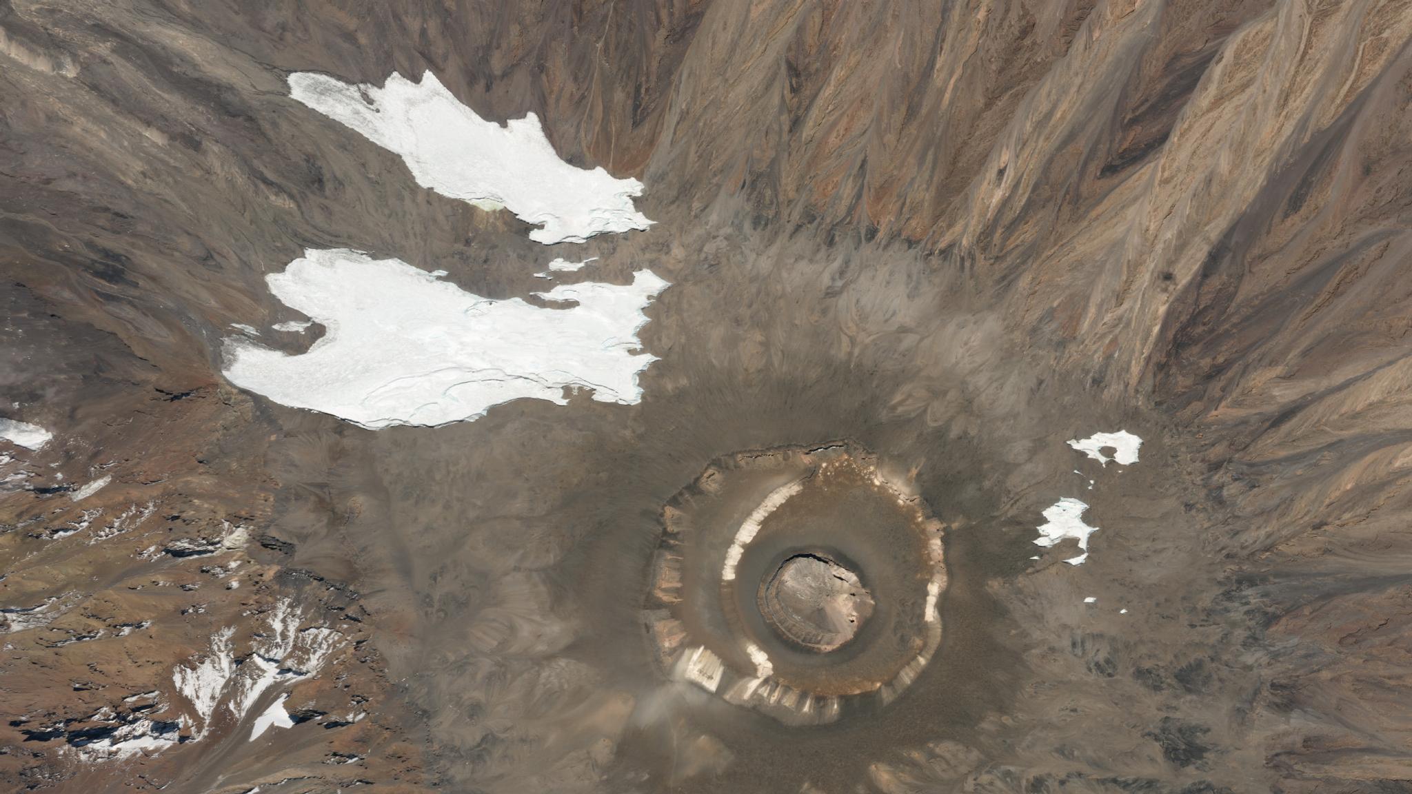
Planet’s high-resolution data helps NASA researchers investigate key climate indicators like the size and range of alpine glaciers. This image of the summit of Kilimanjaro was collected on August 13, 2019. © 2019, Planet Labs Inc. All Rights Reserved.
NewsToday we are pleased to announce that NASA has expanded their subscription with Planet and will provide Planet imagery to all NASA-funded research programs. NASA deemed the pilot an overall success, specifically getting value from Planet’s rapid revisit times and continuous monitoring capability.
The recent contract award expands the scope by making the data available to the entire NASA-funded research community. This brings hundreds of new eyes to this unprecedented Earth-observing dataset, and with that the potential to unlock even more insights and discoveries that can benefit our world.
This is the second contract between NASA and Planet. In April of 2019, Planet announced an agreement with NASA to pilot Planet’s Earth observation data for the identification and tracking of Essential Climate Variables (ECVs).
Over the past year, NASA HQ completed the pilot which included 35 principal investigators who put Planet data through scientific paces. One group used the data for monitoring landslide hazards in the Himalayas, where the steep slopes led to frequent disasters resulting in economic impacts and loss of life. Understanding triggers and effects of landslides can help preemptive measures to be taken, as well as aid in the creation of more accurate models about how to respond in specific areas once a landslide occurs.
The study found that the short revisit time of PlanetScope aided in detecting early warning signs for natural disasters in the region. This includes the ability to look for precursors to landslides and to monitor surface velocities of glaciers as a sign of impending surges that can precede catastrophic floods. Thanks to image resolution and rapid revisit rates, PlanetScope data was found to be essential in reconstructing the sequence of events post-disaster.
Multiple research groups used Planet data to study the effects of climate change on glaciers and Arctic landscapes. PlanetScope is a monitoring constellation, collecting imagery of every place on Earth once a day, making it particularly useful for monitoring remote regions of the Arctic, as these are often neglected in high-resolution imaging.
For information on how to apply for access to Planet imagery through the NASA contract, visit the Planet website.
Ready to Get Started
Connect with a member of our Sales team. We'll help you find the right products and pricing for your needs.