NewsNewsPlanet Exceeds Business Targets, Advancing Through 2020 with MomentumWill Marshall |August 11, 2020|3 min readRead more
StoriesStoriesHow Granular Delivers Fast, Frequent, In-Field Insights to FarmersAriel Rhoda |August 3, 2020|2 min readRead more
NewsNewsPlanet Welcomes Rosanne Saccone as Chief Marketing OfficerWill Marshall |July 28, 2020|3 min readRead more
NewsNewsTech Entrepreneur Wendy Tan White Joins Planet's BoardWill Marshall |July 23, 2020|2 min readRead more
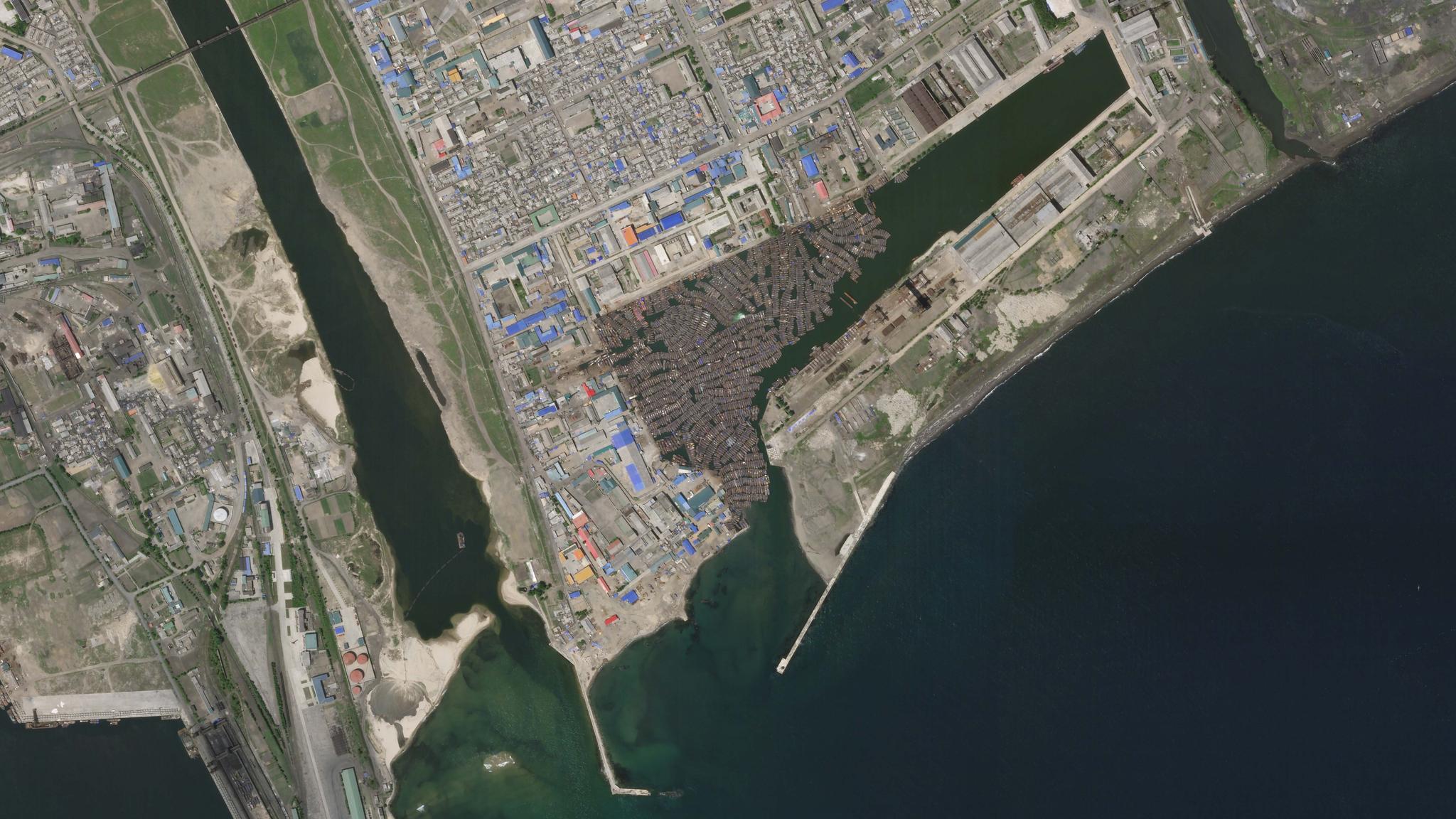
StoriesStoriesStudy Utilizes Satellite Data to Expose Illegal Fishing in North Korean WatersMaya Midzik |July 22, 2020|3 min readRead more
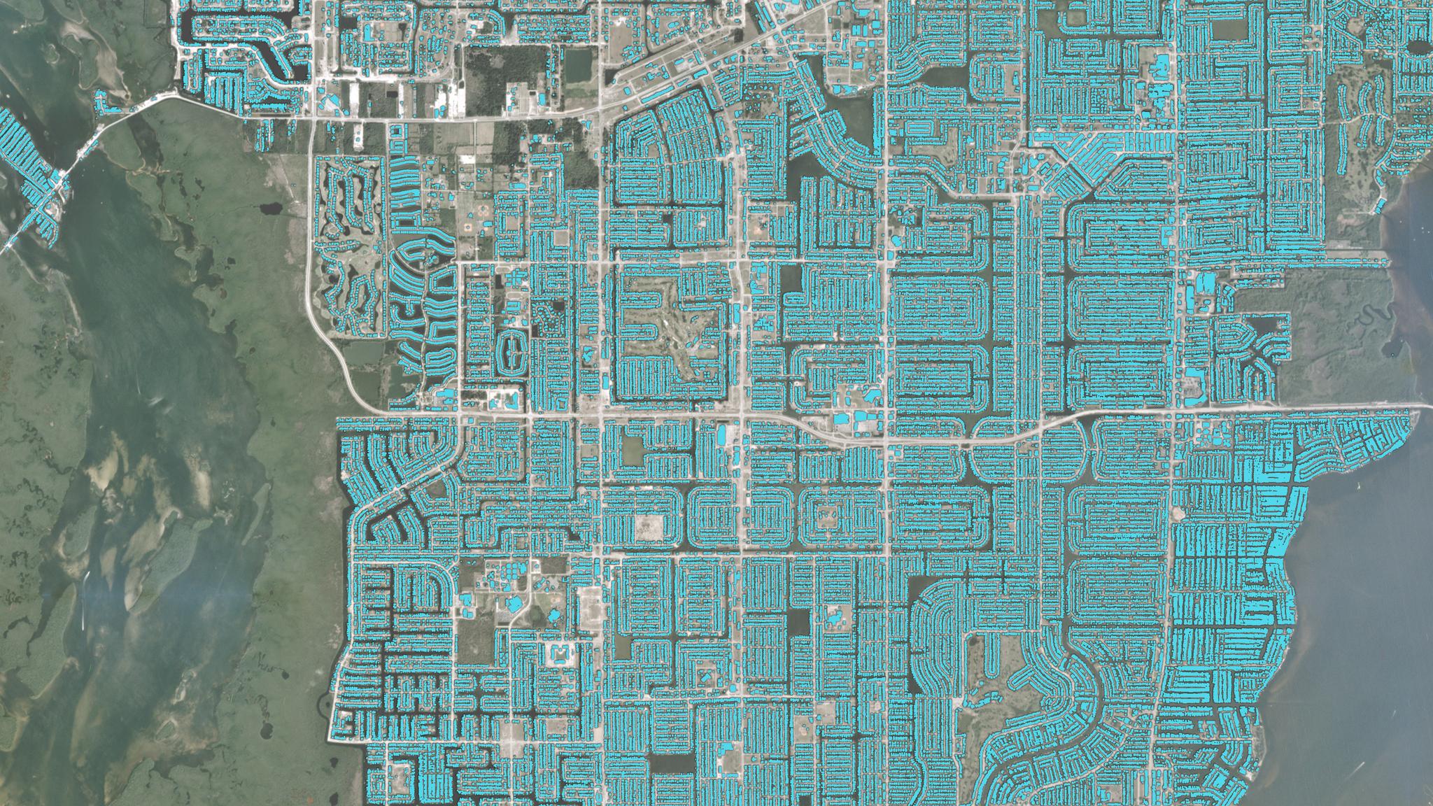
TechTechPlanet Partners with SpaceNet for Multi-Temporal Urban Development ChallengeJonathan Evens |July 20, 2020|3 min readRead more
NewsNewsExplore 2020: Planet Goes Virtual For Its Biggest Annual EventHilary Salazar |July 14, 2020|2 min readRead more
NewsNewsEsri and Planet Expand Satellite Imagery PartnershipDeepthi Shankar |July 13, 2020|3 min readRead more
NewsNewsFalcon 9 Starlink Mission Fails Carrying SkySats 19-21Mike Safyan |July 9, 2020|1 min readRead more
NewsNewsRocket Lab Electron Rocket Fails Carrying Five SuperDovesMike Safyan |July 4, 2020|1 min readRead more