
Planet Celebrates Anniversary of Terra Bella Deal with New Offerings
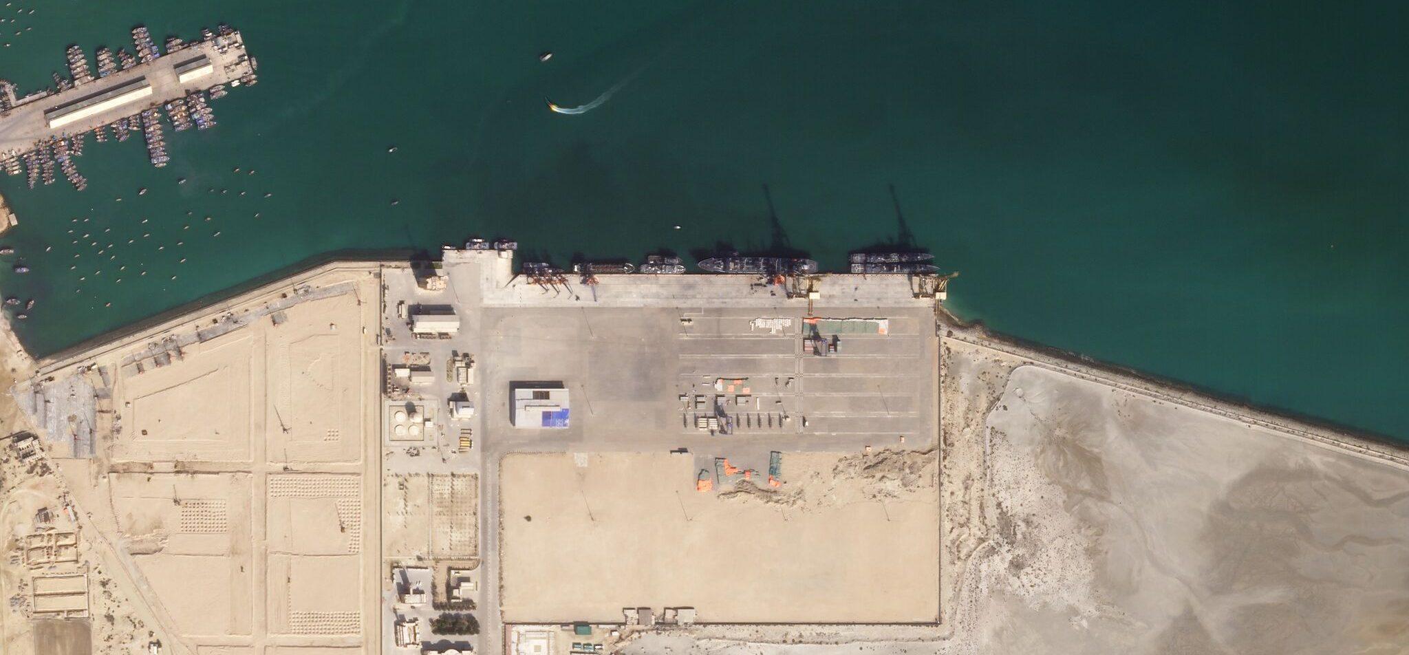
Planet SkySat captures an image of naval vessels at the Gwadar Port, Pakistan. December 14, 2016 © 2016, Planet Labs Inc. All Rights Reserved.
TechIt’s hard to believe it’s been one year since Planet and Google completed a strategic partnership to acquire Terra Bella, making Google a Planet customer and investor. In that time, the Terra Bella and Planet teams have become a cohesive unit, with a shared mission and vision for the future.
The strength of our partnership was put to test last fall when we launched six SkySat satellites. Today, we’re happy to share that these new SkySat satellites are now fully operational and their data commercially available through Planet APIs. This brings the total number of SkySat satellites in orbit to 13 – making it the largest constellation of high-resolution satellites in market.
This is a significant milestone for Planet and our global base of customers. Now, the SkySat constellation can not only image any location on Earth’s landmass at sub-meter resolution and twice-daily frequency, but also collect the data faster and at a lower cost point than traditional imagery providers.
These capabilities ensure that Planet’s customers have the information they need to make critical business decisions. SkySat satellites are instrumental to Planet’s unprecedented daily global dataset, giving customers greater access to high-resolution imagery of the places they care about.
So, what’s new?
- Faster Access. Customers can task SkySats for one-time or recurring collections over areas they care about and access the data in as few as eight hours from collection.
- More Frequent Coverage. SkySats can image anywhere on Earth on a weekly, daily, or even twice-daily basis. More frequent coverage allows customers to see change as it happens and derive more reliable insights.
Ready to Get Started
Connect with a member of our Sales team. We'll help you find the right products and pricing for your needs.