
Planet’s Data Fuels Canadian Boreal Forest Research As Planet E&R Program Hits Five Year Anniversary
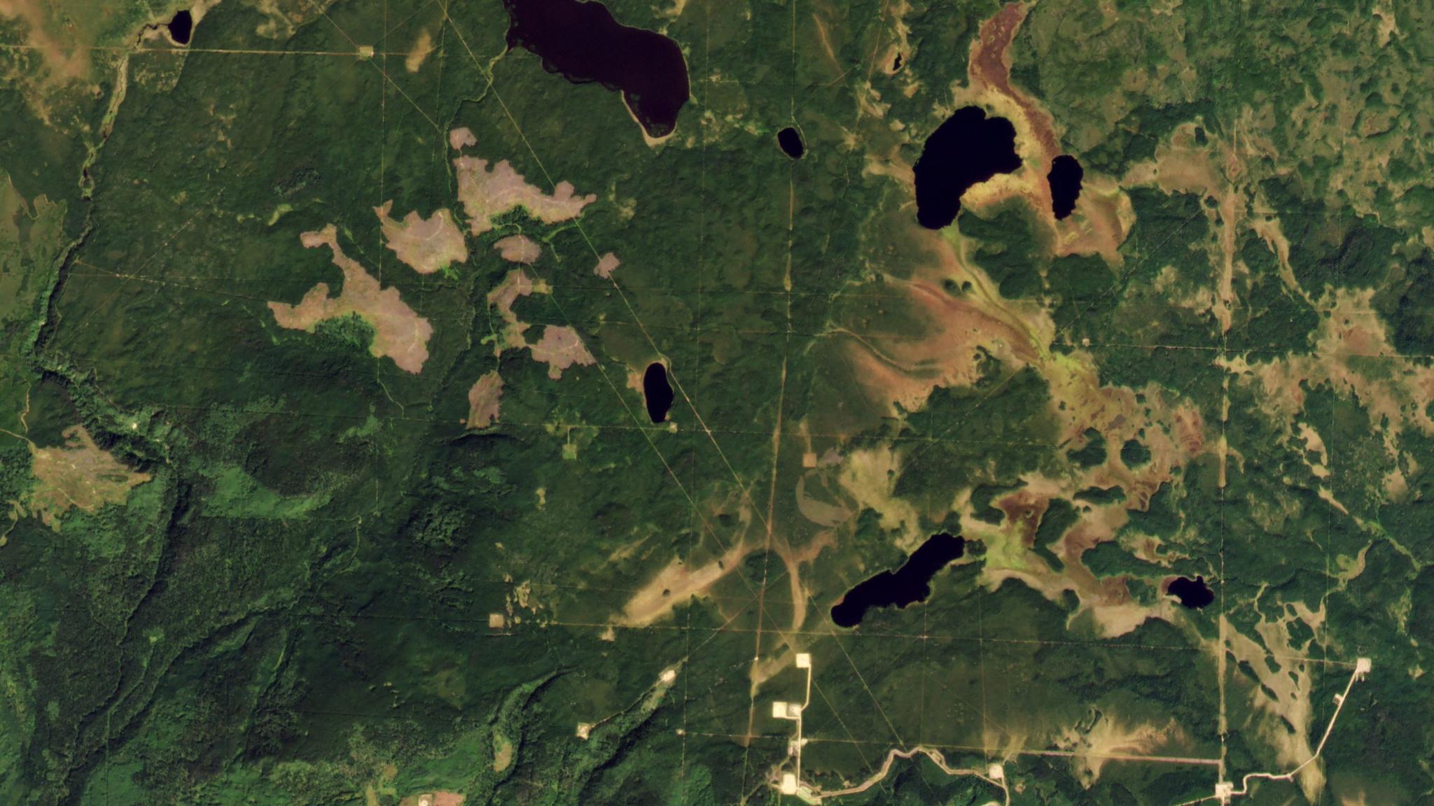
PlanetScope image of forests in Canada’s boreal zone outside of Clear Prairie, Alberta captured on September 2, 2021. © 2021, Planet Labs PBC. All Rights Reserved.
NewsThe boreal forest is one of the largest intact ecosystems left on the planet; however, there are a growing number of human-induced environmental changes that are impacting this vast ecosystem. Numerous integrated research programs focused on boreal forests of Canada have joined forces to use advanced satellite data available from Planet to document how past, present, and future changes are altering the ability of the boreal forest to sustain biodiversity and the people that call this ecosystem home. Through the Planet Education and Research program, the University of Alberta, Yukon University, and the University of Calgary are now using Planet data to map, monitor, and model the dynamics systems of the Canadian Boreal Forest.
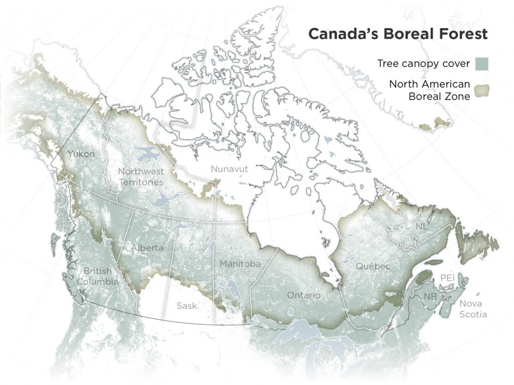
Map of Canada’s boreal forests. Data Sources: Natural Earth, University of Maryland, Natural Resources Canada. Map by Leanne Abraham.
"Biodiversity in the boreal is facing new challenges due to growing industries and climate change, but Planet’s high-cadence satellite imagery is helping us to assess the shifting ecosystem dynamics in the region and support data-informed decision making in Canada,” said Dr. Erin Bayne, the PI for the Boreal Avian Modelling Project. “A network of research initiatives now leverages Planet’s data to evaluate bird populations, vegetation dynamics, and industrial disturbances. This data then helps us to model sustainable interventions to put these forests on a suitable recovery trajectory.”
These interconnected projects support a comprehensive scientific understanding of this ecosystem using Planet’s data:
- The Boreal Avian Modelling Project (BAM) at the University of Alberta is a collaborative project engaged in novel research that evaluates how the effects of extractive industries, agricultural conversion, and climate change are impacting boreal birds. BAM combines historical point count surveys, digital bird song recordings, and satellite data, including PlanetScope, to determine the size of boreal bird populations. BAM uses this information in models to quantify the impacts of land-use and climate change on past, present, and future bird populations.
- BAM informs the Boreal Ecosystem Analysis for Conservation Networks (BEACONs) at Yukon University. Hydrologic and terrestrial connectivity, natural disturbance regimes, and species dynamics, are all analyzed to identify ecological benchmarks that serve as reference areas for understanding the influence of human activity on boreal ecosystems. Using Planet data, BEACONs is able to document the temporal and spatial scale of natural and human disturbances, supporting discussions with local stakeholders about planning proactively to sustain the full range of cultural, environmental, and economic values of boreal systems.
- Boreal Ecosystem Recovery and Assessment (BERA), led by the University of Calgary, is a multi-sectoral research partnership with the goal to understand the effects of industrial disturbance, like resource extraction, on natural ecosystems, and develop strategies for restoring landscapes impacted by climate change. BERA leverages Planet data, combined with other high resolution remote sensing products like LiDAR, to conduct large-scale assessments of the state of natural recovery and the effectiveness of human interventions to such disturbances.
- BAM, BEACONS, and BERA work to address the growing number of challenges facing biodiversity in the boreal forest. To effectively share their research to facilitate impact on policy and society, they have created online data products and decision support tools, including those offered by Alberta Biodiversity Monitoring Institute (ABMI) at the University of Alberta.
“At Planet, we believe that you can’t manage what you can’t measure. The protection of Earth’s critical biodiversity requires innovative programs like BAM, BEACONS, BERA, and ABMI that conduct novel research by measuring, monitoring, and modeling dynamic ecosystem states in the boreal forest. We are thrilled to be providing our daily satellite datasets to researchers working on the protection of vital ecosystems,” said Planet Director of Science Programs Joe Mascaro.
This new collaboration comes as Planet’s Education and Research Program celebrates its five year anniversary. Launched on Earth Day (April 22) of 2017, our E&R Program was designed to provide opportunities for students, researchers, and professors, associated with accredited universities, to access our unique satellite datasets. With this access, participants can review, download, and analyze Planet’s archive of remote sensing data and publish key results.
The program has grown over the last five years, and to date, the number of universities purchasing Planet’s Education and Research site licenses for scientific applications has reached 80 schools in 16 countries, including Yamaguchi University in Japan, MIT and Arizona State University in the US, and Stockholm University in Sweden. Including Planet’s Education and Research Program, their NICFI Satellite Data Program, the company’s recent acquisition of VanderSat, and their partnerships with NASA and DLR, Planet’s data has now contributed to >1,800 academic publications since 2016.
Ready to Get Started
Connect with a member of our Sales team. We'll help you find the right products and pricing for your needs.