A Protocol for Near Real-time Tropical Deforestation Monitoring
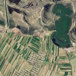
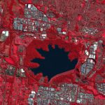
Over the past few decades, traditional Earth observation satellites have made huge contributions to the creation of standardized, historical, and publicly accessible information on land cover and land use change. However, their low spatial and temporal resolutions – exacerbated by limited computing power – have constrained their use by decision makers. The challenge is even greater in tropical forests, where persistent clouds reduce actionable data.
A new paper in Science, by lead author Matt Finer of Amazon Conservation Association and co-authored by my colleagues Joe Mascaro and Forest Stearns, argues that the tradeoff between resolution and frequency of satellite imagery is no longer a significant barrier to achieving near-real-time monitoring of tropical forests. This is due to a dramatic increase in the number of Earth observation satellites and the rise of cloud computing and machine learning, which can quickly process and analyze petabytes of data.

“The capabilities of Earth observation systems and resulting satellite imagery, such as spatial resolution, frequency, and accessibility, have all rapidly improved in recent years,” said Mascaro, a tropical forest ecologist and Director of Academic Programs at Planet. “Planet is delivering an unprecedented dataset that has set the stage for effective near real-time monitoring of vast areas.”
The authors argue that the convergence of technologies has the potential to unleash new opportunities for remote sensing data to inform sustainable land use, economic development policies, and urban planning – provided that governments and policy makers have efficient access to the data.
To that end, they outline a five-step protocol for real-time deforestation monitoring in order to ensure that governments and society at-large can implement this daily information feed into their decision-making. Key steps include rapid detection of forest loss, timely communication of results, and streamlined coordination between actors. The authors also point out the role of machine learning analytical approaches to help prioritize alerts and extract relevant features from imagery.
“There is now a global imperative to address deforestation to achieve international forest, biodiversity, and climate policy goals,” said co-author Rachael Petersen of World Resources Institute. “Near real-time monitoring can now play a large role in those efforts.”
To learn more about how Planet can help monitor land use change on a frequent basis, visit our website. To read about the paper in Science, click here.
)