Search
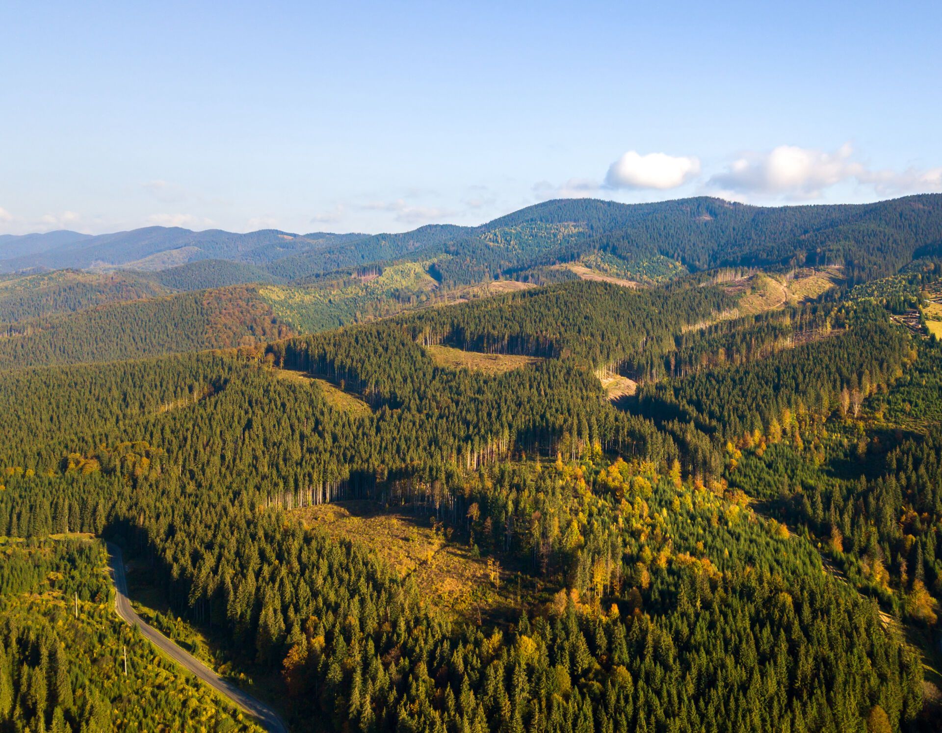
Forest and Land Use Satellite Monitoring from Planet
Planet supports forest owners and stakeholders at the forefront of innovation with remote sensing technologies and data analysis delivered by the world's largest fleet of commercial satellites.


Planet for forests and land use
Powering Forestry 4.0: Planet Provides High-Frequency Insights Across Distributed Forest Assets
Planet's satellite imaging and data helps forest managers and timber operators optimize management practices to ensure productivity without compromising environmental stewardship or compliance with land use regulation.
High Cadence Imagery
Monitor forests in near-real time with the high cadence PlanetScope imagery and mosaics
Automated Analysis
Detect changes to forest health early with RGB and NIR images
Global Coverage and Archive
Optimize harvest operations over time with comprehensive Planet Mosaics and imagery archive
Simplified Access
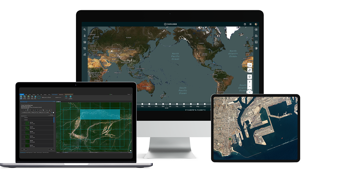
Get fast and intuitive access through Planet Explorer, APIs, and integrations
With Planet's high frequency, high-resolution satellite imagery, you can automatically track forest harvest and clearing, monitor forest health, and enhance forest management practices.
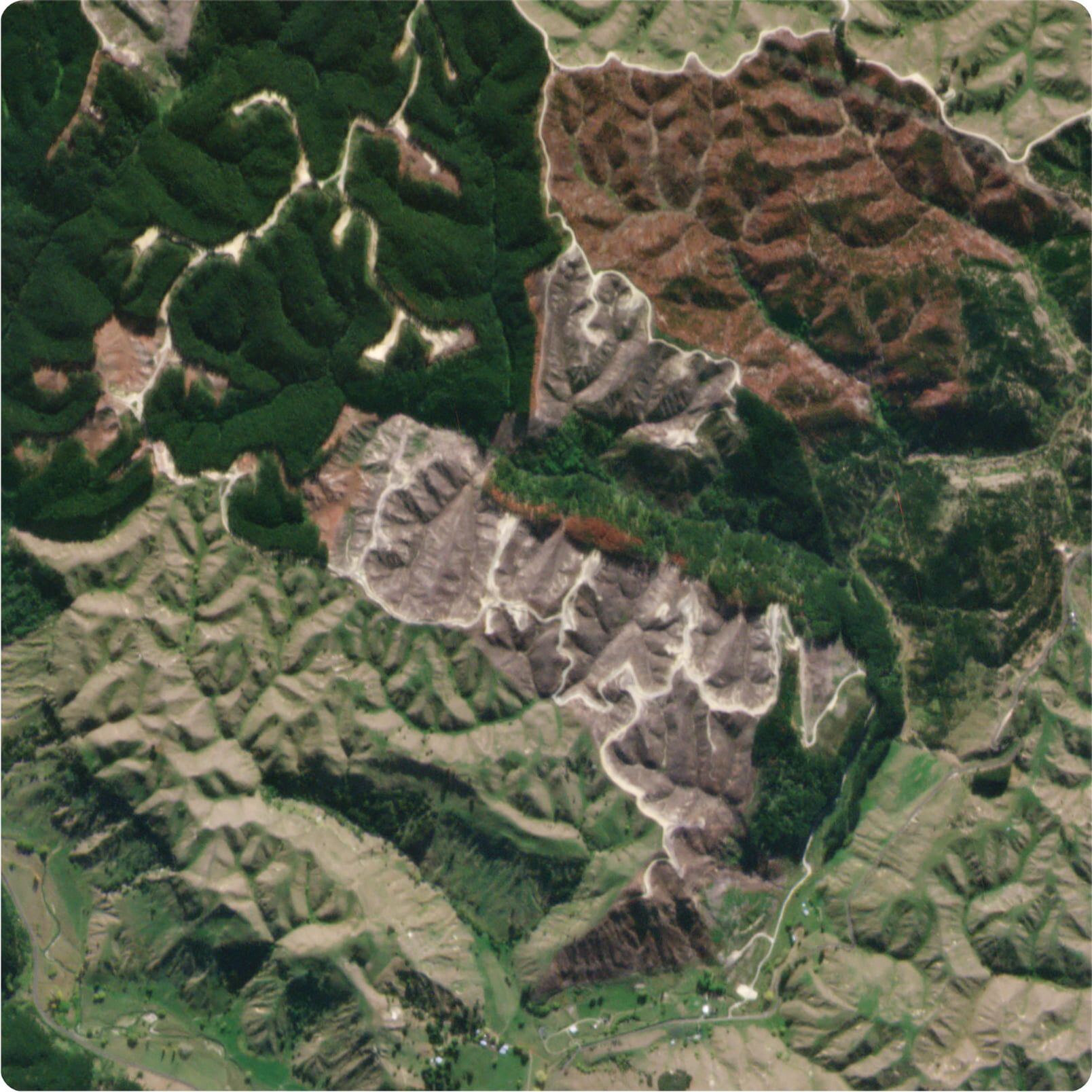
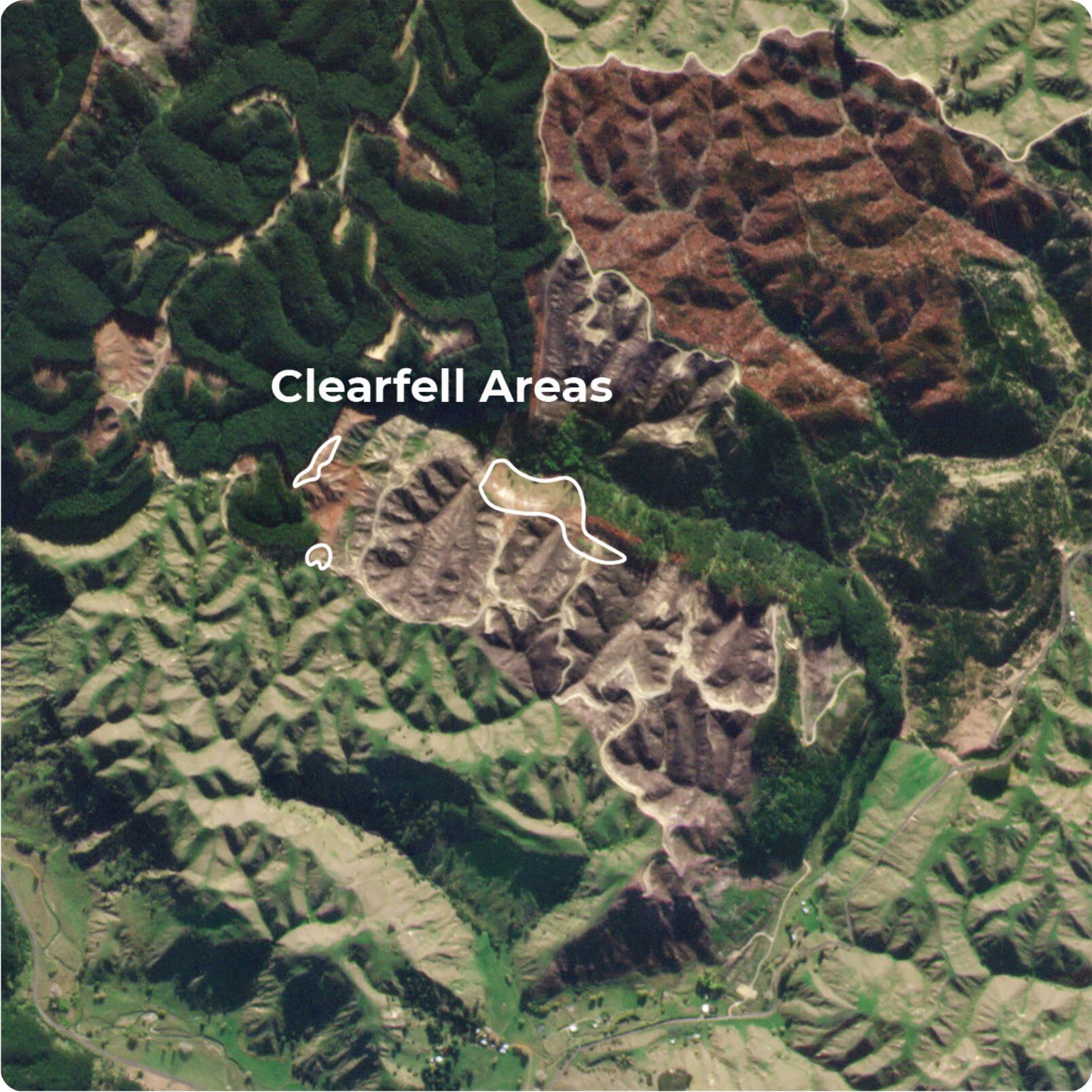
Case Study:
Automated Cutover Mapping with Satellite Imagery
Pan Pac automated the collection and reporting of harvested areas by using high frequency, 3.7 meter PlanetScope imagery. This resulted in significant time and cost savings for their team, streamlined reporting, and improved data accuracy.
Download case study here.
Timber harvesting
Streamline and Optimize Timber Harvest Operations Across the Logging Cycle with Planet
Leverage Planet satellite solutions to define, monitor, and calculate tree harvest areas remotely. Use Planet data and analysis to inform harvest planning, auditing, and inventory.
Simplify Harvest Mapping
Automatically map clearcut boundaries with PlanetScope or SkySat imagery depending on resolution needs
Reduce Labor
Reduce manual efforts in the acquisition of harvest data
Forecast Accurately
Estimate timber inventory and capacity across distributed areas of interest.
High-frequency, high-resolution imagery provides a persistent view of your forest operations, from planning to harvesting to reporting.
Forest monitoring and management
Manage the Health of Your Forest with Planet's Timely Data
With Planet, monitor distributed assets, and track the life cycle of your trees to improve forestry operations and proactively manage forest health. With continuous imaging, detect change as it happens. Respond to natural disasters, pests, and disease in a timely manner.
Detect Change
Monitor change to land use over time using an archive of cloud-free Planet Mosaics
Assess Disaster Impact
Assess the impact of natural disasters in the immediate aftermath with PlanetScope imagery
Mitigate Disaster Risk
Evaluate risk and mitigate potential fires with vegetation analyses
Measure Forest Health
Assess the spread and impact of disease and other significant changes in forest health using NDVI
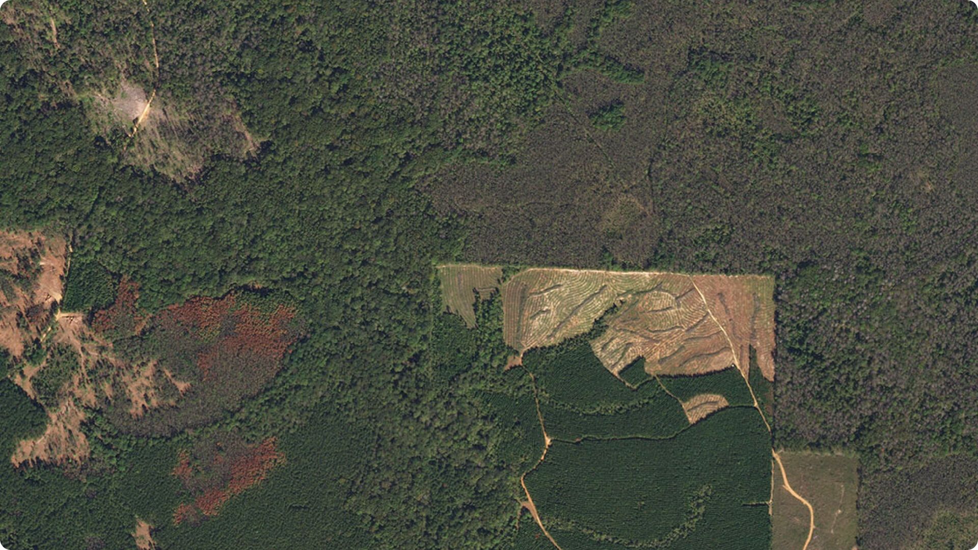
2019
Pine beetle disease spreading in Mississippi
2019
Pine beetle disease spreading in Mississippi
Validate redd+ and mrv
Improve REDD+ Measurement, Reporting, and Verification with Planet
Achieve accuracy, efficiency, and capacity gains in REDD+ measurement, reporting, and verification with Planet's high resolution, broad coverage, and historical imagery archive.
Increase Reporting Accuracy
Move from sample-based estimations to broad-area land classification
Make Informed Estimations
Detect forest canopies and estimate carbon stocks and emissions at scale
Identify Deforestation Trends
Identify trends, assess and manage at-risk areas with Planet Mosaics
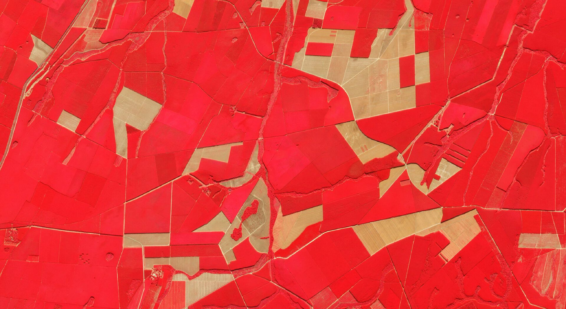
These images show deforestation near the border of Chiribiquete National Natural Park in the Colombian Amazon from August 2017 through August 2019. Planet's Mosaics provide global, cloud-free, monthly snapshots that allow monitoring of forests and other persistently cloudy areas.
Timely indications of illegal deforestation
Detect Illegal Deforestation and Changes to Land Use with Planet
Track and identify illegal deforestation and enforce permits and land use regulations with Planet's high cadence, global satellite imagery.
Early Warning
Prevent widespread forest loss in a timely manner with early indication of deforestation and degradation
Track Illegal Events
Track and identify illegal logging with Planet's high frequency Monitoring
Monitor Change Over Time
Monitor change broadly over time with Planet's historic imagery archive
Real-Time Mapping
Map land use patterns with monthly, cloud-free Planet Mosaics
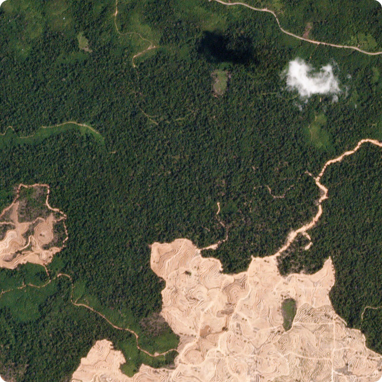
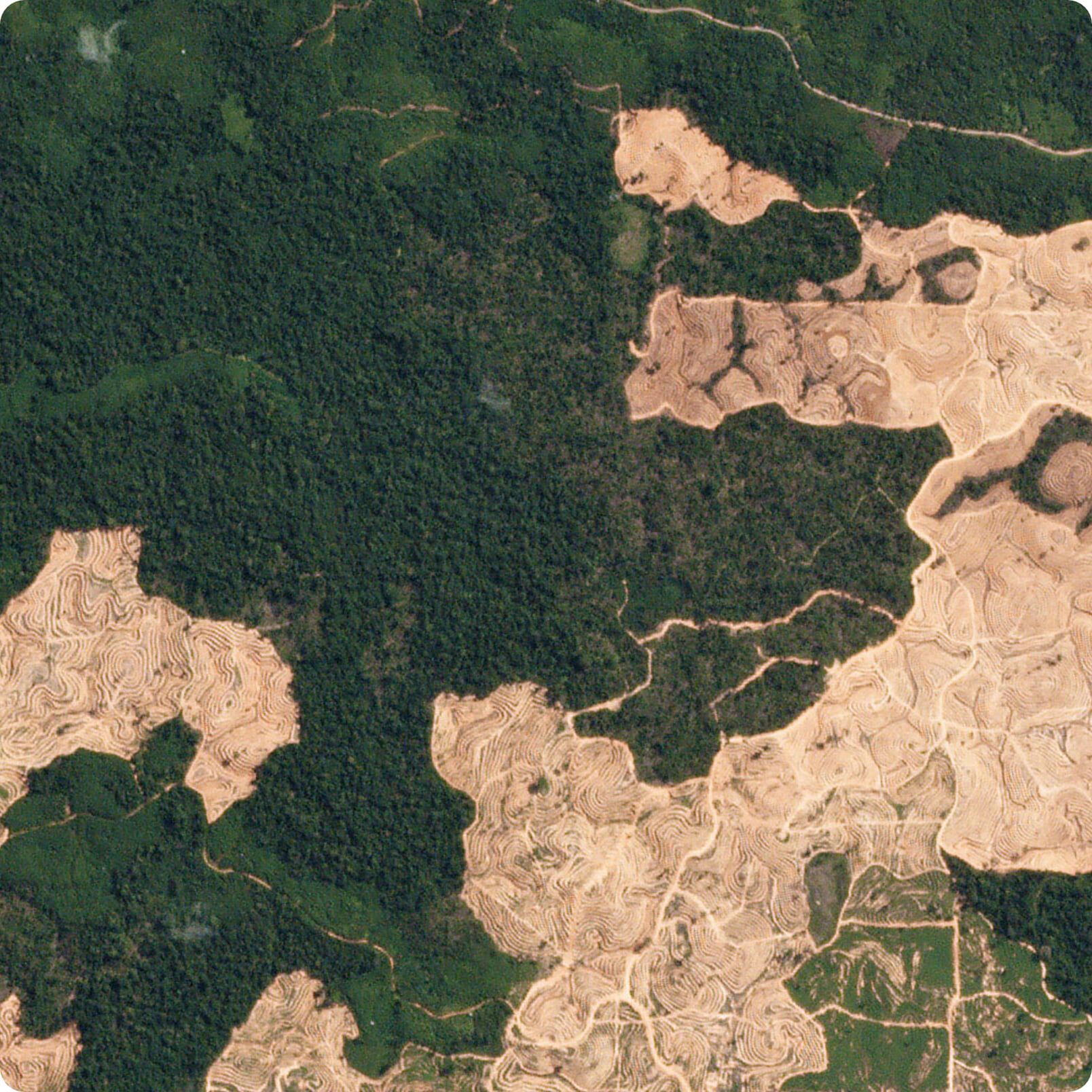
These PlanetScope images show deforestation that occurred between February 15 and July 9, 2019 in the province of East Kalimantan, Indonesia.
Planet imagery may be used to detect and map deforestation events greater than one hectare. Results show that change caused by deforestation can be automatically extracted with high accuracy.

Pete Watt
Head of Resource Monitoring, Indufor
There is no other comparable commercial system offering the combination of sensing large areas in high spatial and temporal resolution.
![[object Object]](https://cdn.sanity.io/images/hvd5n54p/production/603261a63da57430abbf8073cbf0082937b68d36-143x195.png?auto=format)
Petr Lukeš
Remote Sensing Specialist,
Czech Republic Forest Management Institute (UHUL)
Planet's rapid revisit times and high resolution are the most important factors, giving PlanetScope data advantages over alternatives both in forest monitoring and in forest area estimation.

Dr. Hans Ole Ørka
Researcher, Norwegian University of Life Sciences
Very early on, we recognised Planet's daily imagery product as a game-changer for forest operations management. We wanted to ensure New Zealand forestry companies were at the forefront of the spatial and temporal resolution this technology offers
David Herries
Director, General Manager, Interpine
Explore planet products
Discover How Planet Satellite Imagery and Analysis Can Optimize Your Forestry Projects
Planet\'s satellite and platform innovations make high frequency, high-resolution imagery sources accessible, cost-efficient, and simple for forest managers and timber operators to integrate into their workflow.
Planet Monitoring
High frequency, global coverage
Planet Tasking
On-demand, high-
resolution images
Planet Mosaics
Monthly, cloud-free
global mosaics
Planet Professional Services
Expert guidance and
implementation support
Planet's Professional Services team provides a range of services to help you efficiently integrate Planet data and platform within a forestry or land use context. Planet provides launch programs for onboarding, and a range of workshops to build and advance knowledge about the Planet Platform. Planet's Professional Services also include expert guidance on the integration of Planet into your work, alongside a range of data services to optimize Planet.
Ensure the Health and Profitability of Your Forests Today with Planet Satellite Data
Trial Planet data and learn how you can better manage, protect, and enhance your forest operations, or get in touch with our sales team to learn more about our offerings.
© 2026 Planet Labs PBC. All rights reserved.
| Privacy Policy | California Privacy Notice |California Do Not Sell
Your Privacy Choices | Cookie Notice | Terms of Use | Sitemap
