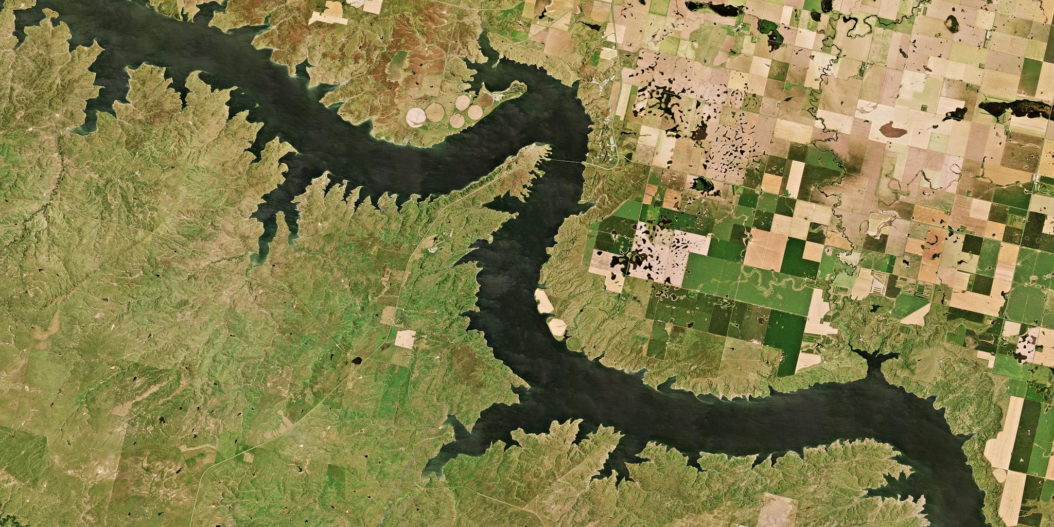
The complex shoreline of Lake Oahe highlights the many tributaries that enter the Missouri River as it meanders through the plains of South Dakota. This PlanetScope image was collected on August 29, 2019. © 2019, Planet Labs Inc. All Rights Reserved.
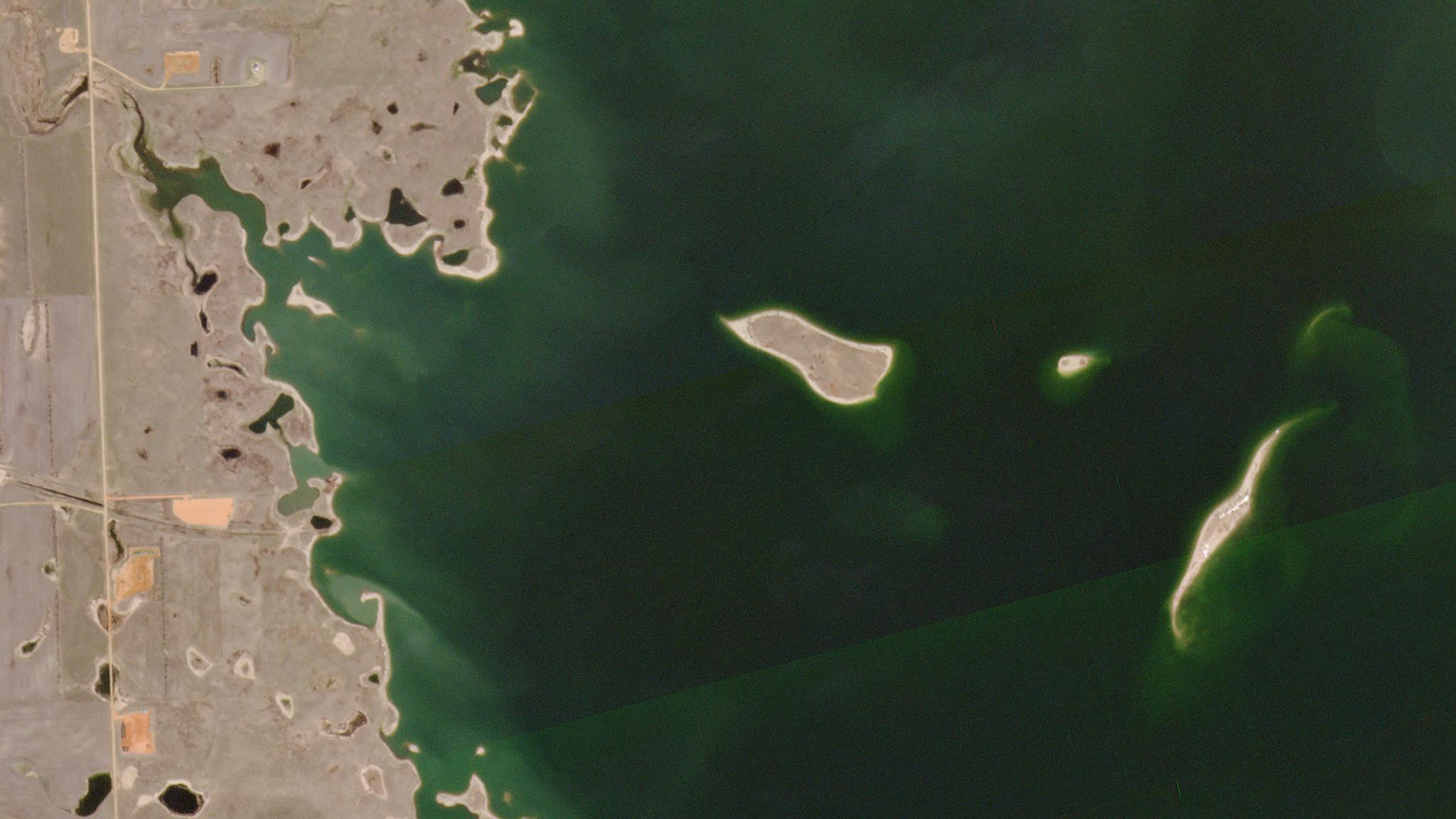
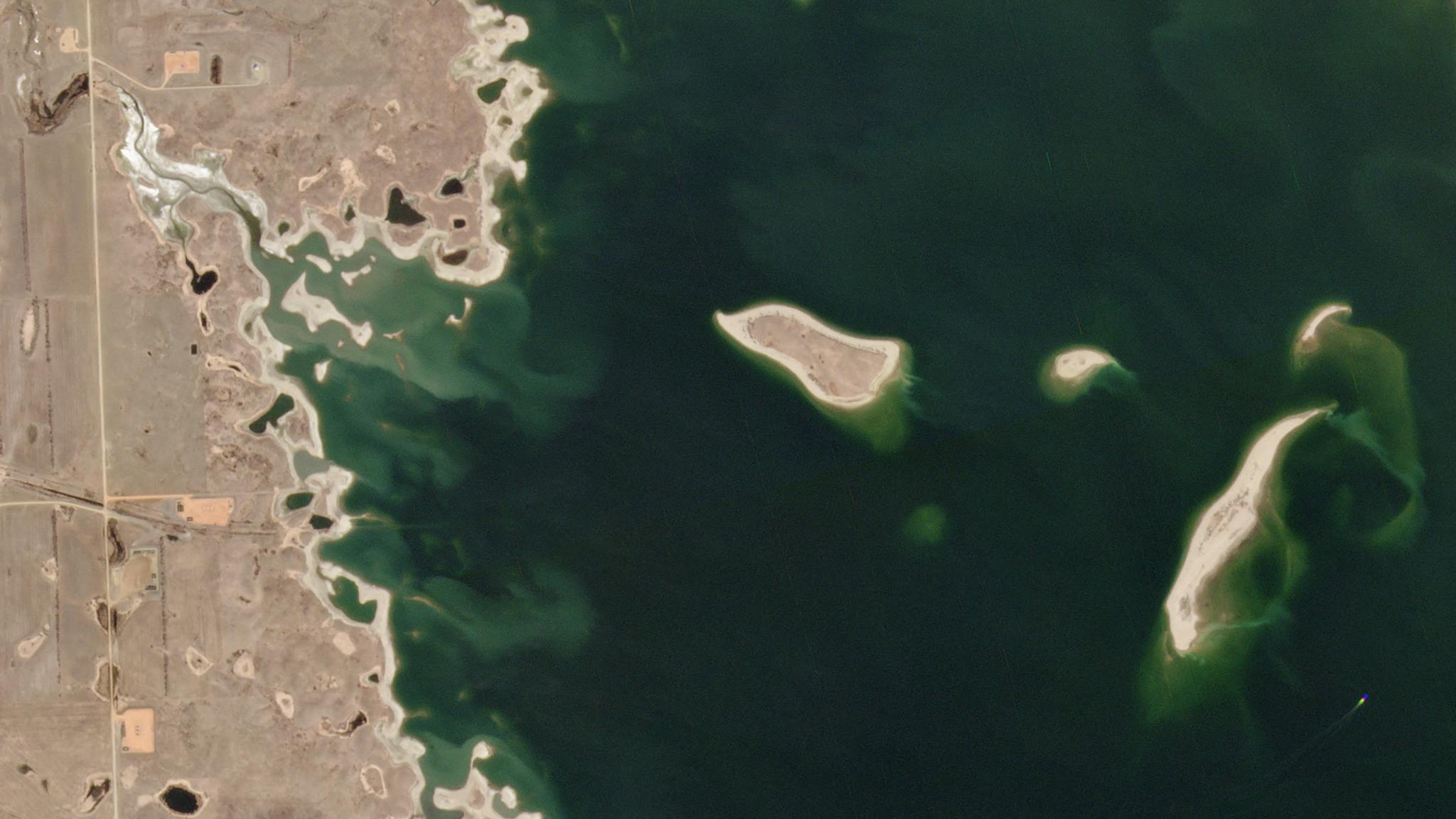
AUTHOR PROFILE Carrie Drake
Curious Planeteer working to make the Earth's changes visible, accessible and actionable.

U. S. Army Corps of Engineers Utilizes Planet Data to Monitor Endangered Species Populations and Their Critical Habitats

Stories

The Missouri River Basin supports an abundance of wildlife, including the least tern and piping plover—shorebirds that are federally listed under the Endangered Species Act. Each depends on the Missouri River for a nesting habitat. As part of their Missouri River Operations Mission, the U.S. Army Corps of Engineers (USACE) is responsible for monitoring parts of the Missouri River Basin to make sure that the Endangered Species Act is adhered to, while ensuring the Missouri River Mainstem System dams continue producing energy.

For more than 20 years, the USACE and U. S. Fish and Wildlife Service have conducted formal consultation under Section 7 of the Endangered Species Act to assess the potential impacts to threatened and endangered species. The most recent consultation in 2018 resulted in a Biological Opinion (BiOp) issued by the U. S. Fish and Wildlife Service to the USACE. The BiOp concluded that continued operation of the Missouri River Mainstem System dams and reservoirs were unlikely to jeopardize the existence of the least tern and piping plover on the Missouri River, as long as the USACE implemented actions described in the BiOp.

USACE selected and utilized Planet’s RapidEye data to assess the habitats in compliance with the BiOp requirements. When Planet retired the RapidEye constellation earlier this year, a new data source was needed. Planet Federal solutions engineer, Bill Raymond, worked with the USACE to identify an alternative solution that would meet their needs: PlanetScope.

The transition to PlanetScope data increased the resolution of the imagery previously utilized for the basemaps, and did so without the large price tag that can often accompany tasking satellites that collect higher resolution imagery. Planet’s agile operations allowed Raymond to support the custom technical integration, ensuring continuity of the mission.

The U.S. Army Corps of Engineers uses PlanetScope data to monitor the habitat of several endangered species along the Missouri River. This pair of images shows the fluctuating shoreline of Lake Sakakawea, North Dakota (one of the river’s many reservoirs) on April 22, 2019, and April 22, 2020. Endangered piping plover nest on the ever-shifting sandbars along the water’s edge, and Planet’s frequent and wide-area imagery helps the Corps ensure that changing lake levels do not damage their habitat. © 2020, Planet Labs Inc. All Rights Reserved.

The U.S. Army Corps of Engineers uses PlanetScope data to monitor the habitat of several endangered species along the Missouri River. This pair of images shows the fluctuating shoreline of Lake Sakakawea, North Dakota (one of the river’s many reservoirs) on April 22, 2019, and April 22, 2020. Endangered piping plover nest on the ever-shifting sandbars along the water’s edge, and Planet’s frequent and wide-area imagery helps the Corps ensure that changing lake levels do not damage their habitat. © 2020, Planet Labs Inc. All Rights Reserved.

The efficiency created by the continual imagery captured by the Planet satellite constellation saves the USACE time and effort. In addition, Planet has provided the USACE with Missouri River imagery that can be utilized for handheld GPS basemaps, which increases the efficiency of USACE’s least tern and piping plover monitoring crews in the field. Compliance with the BiOp enables the USACE to operate the Missouri River Mainstem System dams for the benefit of the American public.

In addition to protecting wildlife, the USACE’s Missouri River Operations Mission also ensures that power is maintained for over one million people.

In 2019, the Missouri River Mainstem System dams generated over 13 billion kilowatt hours of power for residential customers. One of the primary benefits of the mission was the production of hydropower, which doesn’t contribute to greenhouse gas emissions.

BiOp compliance for the USACE’s Omaha, Missouri district will likely continue into the future, and annual collections of Planet imagery products will continue to be valuable for measuring the USACE’s impact for many years to come.

To learn more about how Planet data can be used to monitor other endangered species and their habitats, check out our story on the Araguaia river dolphins, one of the most endangered dolphins on Earth.