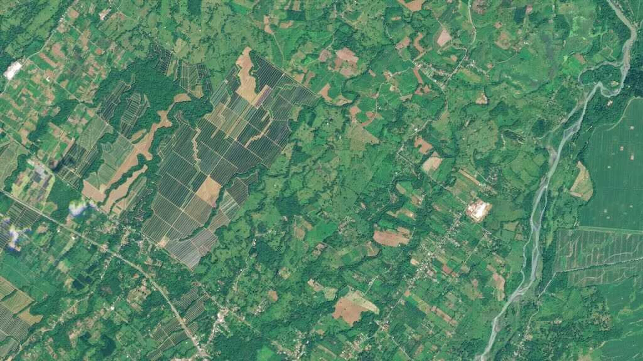
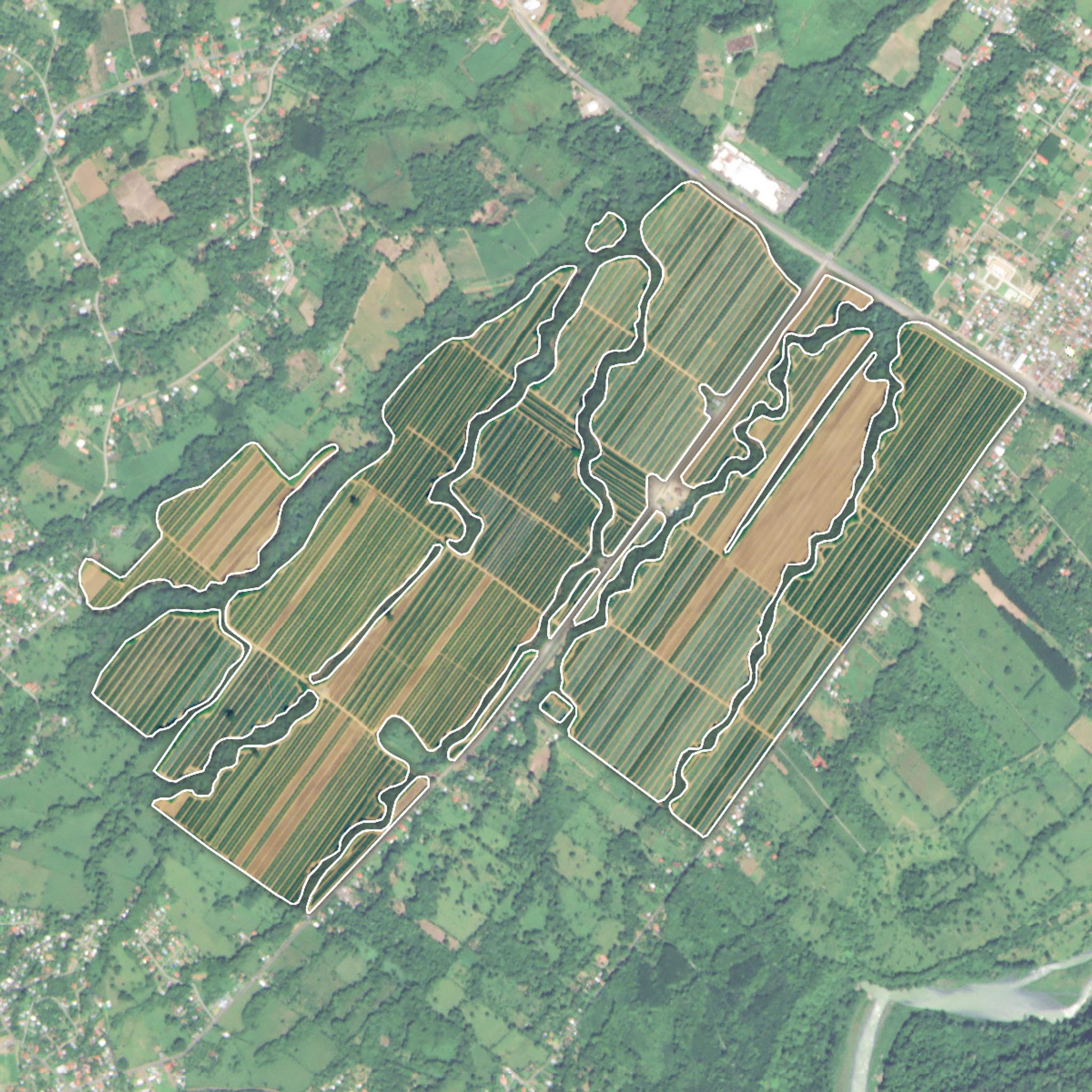
PlanetScope imagery of a pineapple field in Limón, Costa Rica. © 2019, Planet Labs Inc. All Rights Reserved.
AUTHOR PROFILE Shelby Parks
Curious Planeteer working to make the Earth's changes visible, accessible and actionable.

Analyzing the Impact of Agricultural Activity on Ecosystems

Stories
How a Multi-Stakeholder Project, MOCUPP, is Advancing Costa Rica Towards Sustainable Practices to Protect the Country’s Biodiversity

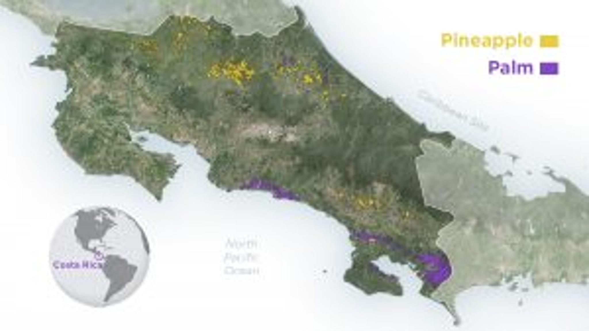
Costa Rica is one of the most biodiverse places in the world, containing nearly 6 percent of the world’s biodiversity. As a result, its ecosystem provides a range of services including wood and timber, plants, and fruits, amongst many others that have fueled industry, scientific research, and culture.

Biodiversity also plays an essential role in the well-being of the planet. When biodiversity is abundant, there is an increase in ecosystem productivity that supports a larger number of species and therefore a larger variety of crops. Additionally, biodiversity protects freshwater sources, breaks down pollutants, and contributes to climate stability. To conserve this rich environment, Costa Rica has signed forty-five international environmental treaties in addition to enacting regulator bodies to protect its diverse environment.

The National Center for High Technology (CeNAT)’s Monitoring of Change of Use in Productive Landscapes project (in Spanish, “Monitoreo de Cambio de uso en Paisajes Productivos” – MOCUPP) uses Planet satellite data to monitor the changes in land use and analysis of deforestation processes associated with agricultural dynamics in the country.

Pineapples growing outside of El Cairo, Costa Rica captured by a PlanetScope satellite on November 23, 2019. Boundaries detected by MOCUPP. © 2021, Planet Labs Inc. All Rights Reserved.

“Our production models depend on biodiversity, so it is imperative to have more sustainable productions. MOCUPP is a powerful tool that accurately records changes in land use and land cover,” said Christian Vargas Bolaños, Researcher at PRIAS Laboratory of the CeNAT.

These observations enable the team to improve productivity and ensure that their decisions contribute to greater conservation and sustainable practices. 

To date, MOCUPP records the annual coverage of three crops: pineapple, palm oil, and pastures. They also study the processes of regeneration, permanence, and loss of tree cover as a result of these crops. 

Map of Costa Rica showing Pineapple and Palm fields. © 2021, Planet Labs Inc. All Rights Reserved.

“Due to the COVID-19 pandemic, and as part of the solutions to overcome the national travel restrictions, Planet imagery provided an alternative to in-person field site visits. The implementation of “virtual tours” allowed the project to collect information that is normally collected in person, to be collected through an alternate way, in this case through the use of high-resolution satellite imagery,” said Vargas

This method has served to validate the MOCUPP products through the use of data with higher spatial resolution in Costa Rica. 

The main finding was that the spatial resolution of Planet’s data enabled PRIAS Laboratory to learn that there were fewer acres of pineapple growing than they had previously thought. The evolution of the pineapple productive landscape decreased from 66,266.01 hectares in 2017 to 65,442.41 hectares in 2019. This represents a reduction of 823.6 hectares, which is explained by the precision of the Planet image material used in the preparation of the products.

“Since we use PlanetScope images to validate the layers for the productive landscape and the gain and loss of that productive landscape, we were able to generate more accurate maps. This is really helpful for the producers because acres that previously would have been reported as a gain in the productive landscape can now be reported accurately as the producers aren’t expanding the crops or deforesting the land,” said Vargas

In alignment with the international treaties and environmental bodies that protect Costa Rica, MOCUPP’s work highlights the impact of agricultural activity on ecosystems. This information provides a view into how to transform the processes into models that advance the country towards sustainability. 

“In the future, this work could allow products to be certified as deforestation-free. At that time, citizens will play an essential role by being able to inform themselves and the products they choose to consume,” said Esteban Castillo, Researcher at PRIAS Laboratory of CeNAT.

As the team looks towards the future, the possibilities of integrating satellite data into their work are boundless. 

“There is the possibility of incorporating new productive units such as coffee, Musaceae (including bananas, plantains, and abaco), sugar cane, rice, among others, depending on the productive development of the country. In addition, there is the need to continue working with Planet images in other future projects led by PRIAS such as evaluating the feasibility of the soil in planting crops, monitoring of crop yield, health analysis of crops, and disease monitoring,” said Vargas

MOCUPP is led by the United Nations Development Program (UNDP) through its Green Commodities Program and is financed by funds Global Environment Facility (GEF). MOCCUP is the work from the collaboration of three organizations: the PRIAS Laboratory of CeNAT of the National Council of Rectors (CONARE), the Directorate of the Real Estate Registry (DRI), and the National Geographic Institute (IGN); It has the backing of the Ministry of Environment and Energy (MINAE), through the National Geospatial Information Center (CENIGA) and the support of the Ministry of Agriculture and Livestock (MAG).

Planet recently entered into a definitive merger agreement with dMY Technology Group, Inc. IV (NYSE:DMYQ), a special purpose acquisition company, to become a publicly-traded company. To learn more about our products, visit our site.