
Estimating Volume Changes for Floodplain Harvesting in New South Wales, Australia
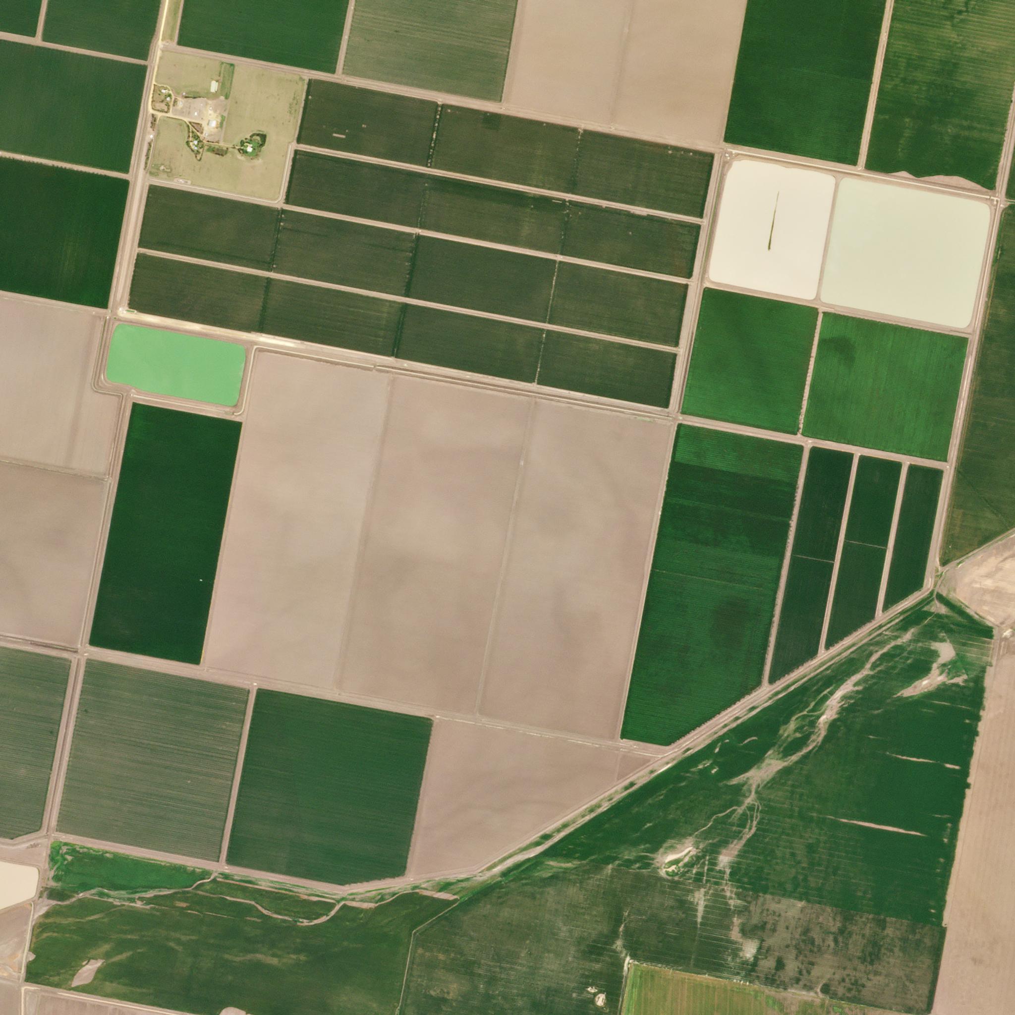
Agricultural fields in Narrabri, New South Wales, Australia. © 2021, Planet Labs PBC. All Rights Reserved.
StoriesThe Department of Planning and Environment in New South Wales (NSW) continually monitors and assesses the use of critical water resources including that stored in the thousands of on-farm water storages. Such assessment is used to evaluate the effectiveness of water restrictions, license and planning conditions to maintain an equitable share of water resources between both users and the environment.
“At certain points in time, we might place restrictions on taking water because of drought or the need to pass water downstream to environmental assets,” explains Mustak Shaikh, Principal for remote sensing at NSW. “We need to track whether users are taking more water than they are entitled to.”
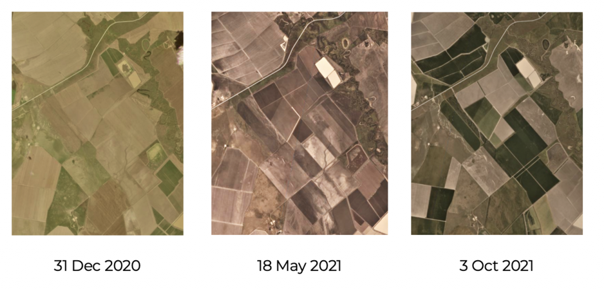
The Department of Planning and Environment in New South Wales used this time series of PlanetScope images to estimate water storage volume by calculating the area.
The challenge for Shaikh and his colleagues was obtaining satellite images with enough cadence and spatial resolution to accurately detect water usage.
By switching to Planet, the department was able to access imagery with the resolution, cadence, and coverage needed for water resource management.
"NSW Department of Planning and Environment has an exceptional experience in water management use case, and Planetscope—with all the advantages that come with it such as high revisit rate and decent spatial resolution—seem to work very well for their applications. They are able to utilize these data in such a diverse way -- ranging from gauging water storage through a simple, straightforward visual observation of scenes, all the way to advanced raster analysis,” says Masrudy Omri, customer success manager.
Moreover, NSW also found tremendous value in Planet’s imagery archive of proprietary datasets going back to 2009, and public datasets back to 1972.
“Planet’s unique advantage is that it captures an archive of all the imagery,” Shaikh says. “If we want to go back in time to observe the impact of certain environmental events, we can do that. We also have daily coverage, which is critical for our day-to-day work.”
Using the Planet platform and its daily, high-resolution images, NSW’s remote-sensing team can estimate the timing of water take, movement, and volume of floodplain harvested water into storage.
Planet now plays a key role in NSW’s water resource management efforts. “Planet provides a unique advantage because of its daily coverage at three-meter resolution. At this resolution, we’re able to see farm infrastructures like storage and irrigation channels,” Shaikh says. “That's the reason why Planet is important for our work.”
To learn more about how NSW’s Department of Planning and Environment is leveraging Planet data, check out the full case study here.
Ready to Get Started
Connect with a member of our Sales team. We'll help you find the right products and pricing for your needs.