
Extracting Insights from Imagery: Planet Analytics Webinar
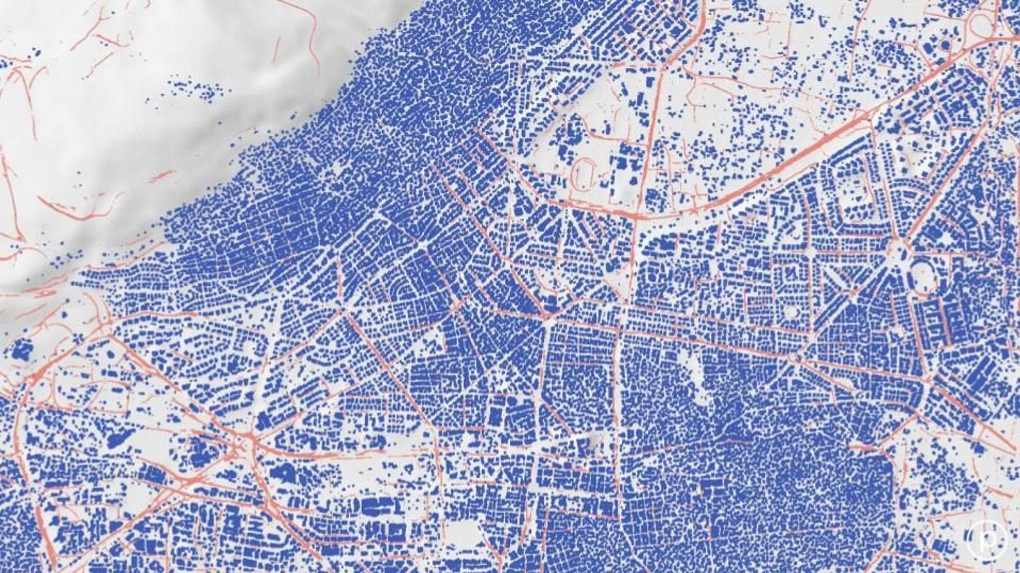
Road detection analytics on an image of Damascus, Syria © 2018, Planet Labs Inc. All Rights Reserved.
NewsSeveral weeks ago, we launched the Planet Analytics beta – our new product designed to help customers and partners more easily consume Planet’s daily satellite imagery and arrive at insights more quickly. To achieve this, Planet Analytics uses machine learning to analyze our global, daily satellite imagery and create “information feeds” that automatically detect and classify objects, identify geographic features, and monitor change over time. The response so far has been positive, but one of the top questions we’ve received has been: what do information feeds look like in action and how do they work? This new on-demand webinar – Introducing Planet Analytics beta © YEAR, Planet Labs Inc. All Rights Reserved. – offers an overview of the product suite as well as a deeper dive into each of the five analytic feeds. You’ll learn:
- How Planet Analytics is differentiated within the geospatial market
- Insights on the initial analytics – roads & buildings, aircraft, maritime vessels, and deforestation detection – and where we’re heading next
- Example uses cases for Planet Analytics
[cta-banner datatag="" thankyoutitle="" thankyoutext="" title="Webinar: Planet Analytics beta" buttontext="Sign Up" buttonhref="https://info.planet.com/webinar-introducing-planet-analytics-beta/" backgroundimage="https://storage.googleapis.com/corpeng-pulse-assets/uploads/2018/08/Copy-of-Planet-Analytics-Webinar-_-August-2018.jpg"][/cta-banner]
Ready to Get Started
Connect with a member of our Sales team. We'll help you find the right products and pricing for your needs.