
NASA Extends Agreement with Planet Under Its Commercial SmallSat Data Acquisition Program
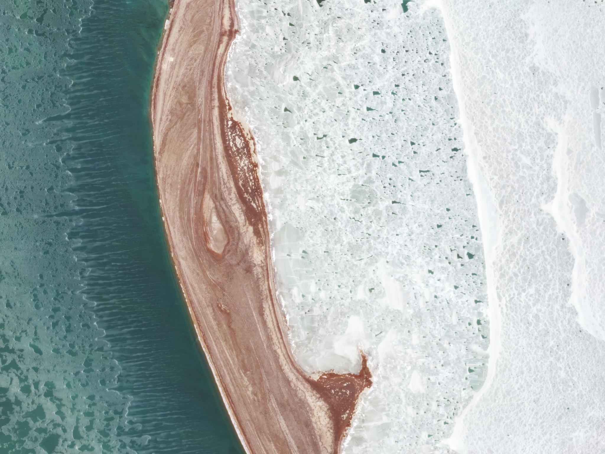
Sea Ice in the Tyuleniy Archipelago, a small group of islands in the Caspian Sea, captured by PlanetScope on December 6, 2020 © 2020, Planet Labs Inc. All Rights Reserved.
NewsAll NASA-funded researchers now have continued access to PlanetScope and RapidEye imagery through September 2021 following an extension of our current agreement under NASA’s Commercial SmallSat Data Acquisition (CSDA) Program.
Through the NASA CSDA Program, scientists have used Planet imagery for a variety of research projects to date and we’re eager to see what innovative projects these researchers will pursue in the coming year. In the last year, PlanetScope imagery was used to validate burned area models of wildfires, analyze the collapse of the last intact Arctic ice sheet due to the impacts of climate change, and assess landslide hazards in the Himalayas.
NASA researchers also used PlanetScope imagery to aid farmers and herders in Africa through SERVIR, a joint initiative of NASA and the U.S. Agency for International Development (USAID). As watering holes become less reliable and predictable due to changes in rainfall in the region, SERVIR created a web-based tool to aid nomadic herders in northern Senegal to find watering holes for their herds for cattle, donkeys, and goats.
NASA researchers have also turned to satellite imagery to investigate the impact of the COVID-19 pandemic and its associated economic shutdowns. Planet data was incorporated into NASA’s COVID-19 Dashboard to monitor changes in traffic and airports over time.
The Togolese government approached NASA Harvest, NASA’s food security and agriculture program, to create a country-wide cropland map with the goal of helping in aid distribution. The Harvest team provided the government with the map they needed within 10 days of receiving the request, allowing the government to mobilize quickly to ensure food security during the global pandemic.
We’re thrilled to provide Planet data to all NASA-funded researchers in an effort to unlock even more insights and discoveries that can benefit our world. Visit our website to get more information on the Planet-NASA CSDA agreement and learn how to apply.
Are you a researcher looking for access to Planet imagery but aren’t funded by NASA? Check out our other Education and Research options.
Ready to Get Started
Connect with a member of our Sales team. We'll help you find the right products and pricing for your needs.