
Pilot Program Pushes Boundaries for Wildfire Detection
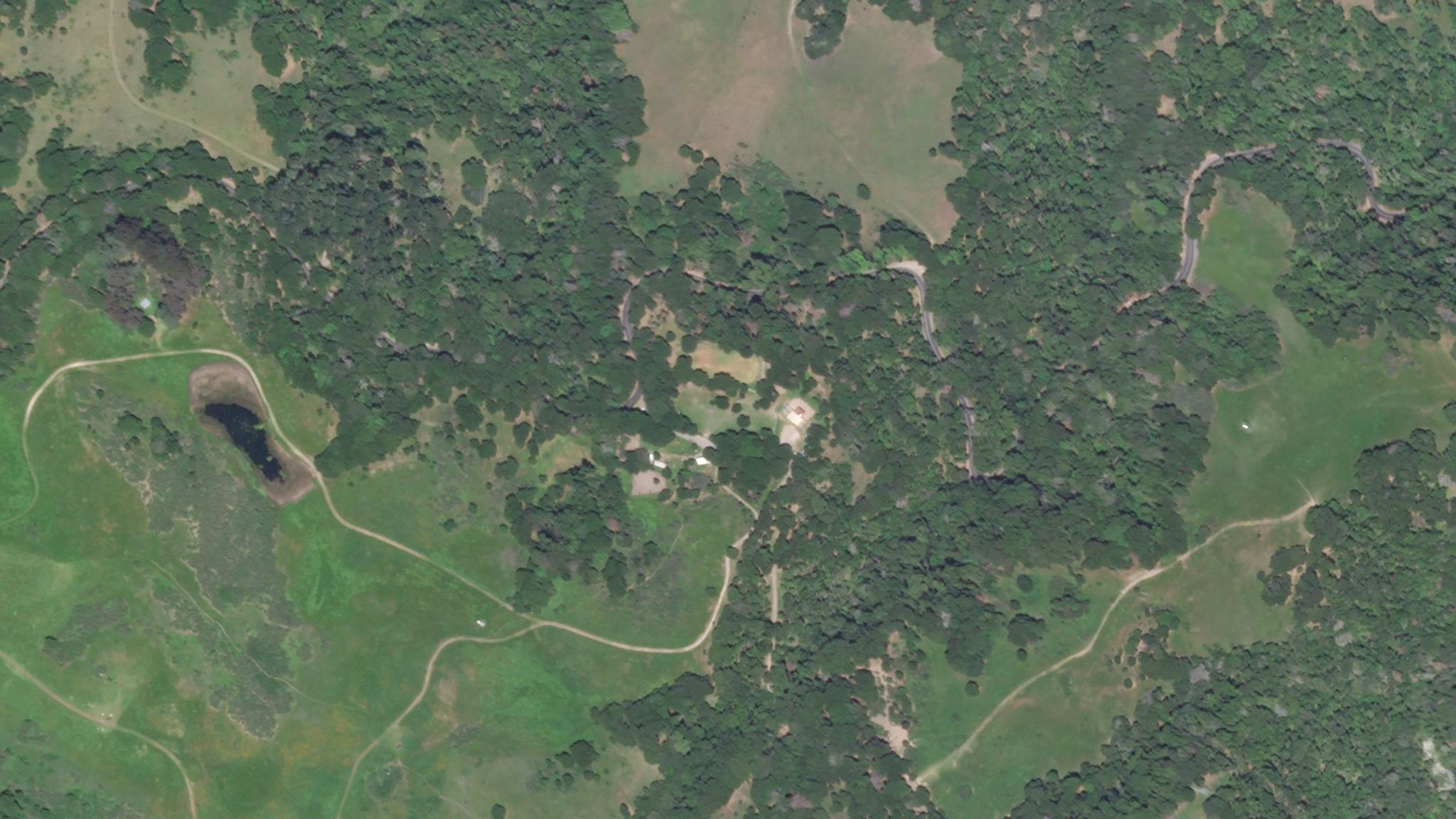
Large crop of a controlled burn site in Orinda from April 30, 2020 © 2020, Planet Labs Inc. All Rights Reserved.
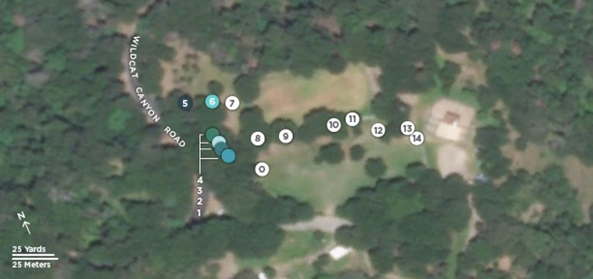
StoriesThe most recent wildfires throughout western North America have re-emphasized the need for early wildfire detection and validation. Time and resources are in short supply for emergency responders, who have a short window to detect and assess wildfires to help prevent the most damage. “Time and resources are both in short supply during the critical first operational period,” says Chief Dave Winnacker of the Moraga Orinda Fire Department. “This period, before large incident management teams have been mobilized, is both when the greatest damage occurs and when the least information is available to guide evacuation and firefighting deployment decisions.” To help fire departments respond during this critical period, Planet, UC Berkeley (UCB) and the Moraga Orinda Fire District (MOFD), with support from the Gordon and Betty Moore Foundation, launched a pilot to determine if a multi-system approach could be beneficial for early wildfire detection. The pilot’s objective was to use on-the-ground fire sensors to detect a fire and then automatically task a satellite to capture high resolution imagery of the burn location. They discovered that on-the-ground sensors could automatically trigger the collection of satellite imagery, which can be used by incident management teams to better understand the extent of a wildfire. Over several trials, the MOFD ignited prescribed fires in oak woodlands where the sensors had been installed. These sensors were made to detect an increase in temperature and a drop in relative humidity, and to send a signal to an interface called BurnMonitor, alerting responders to a potential fire. [caption id="attachment_145848" align="aligncenter" width="612"]
Ready to Get Started
Connect with a member of our Sales team. We'll help you find the right products and pricing for your needs.