
Planet’s Data Supports Safe and Sustainable Mining Management
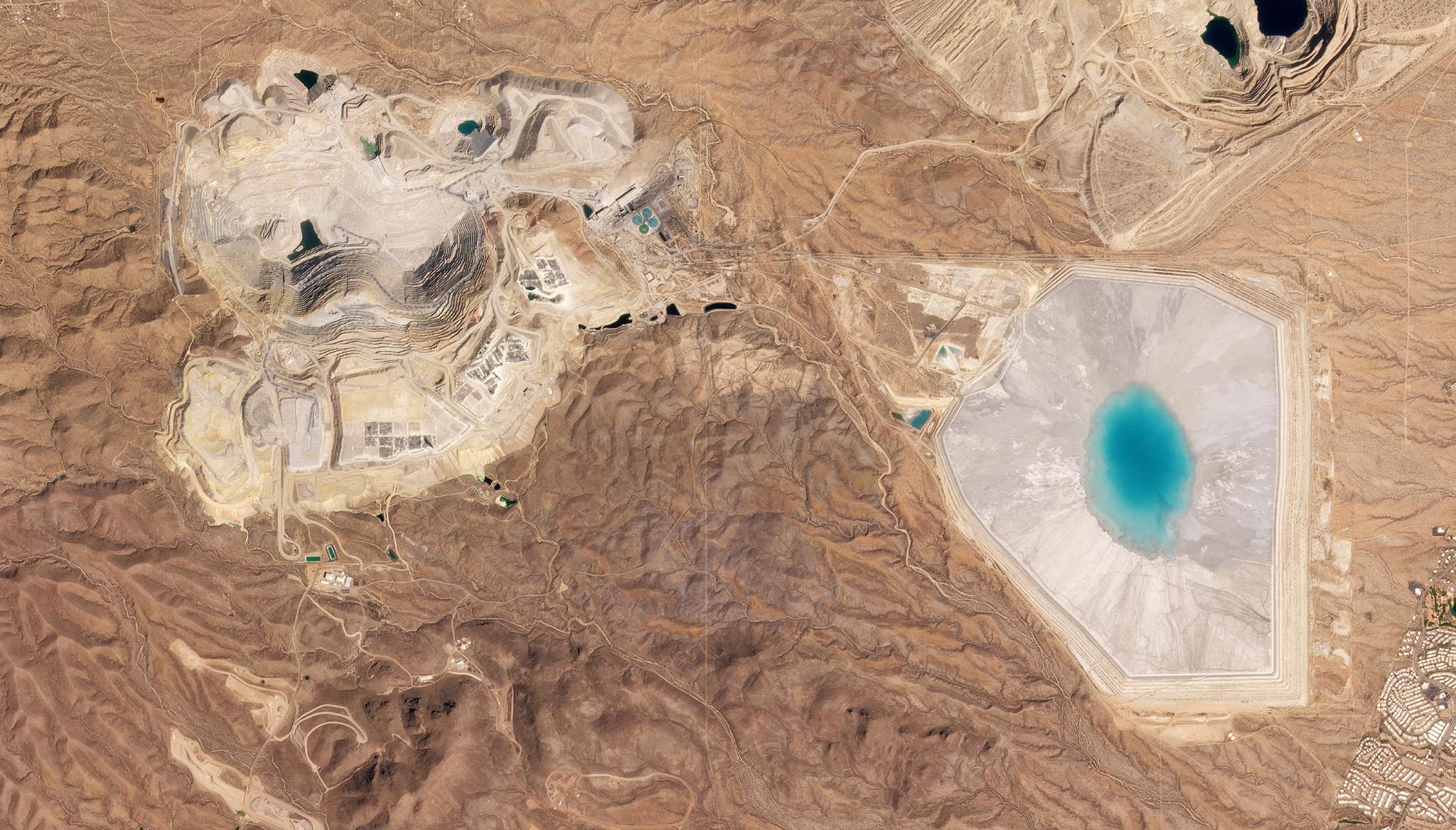
Sierrita Mine and tailing pond outside of Green Valley, Arizona captured by PlanetScope on March 18, 2022. © 2022, Planet Labs PBC. All Rights Reserved.
StoriesFreeport-McMoRan Inc. (FCX) is an international mining company that operates large copper, gold and molybdenum mines. In an effort to support its stated commitment to safety performance, environmental management, and local communities, FCX is using Planet data to monitor and maintain its operations.
Tailings are known as the by-product of mining operations, and consist of the materials left over after the resource extraction takes place, such as sand or silt. To ensure tailings do not negatively impact the surrounding environment, these excess materials are often managed in a storage facility; at a recent Planet Explore event, FCX shared its goal of zero catastrophic failures or unplanned discharges from its Tailings Storage Facilities.
However, as COVID-19 spread across the world, FCX’s interdisciplinary teams of water resource and geotechnical engineers, scientists, and data scientists could no longer have their usual number of inspections on the ground to monitor Tailings Storage Facilities. The team recognized that they needed an extra layer of satellite monitoring alongside the Sentinel-2, Landsat, and UAS remote sensing datasets they were using, and they added PlanetScope to the existing pipeline for Sentinel-2 data in order to reduce time between observations.
“We leveraged near-daily Planet imagery to map water in our facility and built online maps and dashboards so that operations and crew could adapt their processes. This increased visibility for engineers, operators, and other decision-makers, both on- and off-site,” shared Leland Sutter, Geospatial Analyst at FCX.
Planet’s daily imagery allowed engineers to monitor the area of the tailings ponds to more efficiently plan their daily work. Without remote sensing technology, a FCX worker would need to measure water at these extensive facilities on the ground with markers and range finders. Instead of physically walking the miles-long dam crest – which can be dangerous – engineers could now remotely gain a better understanding of water location and stay safe while doing so. By leveraging daily imagery from Planet, the water management team can more robustly calibrate and validate their water models, and derive pond area outlines with multispectral analysis and machine learning techniques.
FCX also made Planet imagery available in their GIS system for general mapping needs. With frequent imagery collections, they are now able to ensure there is recent imagery of mine sites with minimal cloud cover. Additional use-cases have been found for dust control and air quality permitting as areas with less moisture are more likely to be a source of dust which can lower air quality and can be prioritized for dust suppression.
“PlanetScope imagery is a great solution for high temporal, medium spatial resolution imagery. Working with Planet’s software developers and product owners, FCX has seen a huge improvement in online visualizations. Online visualizations minimize the amount of data that must be downloaded while improving the speed at which users can make decisions. Development is continuously ongoing, so you’re always excited to see what’s next,” said Leland Sutter.
Ready to Get Started
Connect with a member of our Sales team. We'll help you find the right products and pricing for your needs.