
Planet’s response to earthquakes in Turkey and Syria
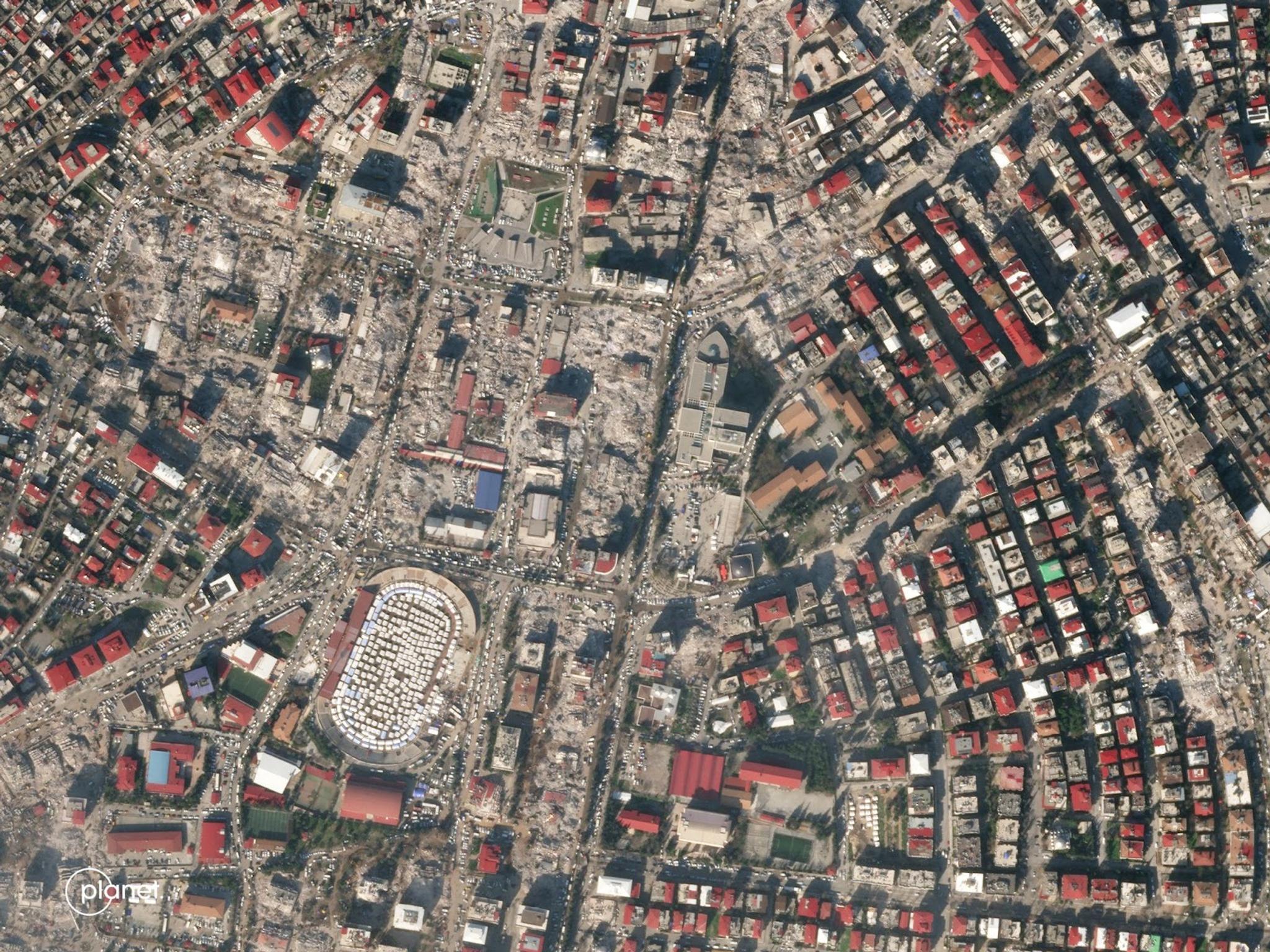
Planet SkySat image of Kahramanmaras, Turkey taken February 9, 2023. © 2023, Planet Labs PBC. All Rights Reserved.
NewsWe are heartbroken by the tragedy in Turkey and Syria, and Planet remains committed to assisting with the ongoing disaster response by providing data to the International Charter Space and Major Disasters, which makes our imagery available to the public, media, volunteers, humanitarian organizations, and other coordinating bodies during select disaster events.
Getting actionable data into the hands of early responders is paramount and Planet has been working with Microsoft AI for Good Lab and partners from academia, governments and other satellite providers (including Berkeley Artificial Intelligence Research, Defense Innovation Unit and Maxar Technologies) to produce a building damage assessment to assist in the response efforts from Turkey’s Ministry of Interior Disaster and Emergency Management Presidency (AFAD).
As you can read in this report, after the earthquake in Turkey on February 6th, the team began to utilize artificial intelligence (AI) methods and high-resolution satellite imagery from the first three days of the disaster to assess the extent of damage to buildings in the four cities of Marash (also known as Kahramanmaraş), Turkoglu, Nurdagi, İslâhiye.
A summary of assessment results include:
- An estimated 3,849 buildings damaged or destroyed across the four cities
- An estimated 160,000+ people live in or immediately adjacent to damaged buildings (according to WorldPop 2020 gridded population estimates)
- Found the city of Marash (Kahramanmaraş) to be the most heavily affected, both in magnitude and proportion of damage, with 7.44% of buildings in the city sustaining some level of damage visible from satellite imagery (Side-by-side of SkySat and analyzed data pictured below)
This modeling tool was initially developed with Microsoft AI for Good Lab on behalf of the United Nations for both Ukraine building damage assessment and to help in future scenarios. The intent being to help organizations bypass inherent traditional damage assessment challenges and support the scale and speed needed for ground teams to respond effectively.
Because of the learnings and tools developed during that Ukraine assessment, the teams were able to quickly scale and replicate those models here, generating what would have previously taken weeks or months to complete within a few days following the aftershocks.
To receive more information or access to disaster response data from Planet, please contact: disaster-access@planet.com.
Ready to Get Started
Connect with a member of our Sales team. We'll help you find the right products and pricing for your needs.