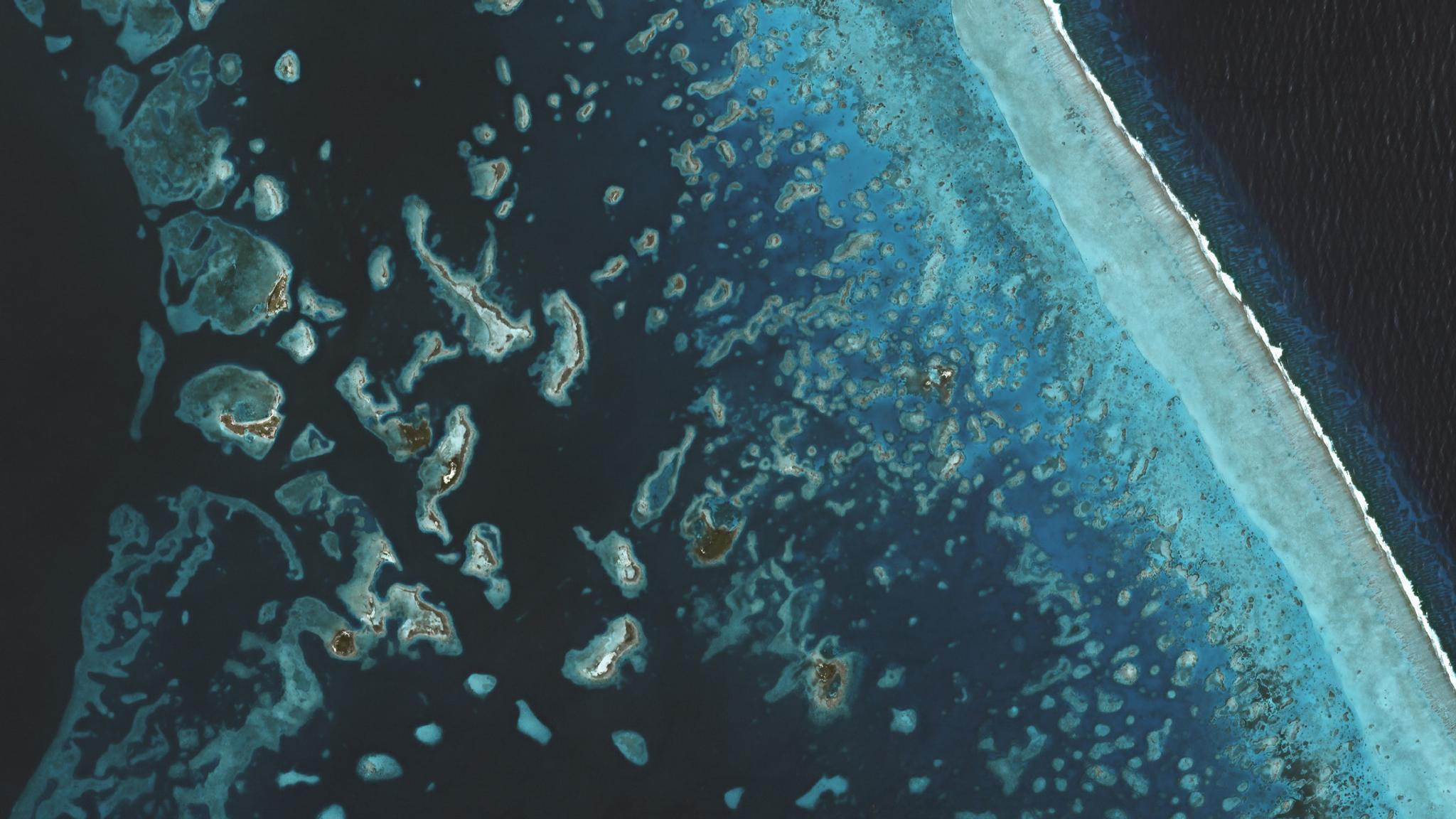
Coral reefs off the coast of Belize captured by PlanetScope. © 2019, Planet Labs Inc. All Rights Reserved.
AUTHOR PROFILE Lauren Neville
Curious Planeteer working to make the Earth's changes visible, accessible and actionable.

Powered by Planet Data, The Allen Coral Atlas Completes Its Mission to Comprehensively Map All of the World’s Coral Reefs from Space
News

Today marks a major milestone for global ocean science, management and biodiversity conservation. Utilizing more than two million Planet images, ground data collected from around the world, and advanced machine learning techniques, our partners at the Allen Coral Atlas, housed at Arizona State University, have now completed the first-ever, high-resolution spatial and thematic detailed mapping of all the world’s tropical, shallow coral reefs. The results are available for free at allencoralatlas.org

Starting with a base layer of coral reef satellite images, the Atlas project interweaves a series of robust data layers to map reef structure, benthic information, and species composition. Planet provides a global coral reef mosaic from PlanetScope satellite imagery as part of this foundational layer. This continuously updated high-resolution imagery of coral reefs, allows the mapping project to scale across the global tropics. With this level of timeliness and detail, conservationists, governments and local communities can plan more precisely and effectively target conservation and restoration interventions.

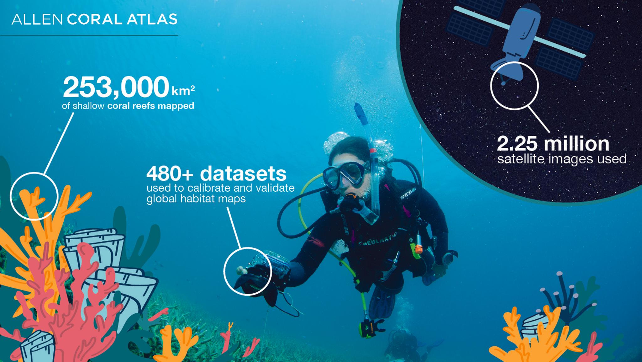
Infographic presents the Allen Coral Atlas Mapping Scale, Credit: Allen Coral Atlas

Coral reefs hold the largest amount of marine biodiversity out of any oceanic ecosystem and they provide an abundance of ecosystem services supporting the global economy by providing fishing stocks, real-estate storm protection, and tourism. But, in recent decades, they have been faced with a myriad of complex threats, ranging from climate change and invasive species to nutrient pollution and degradation. Monitoring these key ecosystems for signs of vulnerability and resilience can help scientists, regulators, and business operators understand how to protect these vital sources of life. 

“Our mission at Planet is to ‘Use space to help life on Earth’. Nowhere is that life more spectacularly on display – or more profoundly imperiled –  than on the world’s reefs,” said Andrew Zolli, Planet’s Vice President for Sustainability and Global Impact. “Preserving and protecting such ecosystems takes a constellation of actors – scientists, technologists, local communities, conservationists, philanthropies, and NGOs – all working together in a spirit of collaboration. It’s been humbling – and galvanizing – to see what we can accomplish together.”

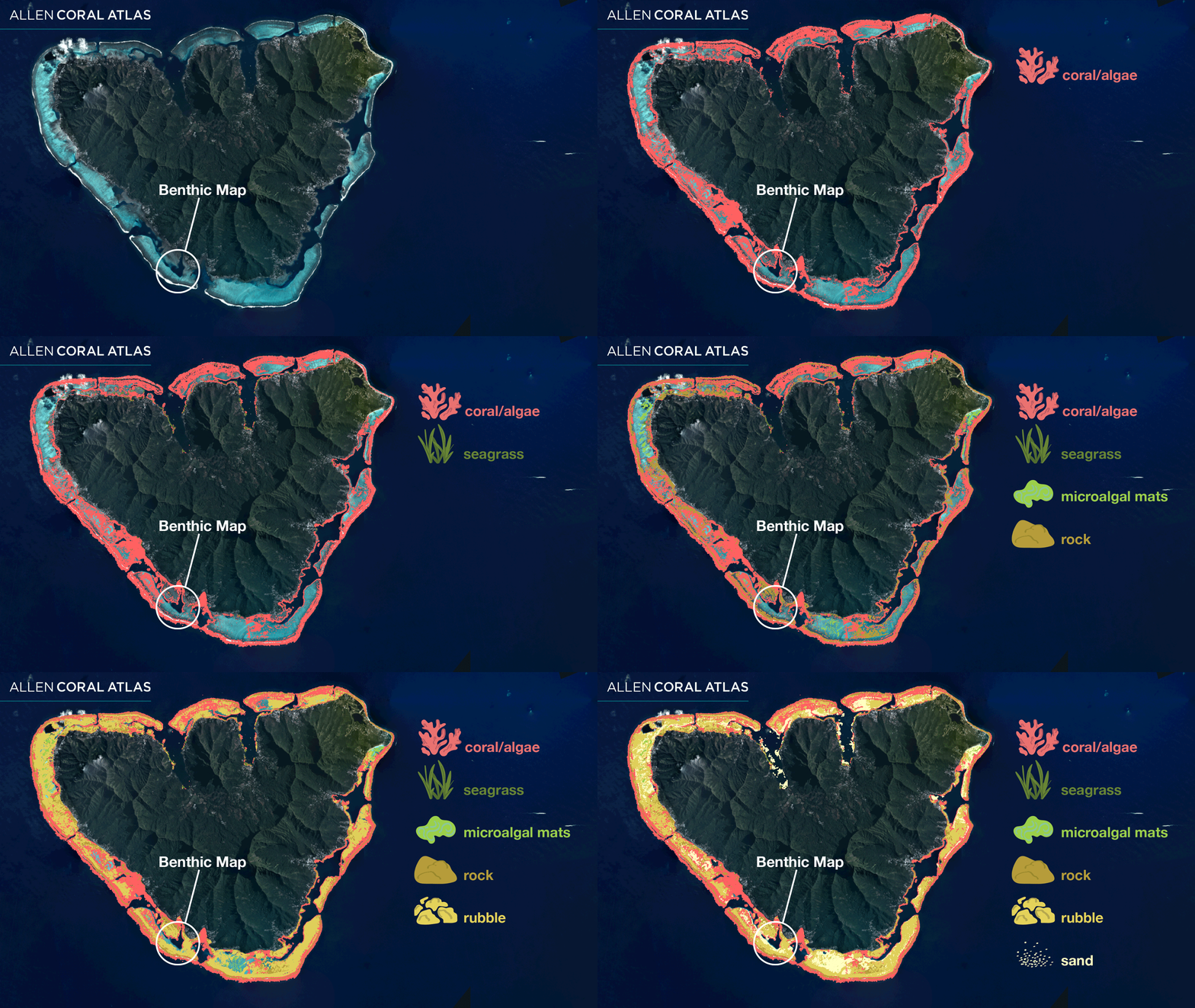
Benthic Map layers shown over Planet satellite imagery of Mo’orea. Credit: Allen Coral Atlas

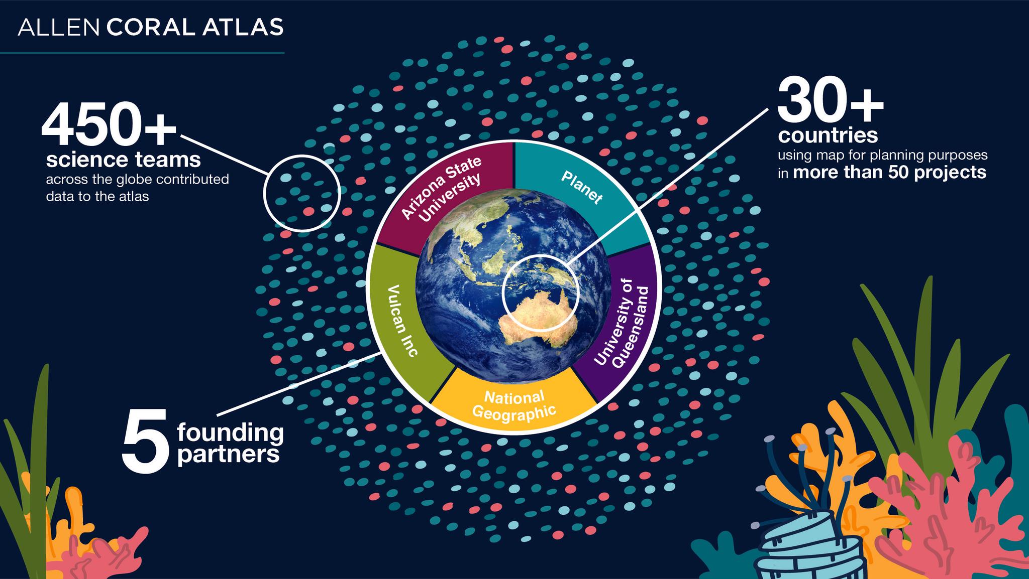
The Allen Coral Atlas serves as a partnership between Planet, Vulcan Inc., a privately held company founded by Microsoft co-founder Paul G. Allen, Arizona State University (ASU) Center for Global Discovery and Conservation, University of Queensland, and the National Geographic Society. After Planet provides a significant portion of the base satellite images, they are further cleaned up by Arizona State University’s correction models which calibrate the images for atmosphere and water attenuation. The Atlas then leverages datasets from hundreds of local scientific research teams to report benthic structure and species composition information for each site. The University of Queensland applies machine learning and local reference data to support the interactive benthic and species mapping interface. After all of this, National Geographic engages communities and conservationists around the globe to utilize the Atlas for sustainable coral reef ecosystem management and scientific research.

Infographic presents the Allen Coral Atlas Mapping Process, Credit: Allen Coral Atlas

Now that the Allen Coral Atlas has reached the first ambitious milestone of mapping all of the tropical, shallow coral reefs on the planet, it is officially the most comprehensive scientific assessment of the world’s reef ecosystems. This mapping project can also now integrate with the Atlas’s bleaching detecting system to rapidly monitor temperature and pollution threats and find responsive interventions. Planet’s high-cadence PlanetScope imagery and SkySat tasking capabilities combined with these robust species datasets can help inform marine spatial planning and marine protected area monitoring in-real-time.

“The Allen Coral Atlas is a paragon example of a digital public good. By putting the data in many peoples’ hands, the Atlas is enabling countless new forms of collaboration, scientific research, and conservation,” added Zolli. “It’s a model for the future.”