
Dattabot: Helping Indonesian Farms Secure Loans With Space Data
Farmers are often at the mercy of the elements. A wetter-than-usual growing season, for example, could provide a hospitable environment for crop diseases that significantly impact yields. Changes in crop conditions over time could signal near-term production booms or long-term problems.
For Indonesian farmers, the uncertainty of weather patterns, soil conditions, and disease outbreaks can create an additional challenge: many can’t secure loans at reasonable rates.
“Financial institutions are reluctant to provide financing to small farmers who often cannot reliably predict crop yields,” explains Dina Kosasih, agriculture vertical lead at Jakarta-based data analytics company Dattabot. “Many of these farmers end up resorting to sources that provide credit at exorbitant rates.”
Dattabot is helping to change that. As a key member of Planet's Application Developer Program, Dattabot uses big data analytics as a way of generating new insights for farmers as well as for organizations in consumer goods, government, and financial services.
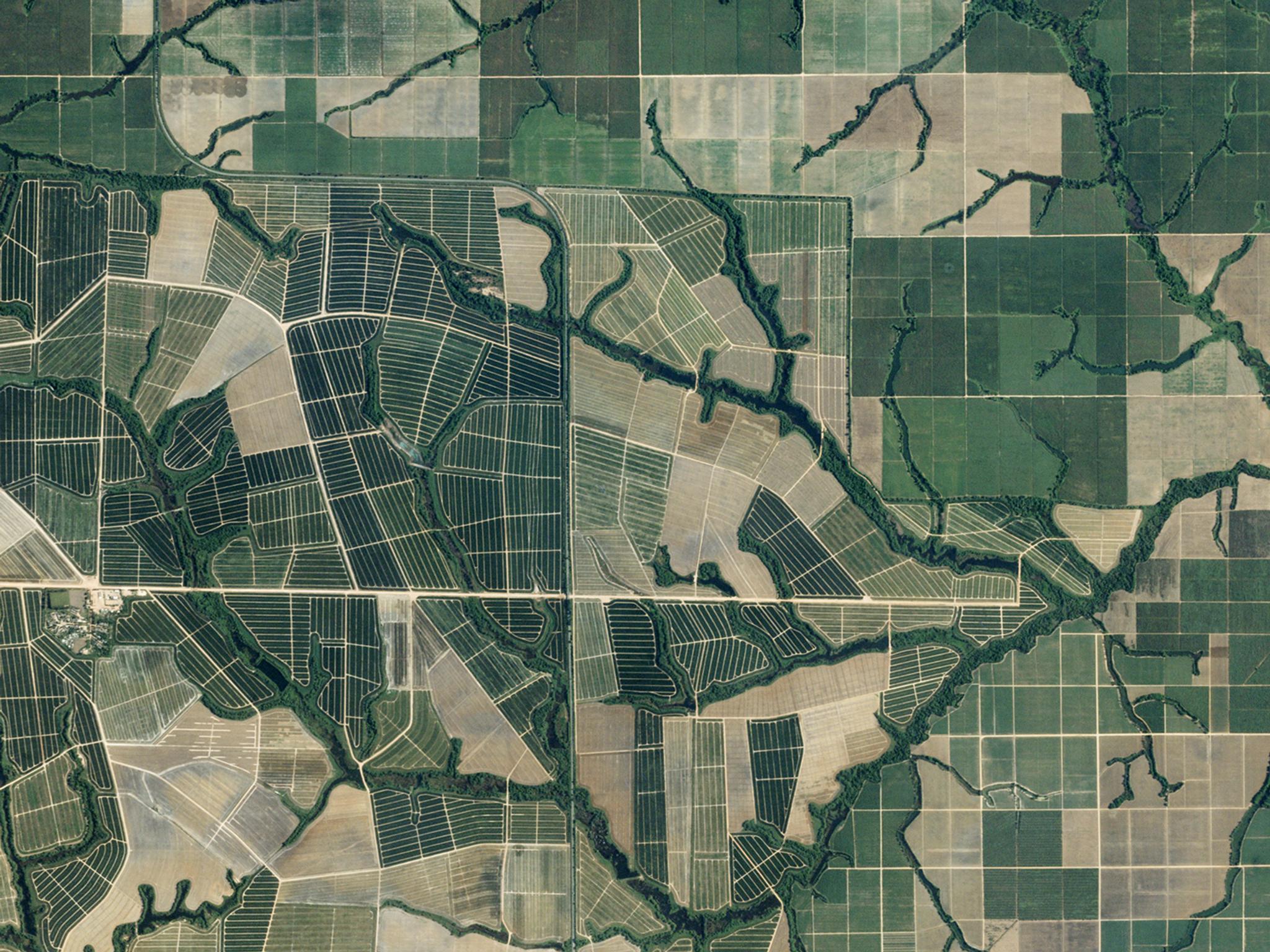
Assisting farmers required Dattabot to analyze data on crops and soil captured from above. At first, Dattabot considered using drones to collect images of farms and record sensor readings. But these relatively low-flying devices took too long to cover even small farms and were too frequently grounded due to poor weather. To overcome these obstacles to visualizing the ground, Dattabot decided to use data collected from space.
Dattabot Capitalizes on High-Frequency Satellite Imaging From Planet
Dattabot wanted to capture images from larger areas of farmland, faster, to keep costs under control. At the same time, the company wanted to collect images at a greater frequency and consistency than a drone could manage.
“We needed high-frequency imaging to have the best chance of getting clear, cloud-free shots of farms,” says Kosasih. High-frequency imaging can also help anticipate crop changes that might signal disease, pests, or soil problems.
The Dattabot team decided to work with Planet. We are able to capture high-frequency and high-resolution images, and deliver continuous data that is ready for analysis. “Planet is unique in delivering data from its satellites directly to the cloud, and we can access that critical information within 24 hours,” says Kosasih.
Farmers, and Their Lenders, Can Better Anticipate the Future
By producing new insights from satellite data that we collect and deliver, Dattabot is helping to make a huge difference in the lives of farmers. Through its analysis, Dattabot can provide farmers with agricultural recommendations that improve their crop yields. At the same time, better information is expected to give farmers easier access to credit.
The Dattabot team anticipates that financial institutions will have the confidence they need to lend money to small farmers. To help increase the odds of securing loans, Dattabot is also partnering with organizations that promote microfinance. Connecting small farmers with small-scale lenders could help ensure more farmers receive the financial support they need — not just to survive but to flourish.
Want to learn more about Dattabot’s success with Planet? Learn more about Planet's agricultural and finance offerings.
Ready to Get Started
Connect with a member of our Sales team. We'll help you find the right products and pricing for your needs.