
Getting to Ground-Truth in Asia: Part Two - How Countries Use Satellite Data for Forest Management
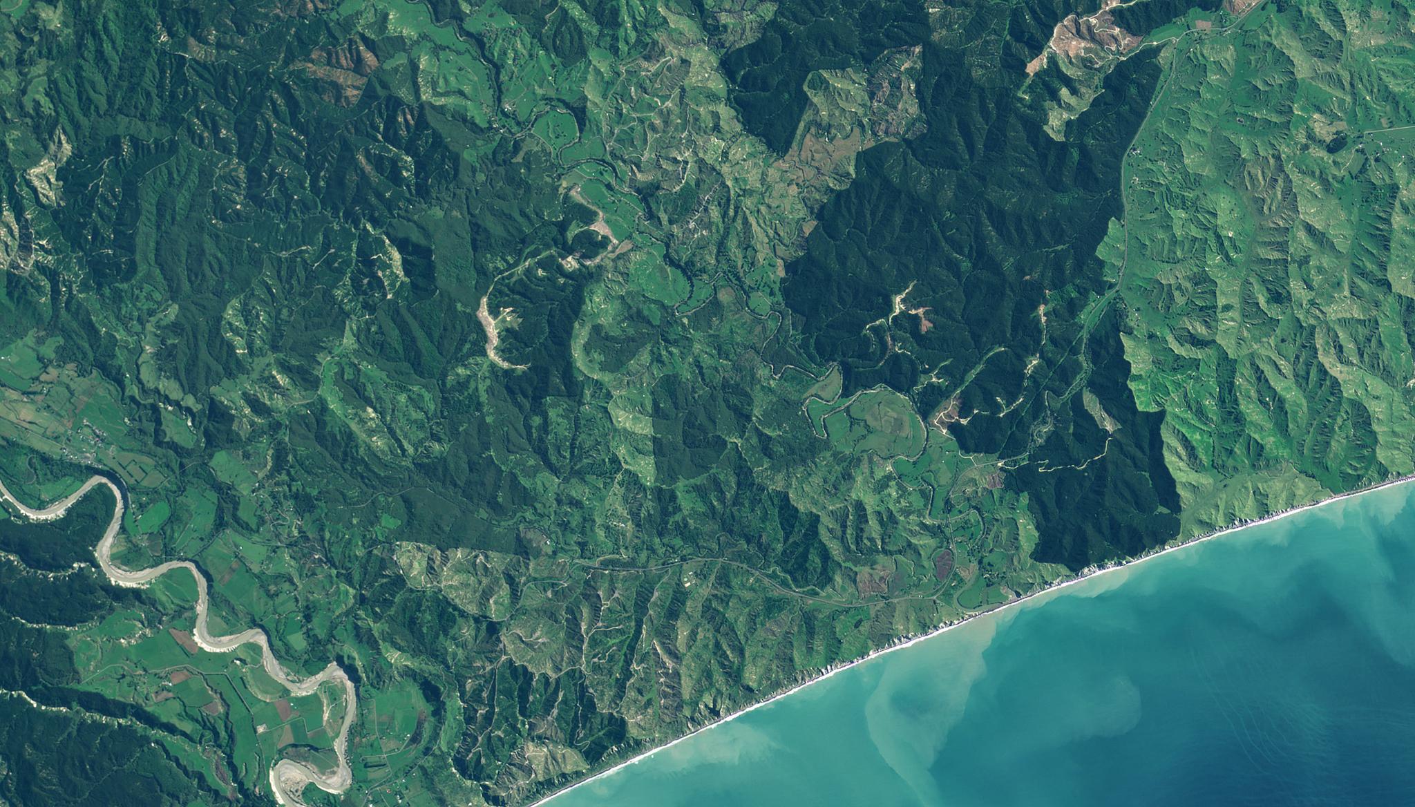
PlanetScope image of managed forests in Wairora, New Zealand taken May 15, 2023. © 2023, Planet Labs PBC. All Rights Reserved.
StoriesAs we saw in Part One of this “Getting to Ground-Truth in Asia” series, there can be discrepancies between what’s reported by onsite workers and what can be seen from space. Today we’re looking at how civil governments and commercial entities are using Planet’s satellite data to help them better understand and verify forest cover – whether that’s for healthy harvesting or ecosystem rehabilitation.
Forest management: legal harvesting and ecosystem health
Verifying reported information from contractors alongside satellite data is a tool deployed by our partner Interpine, a forestry consultancy, on behalf of wood processing manufacturer Juken New Zealand. They’re using both medium-resolution monthly basemaps with PlanetScope to verify the areas that are being or have been harvested and high-resolution tasking with SkySat to verify the designated areas before they’re harvested as well as the growth of early-age trees.
They tackle this project in 3 ways:
- Area verification before harvesting – An accurate measurement of an area is needed for harvest planning. When a tree’s age hits 20 years and above, Interpine can create an accurate area assessment of standing trees – without gaps that are created by windfall, ground slips or failed trees. They use satellite imagery to verify the actual area to be harvested.
- Harvesting verification – After contractors are sent out to harvest a block in a forest, they send information back to the head office indicating the area that was harvested. Sometimes, this is in the form of a hand-drawn map, and in some cases, forest managers ask the contractor to walk the periphery with a GPS device to capture the harvested tract of land. Because of the financial and environmental effect of the harvested area, the measurements need to be accurate. That’s why the PlanetScope imagery is used to verify the actual area harvested against the information received from the contractors. The harvested area is calculated monthly, and contractors are paid accordingly. The harvested area, combined with the age of the trees, are used to calculate the estimated volume of wood that’s sold.
- Area verification of early age trees – After an area has been harvested, replanting follows. So an accurate planting area needs to be assessed after the trees are about 4-5 years in age as some may have failed-to-thrive and need to be removed. Again, the Interpine team uses imagery to verify the planted area, remap the boundaries, and to take out gaps where trees have failed to grow. The value of a tract of land is determined by the area of standing trees. Just like in the harvesting phase, accurate area calculations are critical.
Forest rehabilitation is also a project the Philippines’ Forest Management Bureau is undertaking with the help of satellite data.
Our partner Geospectrum works on the Forestland Management Project (FMP), which is a project of the country’s Forest Management Bureau and Department of Environment and Natural Resources, and is co-funded by the Japan International Cooperation Agency.
The FMP invested around Php 1 Billion (approximately $18M USD) in site development (plantation establishment) as its forest and watershed rehabilitation strategy to improve its overall forest and watershed ecosystem health. Yet, monitoring the overall change in forest cover – one of the key metrics of FMP’s site development intervention – proved to be challenging on two fronts: (1) manual monitoring and validation of forest cover was laborious, costly, and took too long to tabulate forest cover change results; and (2) establishing a baseline would only be possible with a secondary set of data.
So, Geospectrum introduced Planet satellite data and analysis as both a cost-effective means of measurement and a uniform data source to inform the baseline for detection change.
“Not only did Planet’s satellite data prove to be a cost-effective way to successfully monitor periodic forest cover change, but Geospectrum’s Forest Cover Change Analysis is now being used as the basis to report the end-of-project results around site development and watershed rehabilitation,” said Mr. Ansel Cabrera of the FMP.
Additionally, FMP is deploying the same processes and methodologies for other forest/watershed land rehabilitation use cases such as in the National Greening Program. For example, if combined with some AI/ML modeling applications, satellite data can assist in analyzing trends and patterns of forest cover change and vulnerabilities, which are important inputs for future forest management interventions.
Planet in the Asia-Pacific region
Planet designs, builds, and operates the world’s largest fleet of Earth observation satellites with a mission to use space to help life on Earth – as evidenced through projects like those above working in areas of food security, ecosystem rehabilitation and disaster response. Planet formally established our presence across Asia and Australia since 2017, with around 40 employees, serving over 130 customers and working with ~40 partners across the continent.
As a part of this series, you can read more about how satellite data is being used to verify crop production in India here. Come back for Getting to Ground Truth in Asia - Part Three, in which we’ll see how Pacific Island Countries are using satellite data to build infrastructure inventories and damage response systems.
Ready to Get Started
Connect with a member of our Sales team. We'll help you find the right products and pricing for your needs.