
Out of the Woodlands: Innovating Satellite Data Use in Asia-Pacific Biodiversity Conservation
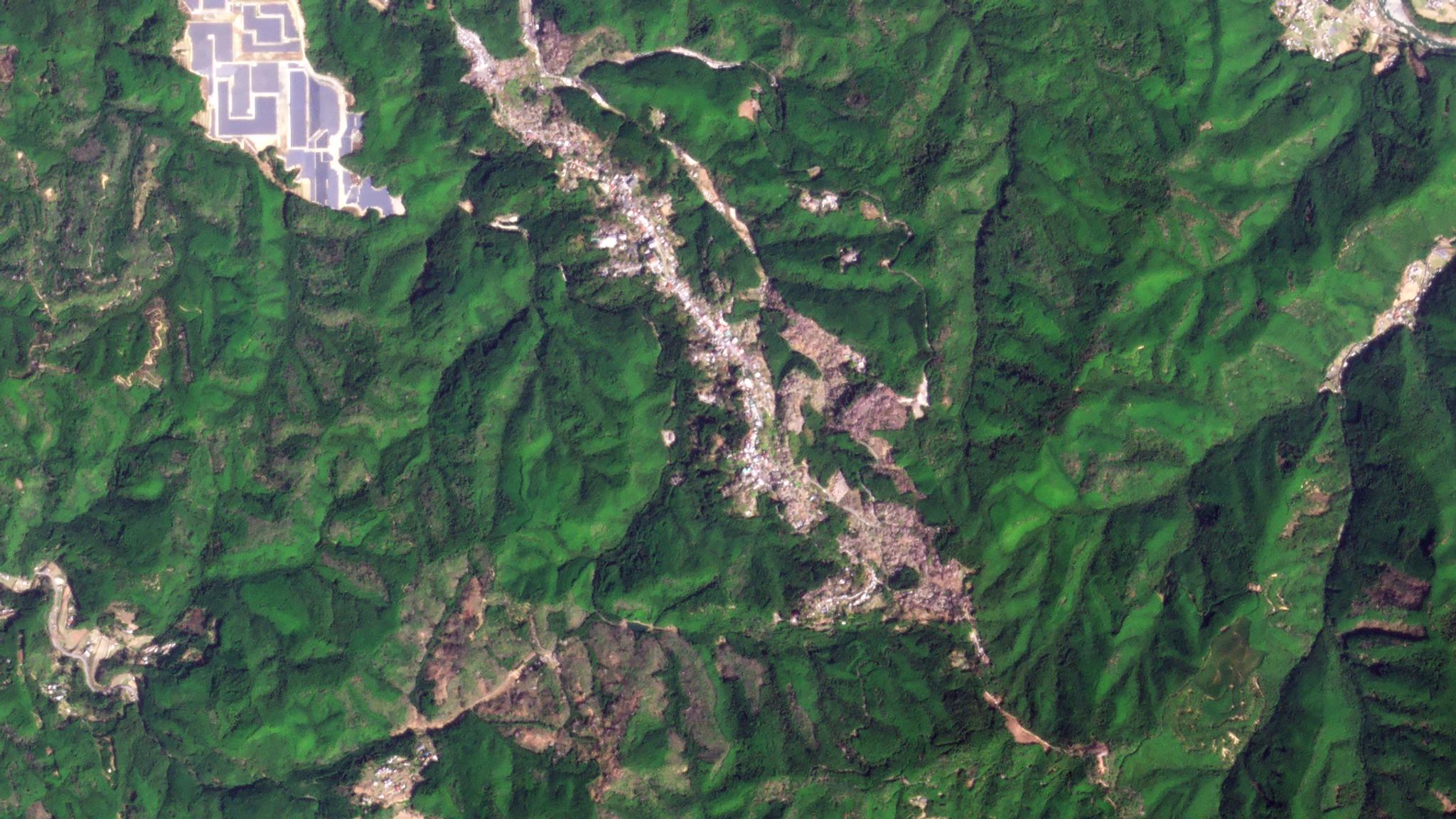
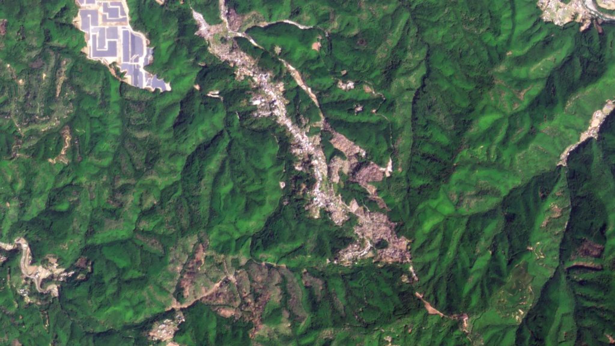
Planet image of Mount Yoshino in Nara Prefecture, Japan © 2024 Planet Labs PBC. All Rights Reserved.
StoriesInternational Day of Forests comes once a year so we make the most of it with our signature Planet satellite images captured by our SkySat satellites. As proclaimed by the United Nations, the day is observed “for people to work together to ensure forests are part of any future climate change strategies.” This year’s theme focuses on forests and innovations to create new solutions for a better world. We've put the spotlight on Asia-Pacific’s lush forests and decided to take a deep dive into satellite data’s role in preserving these natural carbon sinks to raise awareness.
Exploring Asia-Pacific’s Forestlands
Mount Yoshino, Japan
Planet image of Mount Yoshino in Nara Prefecture, Japan © 2024 Planet Labs PBC. All Rights Reserved.
Japan’s spring season is synonymous with cherry blossoms or the sakura, the Japanese term for the enchanting pink petaled flowers. The country even celebrates an annual Ueno Cherry Blossom Festival where thousands of tourists and locals flock to see the cherry blossoms in full bloom. Predicting its peak season has cultural and economic implications, it is even historically tied to the start of a new fiscal year in April. Weather trends have raised alarms since the flowering week shifted in recent years. Experts predicted that, in the most extreme case, Japan may experience just two seasons. This catastrophic event could affect the timing and intensity of cherry blossom season as buds need both the cold and hot temperature cycles to fully develop.
Mount Bromo, Indonesia
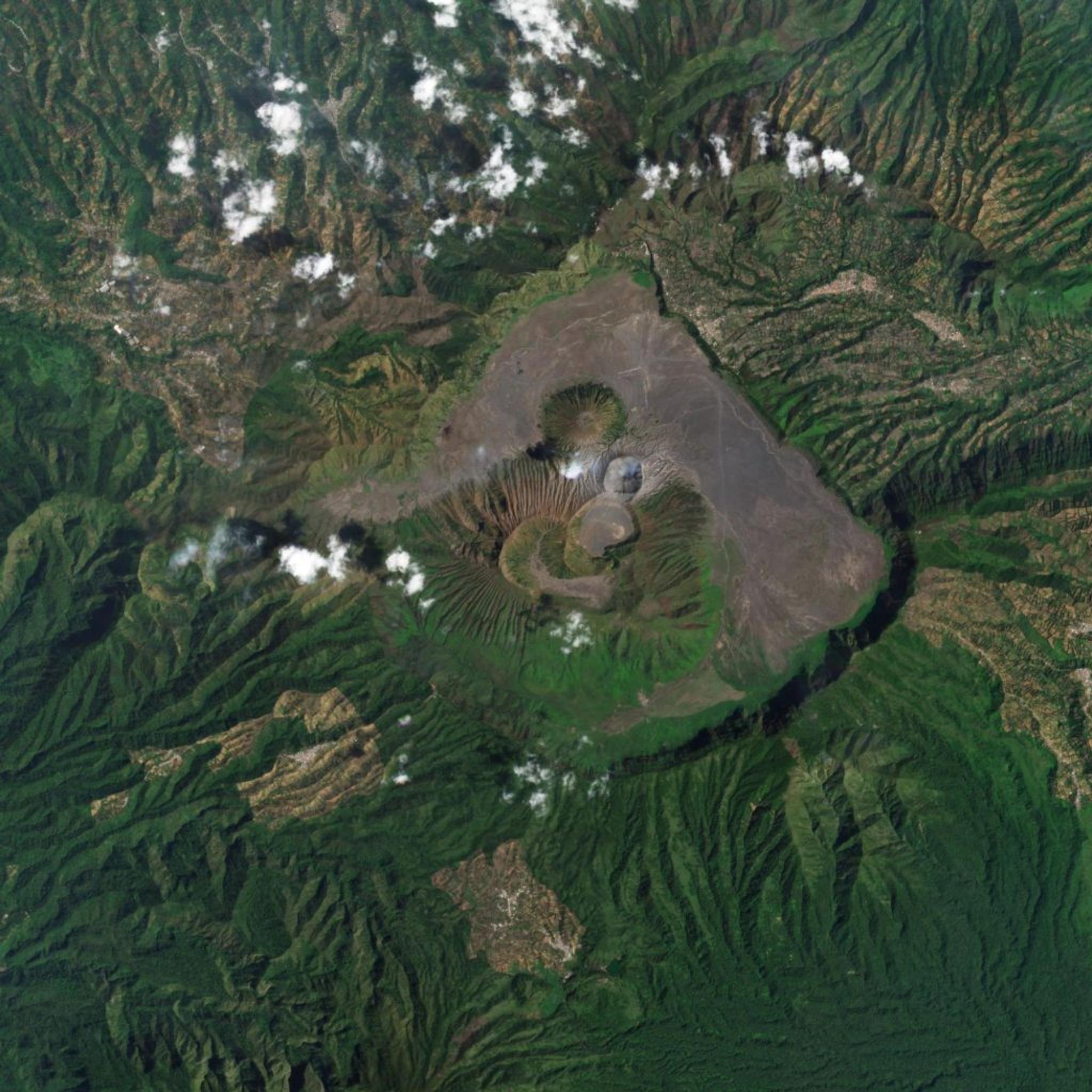
Planet image of Mount Bromo in East Java, Indonesia © 2024 Planet Labs PBC. All Rights Reserved.
From the cherry blossoms, we visit the home of the mythical Komodo dragon–Indonesia. The Indonesian archipelago is the world’s third-largest rainforest ecosystem and is home to 17% of the global wildlife population. But it is no stranger to the threats of climate change. Mt. Bromo, part of the majestic Tengar Massif, went through numerous natural and human-caused forest fires that damaged the area extensively. These challenges contributed to the habitat loss of the diverse flora and fauna found in the landscape. In 2021, the International Union for Conservation of Nature (IUCN) listed the Komodo dragon as endangered despite efforts to conserve their habitats and prevent illegal smuggling of the animals.
Wollemi National Park, Australia
Planet image of Wollemi National Park in New South Wales, Australia © 2024 Planet Labs PBC. All Rights Reserved.
Jumping from one reptile to another, Wollemi National Park houses the rare Wollemi pine, believed to be a living fossil from the age of the dinosaurs. Before its discovery in 1994, botanists had only seen fossilized samples of the tree dating back to 90 million years ago. Aptly called the “dinosaur tree,” this botanical marvel’s existence is facing threats from bushfires, prolonged drought, and human disturbances. Its resurgence was likened to resiliency and yet, conservationists fear for the survival of the species.
Pench-Satpuda Wildlife Corridor, India
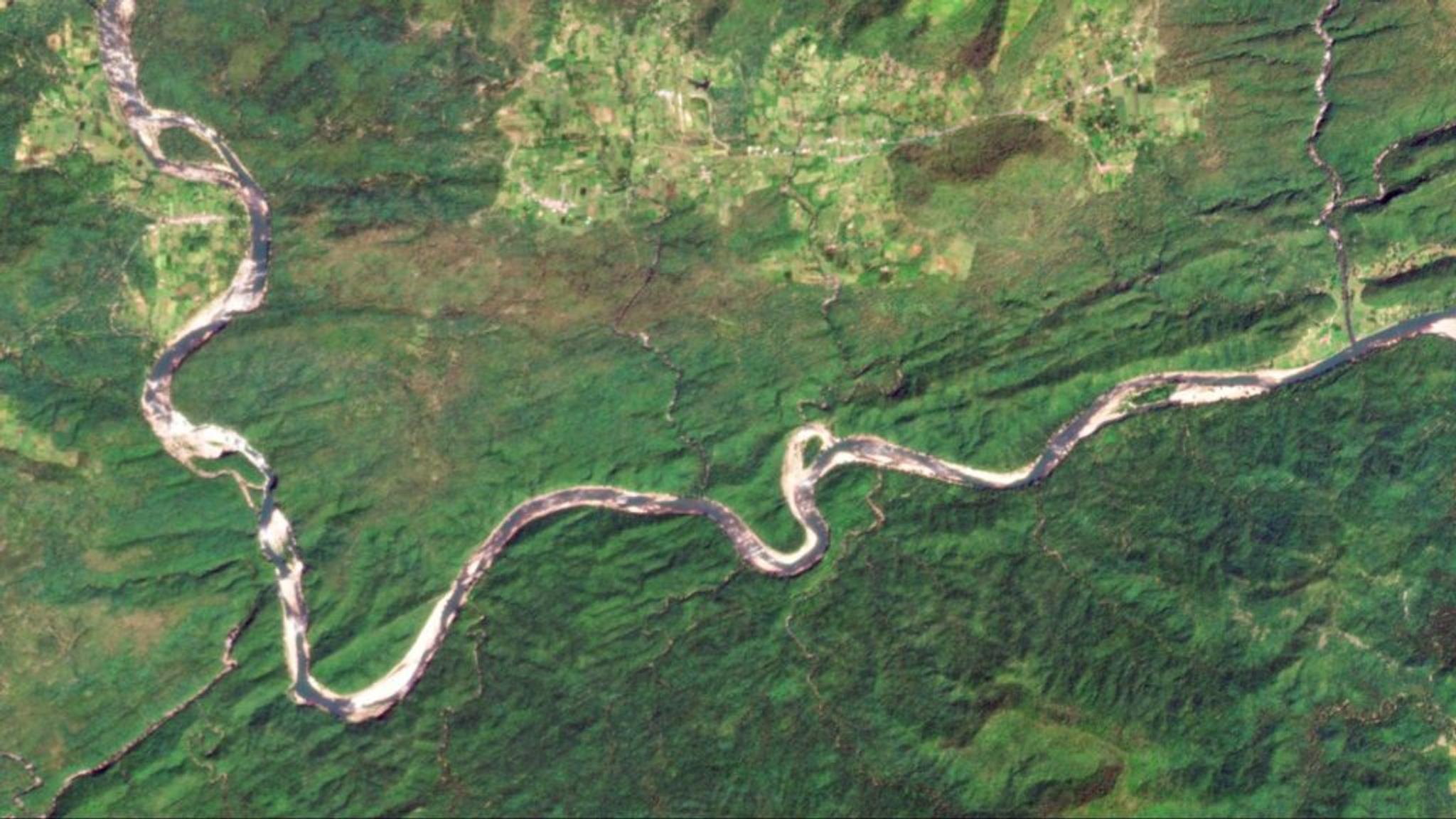
Planet image of Pench-Satpuda Wildlife Corridor in Madhya Pradesh, India © 2024 Planet Labs PBC. All Rights Reserved.
Now that we went to the land before time, we are going to the land of the jungle book. It was said that the famous book’s location was inspired by the Pench National Park itself in Madhya Pradesh. It is no surprise that Pench is a tiger reserve with a wildlife corridor connecting to the Satpuda Tiger Reserve. No two wildlife corridors have the same features but all of them serve as safe passages for animals to expand and connect with other populations. This process is crucial for ecosystems to thrive and reduce migration barriers. Wildlife corridors in between tiger reserves allow them to roam in vast areas for food, mating, or territorial expansions. Illegal poaching and loss of habitable areas challenged India’s tiger population. However, conservationists and the Indian government happily reported that the 1973 Project Tiger is seeing encouraging results.
Seoul Forest Park, Republic of Korea
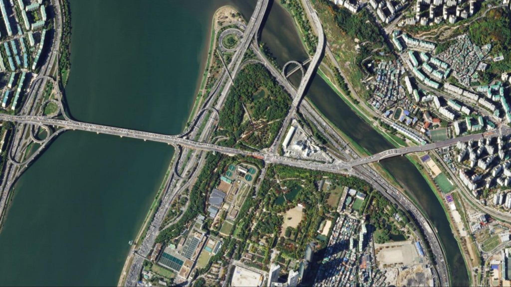
Planet image of Seoul Forest Park in Seoul, Republic of Korea © 2024 Planet Labs PBC. All Rights Reserved.
Nestled in the middle of the Republic of Korea’s metropolis, Seoul Forest Park is the city’s lungs, providing a much-needed breather to its residents. Aside from being an urban green space, it houses deer, ginkgo tree forests, tulips, and cherry blossoms. It was originally a royal hunting ground and a military inspection facility before transforming into Seoul’s first water treatment infrastructure to horse racing tracks, golf course, and sports park until its present state as a sustainable urban park. The park is part of the government’s efforts to reduce greenhouse gas emissions.
Connecting the Dots to Conservation Using Satellite Data
Can you guess the common theme from our featured forests? That’s right, all of them are facing the climate crisis in different ways. Although governments, citizens, and international organizations launched various projects for biodiversity conservation, we are still on a long stretch from the 2030 Agenda for Sustainable Development.
With complex ecosystems and cultural implications, preventing forest and ocean degradation has no one-size-fits-all solution. However, satellite data has emerged as a game-changer in the field of forestry management and conservation. Planet partner, Geospectrum works with the Forestland Management Project, under the Philippine Forest Management Bureau (FMB) and Department of Environment and Natural Resources (DENR), to rehabilitate forests using satellite imagery. They conducted a time series analysis to track their progress in forest cover changes. The data was used for internal monitoring and categorizing them into rehabilitation, conservation, or protection status. The images served as an external communications medium to communities benefiting from the project. Because of the project’s success, they are implementing a similar process and methodologies in other government-led programs such as the National Greening Program.
The power of satellite imagery does not end there. With satellites orbiting the Earth, scientists and conservationists have ground-level invaluable insights that were once unimaginable. Take for example, the NGIS-led restoration of Australia’s otherworldly giant kelp forests. This multi-stakeholder project utilized Planet satellite imagery and AI to map kelp forests. The mapping process led the team to identify intervention strategies unique to the area while saving resources through remote sensing applications.
Moving Forward
There is a Japanese saying that roughly translates to, “If a fish cares for water, the water will care for the fish.” We already have everything we need on this planet, all that it asks is for us to be stewards of it. Through the emergence of AI coupled with unprecedented access to satellite data, the path is paved for informed decision-making and the production of comprehensive but cost-effective reports of our progress. The tools and technology are upon us, and we must innovate to find better solutions for a more resilient future.
Ready to move forward with this initiative? Take it to the next level by joining our Planetology Webinar “Making A Difference In Forestry With Planet Data” on March 21, 2024:
Webinar time for Europe, Middle East, and Africa
Dive deeper into the use cases, interact with industry experts, and gain actionable insights to drive your visions forward.
Ready to Get Started
Connect with a member of our Sales team. We'll help you find the right products and pricing for your needs.