NewsNewsPlanet Insights Platform Delivers Powerful Tooling for Unlocking Earth Observation DataPlanet Labs PBC |April 9, 2024|4 min readRead more
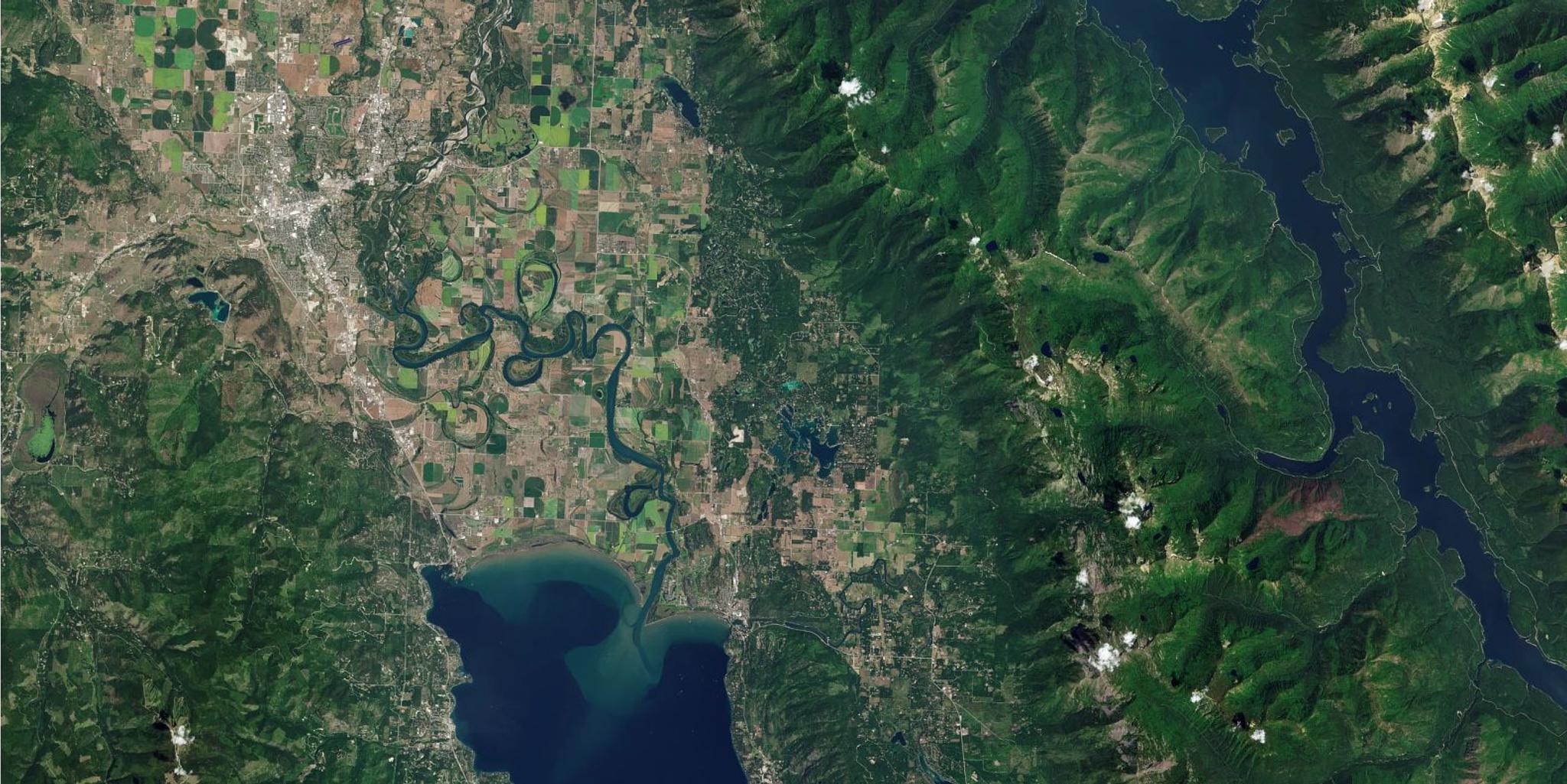
TechTechMultidimensional Earth Data for Broad Area ManagementJenna Mukuno |April 9, 2024|12 min readRead more
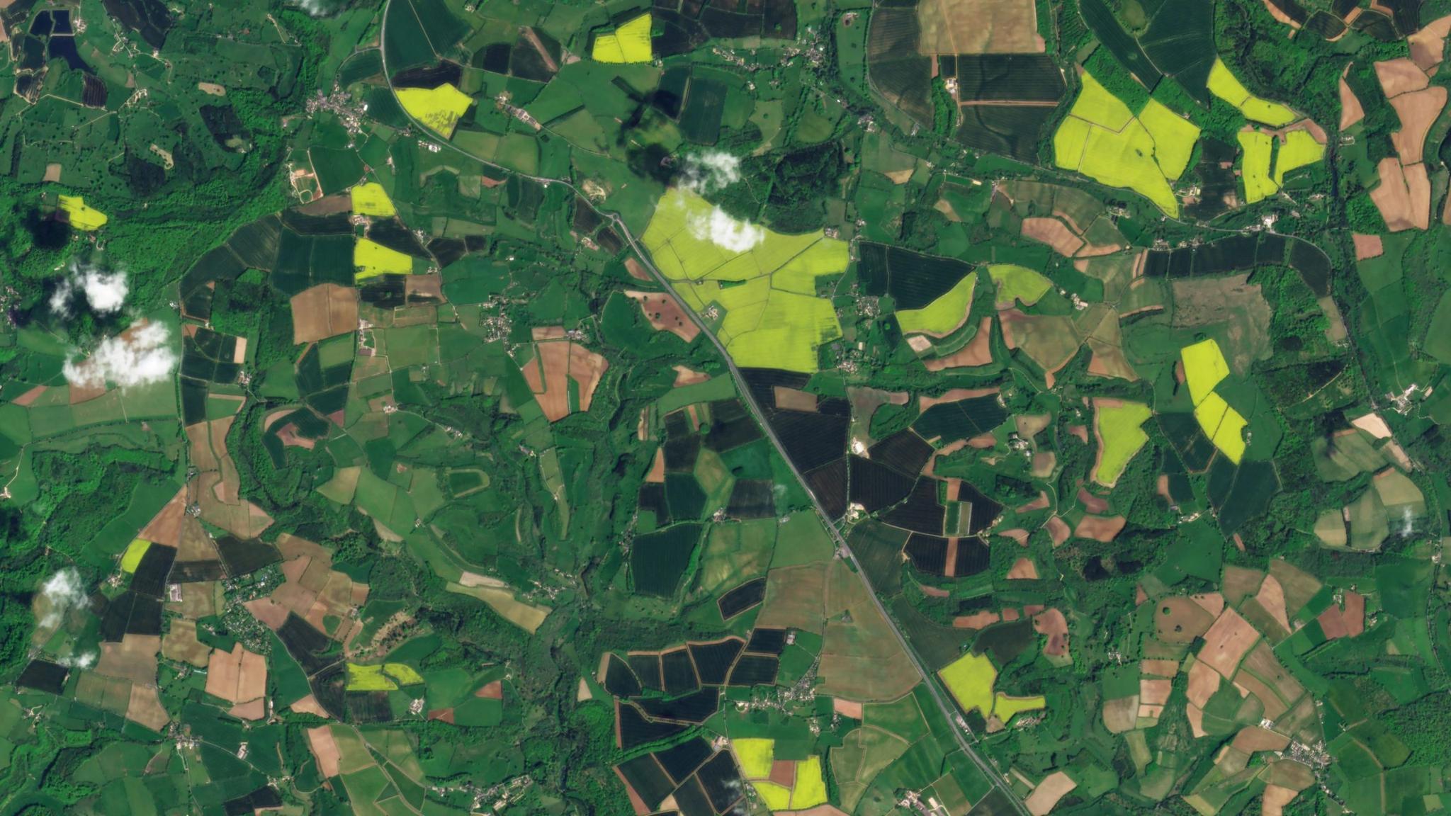
StoriesStoriesPlanet Insights Platform Transforms Agricultural Data ManagementLauren Cottrell |April 9, 2024|4 min readRead more
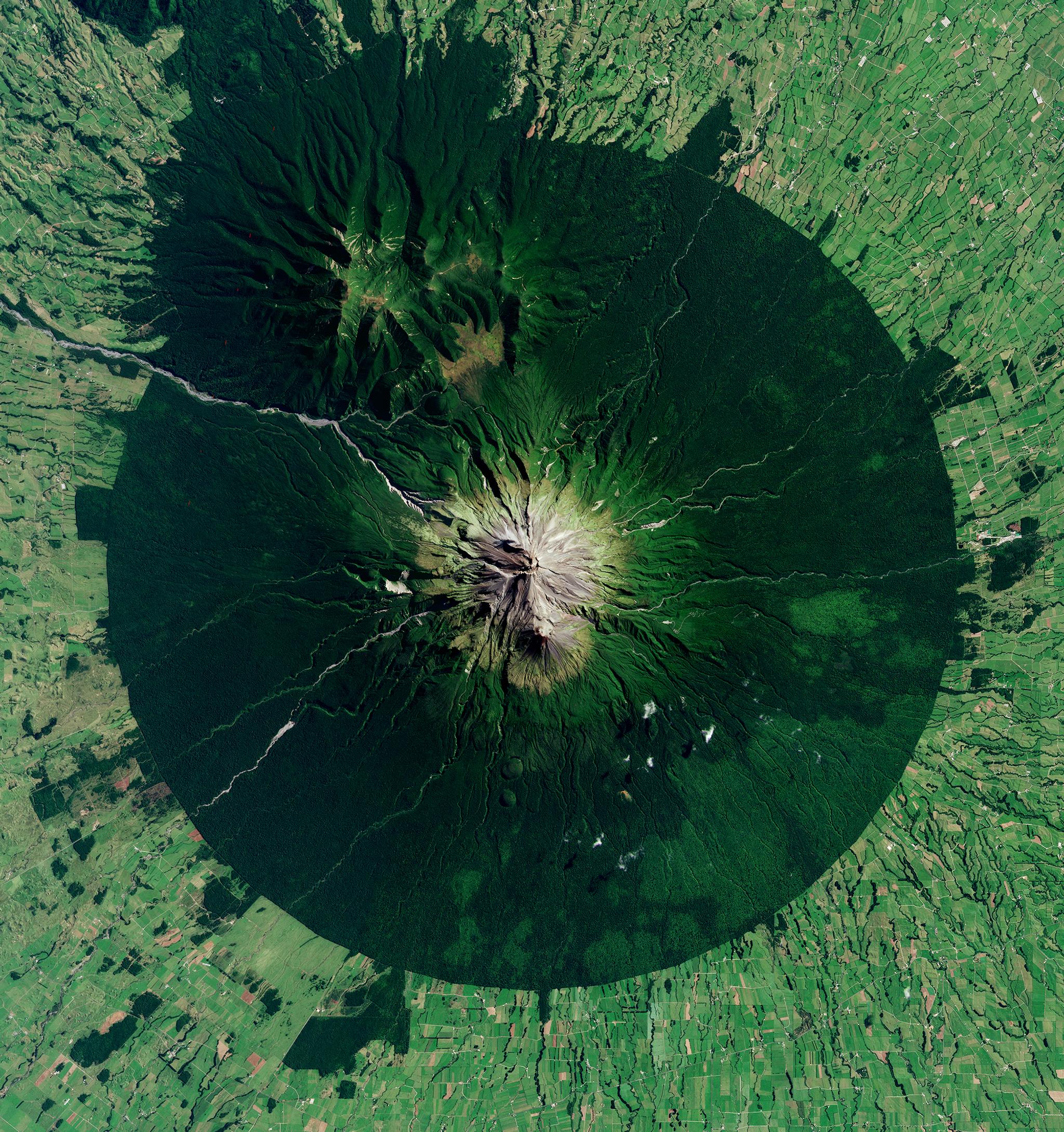
StoriesStoriesMapping the Future: Innovative Solutions for New Zealand’s Biodiversity RestorationJaneth Fule |April 4, 2024|5 min readRead more
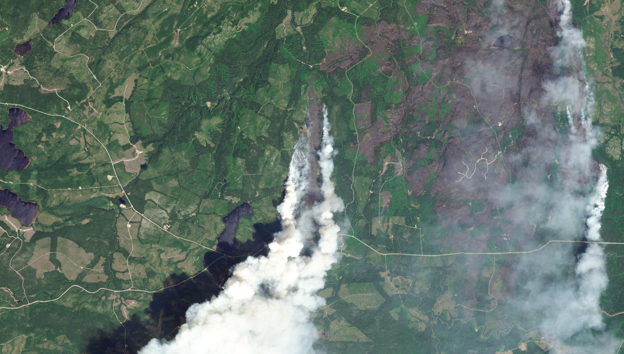
TechTechDriving Digital Transformation in Wildfire Fuels Management With Satellite DataMadeline Dahm |April 3, 2024|6 min readRead more
TechTechNext Generation Agriculture Monitoring at Scale With Planet’s Crop BiomassStephanie Giard |April 2, 2024|3 min readRead more
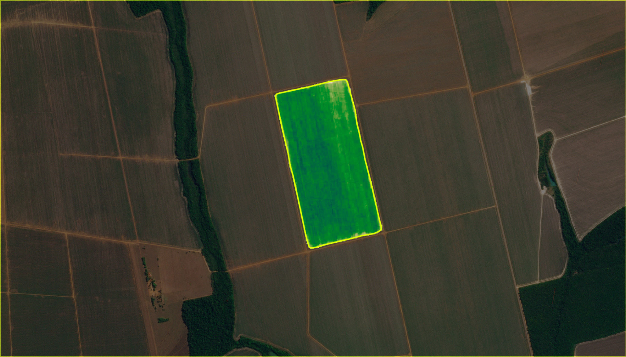
TechTechPlanet’s Newest Planetary Variable, Automated Field BoundariesStephanie Giard |March 26, 2024|2 min readRead more
StoriesStoriesOut of the Woodlands: Innovating Satellite Data Use in Asia-Pacific Biodiversity ConservationJaneth Fule |March 19, 2024|6 min readRead more
StoriesStoriesPlanet and Bayer Partner to Shape the Future of Farming with Resilient Supply Chains and Enhanced Product DevelopmentLauren Cottrell |March 14, 2024|3 min readRead more
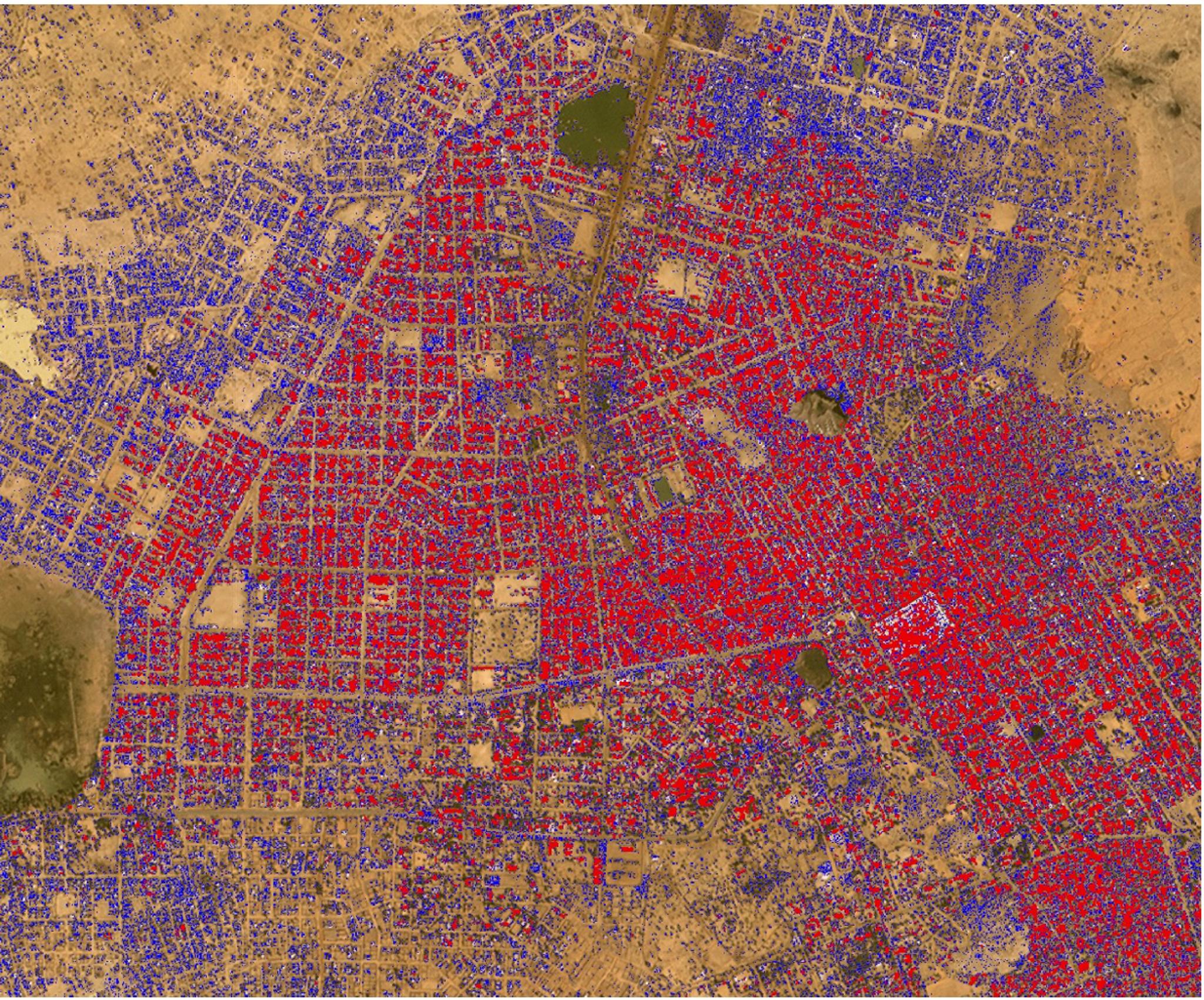
StoriesStoriesIHME, Microsoft, and Planet Collaborate to Map Climate-Vulnerable Populations In Unprecedented DetailAndrew Zolli |February 28, 2024|5 min readRead more
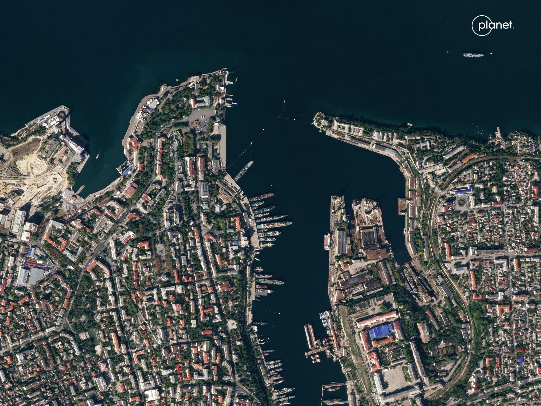
StoriesStoriesSatellite Data For Transparency in Global Conflict: Radio Free Europe/Radio Liberty on Russia’s War Against UkrainePlanet Labs PBC |February 23, 2024|3 min readRead more