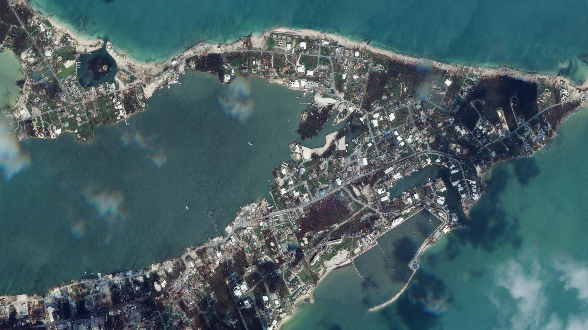
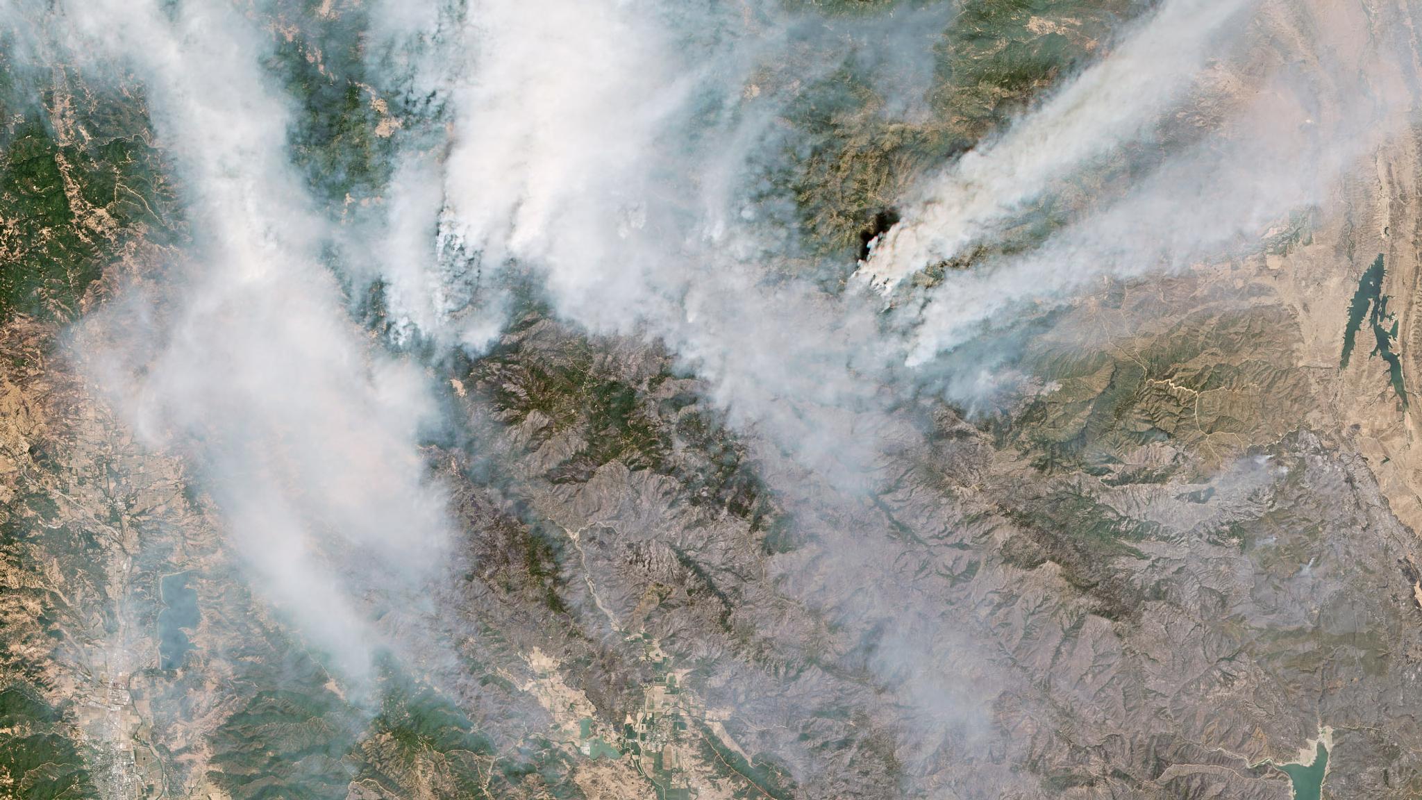
NewsNewsHurricane Dorian, Amazon's Burning Forests, the Iranian Rocket Launch and MoreKrissy Eliot |September 6, 2019|5 min readRead more
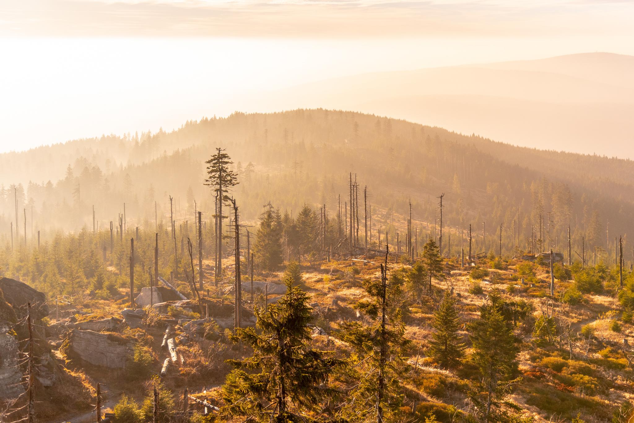
StoriesStoriesBark Beetles Are Decimating Forests: Satellite Data Can HelpSejal Doshi |September 3, 2019|4 min readRead more
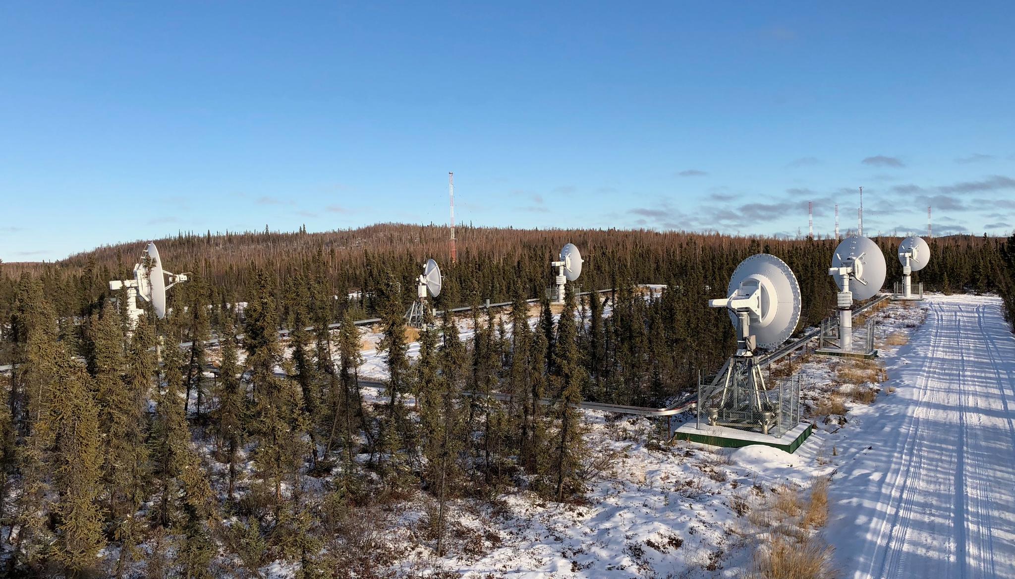
TechTechB14: The Cubesat with One of the World’s Fastest Satellite RadiosKiruthika Devaraj |August 28, 2019|3 min readRead more
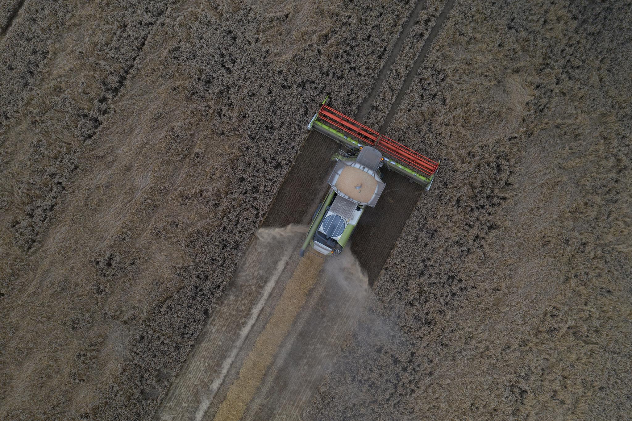
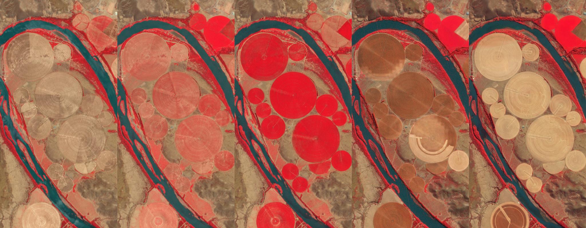
StoriesStoriesSatAgro: The Startup That’s Helping to Drive Digital Agriculture in PolandZara Khan |August 26, 2019|4 min readRead more
NewsNewsPlanet Analytic Feeds No Longer in Beta, Achieve Global ScaleJenna Mukuno |August 15, 2019|2 min readRead more
TechTechPlanet Experts Discuss Future of Analysis Ready Data at 2019 ARD WorkshopIgnacio Zuleta |August 13, 2019|3 min readRead more
NewsNewsIntroducing Next-Generation PlanetScope ImagerySejal Doshi |August 6, 2019|2 min readRead more
NewsNewsEuropean Space Agency to Utilize More Planet ConstellationsAthiye Jawad |August 5, 2019|2 min readRead more
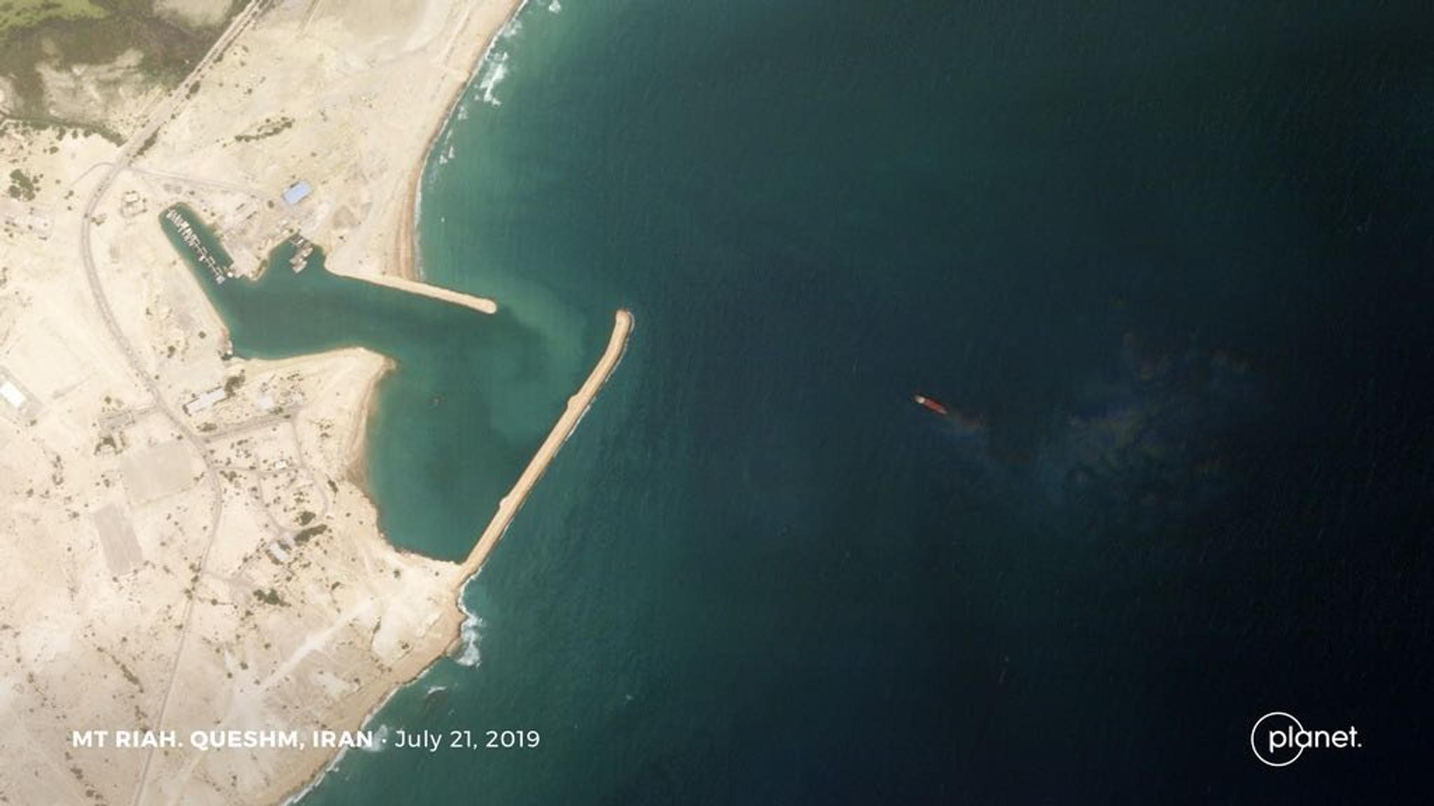
NewsNewsTanker Seizures, the 737 MAX Stack Up, and North Korea’s SubmarinesKrissy Eliot |August 1, 2019|3 min readRead more
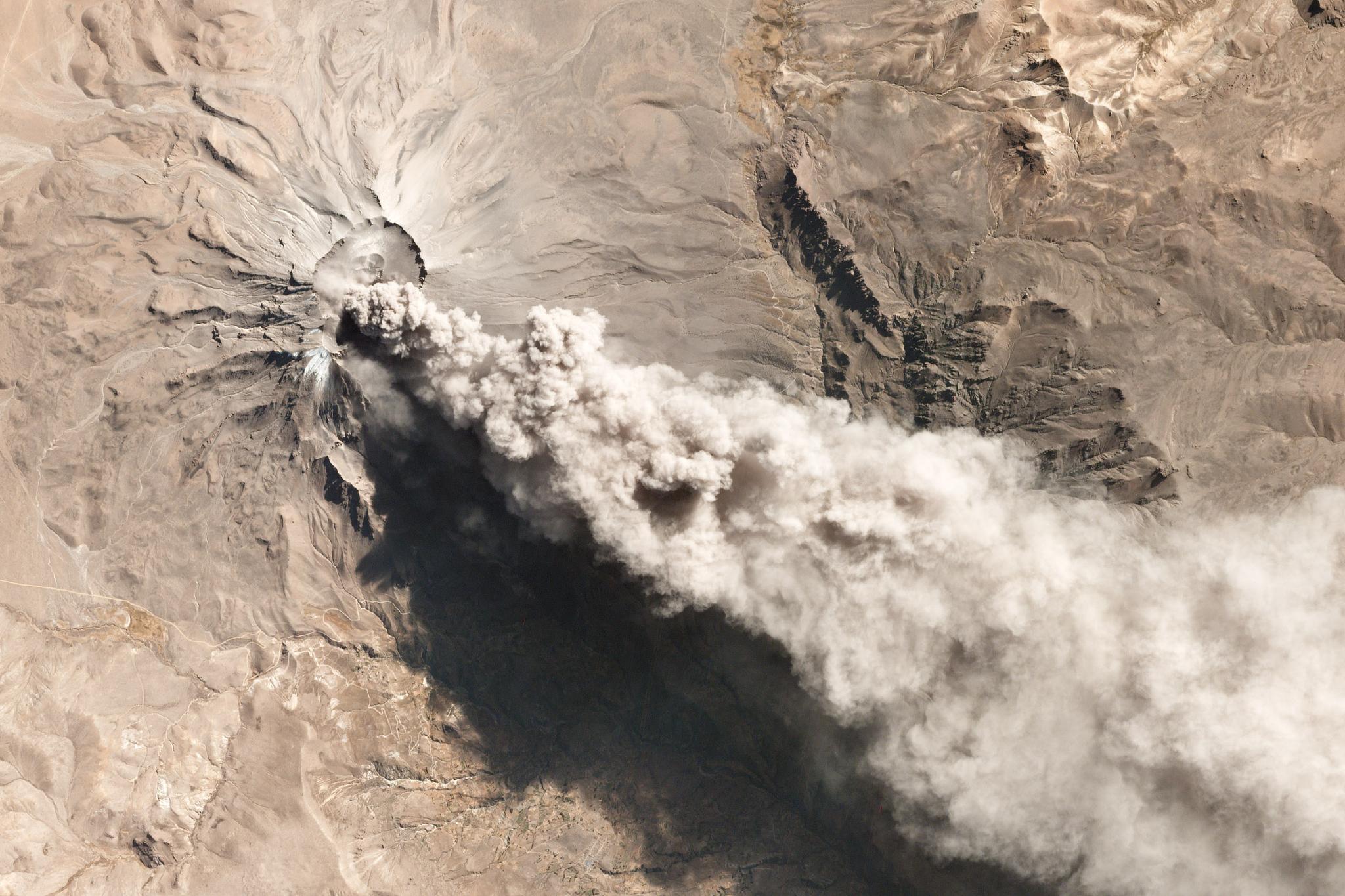
TechTechHow Satellite Imagery Can Help Predict Volcanic EruptionsRobert Simmon |July 31, 2019|6 min readRead more
NewsNewsMore Freedom to Explore with New Planet BasemapsJenna Mukuno |July 24, 2019|2 min readRead more