
Planet Becomes First Private-Sector Data Provider to Directly Support the International Charter on Space and Major Disasters
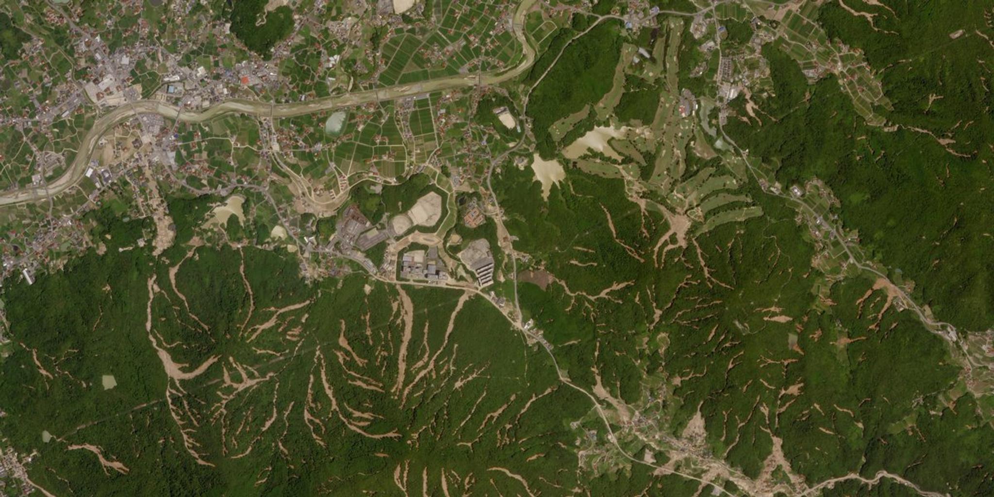
Imagery of the flooding and resulting landslides in Kure, Japan. Captured by SkySat on July 15, 2018 © 2018, Planet Labs Inc. All Rights Reserved.
NewsFrom Hurricane Maria to massive floods in India, the increasing occurrence and intensity of natural disasters around the globe has created a need for greater coordination between the private and public sectors to improve disaster preparedness and emergency management. Planet supports these efforts, and is happy to share that we have become a formally approved private-sector data provider of the International Space Charter and Major Disasters, a consortium of international space agencies that provide rapid access to satellite data in the event of a natural or manmade disaster.
“The Charter is very pleased to welcome the company Planet with its constellation of microsatellites as an approved partner in the Charter,” said Mike Williams, EUMETSAT and current chair of the Charter.
“The Charter members believe that Planet’s large constellation will add to the Charter’s ability to respond effectively to calls after major disasters worldwide,” said Hans-Peter Lüttenberg, DLR and current co-chair of the International Charter.
Planet has adhered to the Charter in an unofficial capacity since 2016, providing imagery for events like Hurricane Matthew. By becoming a formal provider, Planet will distribute PlanetScope imagery in a more targeted, consistent fashion for disaster events throughout the year. As a result, the Charter’s users – emergency response authorities in countries worldwide – will now have access to PlanetScope imagery during disaster events.
Timely access to daily high-resolution PlanetScope imagery will help to more efficiently and accurately respond to both natural and manmade disasters. With recent pre- and post-event PlanetScope imagery of a particular area or multiple sites, responders can verify damages with confidence, allocate resources, and provide aid more effectively.
To learn more about how Planet distributes data to accelerate humanitarian response, visit our Disaster Response Program page.
Ready to Get Started
Connect with a member of our Sales team. We'll help you find the right products and pricing for your needs.