
Planet Launches Next Generation PlanetScope with Eight Spectral Bands and Quality Improvements
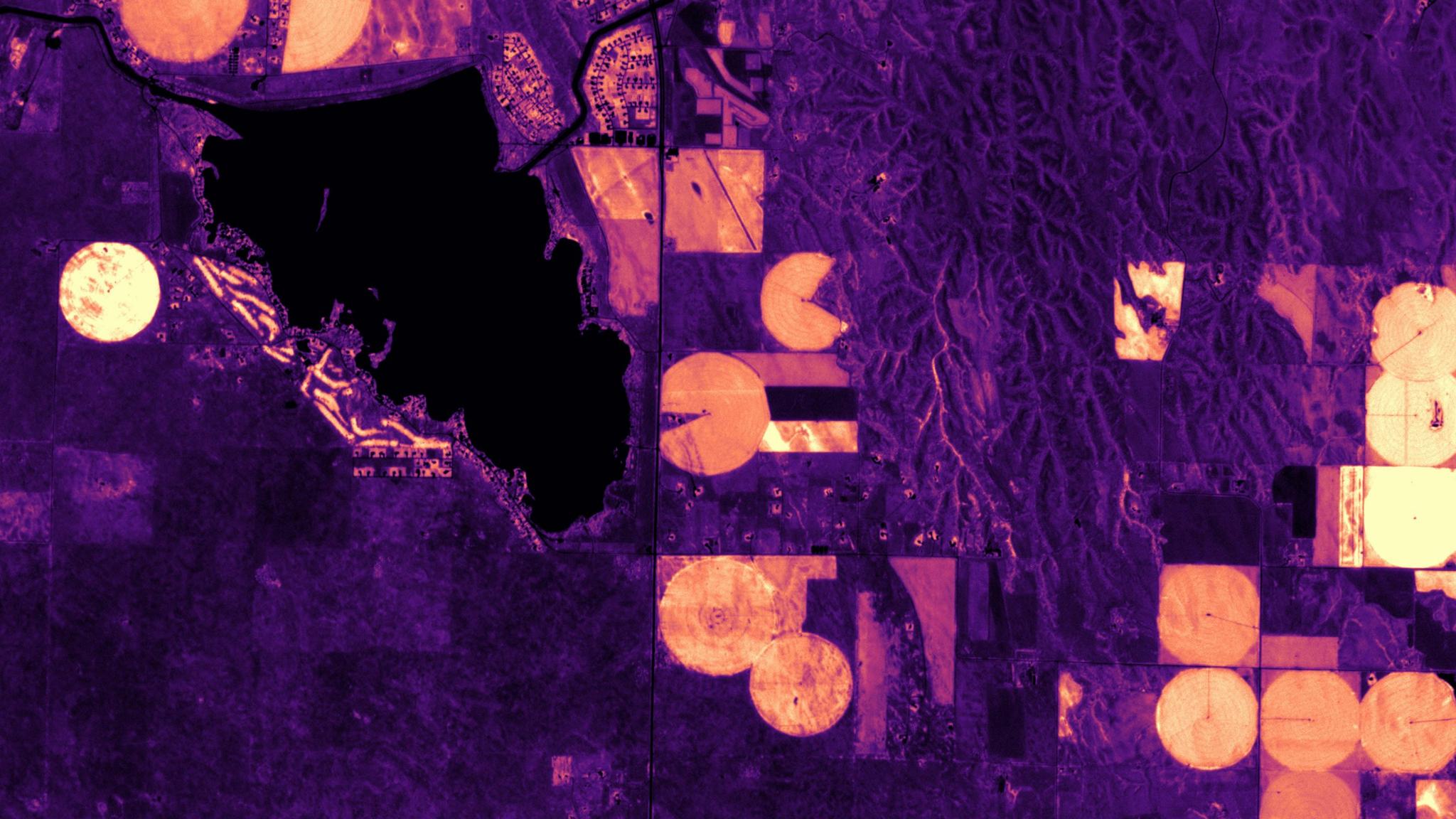
RTVIcore analysis with 8-band PlanetScope imagery of fields outside of North Platte, Nebraska. © 2021, Planet Labs PBC. All Rights Reserved.
NewsToday we announced the general availability of the next generation of our PlanetScope Monitoring product, offering high quality, analysis-ready data to all existing PlanetScope customers. While previously offering four spectral bands, PlanetScope will now include eight spectral bands in addition to a series of enhancements, providing our customers with richer, cleaner, and more consistent data to empower deeper analysis of Earth’s changing conditions.
“Planet is focused on delivering the most timely and accurate data possible to our customers. We are excited about this release because we know it empowers customers to enhance their analyses and decision-making with robust, global-scale data. Our customers and partners will use the new features to power analytics and solutions across broad industries,” said Planet VP of Product Imagery Jim Thomason.
Next-generation PlanetScope Monitoring includes a range of improvements that help our customers spend less time processing and cleaning data before analysis so that they can focus on their critical business needs. The PlanetScope visual data products are sharper and have fewer sensor artifacts, improving human inspection of change. The PlanetScope analytic data products are calibrated to Sentinel-2 and have improved spectral band alignment, enabling accurate time-series analysis and machine learning models. In addition, PlanetScope data now includes the coastal blue, yellow, a second green, and red edge spectral bands to provide deeper understanding of physical change.
PlanetScope data already provides our customers with critical insights for natural resource management and security, and enables them to monitor wetlands, conduct climate research, analyze agricultural regions, and provide emergency response to communities experiencing disasters. With the next-generation PlanetScope capabilities, our customers will now be able to gain even greater data insights, in a more accessible way, to rapidly support people on the ground – from agronomists to civil servants.
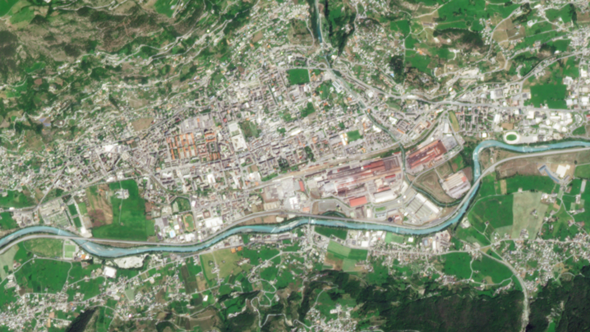
This true-color image of Aosta, Italy shows the latest PlanetScope capabilities with improved band-to-band alignment. © 2021, Planet Labs PBC. All Rights Reserved.
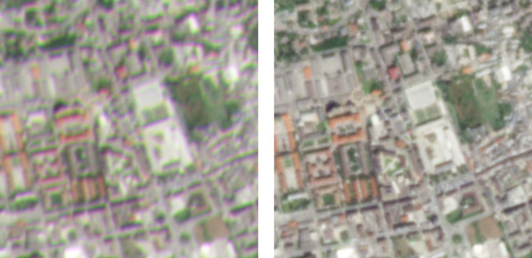
With a tighter crop of Aosta, Italy, this side-by-side comparison shows the enhancements between PlanetScope’s previous capabilities (left) with the latest capabilities (right). Green and magenta fringes are visible in the original image (left), while individual bands in the reprocessed data (right) are aligned with sub pixel accuracy. The changes enhance perceived sharpness and improve the accuracy of algorithms (like normalized difference vegetation index) that rely on ratios of brightness between bands. © 2021, Planet Labs PBC. All Rights Reserved.
Early access users of next-generation PlanetScope Monitoring have been able to leverage these enhancements to support environmental monitoring and protect human health in coastal communities. SargAssure, a UK Space Agency-funded project, currently uses the spectral data to monitor large influxes of seaweed, known as sargassum, as it washes up onto coastal beaches. As large piles of the seaweed decompose, they release harmful chemicals that can cause respiratory and skin issues for beach-goers; this has prompted organizations to now monitor and provide early-warning systems for local communities. German-based EOMAP, a remote sensing company that focuses on the safety of marine and freshwater systems, is also using PlanetScope’s eight-band capabilities to collect critical water quality metrics to support human health and livelihoods.
“PlanetScope images provided by SuperDoves hit the sweet spot of spatial, spectral, and temporal resolution needed for tactical sargassum monitoring on beaches and in nearshore waters,” said Geoff Smith, Director at Specto Natura and partner in the SargAssure project. “The influxes of sargassum are highly dynamic depending on tides, ocean currents, and wind directions, requiring high cadence for effective monitoring,” he added, emphasizing the need for PlanetScope’s daily imaging capabilities.

Here is an example of one of the SargAssure products showing the accumulation of sargassum on the beach fronting a hotel on the Mexican Caribbean Coast compared to true color Planetscope data (left) and Bing Aerial coverage (right). At these temporal and spatial resolutions timely mitigation activities can be deployed more effectively. Image credit: SargAssure © Bing Aerial.
"Planet SuperDoves deliver additional spectral information. This allows us to retrieve better data on atmospheric properties and specific absorption features of chlorophyll-a or cyanobacteria in inland waters,” said Karin Schenk, Head of Water Quality at EOMAP. “We value the combination of up-to-date daily images and recordings at high spatial resolution. By processing such data, we enable and empower our clients - water managers and authorities - to monitor dynamics in even very small water bodies. For instance, they can better control bathing water in lakes or flushing activities in hydropower installations on rivers." With our agile aerospace approach, Planet is continually investing in our core products, leveraging the latest software advancements to deliver our customers and partners more value every year. Starting today, this update will provide our PlanetScope customers with spectrally rich, global-scale data and a more streamlined platform experience to access the information they need. To learn more about this new PlanetScope update, join our product webinar on March 24, 2022.
Ready to Get Started
Connect with a member of our Sales team. We'll help you find the right products and pricing for your needs.