
NASA Researchers Use Planet Data to Study the Effects of Climate Change on our Cryosphere
Lake Niels, Greenland captured by SkySat on July 29, 2019. © 2019, Planet Labs Inc. All Rights Reserved.
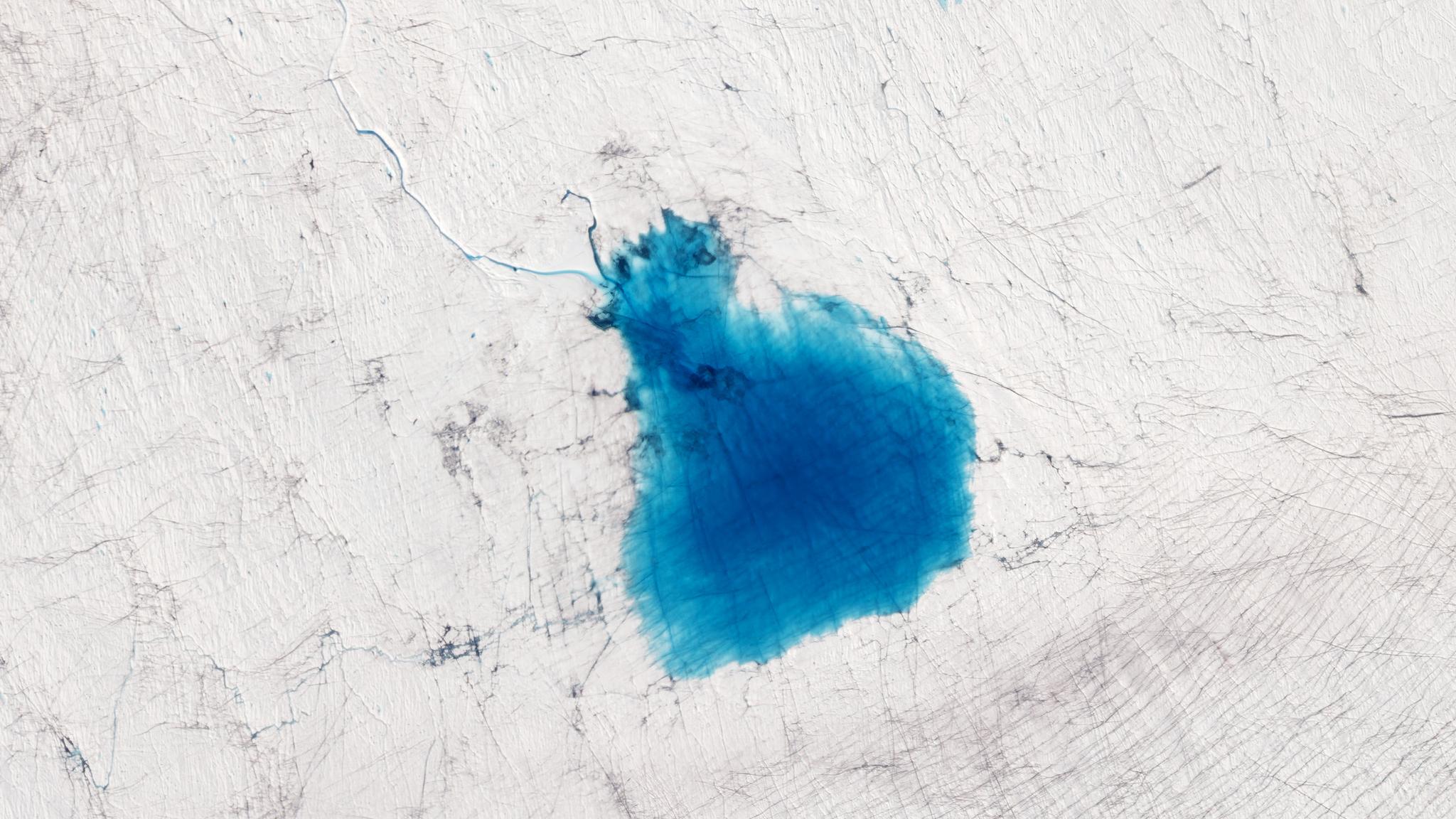
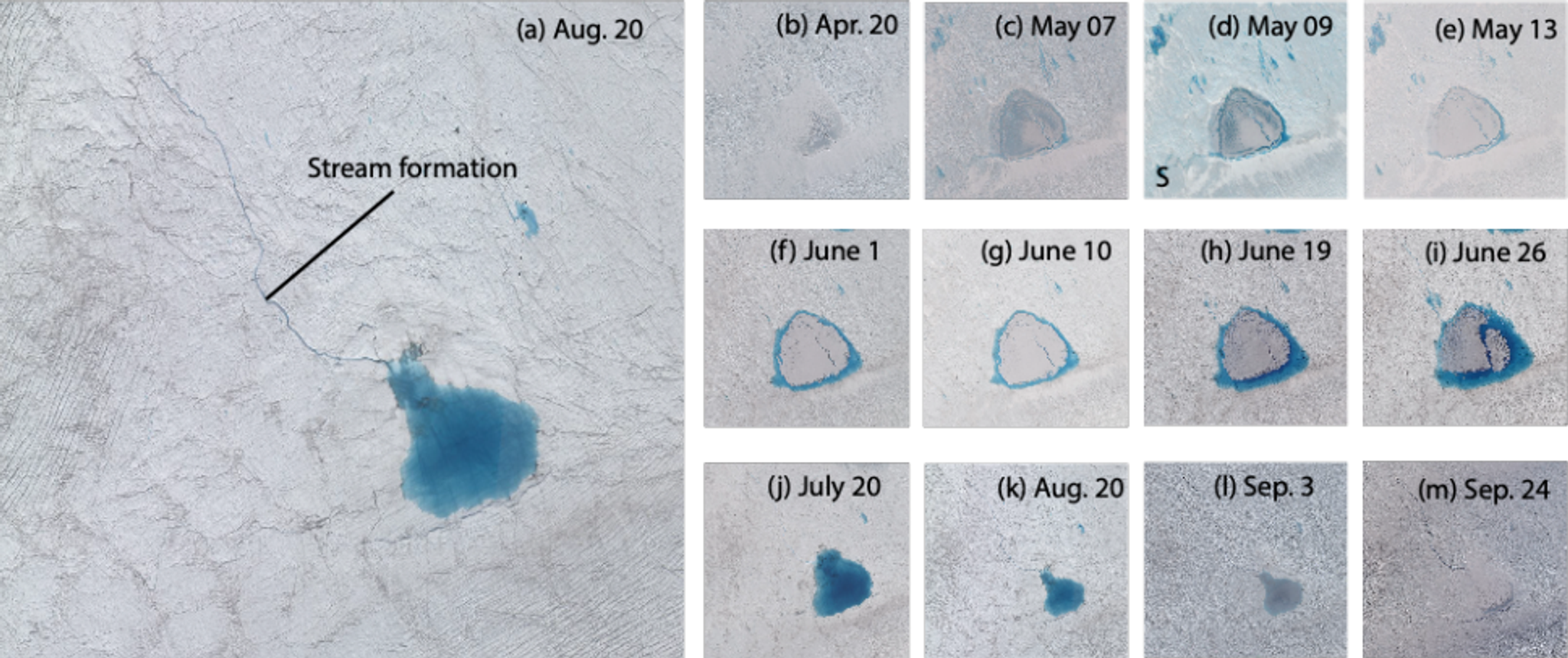
TechThrough an agreement with NASA and their Commercial SmallSat Data Acquisition (CSDA) Program, access to Planet imagery is available to all NASA-funded researchers. Taking advantage of the high cadence of PlanetScope and the high resolution of SkySat, these researchers have utilized Planet imagery to understand dynamic processes on Earth. The cryosphere—frozen areas of our planet such as the Arctic, mountain glaciers, and Antarctica—is changing at a rapid pace due to climate change. Therefore, frequent monitoring of these regions is critical to understanding how they are being impacted and what mitigation strategies are needed. A team out of NASA’s Goddard Space Flight Center led by Dr. Rajashree Tri Datta combined PlanetScope and SkySat with imagery from the European Space Agency’s Sentinel-2 and lidar data from NASA’s ICESat-2 (satellite) and Operation IceBridge (aerial) to track melting of the Greenland ice sheet. The study focused on summer 2019, which was a particularly intense melt season compared to previous years, likely influenced by climate change. Datta’s team looked at how meltwater on the ice sheet drained over time and the effects of local topography across these datasets. They tasked SkySat to acquire high-resolution imagery approximately every four days over their areas of interest to coincide with ICESat-2 and Operation IceBridge passes, providing high-resolution topographic information alongside the routine near-daily PlanetScope coverage. Creating an algorithm to calculate lake depths from ICESat-2 lidar, they were then able to adjust the algorithm to use the spectral information in both PlanetScope and SkySat to estimate lake depths and volumes. Their results show that this methodology can be applied to the Antarctic as well, where surface ice melt is also active due to climate change. Tracking melting in both Greenland and Antarctica is critical as meltwater from these two ice sheets is the largest contributor to sea level rise today. [caption id="attachment_146460" align="aligncenter" width="968"]
SkySat video of Mount Saint Helens, Washington captured on October 1, 2019. © 2019, Planet Labs Inc. All Rights Reserved.
An additional study out of UW led by Anthony Cannistra used machine learning with PlanetScope surface reflectance products to conduct automated calculations of snow-covered area. Using a convolutional neural network (CNN) over study sites in California and Colorado, they were able to obtain good agreement between results from their CNN when compared to near-coincident NASA Airborne Snow Observatory (ASO) lidar data—a gold standard for ultra-high-resolution snow mapping. According to the study authors, the “unparalleled spatial and temporal coverage [of PlanetScope] offers an excellent opportunity for satellite remote sensing of snow, with real implications for ecological and water resource applications.” If you are a NASA-funded researcher interested in getting access to Planet imagery, see our NASA landing page for information on how to apply for access through their CSDA program. For other researcher data access options, see our Education and Research page.
Ready to Get Started
Connect with a member of our Sales team. We'll help you find the right products and pricing for your needs.