
Taming Wildfires with Vegetation Management
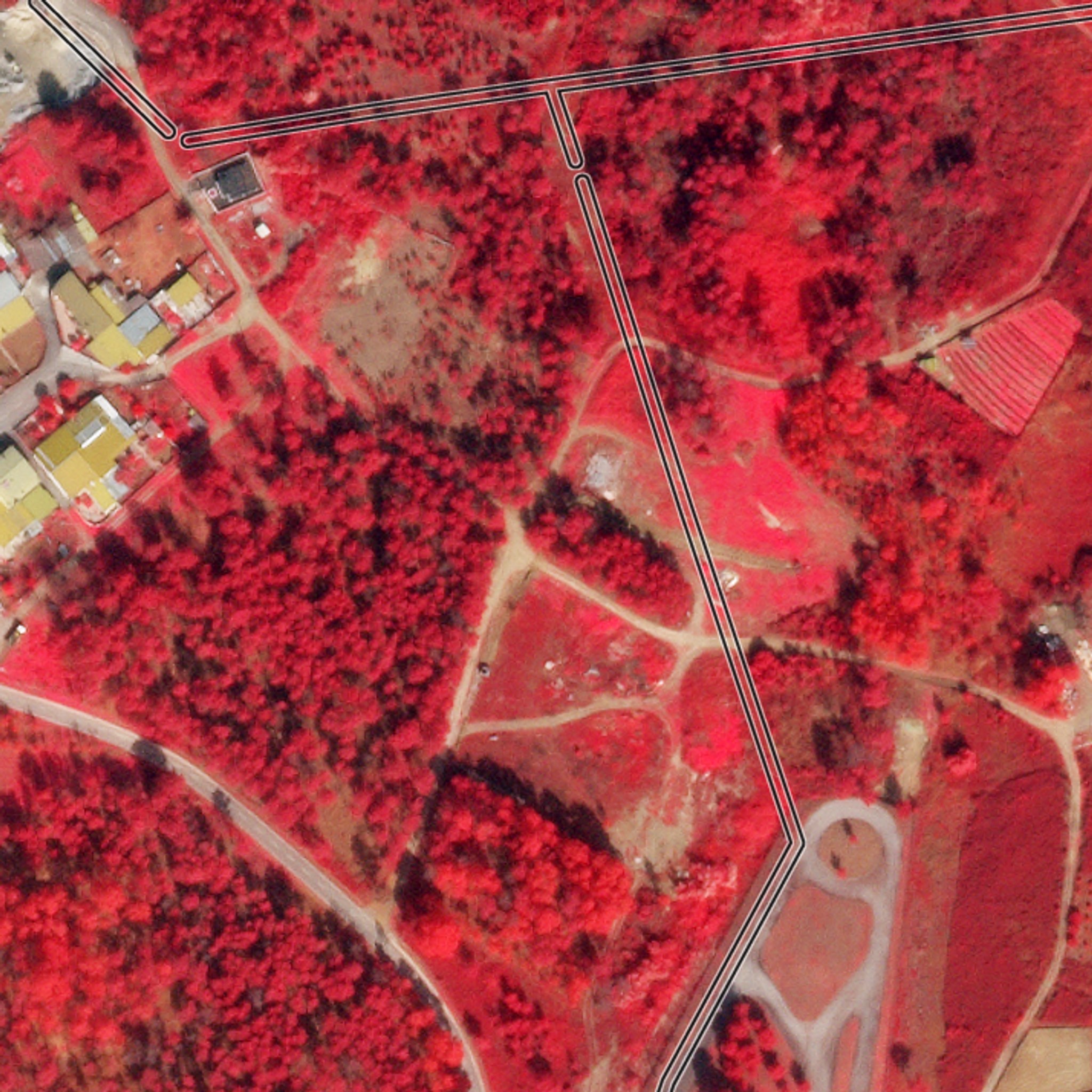
This false-color (near infrared, red, and green) SkySat image collected on March 3, 2021, shows the state of vegetation surrounding distribution lines near Campo, Portugal. Four-band imagery helps provide needed information on vegetation health & vigor. © 2021, Planet Labs Inc. All Rights Reserved.
NewsEvery year, wildfires consume millions of acres of land around the globe. Such fires triggered by a combination of electrical networks and extreme weather include the 100,277-hectare Lutz Creek fire in British Columbia, “Black Saturday” in Victoria, Australia, and the Camp Fire in California in November 2018, which destroyed over 150,000 acres, 13,972 residences, 528 commercial structures, and 4,293 other buildings, and took the lives of 86 people. While a variety of factors contribute to wildfire ignition, the increasing climate crisis coupled with electric assets has led to some of the most damaging wildfires globally. Moreover, wildfires are also damaging to electric utilities, leading to financial distress. One of the tools to combat wildfire ignitions is preventative power shutoffs, especially in high-risk weather conditions to mitigate the chance of electrical equipment wildfire ignition. These preventative blackouts can have significant impacts on health, safety, and economic repercussions. One company seeking to make a tangible impact is Overstory. Overstory aims to help solve the climate crisis by providing real-time intelligence about the planet’s vegetation powered by artificial intelligence (AI) and satellite data. Today, Overstory helps energy companies to mitigate wildfires and power outages by improving the safety and reliability of the transmission and distribution system and reducing grid operation costs. “We focus on electric utilities because it's a clear case where we can help. We see climate change as the biggest existential crisis we’ve ever faced and we believe trees and plants are critical to mitigating climate change and also adapting to it,” said Indra den Bakker, CEO and Co-Founder of Overstory. Using machine learning to interpret satellite imagery and climate data Overstory extracts insights from Planet data, providing real-time information to its utility customers based on high spatial and temporal resolution satellite data, including multi- and hyperspectral imagery, SAR, and video. Moreover, by applying AI algorithms specialized in trees and vegetation, Overstory helps customers to predict grow-in and fall-in risks based on species, growth, weather and climate, and vitality. [caption id="attachment_146405" align="aligncenter" width="1026"]
Ready to Get Started
Connect with a member of our Sales team. We'll help you find the right products and pricing for your needs.