
Using Planet Satellite Data to Monitor Threats to Wildlife and Ecosystems
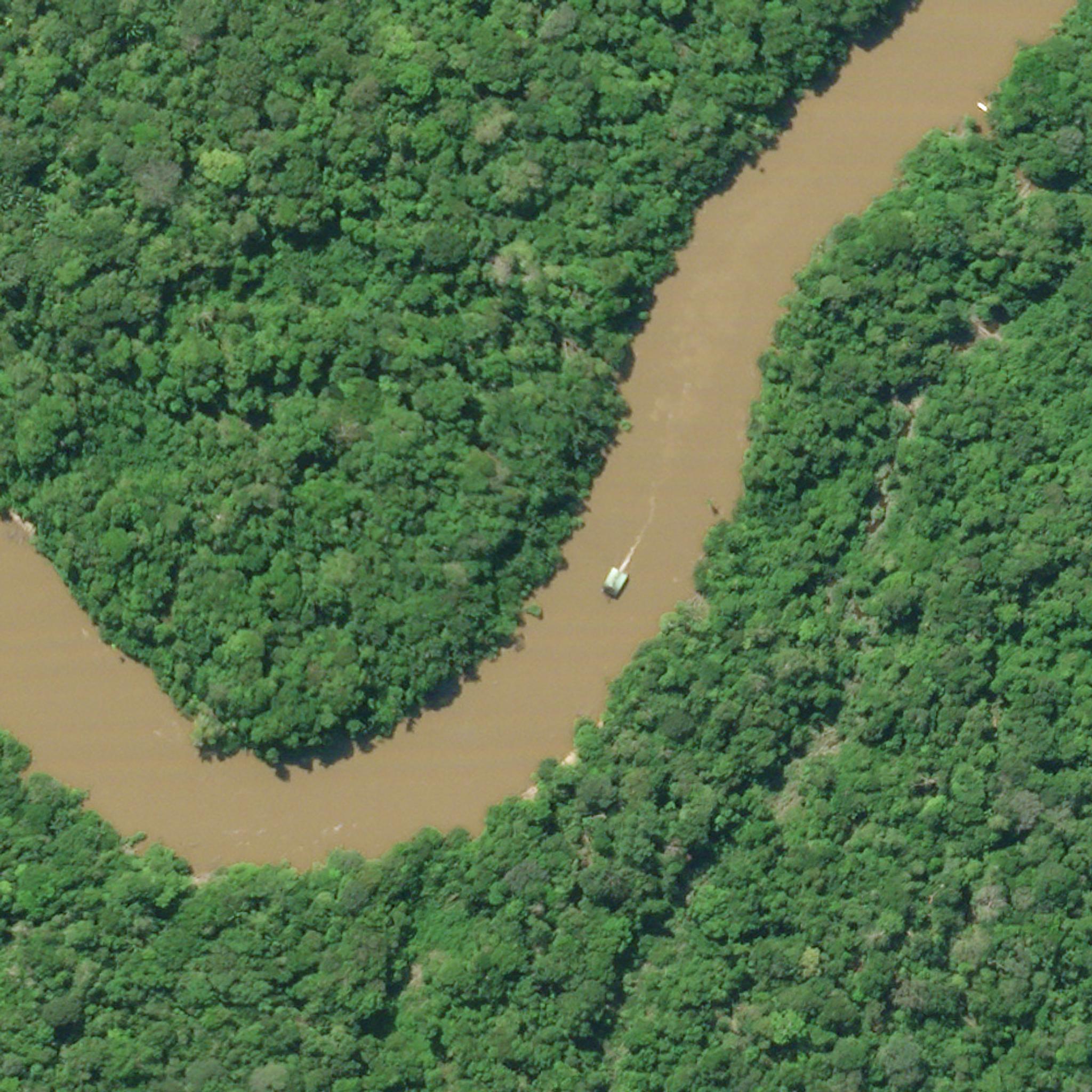
SkySat imagery of Rio Puré National Park in Colombia captured in March 2021 shows the detection of dredgers © 2021, Planet Labs PBC
StoriesIn remote regions of the world or those where political conflicts reduce access to protected areas, researchers and conservationists need solutions for monitoring activity that threatens wildlife and ecosystems. Frankfurt Zoological Society (FZS), an international conservation organization founded in 1858 focuses on maintaining biodiversity and conserving wildlife and ecosystems in protected areas and outstanding wild places. To achieve these goals, FZS needs to demonstrate the presence of threatening activity to local law enforcement and protected area agencies so they can take action. “We have to protect nature’s pristine areas,” explains Manuel Engelbauer, FZS’s South American program officer. “All of the crises we’re trying to tackle come together in one major goal – protecting nature’s pristine areas and biodiversity throughout the world.” But monitoring activity in protected areas – especially unauthorized activity such as gold mining, logging, and poaching – has demanded costly and time-consuming tools, such as overflights and ground-truth surveying expeditions. At the same time, nature conservation agencies are facing budgetary and personnel challenges as the COVID-19 pandemic impacts government revenues and donation drives, further limiting monitoring. With the growing need for frequency at high resolution, FZS turned to Planet. From Engelbauer’s point of view, Planet has three advantages for FZS: Ease of use. In many of the protected areas that FZS supports, there are no GIS specialists to support conservation teams. “Planet is as easy to use as Google Maps,” Engelbauer says to teams. “They can visualize the area very quickly as well as make decisions on what to do with that information.” Scope of data. FZS relies on constantly renewed data to detect change over time. “Many times the teams would use images from open access sources, but the teams never knew how old the data was, especially images for remote areas,” Engelbauer says. “With Planet, we know that the images are current.” Trust in data. FZS conservationists need to share trusted, reliable, and timestamped data to local agencies and law enforcement to drive action in protected areas. “Being able to say to an agency, ‘This was the situation on the ground on this specific date,’ has helped us a lot,” Engelbauer says. With Planet’s network of SkySats, FZS can identify “hot spots” that should be investigated more closely, locate potential illegal activity, and monitor change over time. “With our investments in Planet, we now have much more information about protected areas, compared with the time and money spent on overflights,” Engelbauer says. “Information and time are our currency – they are invaluable to us. We can show that action is needed without the delays that would cause incalculable damage to our protected areas.” Read the full case study here to learn about how FZS is monitoring activity in areas across the globe. Planet is a Public Benefit Corporation (PBC), trading on the New York Stock Exchange as PL, in which its mission is encoded into its corporate DNA, obligating Planet’s directors to stay true to their mission as part of their fiduciary duty to their stockholders. Planet’s public benefit purpose is: “To accelerate humanity to a more sustainable, secure and prosperous world by illuminating environmental and social change.”
Ready to Get Started
Connect with a member of our Sales team. We'll help you find the right products and pricing for your needs.