
Planet’s High-Resolution Satellite Monitoring Helps NICFI General Partners Reduce and Reverse Tropical Forest Loss
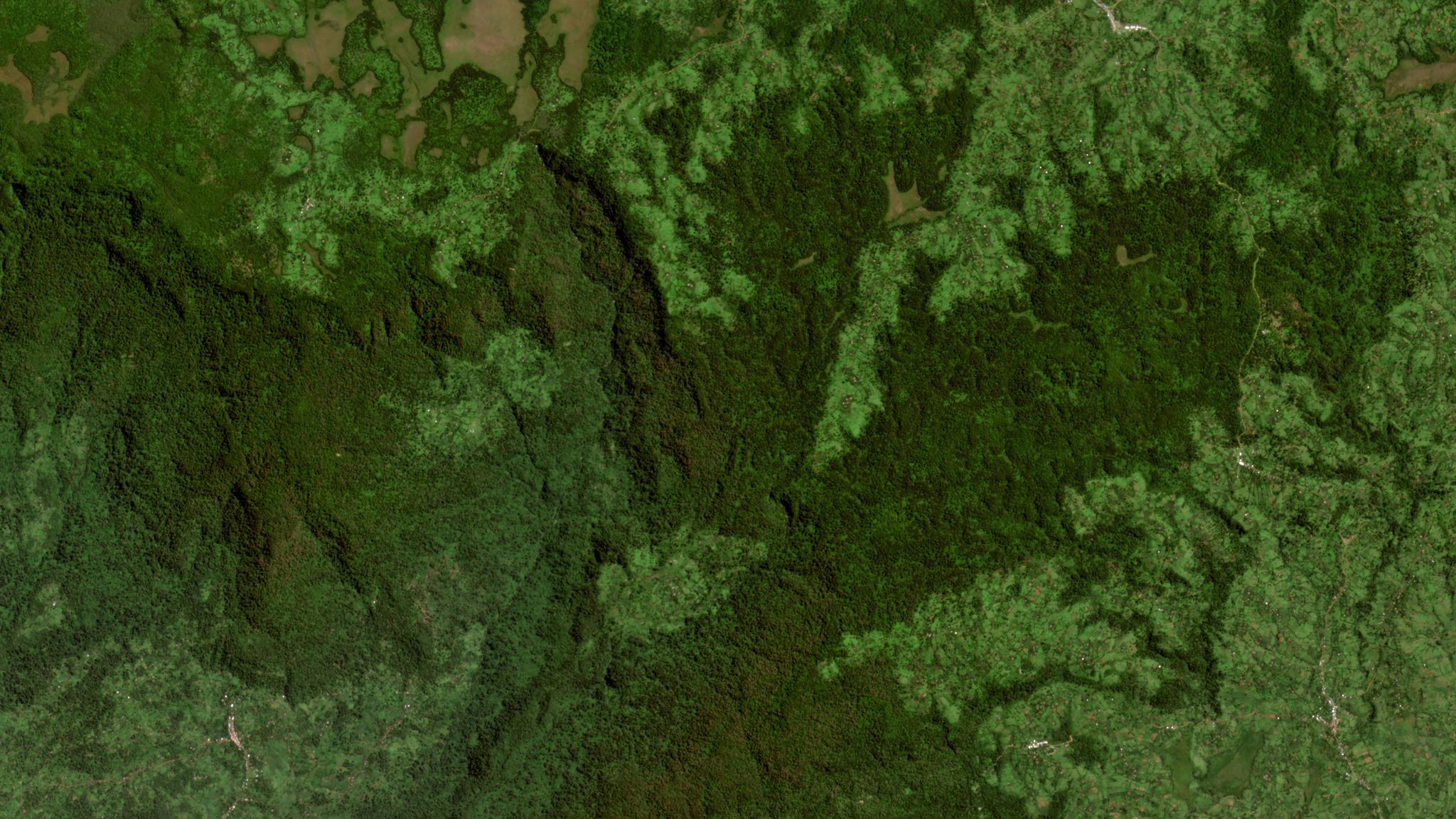
NICFI tropical forest project location in Ethiopia © 2021, Planet Labs PBC. All Rights Reserved.
NewsSince October 2020, when Norway’s International Climate & Forests Initiative (NICFI) launched its Satellite Data Program with an international contract awarded to Kongsberg Satellite Services (KSAT) with partners Planet and Airbus, the global community has had a tremendous resource available in the fight against tropical deforestation: High-resolution satellite monitoring.
The NICFI Satellite Data Program has three levels of access:
- Purpose Allies, such as Global Forest Watch and Mapbiomas, help share visual, monthly data with the public at large and non-technical users;
- Third Party Participants, including Government, NGO, Academic, and Private Sector stakeholders, can access analysis-ready, monthly data to help achieve NICFI’s strategic purpose; and
- General Partners, selected by the Norwegian Ministry of Climate and Environment, can access Scenes-level data - including Planet’s daily monitoring and Airbus’ historical archive.
For the past few quarters, we have highlighted the work of our Purpose Allies and Third Party Participants – including those working across the government, private sector, and NGO sectors; and those working across a variety of platform partners, such as Google Earth Engine and Microsoft Planetary Computer.
Today, we are excited to share more information on what the NICFI Satellite Data Program’s General Partners are doing with the additional Scenes-level data for the fight against deforestation.
- The Amazon Environmental Research Institute (IPAM) is putting the Planet-NICFI Data to work to monitor and report on native vegetation that could be legally deforested, but that farmers chose not to when participating in the CONSERV program – a private, voluntary mechanism that compensates rural producers for conserving native vegetation.. The high-resolution of the data is helping improve their deforestation, degradation, and fire detection algorithms that are critical to this work, with recent improvements being especially useful for capturing early patterns of degradation at a fine scale.
- The National Sustainable Development Fund of Mozambique is using the data to derive validation information for annual monitoring of deforestation, as well as to test the production of their own high-resolution deforestation alerts (Fig 1). For further information: https://www.fnds.gov.mz/mrv/
- The Peruvian Service for National Protected Areas is accessing the Planet-NICFI Data through the QGIS plug-in to classify deforestation alerts within 38 Nationally Protected Areas of the Peruvian Amazon, covering an area of almost 17 million hectares in high-resolution monitoring.
- The United Nations Office on Drugs and Crime is using the data to research illicit activities (such as illegal logging, mining, and/or cultivation) as drivers of deforestation and forest degradation, noting “The NICFI Program gives great opportunities to carry out applied research, to develop new methods and tools, and to improve the quality of information produced.”
- Forests of the World is using the Planet-NICFI Data to empower Indigenous communities to stop the loss of forests, defend their rights, and sustainably govern forest resources. They are working with Indigenous communities across the tropics, including in Bolivia, Nicaragua, Panama, Ethiopia, and Uganda – integrating the high-resolution satellite monitoring into community alert systems; monitoring illegal deforestation as well as compliance with conservation and forest management plans; identifying areas for restoration; and supporting Indigenous rangers in the field.
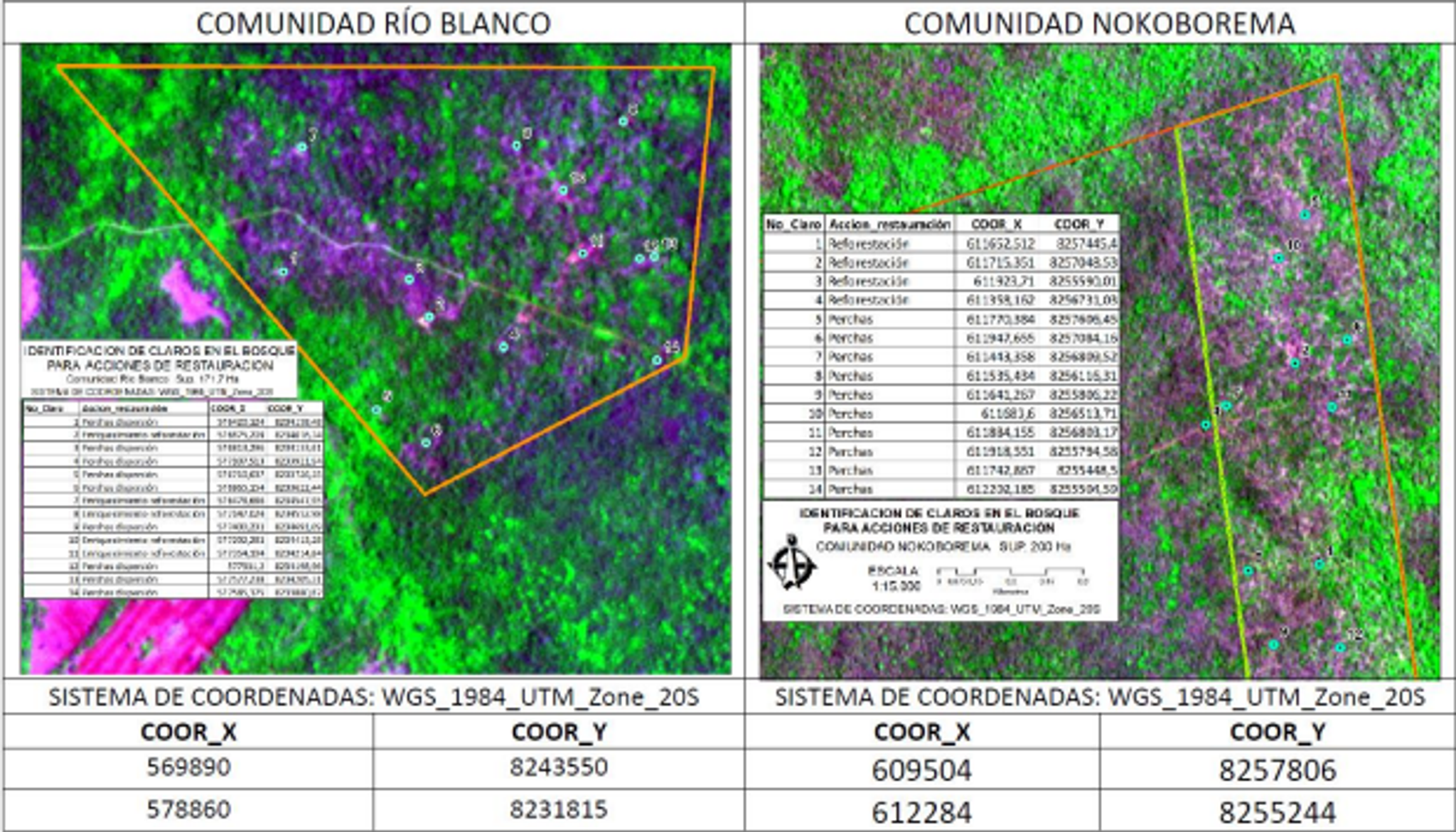
Forests of the World uses Planet-NICFI Data for the identification of clearings to be restored after timber extraction or forest fires, communities of Río Blanco and Nokoborema in the Indigenous territory of Monte Verde, Bolivia.
- The Ministry of Environment of Panama is using the Planet images to verify and map forest cover, refining estimates from Sentinel-2. Given the frequent revisit, it is especially helpful in the cloudy parts of the country.
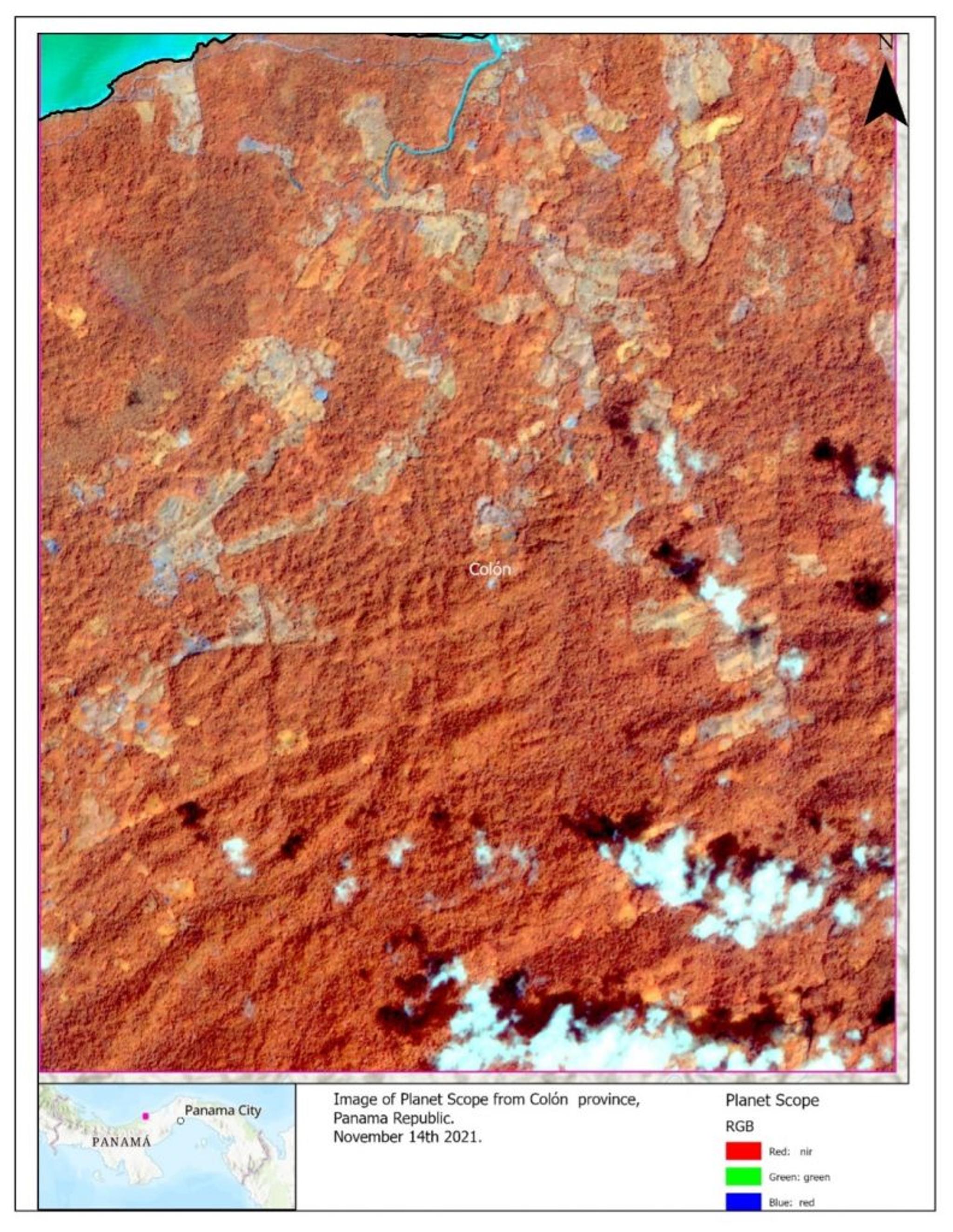
The Ministry of Environment of Panama uses the Planet images in the north of Colón. The Ministry uses the 4-Band daily imagery with the aim of identifying sites that are being illegally deforested and works with park rangers to determine the causes of the incidents.
We are amazed with this user community and, as we kick off a new year, more inspired than ever to continue serving the NICFI Satellite Data Program’s Purpose Allies, Participants, and General Partners in their critical work to reduce and reverse tropical forest loss.
Here is the comprehensive user guide on how to access the NICFI Satellite Data Program.
Ready to Get Started
Connect with a member of our Sales team. We'll help you find the right products and pricing for your needs.