Ignite Geospatial Insights With Planet Data
Supercharge analysis with actionable data and best-in-class GIS integrations
DAILY DATA WITH AN OPEN, ACCESSIBLE PLATFORM
Global coverage, daily insights
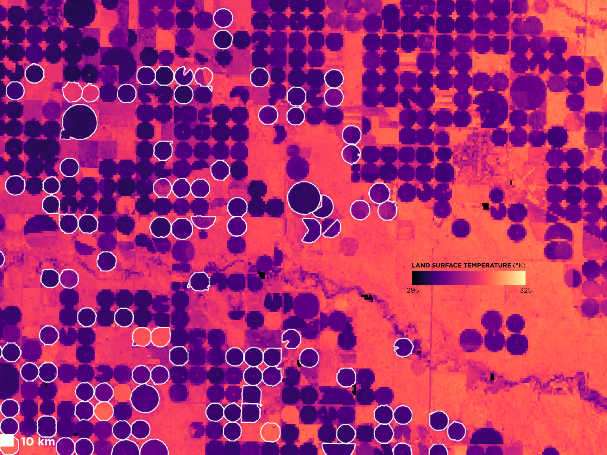
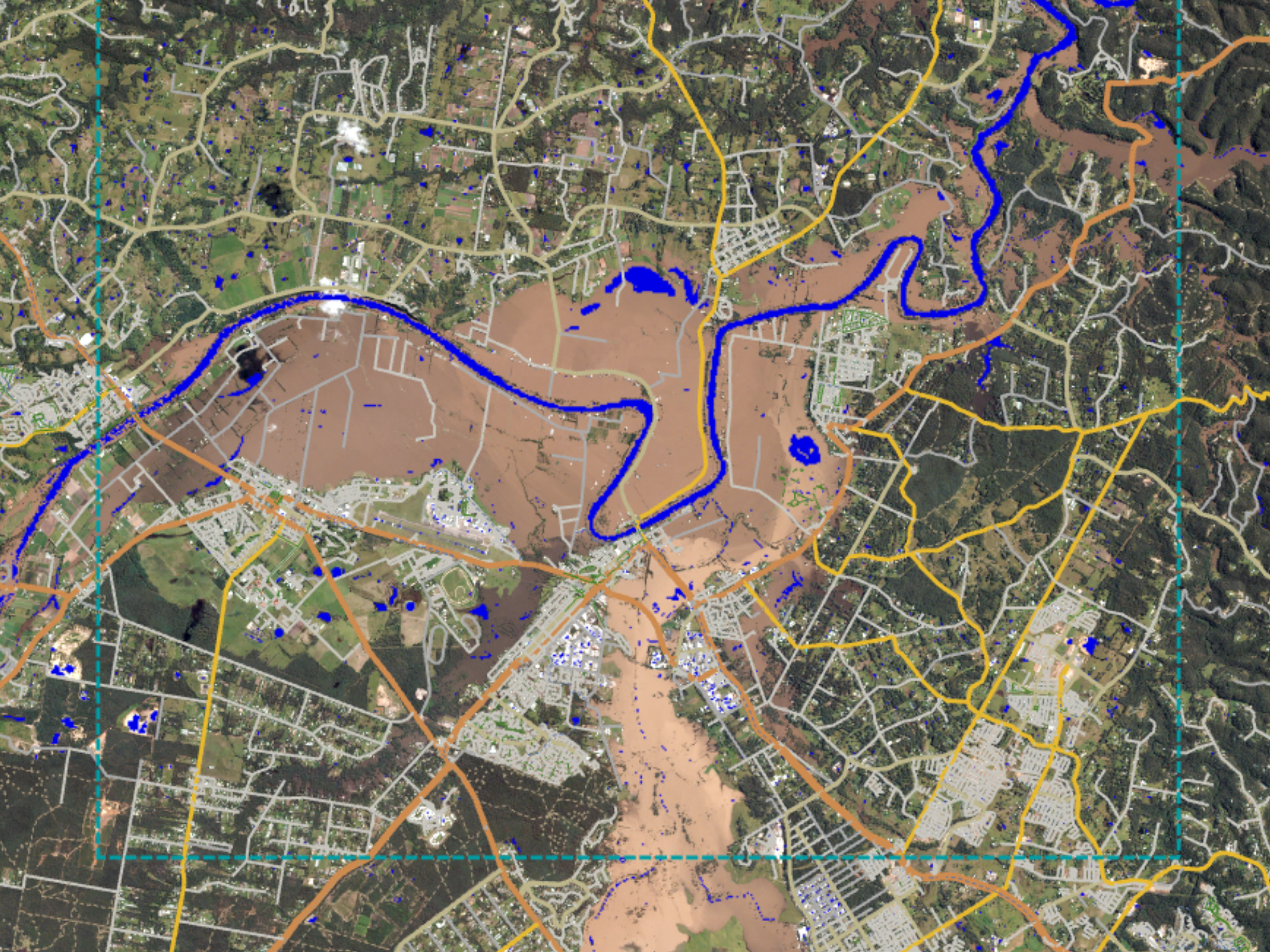
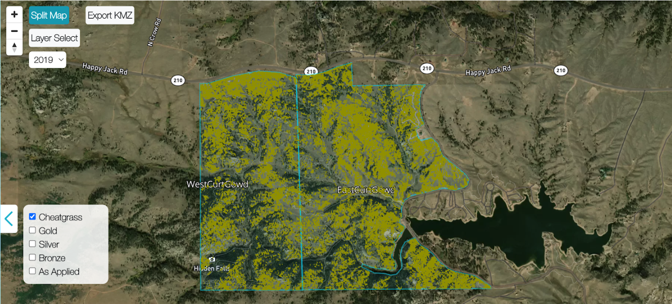
Planet satellite imagery is a living dataset of global change. Drive richer analysis with high-spatial resolution and high-frequency data, broad-area coverage, and automated detection feeds – integrated directly into your geospatial platform.
© 2026 Planet Labs PBC. All rights reserved.
| Privacy Policy | California Privacy Notice |California Do Not Sell
Your Privacy Choices | Cookie Notice | Terms of Use | Sitemap