Menu
Contact SalesLogin
Contact Sales
Login

Search

See. Decide. Act.

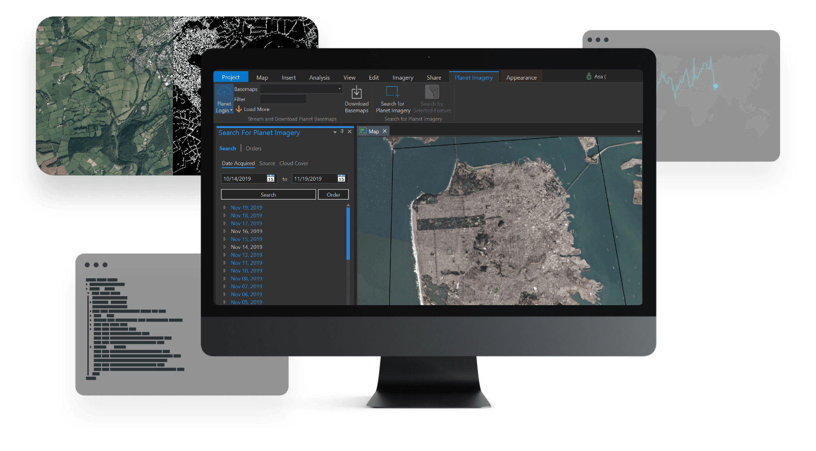
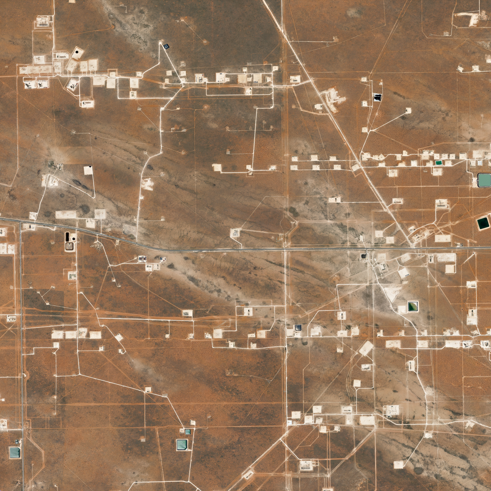
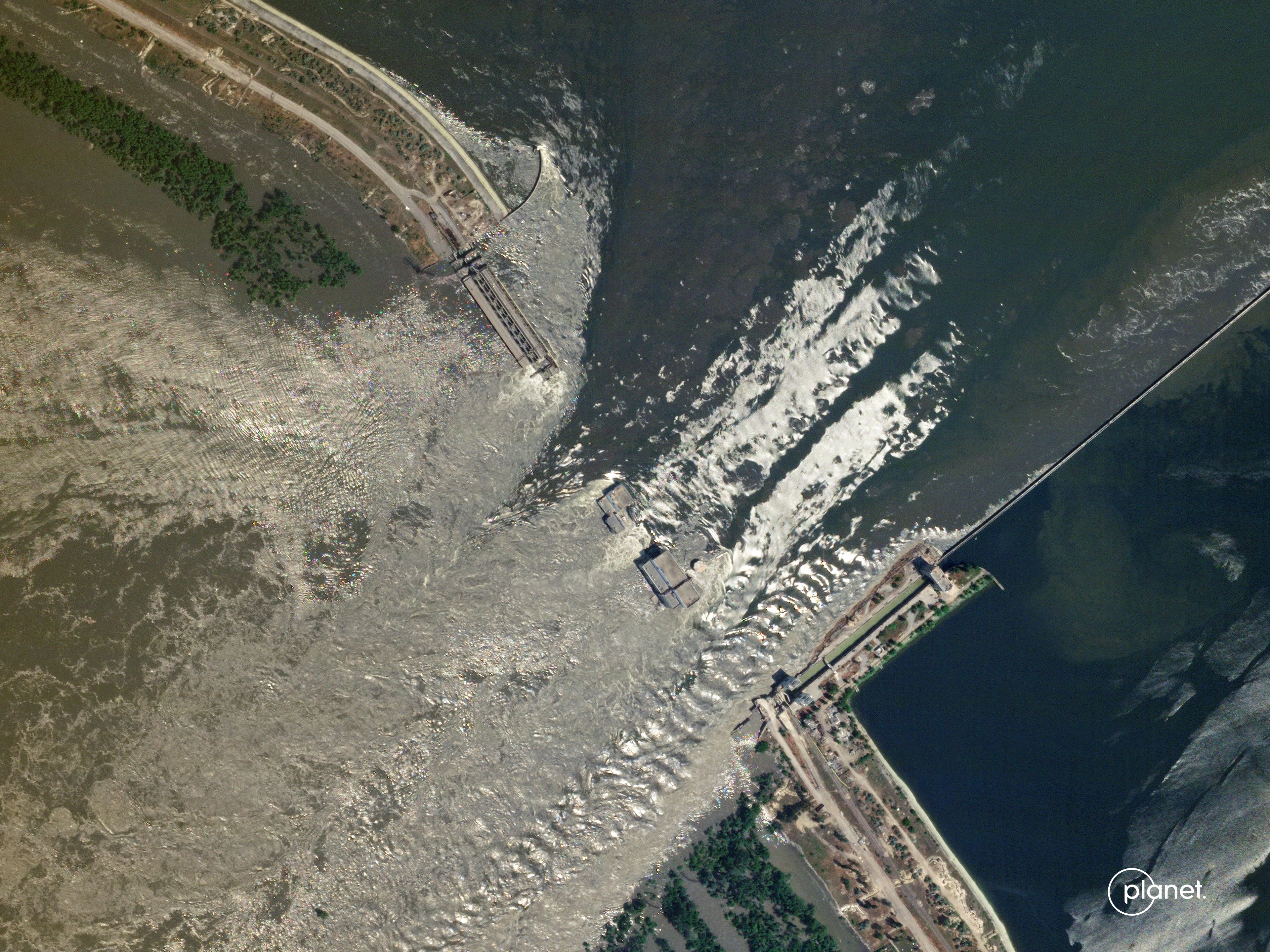
Planet is the leading provider of global, daily Earth data and geospatial solutions with always-on satellite monitoring, high-resolution tasking, and state-of-the-art analytics

Accessible, reliable, real-time coverage over any area of interest on  Earth

We provide a multidimensional view that empowers agencies to react quickly to novel threats, operate across ecosystems, and improve resource utilization.

Learn more

Working with Planet, NOAA gets a more complete and frequent stream of information about the status of our oceanic and coastal world. Planet’s high-cadence imaging helps us identify and track potential oil spills, and with tasking capabilities, we’ve advanced our situational awareness for vessel monitoring or marine debris.

Physical Scientist

Jerome Fisher

Physical Scientist

LOOK BROADER

Reliable, near-daily Earth observation data to gain a wider, more complete  picture.

PlanetScope data captures Earth’s landmass and coastal areas on a near-daily basis.

Read More

Missile silo construction in Yumen, China.

Construction of the Felipe Ángeles International Airport near Mexico City, 2017-2024.

LOOK BACK

Travel back in time and space to establish a historical  baseline

The Planet Archive – composed of proprietary and public datasets – enables change detection and time series analysis.

Read More

LOOK CLOSER

Zoom in and characterize change in greater detail and  context

Planet SkySat Tasking captures images with exceptionally high resolution to analyze smaller infrastructure or objects like ships, vehicles or individual trees.

Read More

Maritime vessel detection in the Port of Sevastopol, Ukraine

Forest Carbon measured over Goiás, Brazil

LOOK DEEPER

See beyond what’s visible to the naked eye with derived data  products

Planetary Variables reveal biophysical properties measured over time, including Soil Water Content, Land Surface Temperature, Crop Biomass, and Forest Carbon.

Read More

ACHIEVING POLICY GOALS IN AN ERA OF  CHANGE

Scale visibility across geographies, steward taxpayer dollars wisely, and demonstrate ROI. Broad area management with Planet reduces delays and blindspots, reducing risk to people, cities, and protected lands.

Loading

Corey Jaskolski, President and CEO of Synthetaic, shares how their artificial intelligence (AI) software leverages Planet global data to draw insights across time.


E-book: Driving Program and Policy Effectiveness With  Planet

Learn how Planet broad area management solutions bring together global daily Earth data, derived data products, and cloud-based tools to help governments make informed decisions.

Download Now
Planet Monitoring
Investors

© 2024 Planet Labs PBC. All rights reserved.
| Privacy Policy | California Privacy Notice |California Do Not Sell
Your Privacy Choices  | Cookie Notice | Terms of Use | Sitemap